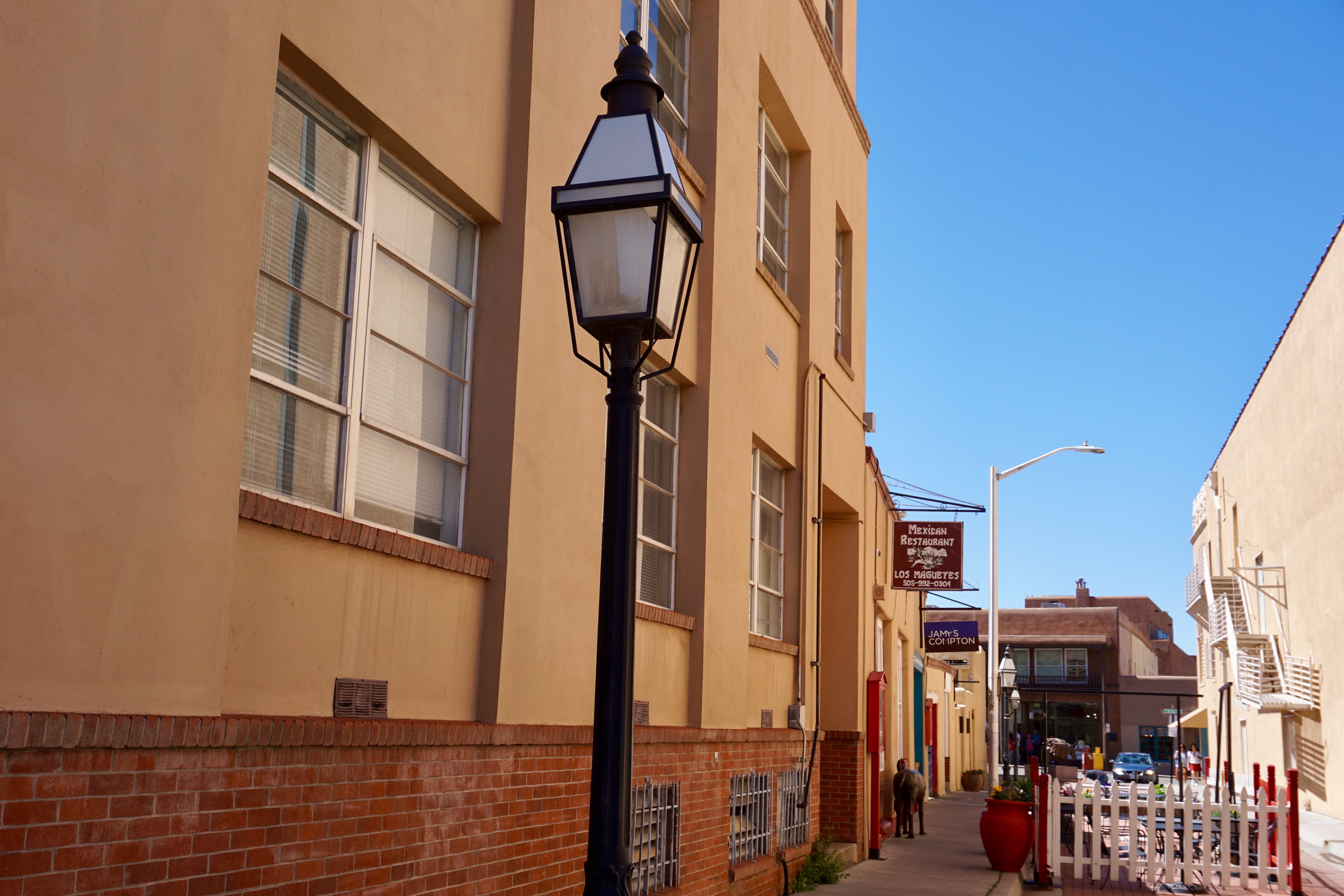
Wrapping up my 2023 Santa Fe photo dump with a cavalcade of signage.
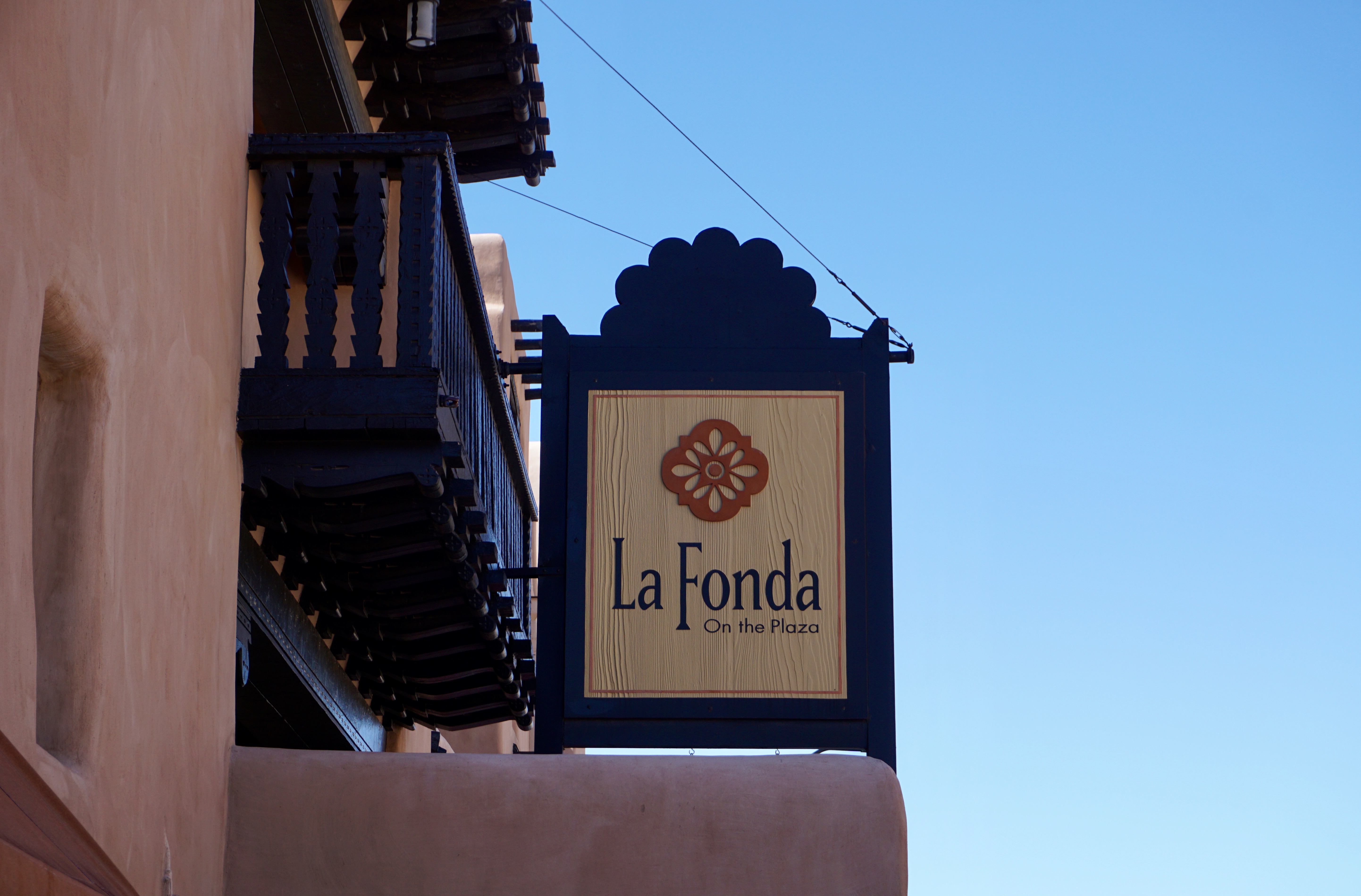
We had drinks at sunset on La Fonda’s rooftop cantina one evening, including some of the most delicious–and dangerous margaritas I’ve ever sipped.
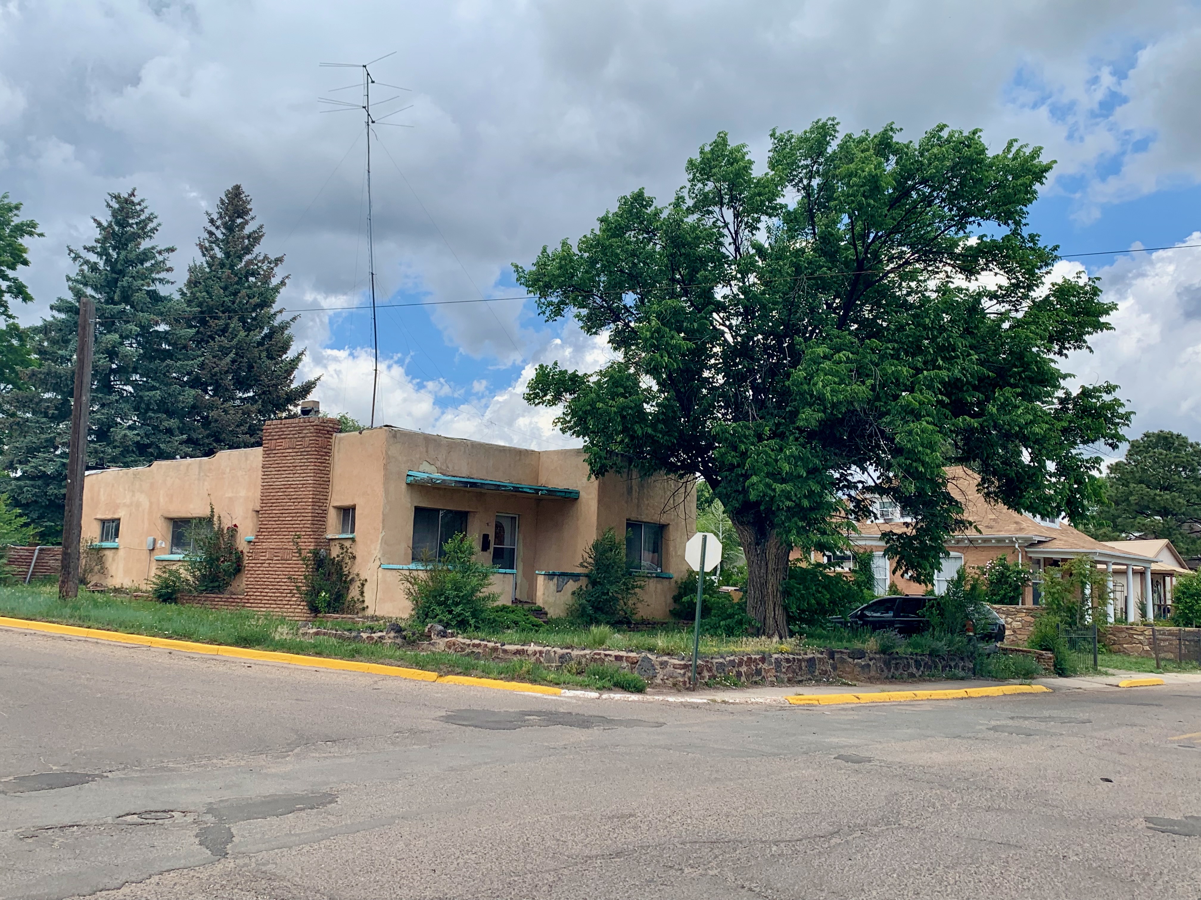
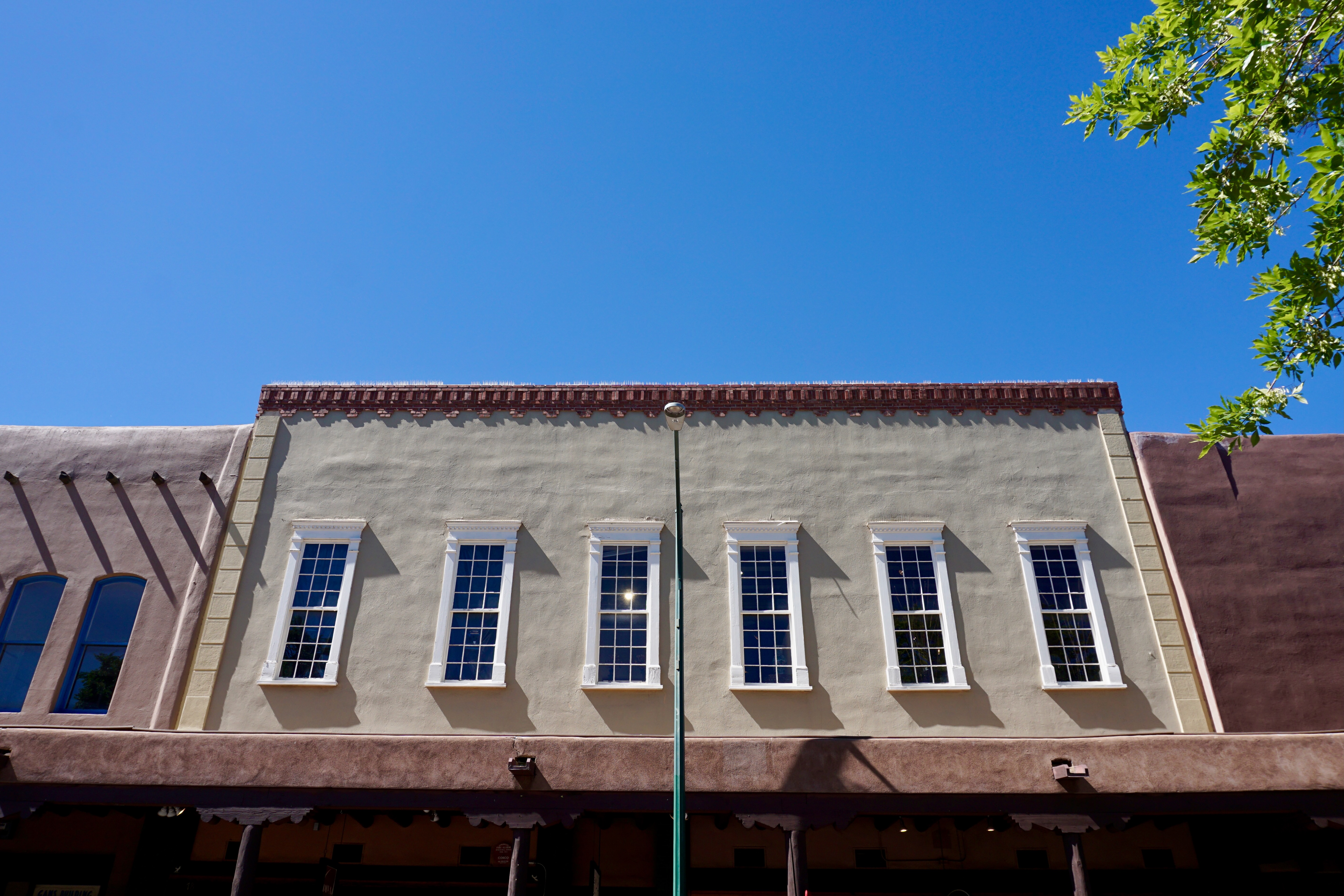
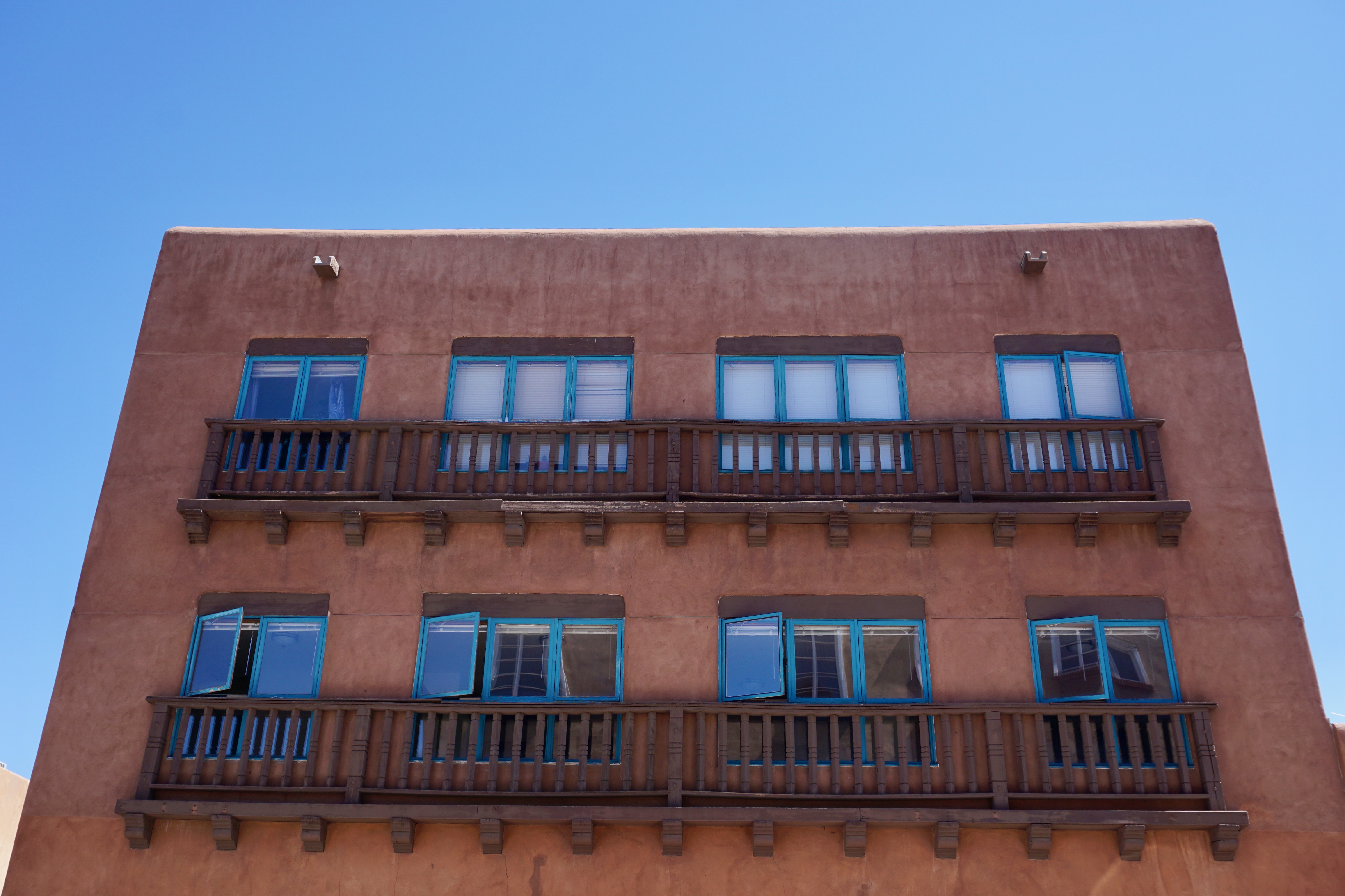
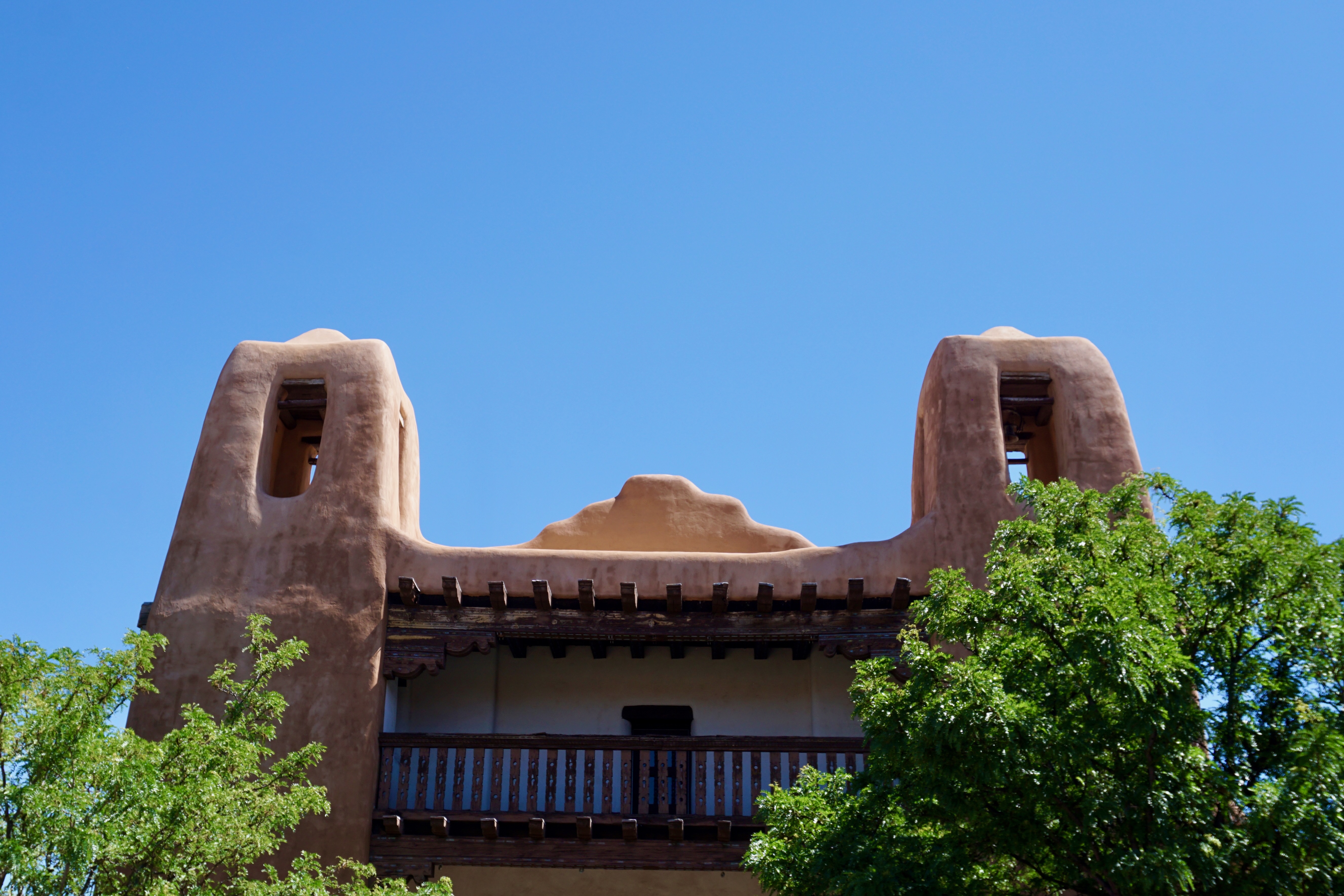
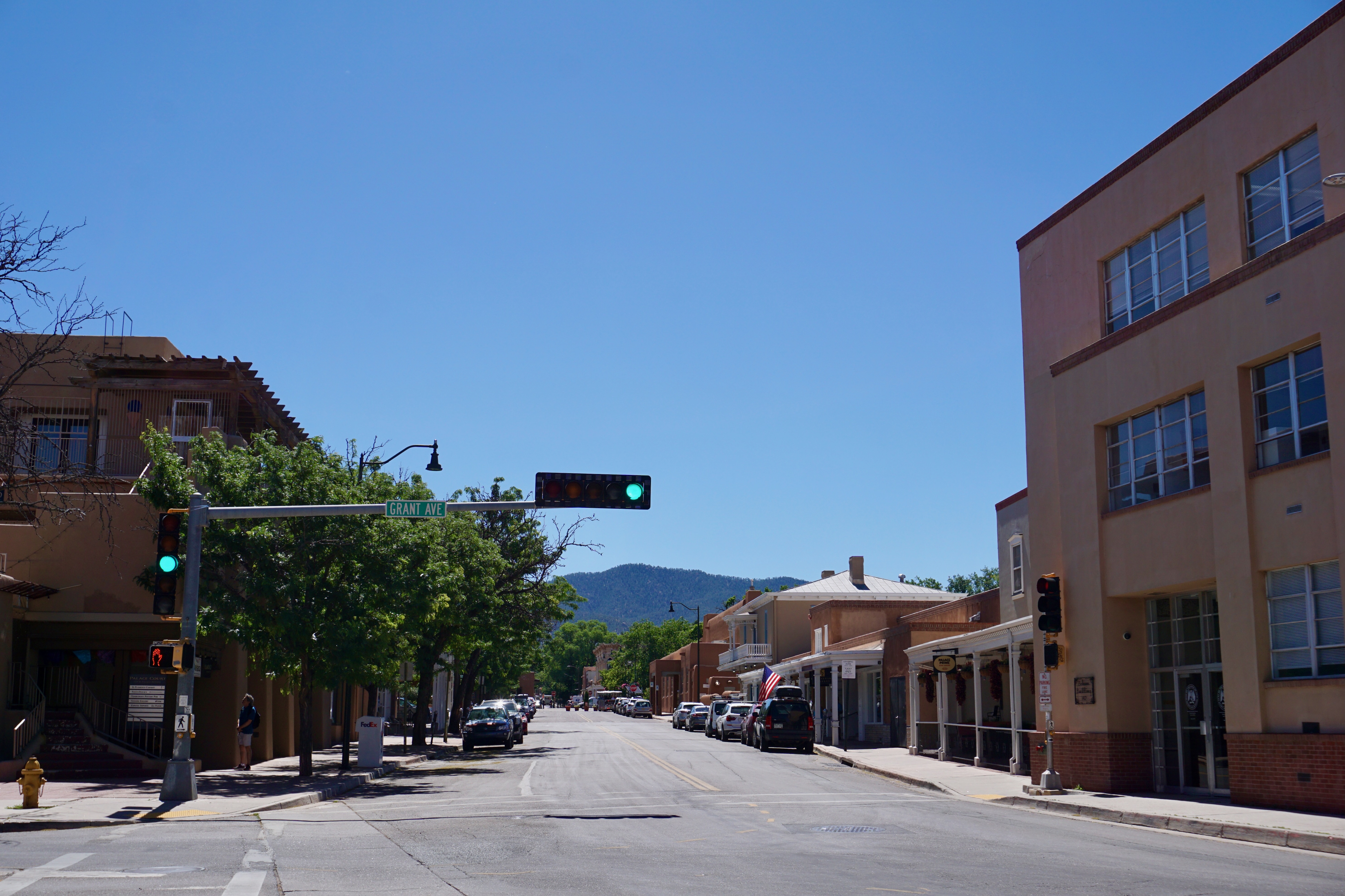
Again, the blue New Mexico skies make everything appear brighter.
I suppose this could just as easily be Texas, but it works.
Not the estate of Charles Foster Kane nor a roller disco. Alas, it’s a home goods store.
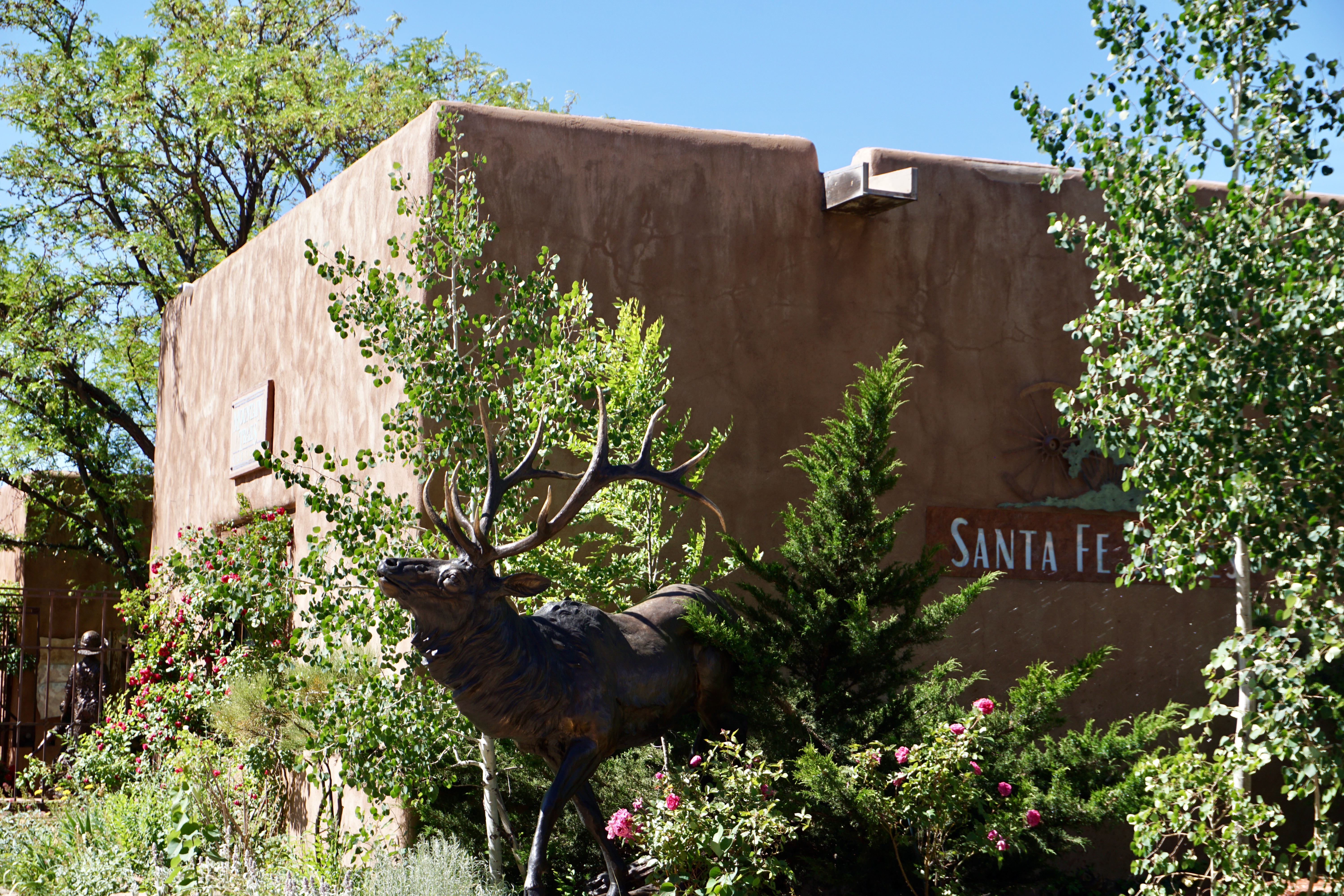
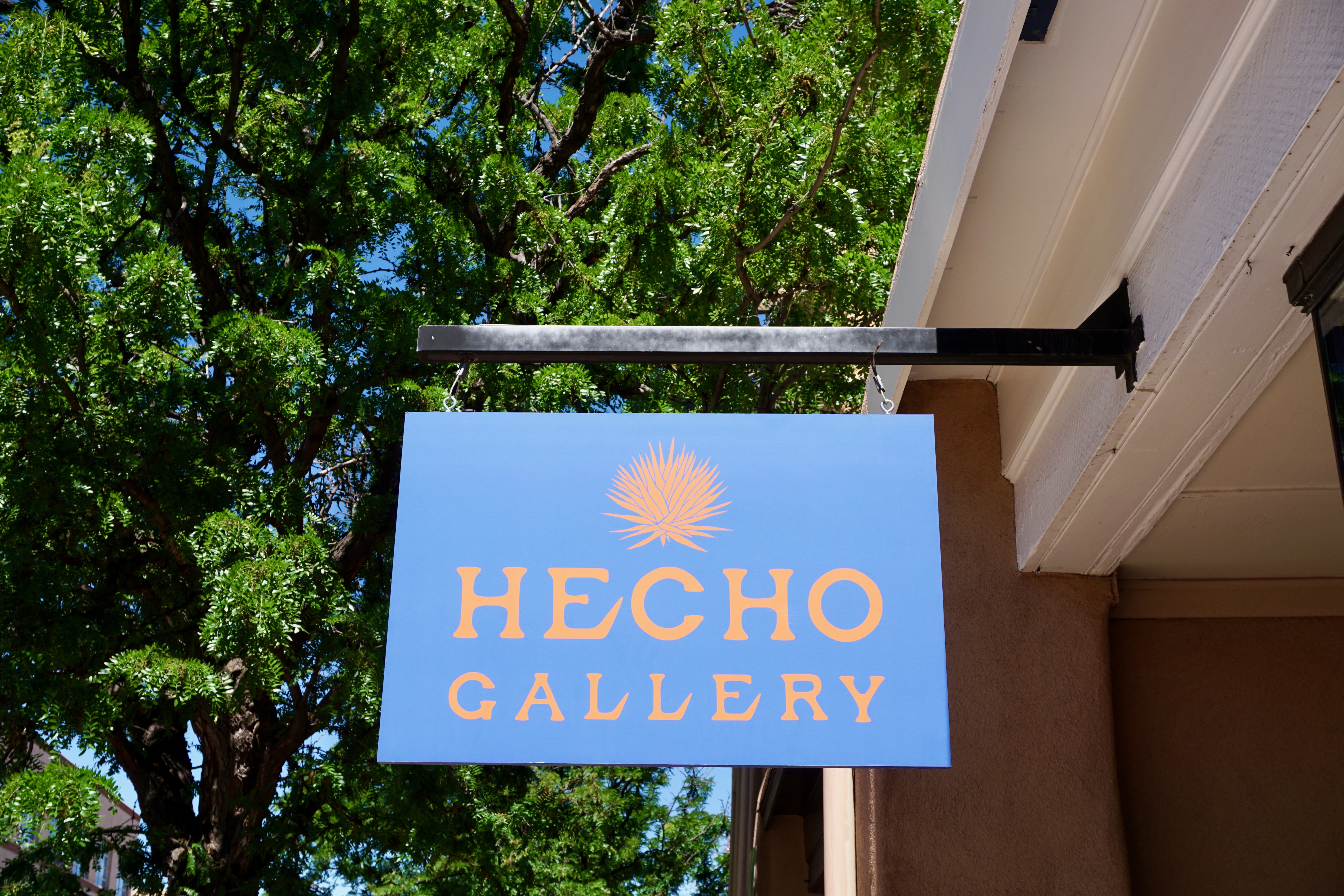
Why name your gallery when bright red against adobe easily draws one in?
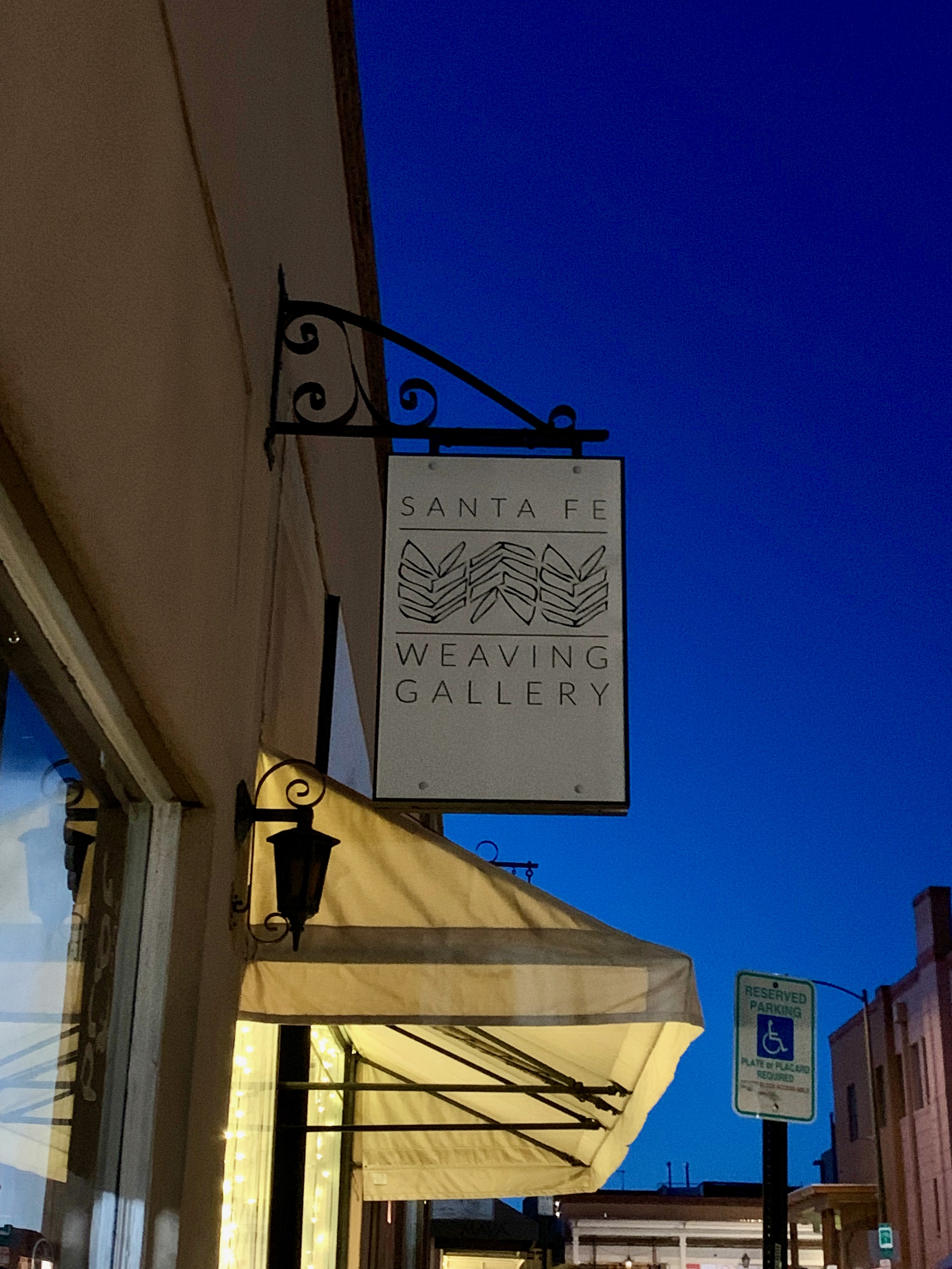
So many galleries in Santa Fe.
Some of them take on an otherworldly glow at night.
Dog-friendly vacation rentals just outside the Plaza.
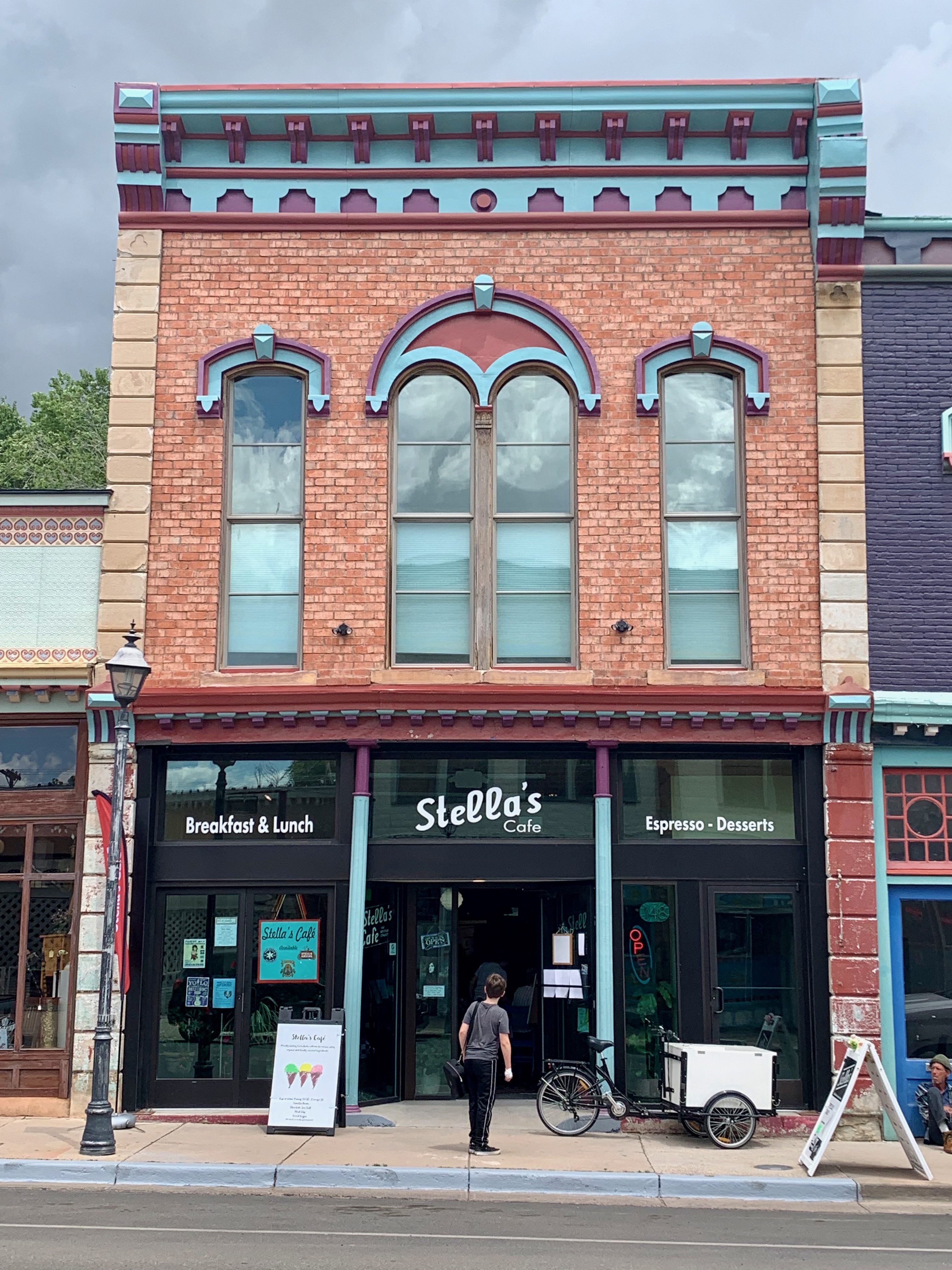
Cafe Sonder did not survive the pandemic but at least its retro-cool sign remains (for now.)
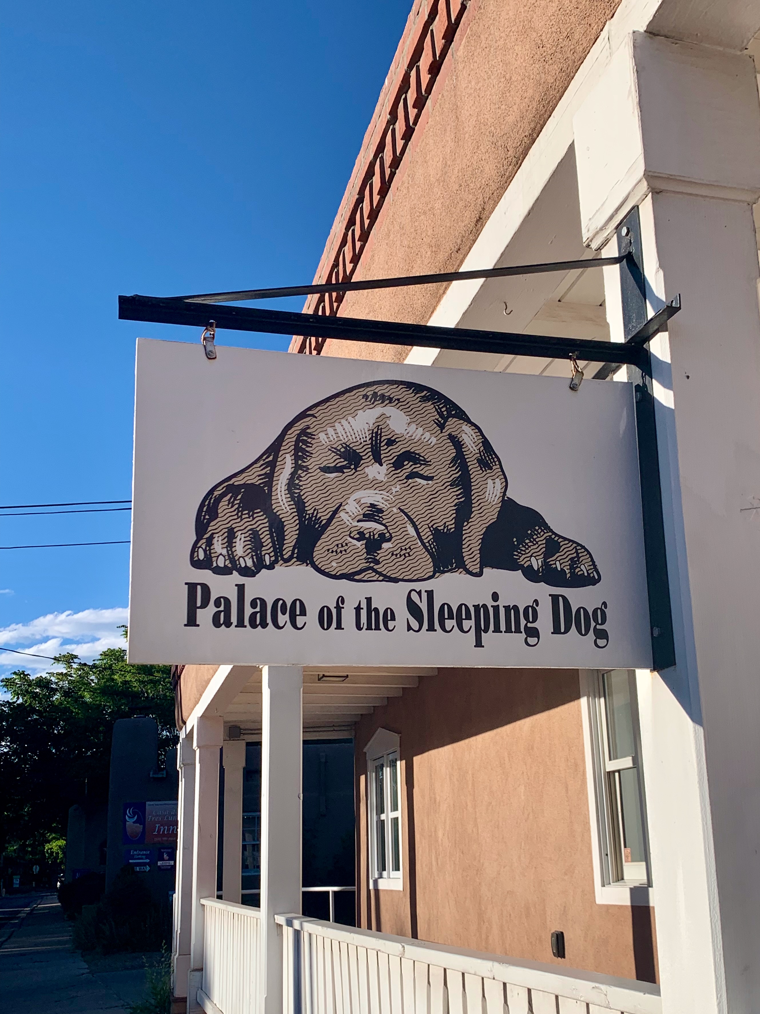
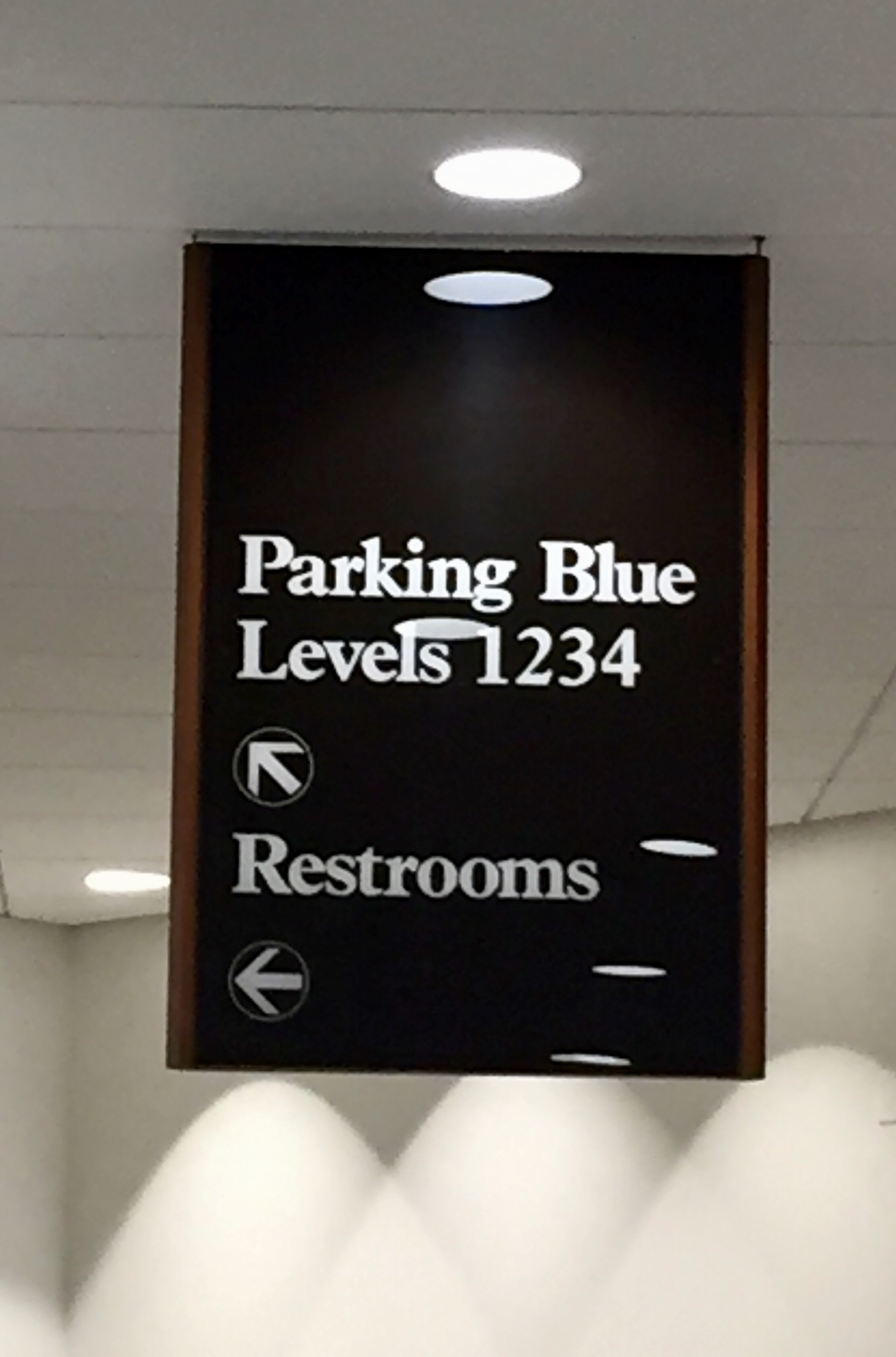
Kudos to this curious but compelling signage.
“Ladies and Gentlemen, we have a really big shoe for you today…”
Rather than use boring old letter grades, restaurant cleanliness in New Mexico is simply APPROVED (or not.)
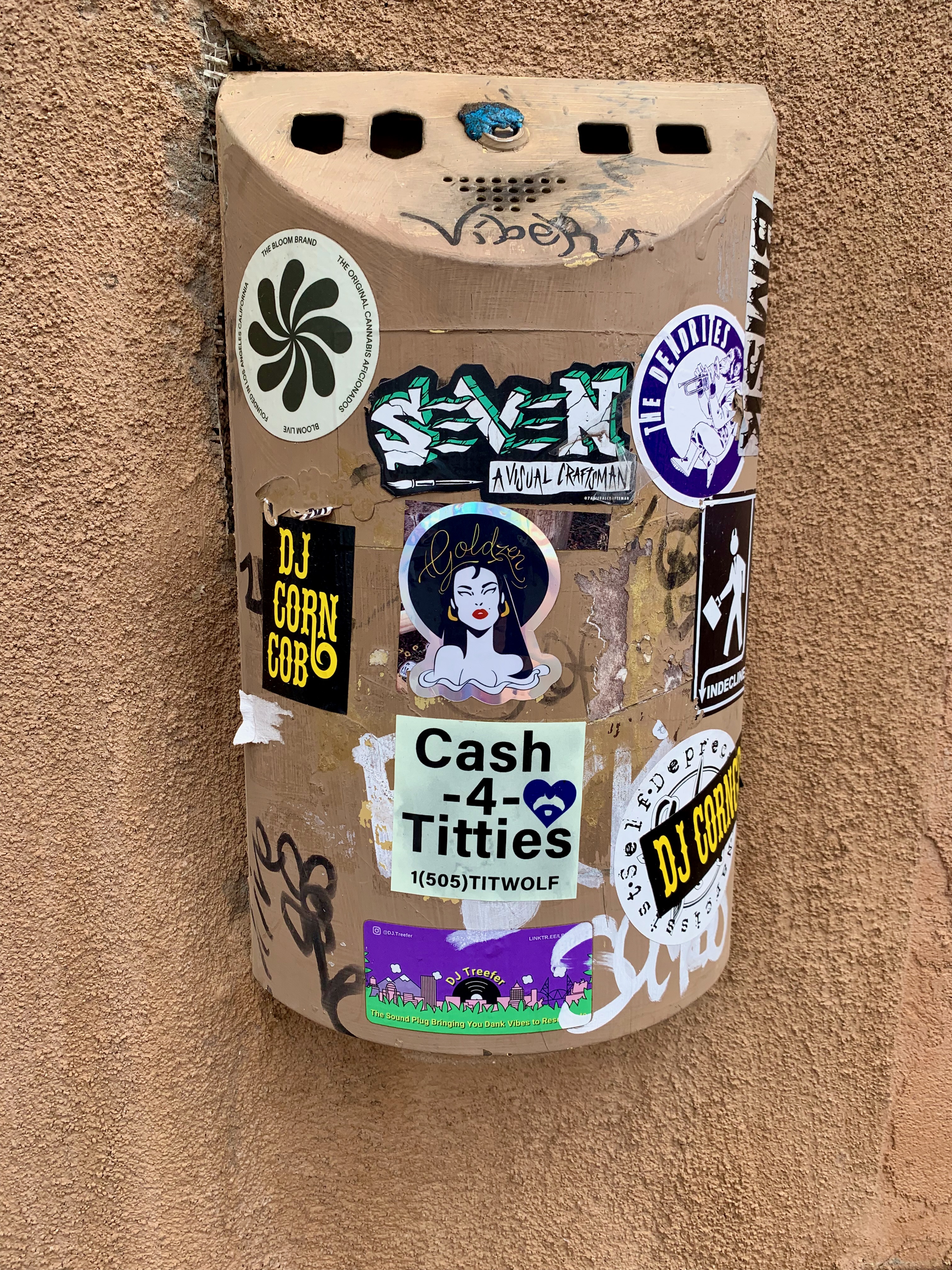
I’ve saved the worst (best?) for last: DJ Corncob sounds like an alias Jason Mendoza might’ve used if he was from the Midwest instead of Jacksonville, but one can’t deny how, ahem, Cash-4-Titties really draws one in.
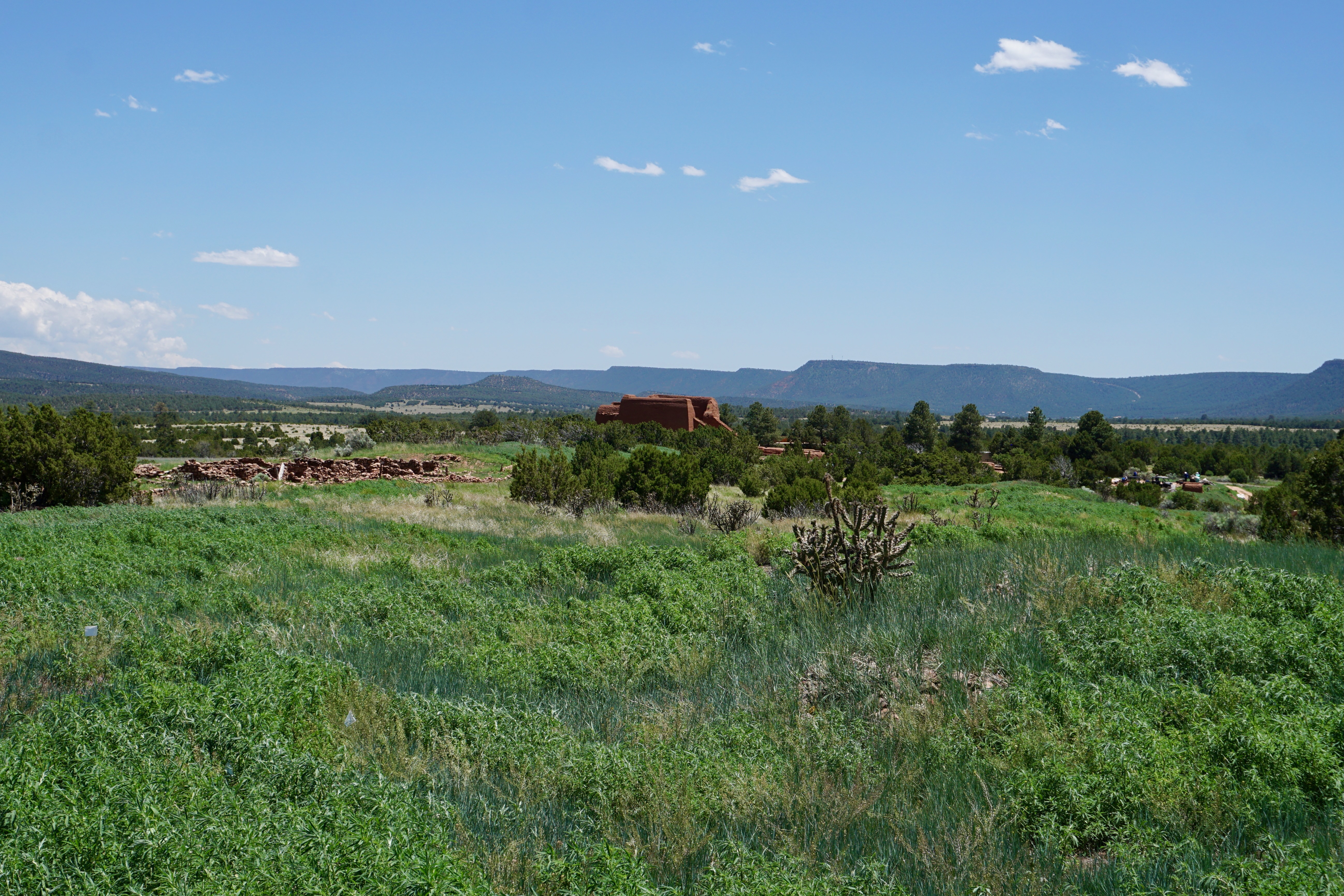
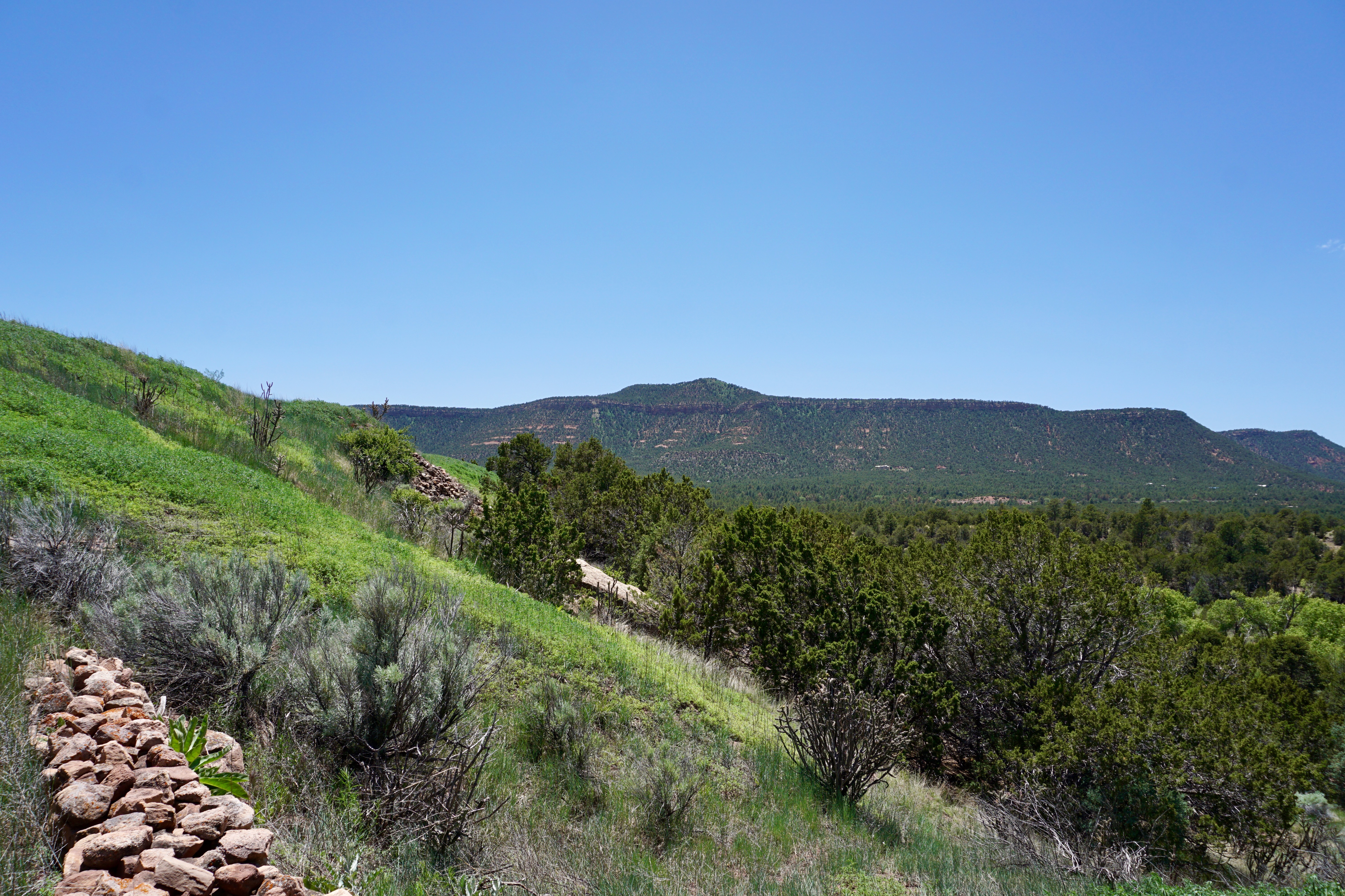
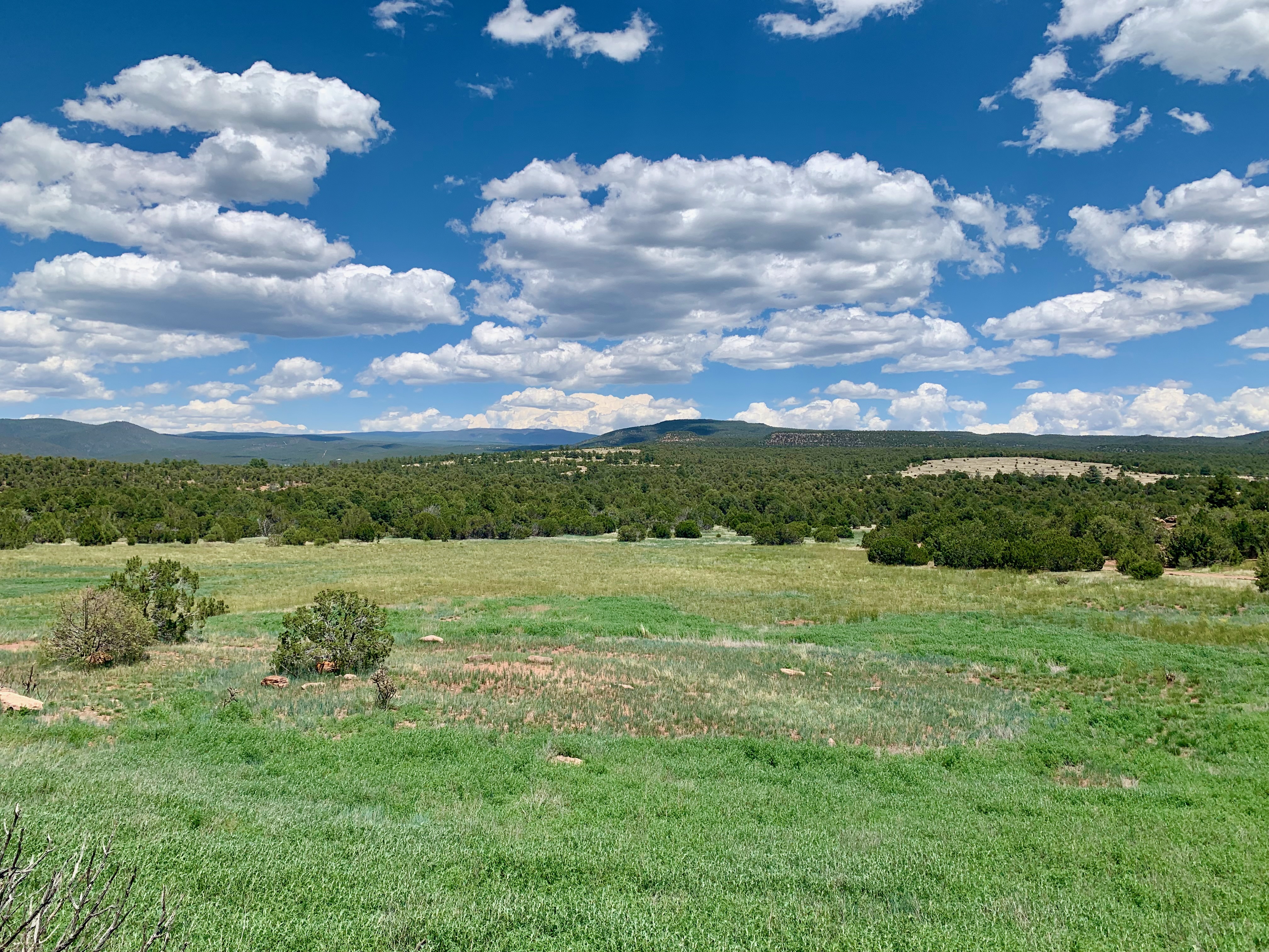
Located roughly halfway between the two cities, the park covers thousands of acres.
We walked the Ancestral Sites Trail, a 1.25 mile hiking loop with lush greenery and beautiful mountain vistas.
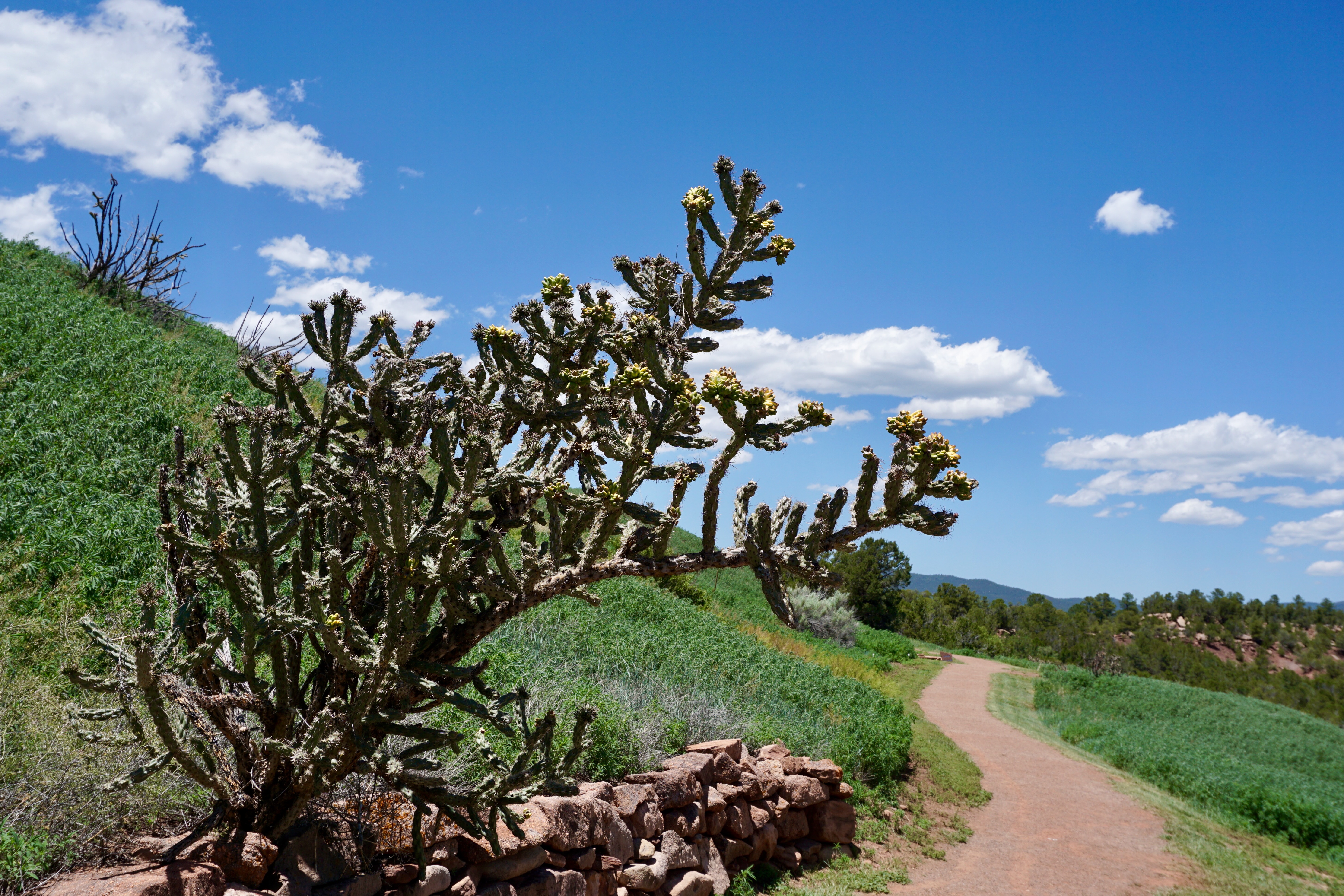
Purple flowers dotted along the trail add a muted but effective splash of color.
The juxtaposition of cactus trees and green grass is not something you’ll find in every corner of desert-heavy New Mexico.
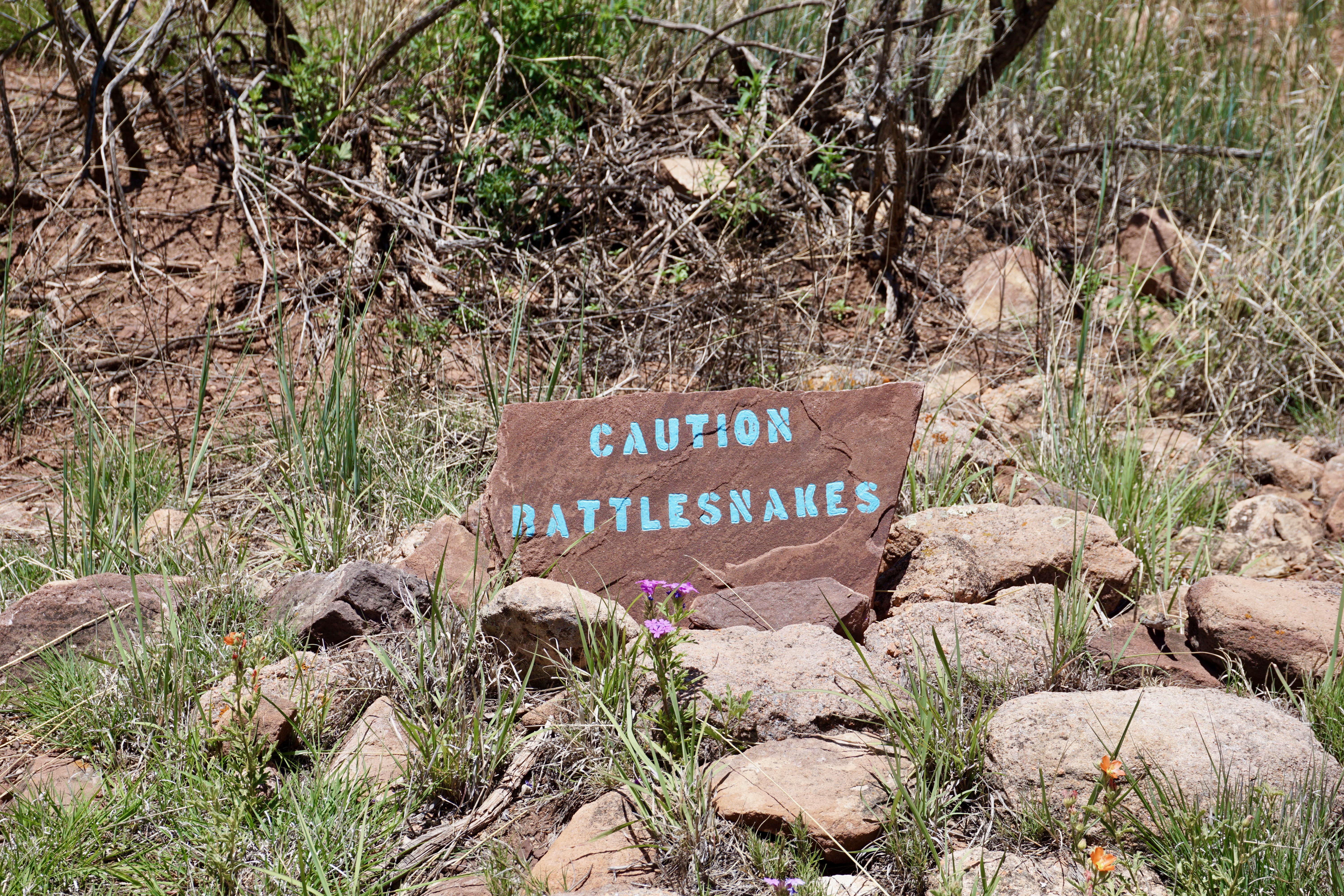
I honestly first read this as “Enter With Carl” (Sandburg? Sagan?), but most made-made holes in the ground do require a certain amount of mindful navigation.
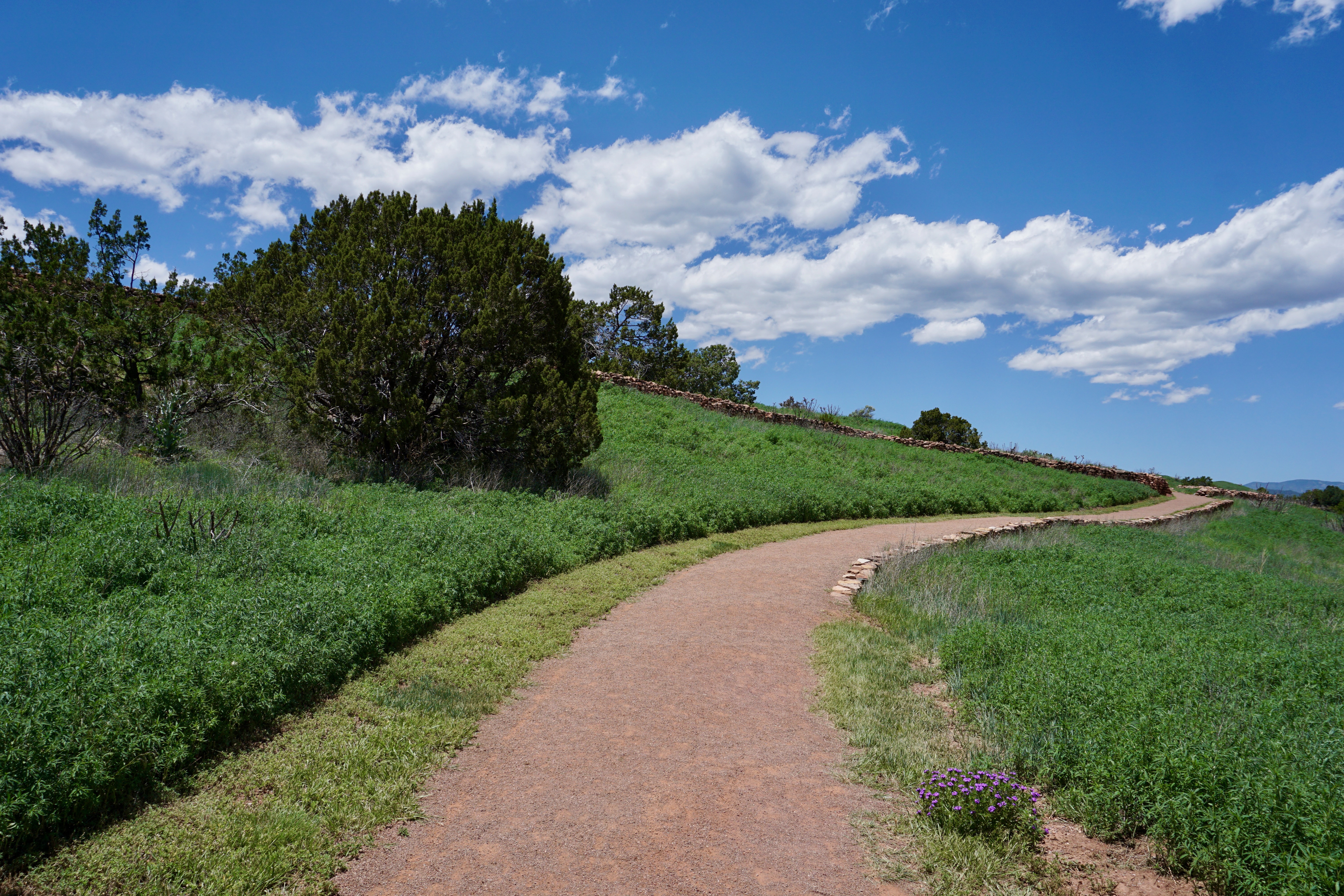
It’s best to stay on the path.
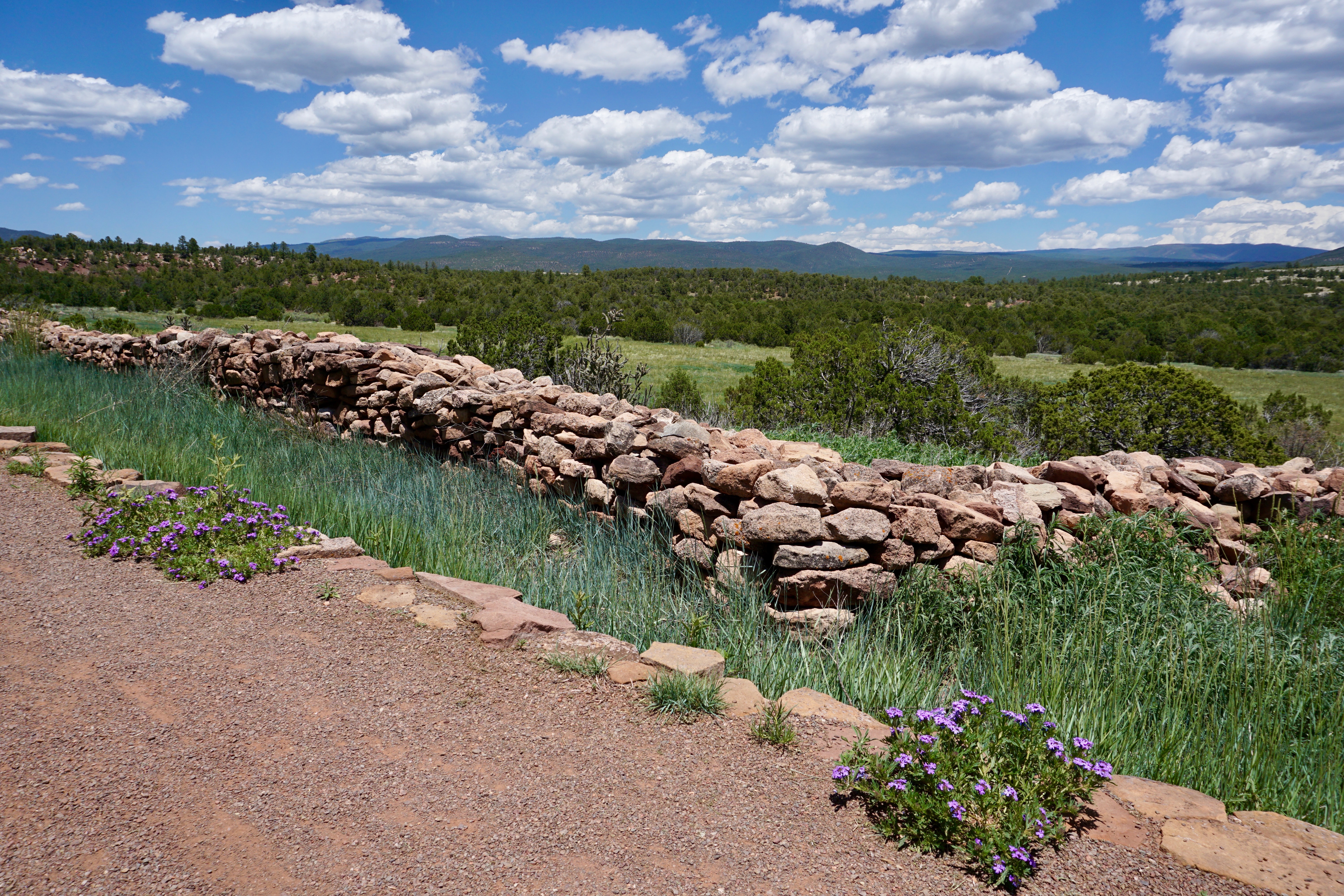
Walking along the trail, I had no shortage of opportunities for taking landscape shots.
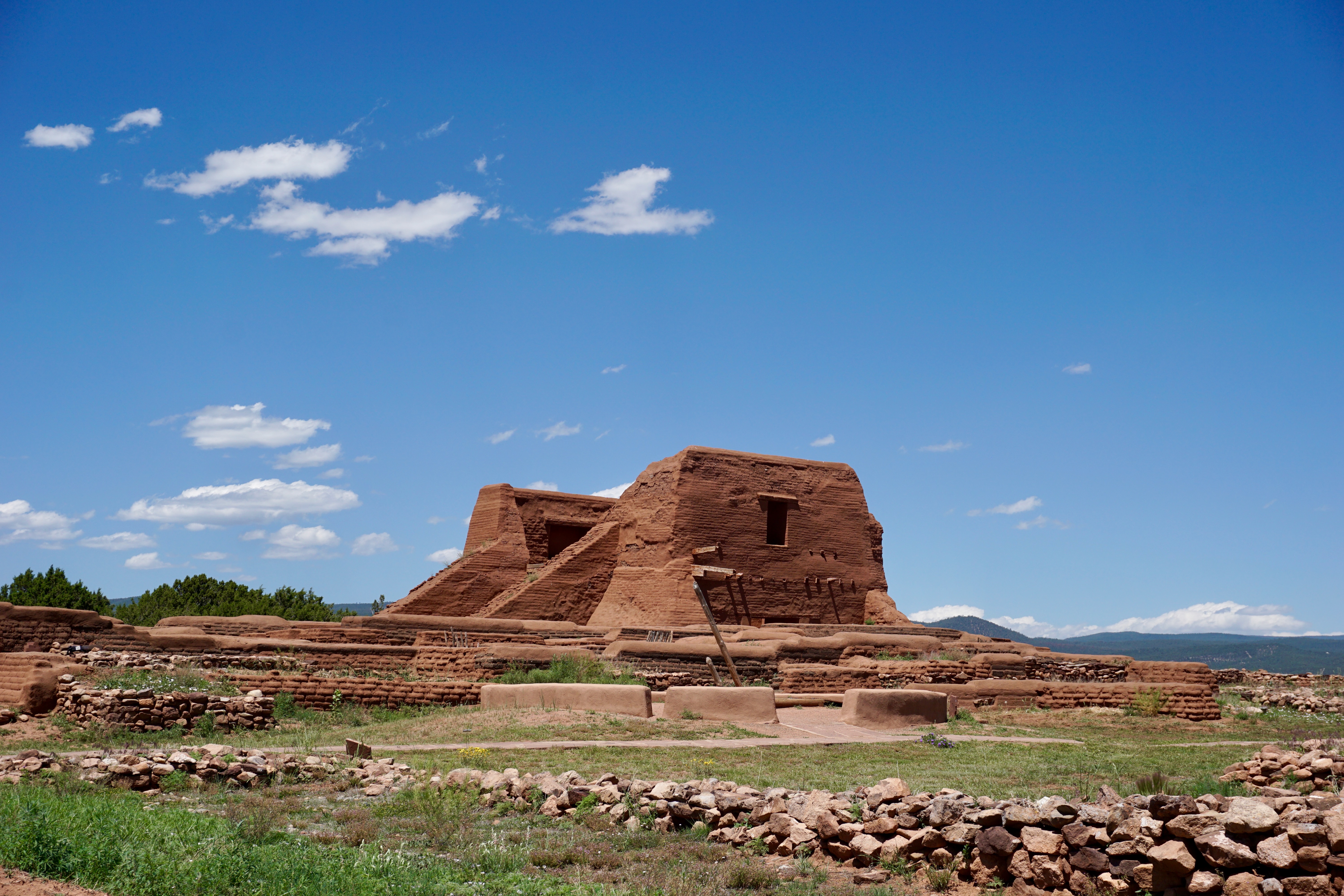
However, Pecos is not just limited to scenic nature.
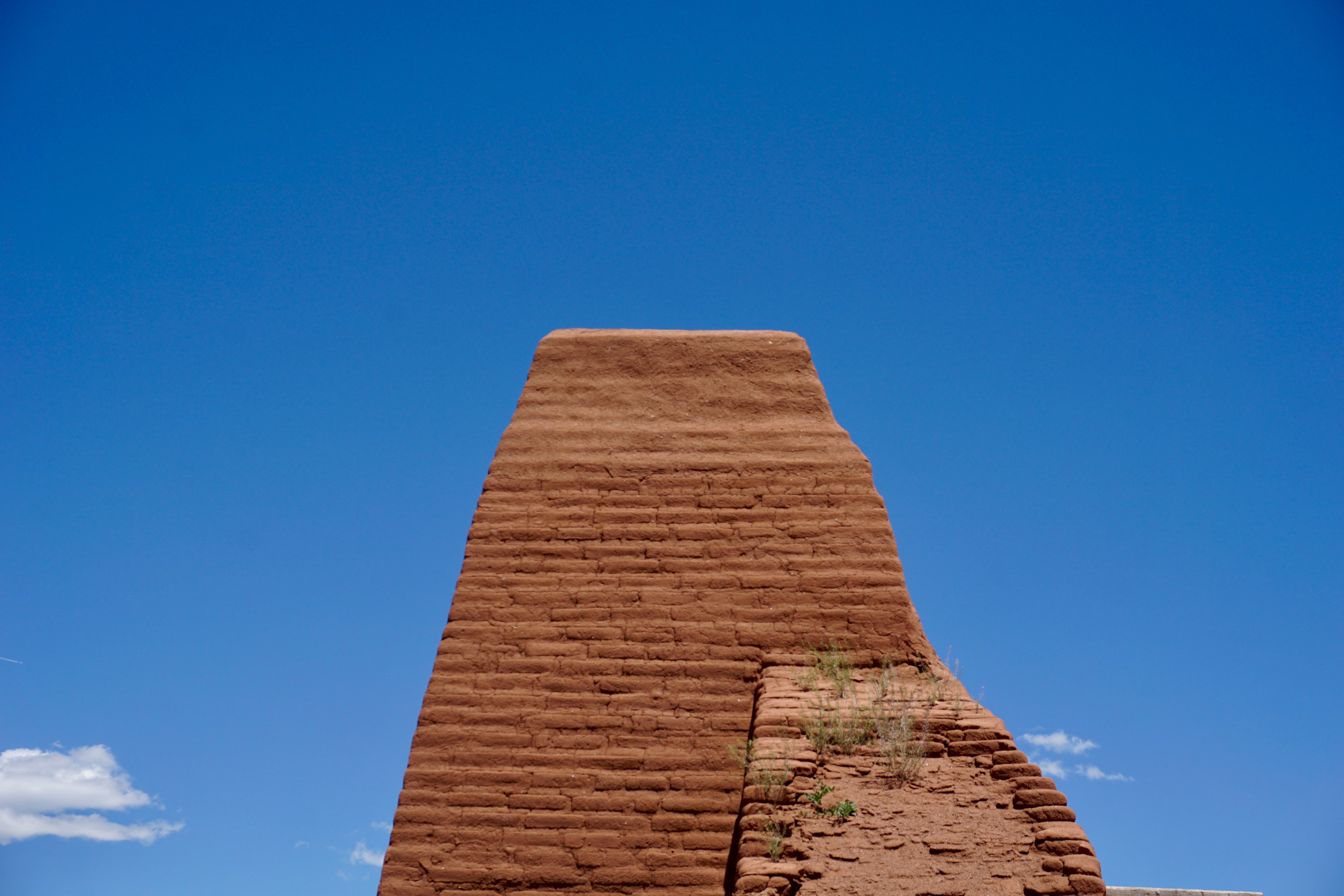
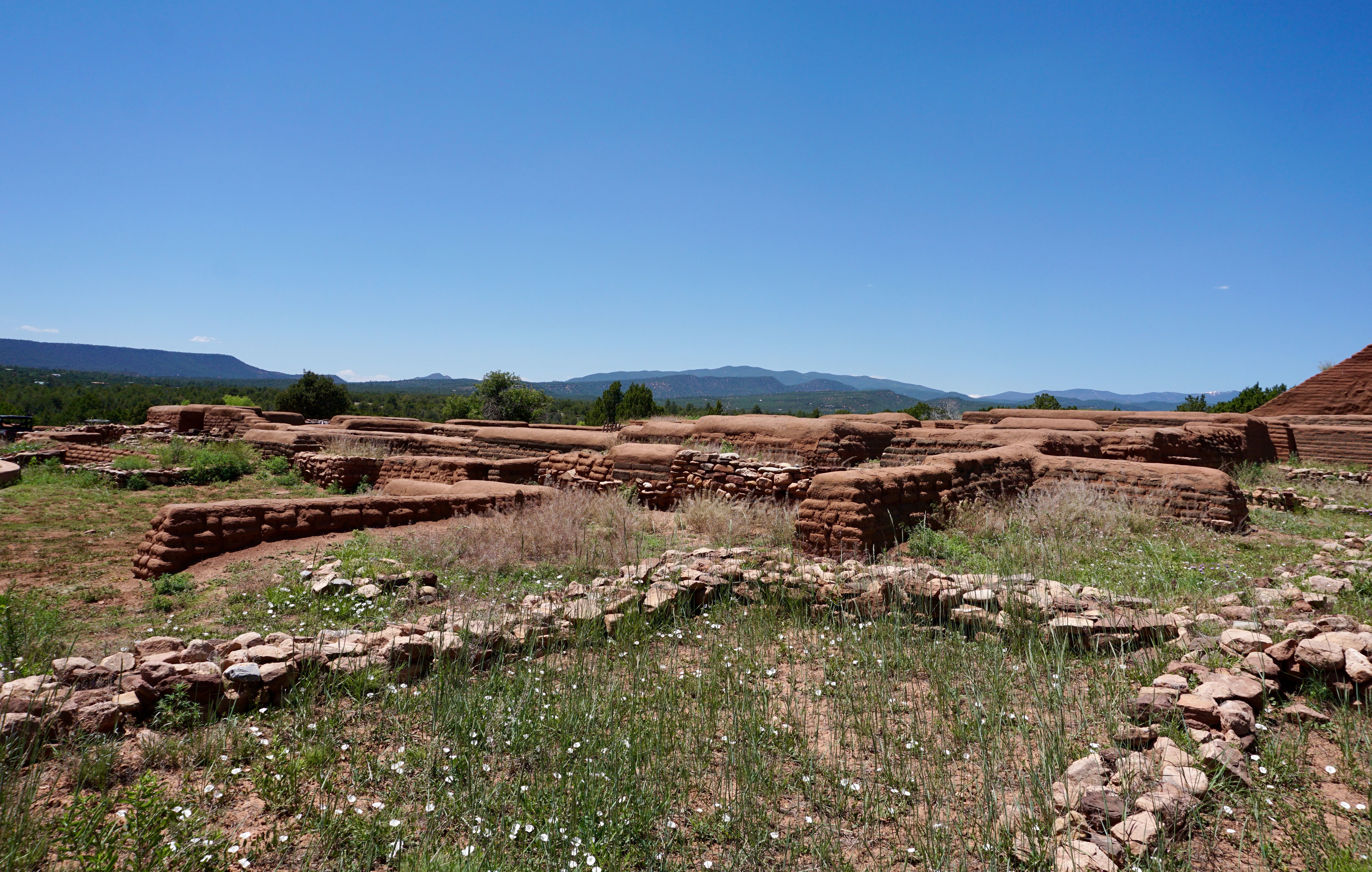
This trail’s centerpiece is the ruins of Pecos Pueblo and the Mission of Our Lady of the Angels of Porciúncula.
What remains of the Mission itself is relatively substantial.
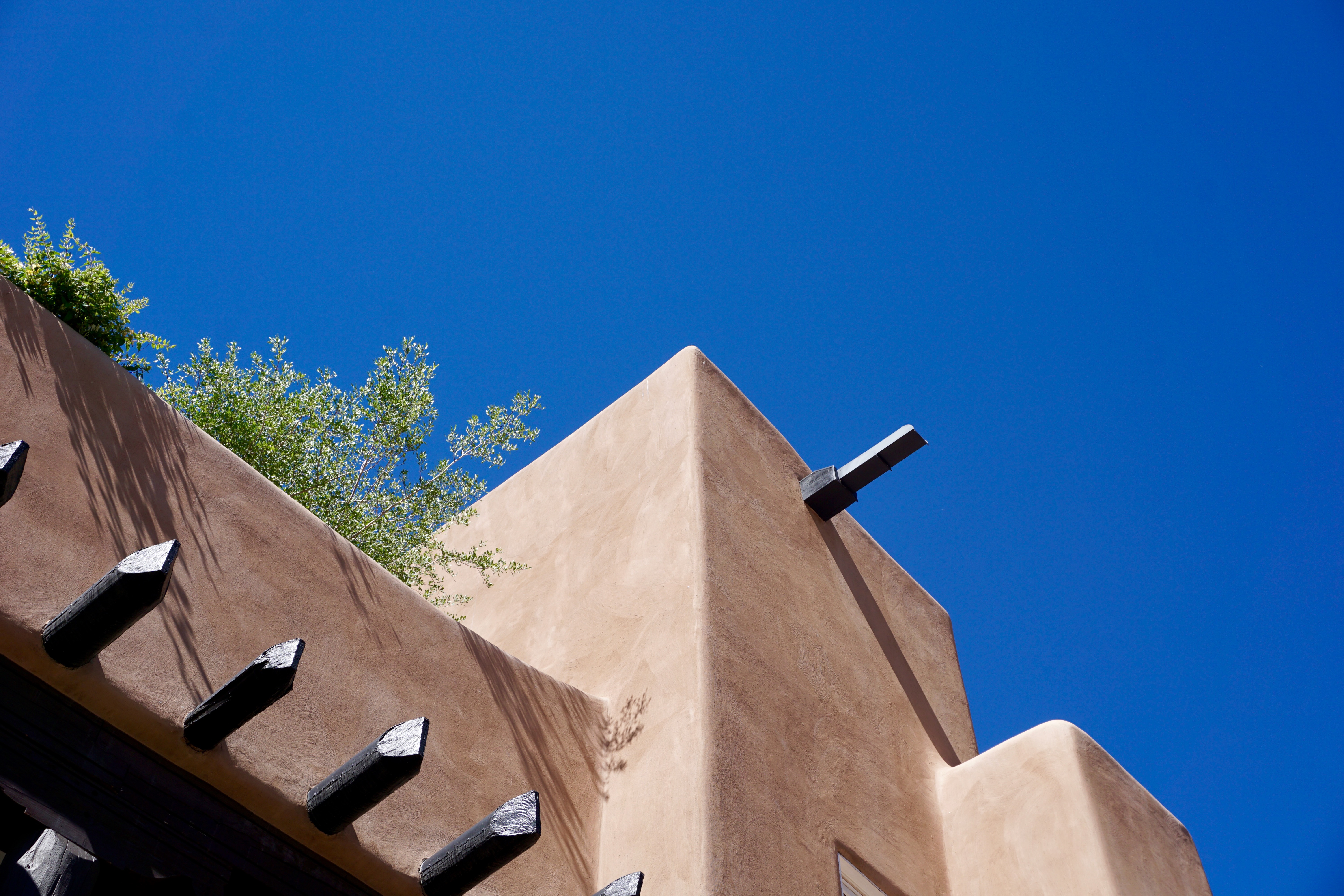
It cuts a striking figure against New Mexico’s bold, blue, endless skies.
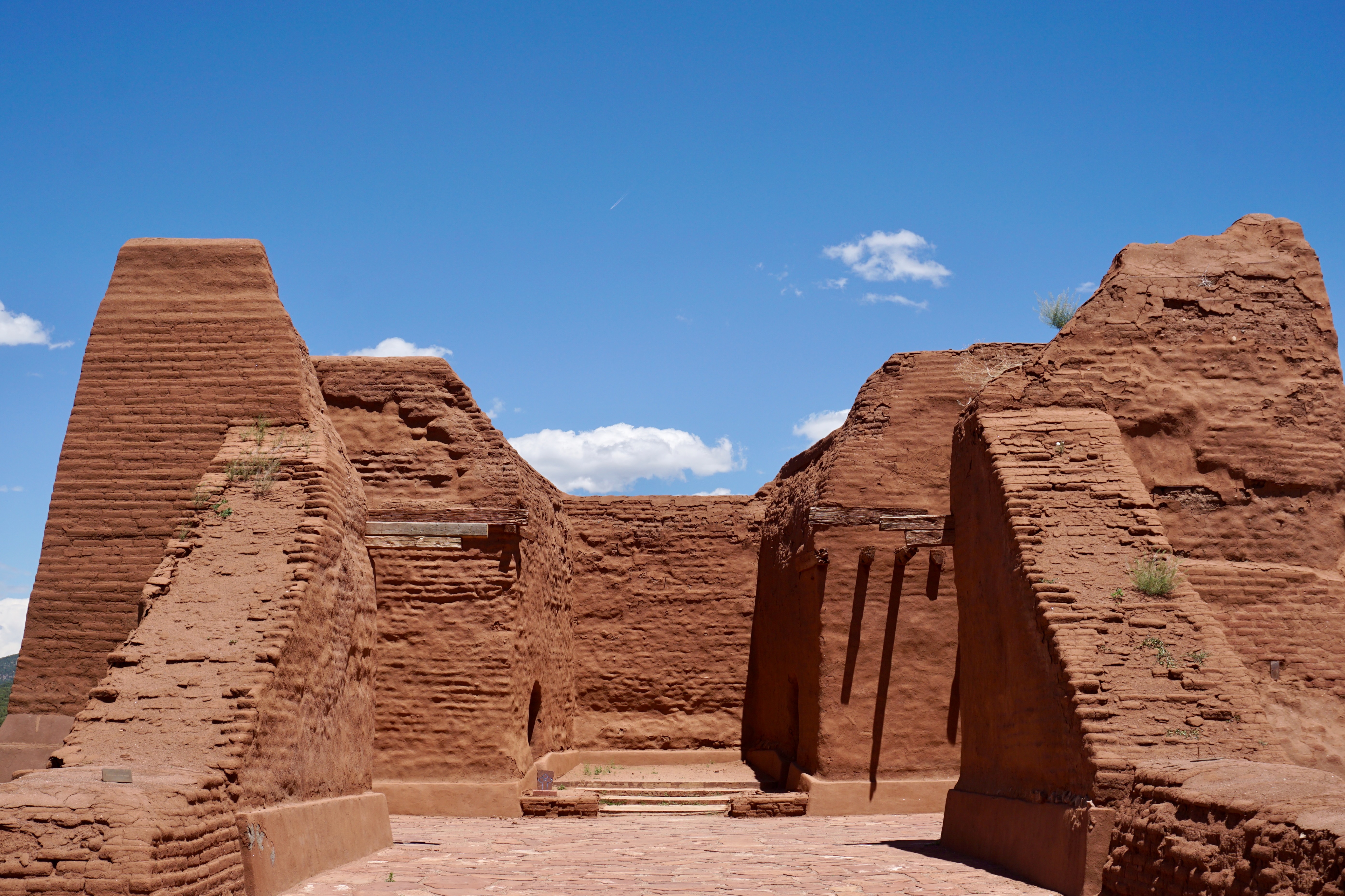
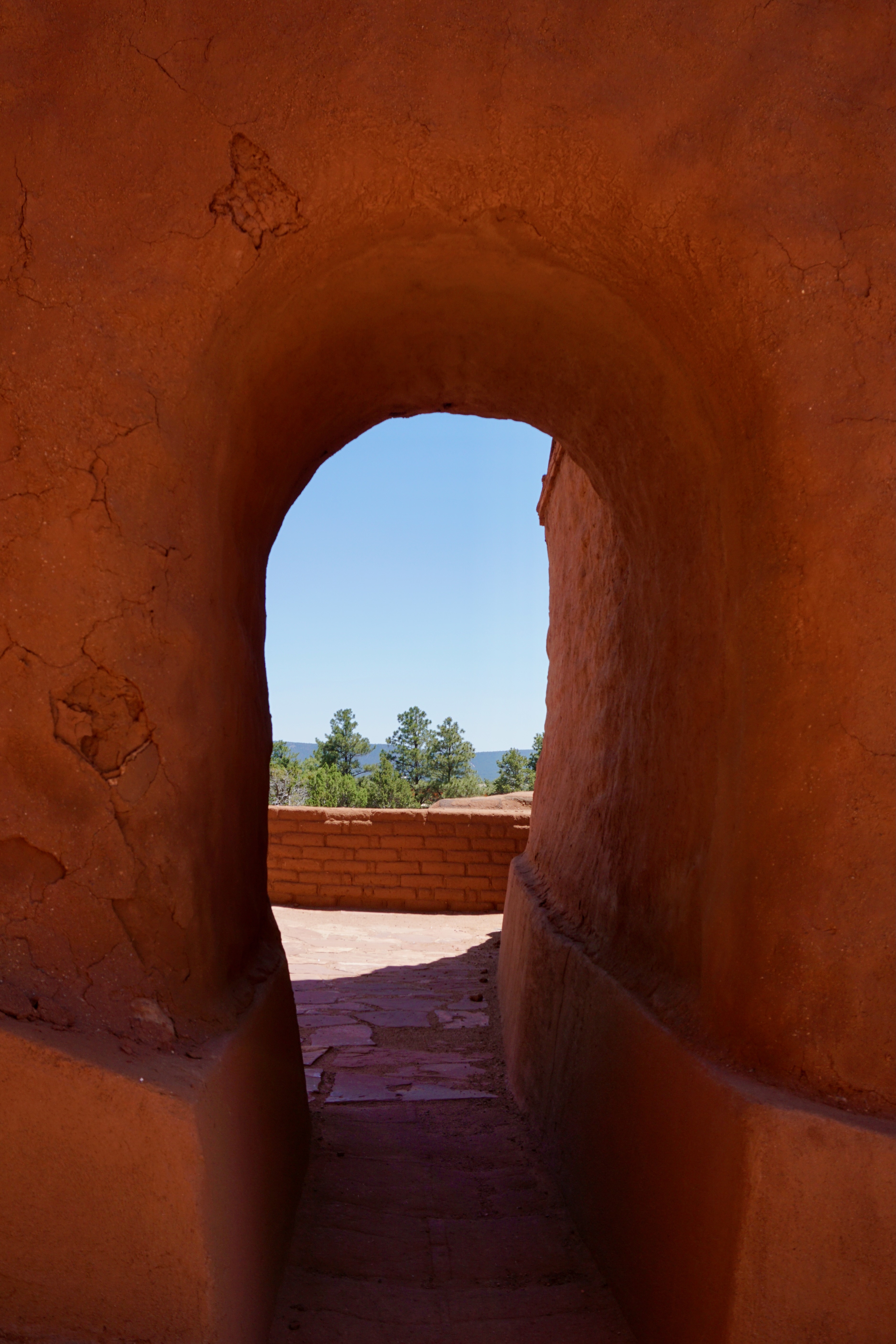
A patch of sky within a fortress of adobe.
A man-made hallway onto a world of tall trees and mountains.
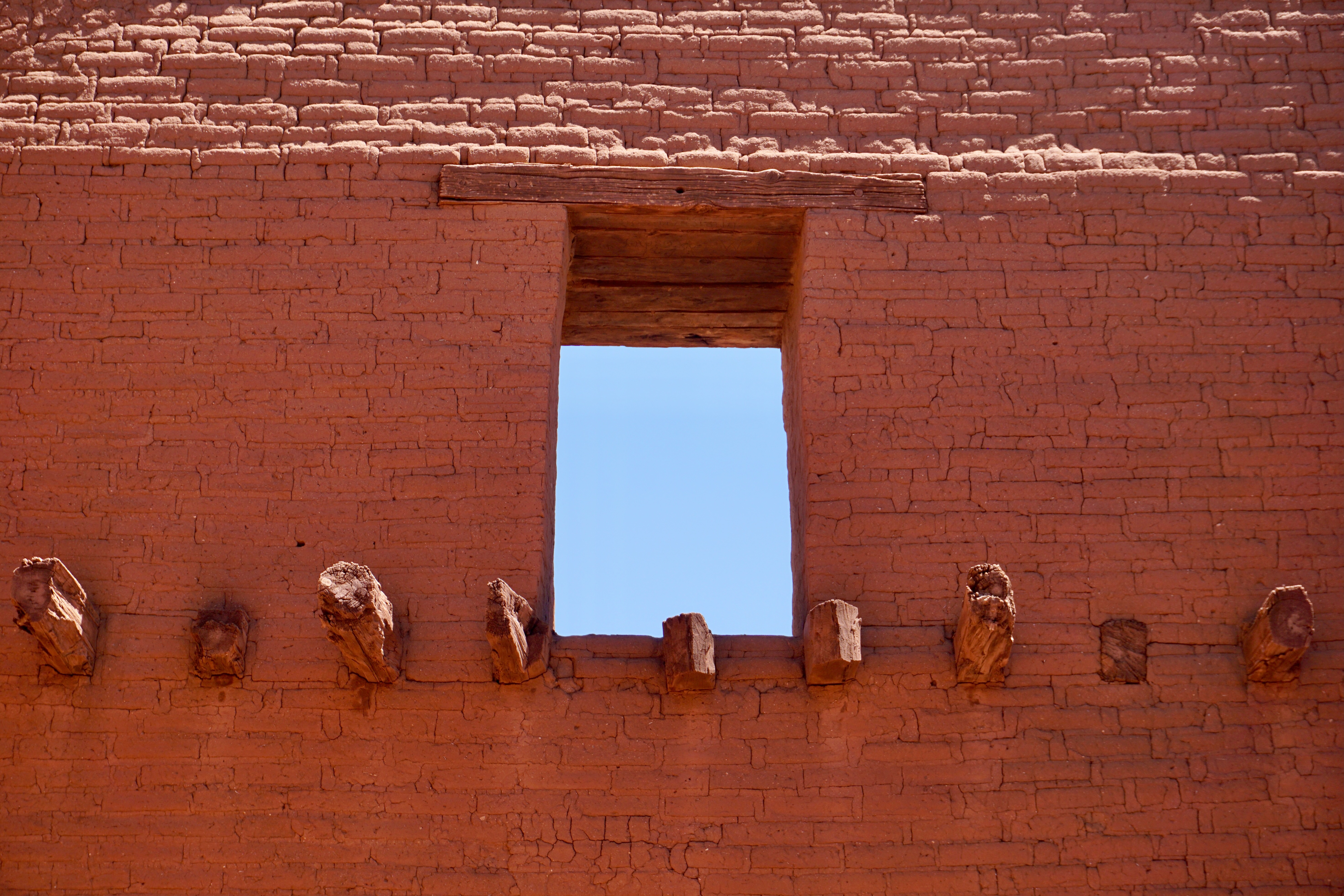
What’s left of the Pueblo, built sometime around 1619.
Although one of the sites of the 1680 Pueblo Revolt against Spanish colonizers, today, Pecos is a somber, peaceful place. A half-hour drive from Santa Fe, it’s one of the more convenient ways to take in the simple, lovely essence of New Mexico.
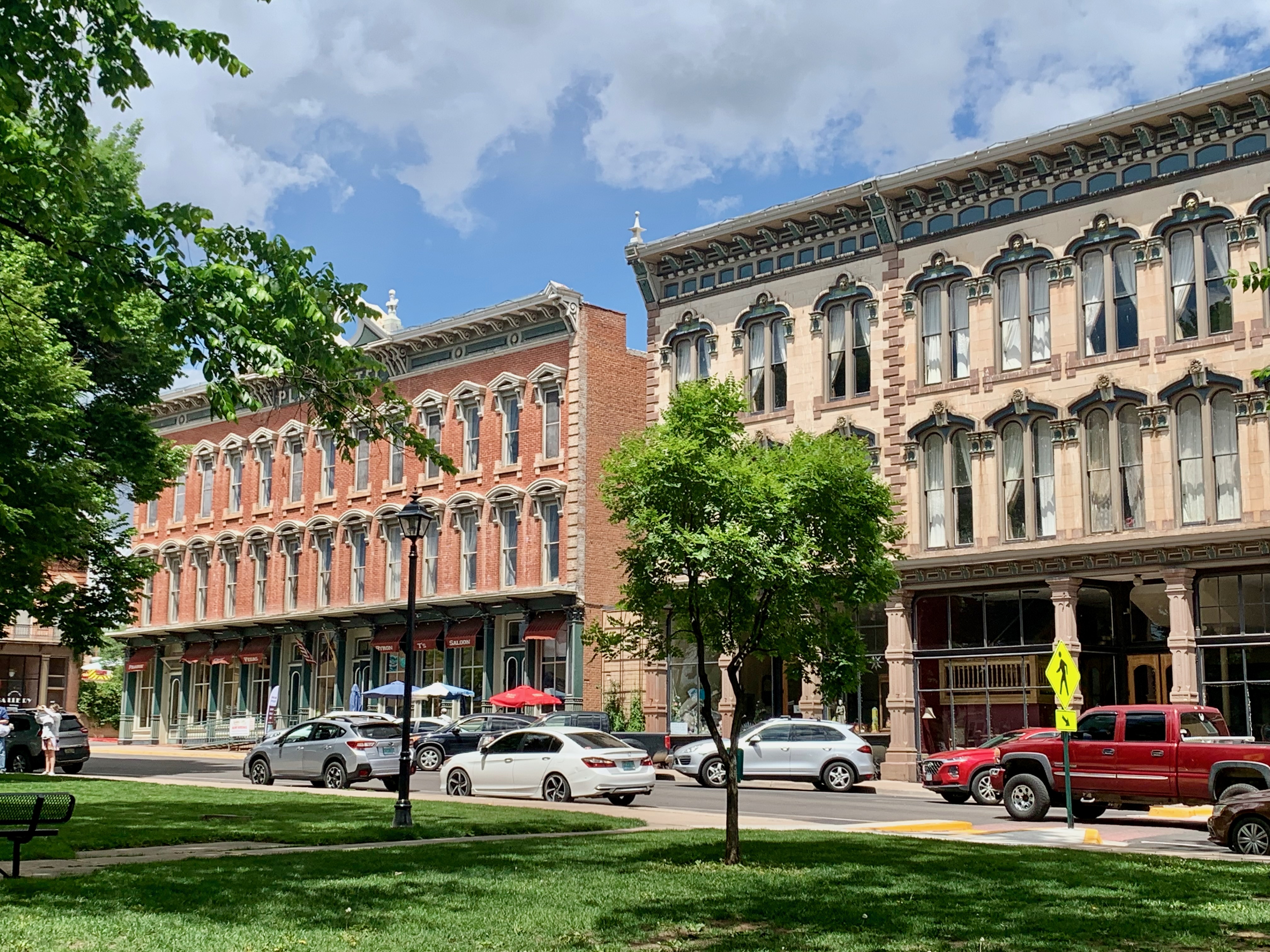
An hour east of Santa Fe, it’s the county seat of San Miguel County, with a population of 13,166.
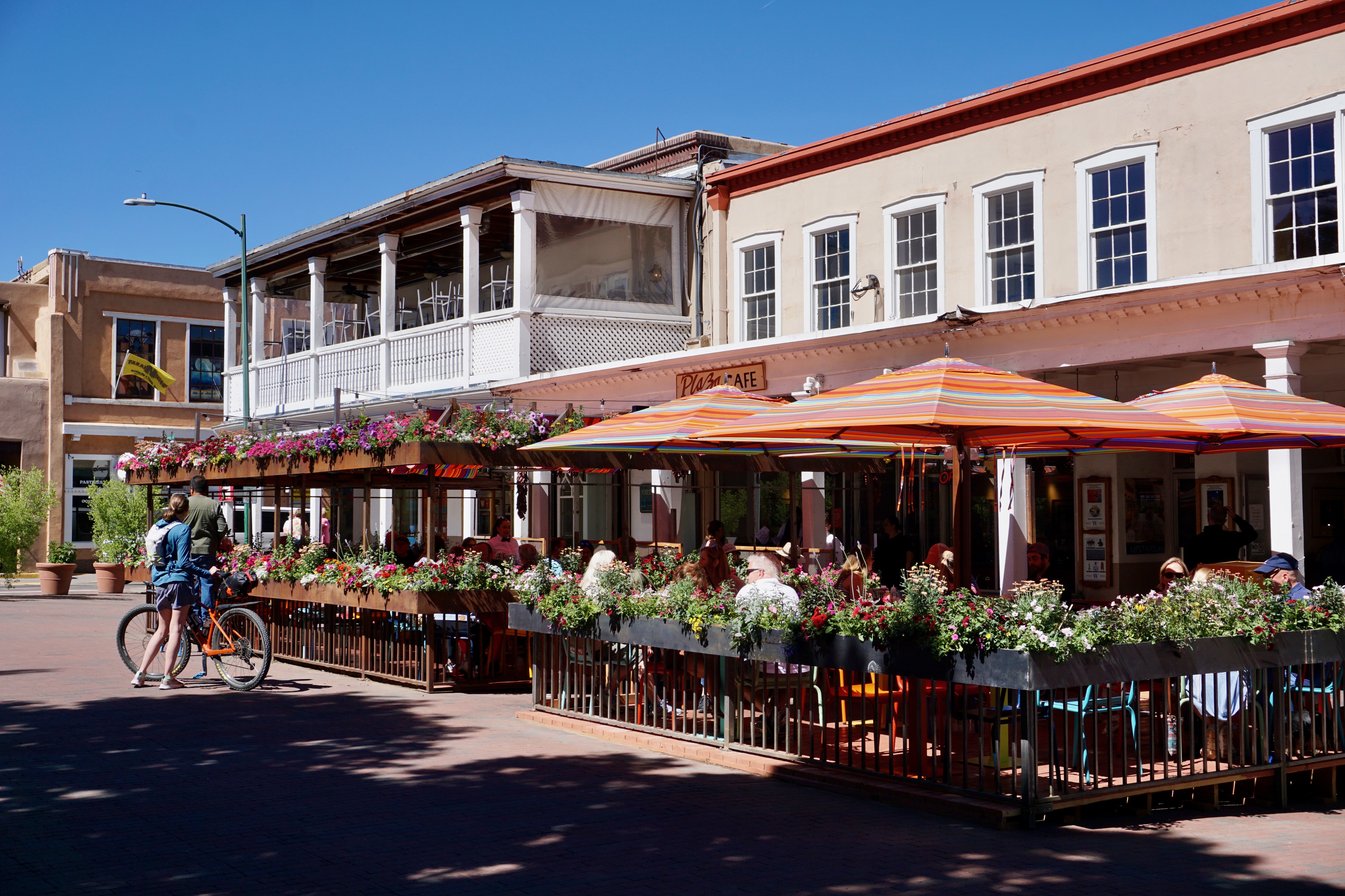
Looking for a day trip locale other than Taos, Las Vegas seemed a good bet due to its downtown Plaza with its share of beautiful, historic buildings…
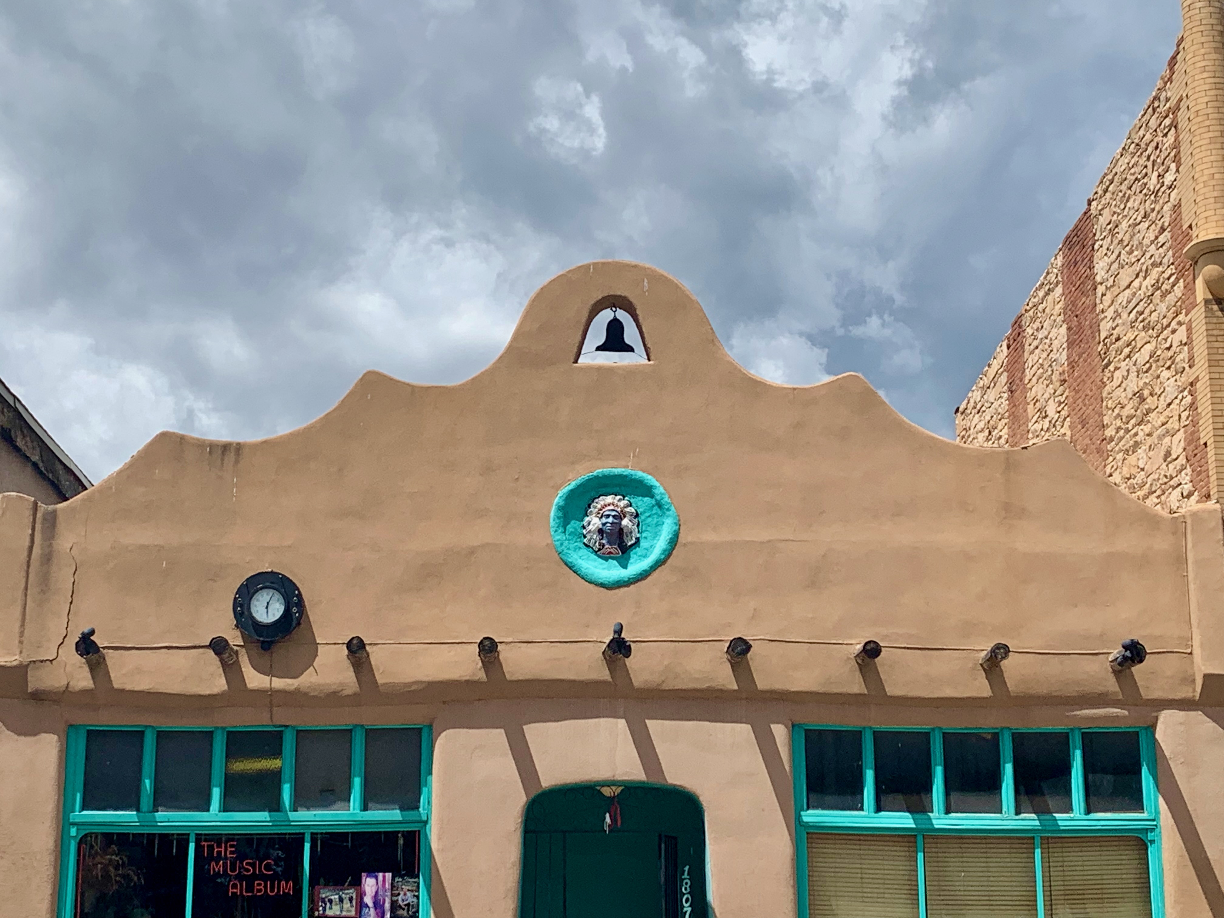
…but not as many as the tourism brochures would have you believe. As with most of New Mexico, there’s a considerable amount of adobe.
Some of the abode buildings are more aesthetically pleasing than others, particularly when flanked with turquoise paint.
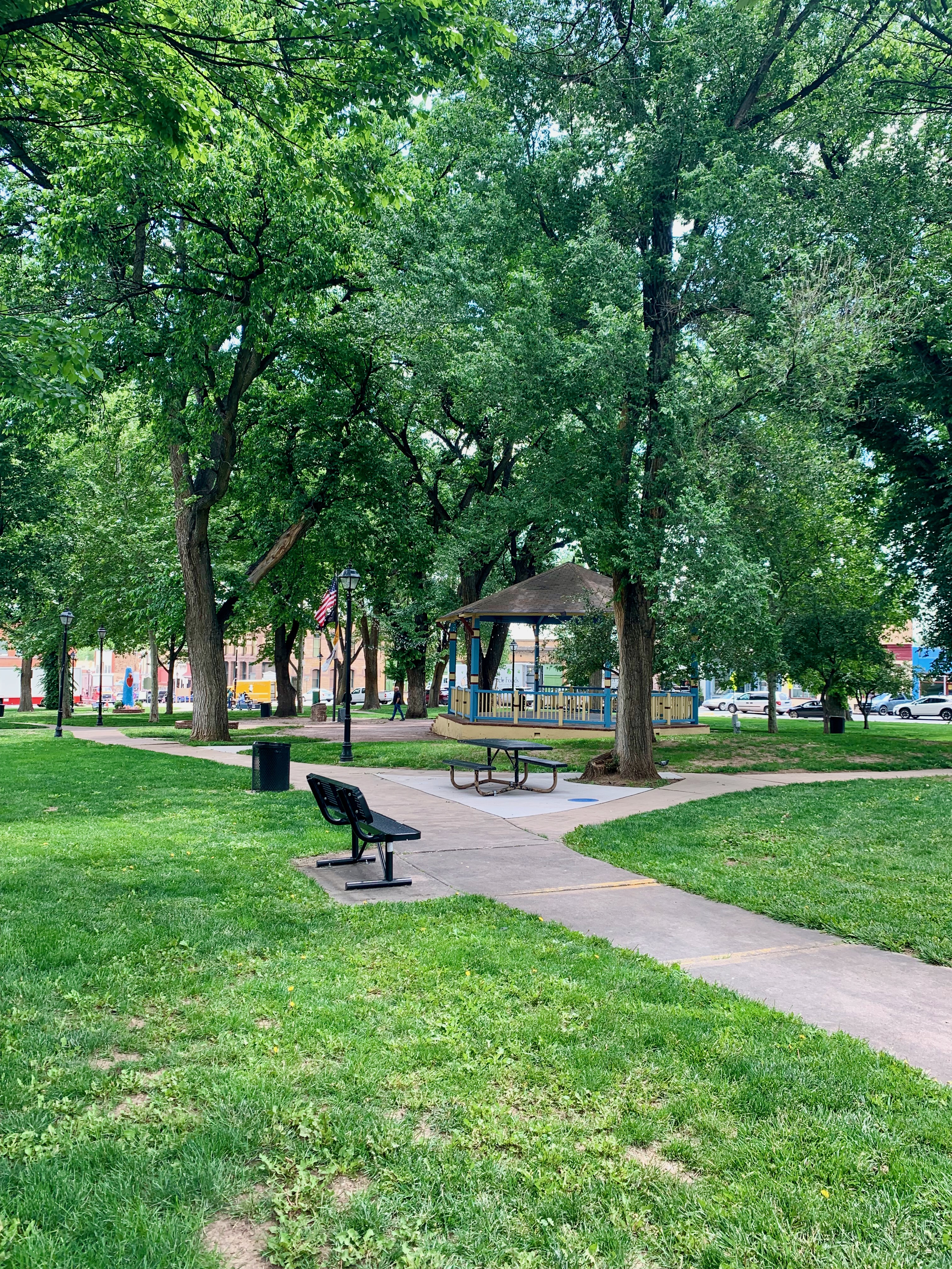
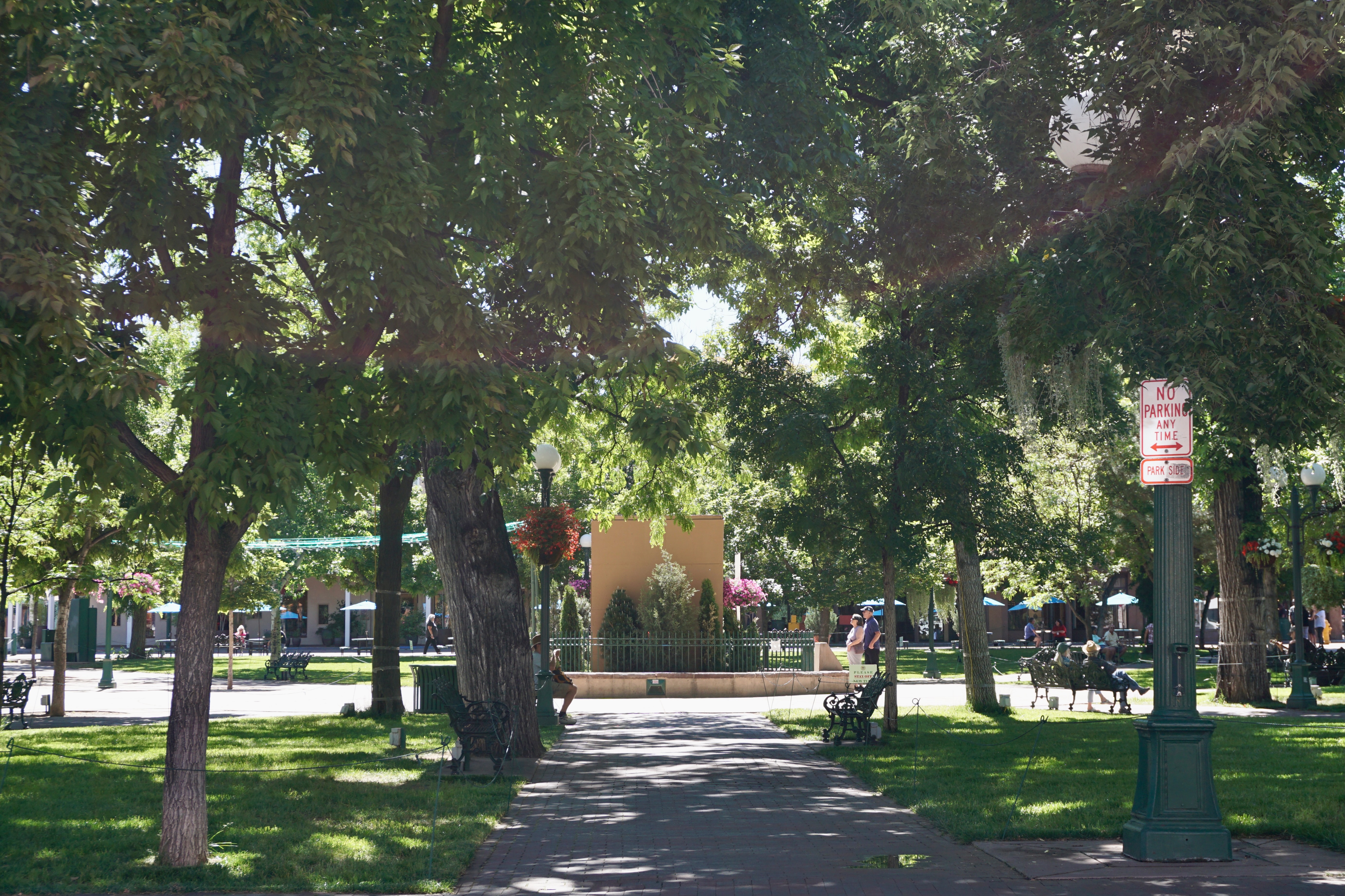
Still, the leafy Plaza is pleasant, if not as bustling as Santa Fe’s (on a cloudy Monday afternoon, anyway.)
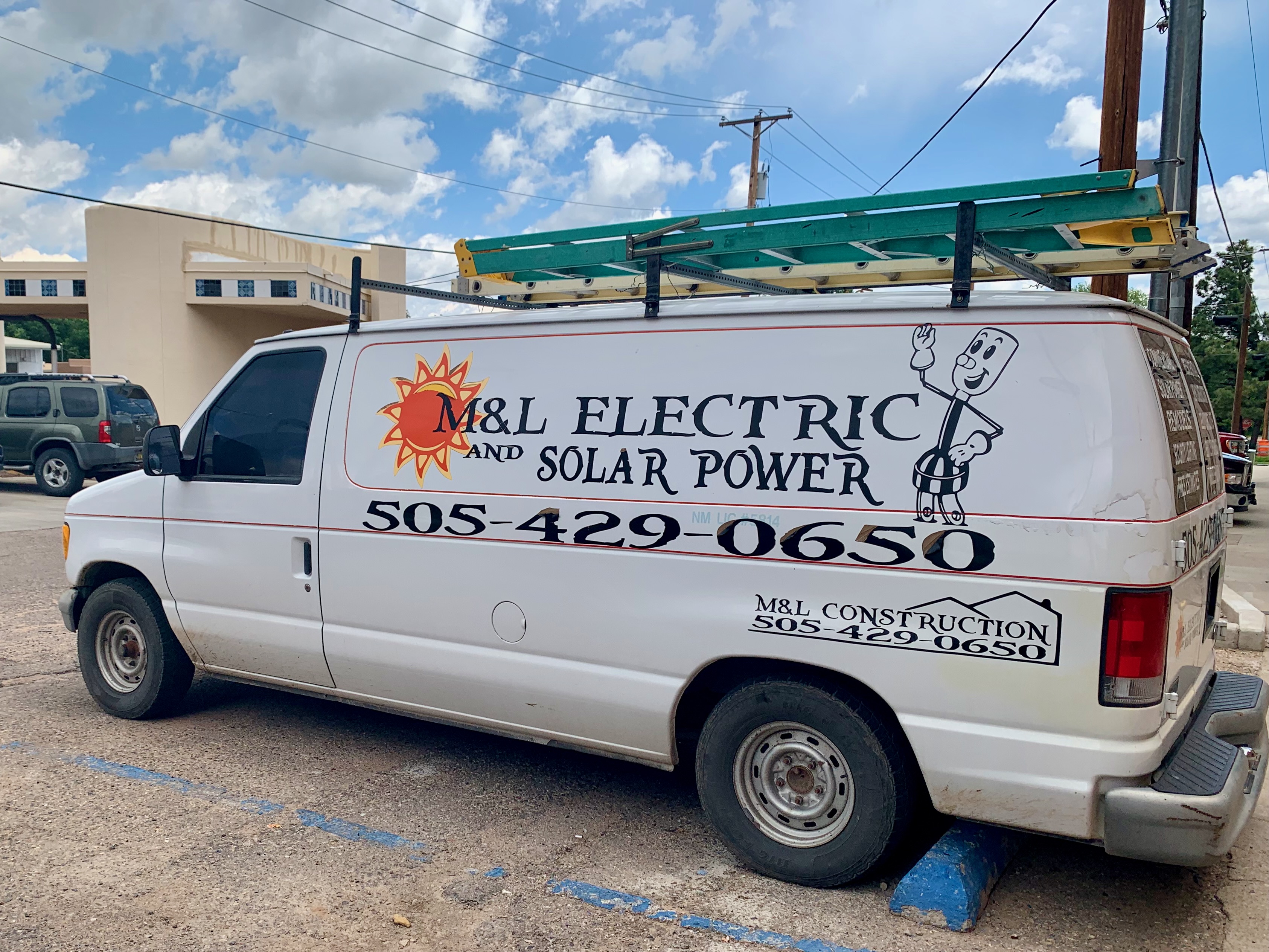
We explored beyond the Plaza a bit into this residential neighborhood…
…and directly behind the Plaza Hotel (seen in the first two pix above), I spotted this whimsical van for a local business.
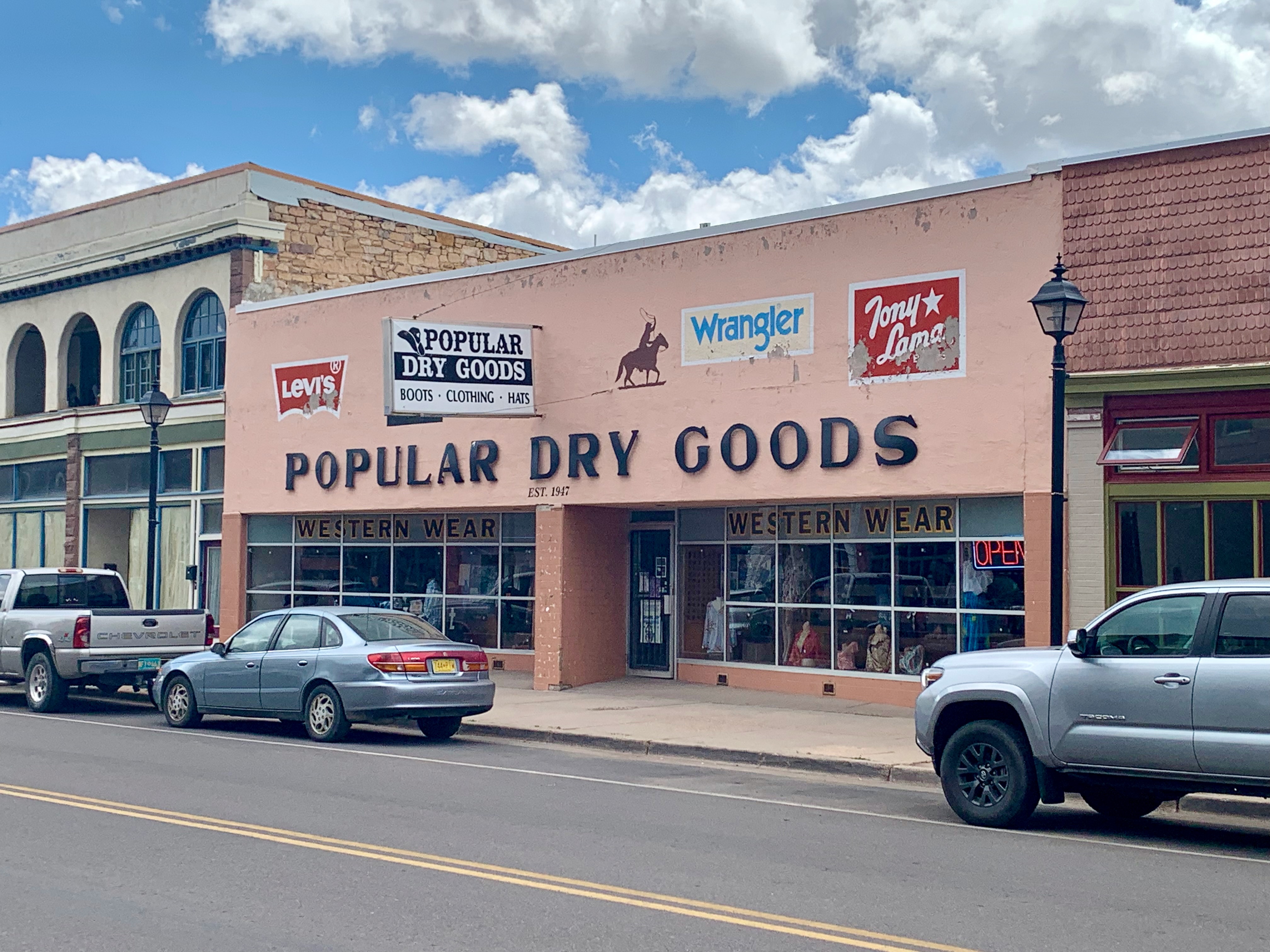
Fortunately, one only had to look towards Bridge Street east of the Plaza to find some small town, Main Street charm.
I mean, would you rather have a boring ol’ Family Dollar in your small town or this vintage beauty (no matter how dilapidated the front signage?)
Erected when the railroad first came through in 1879, Stern and Nahm is one of the oldest buildings in town.
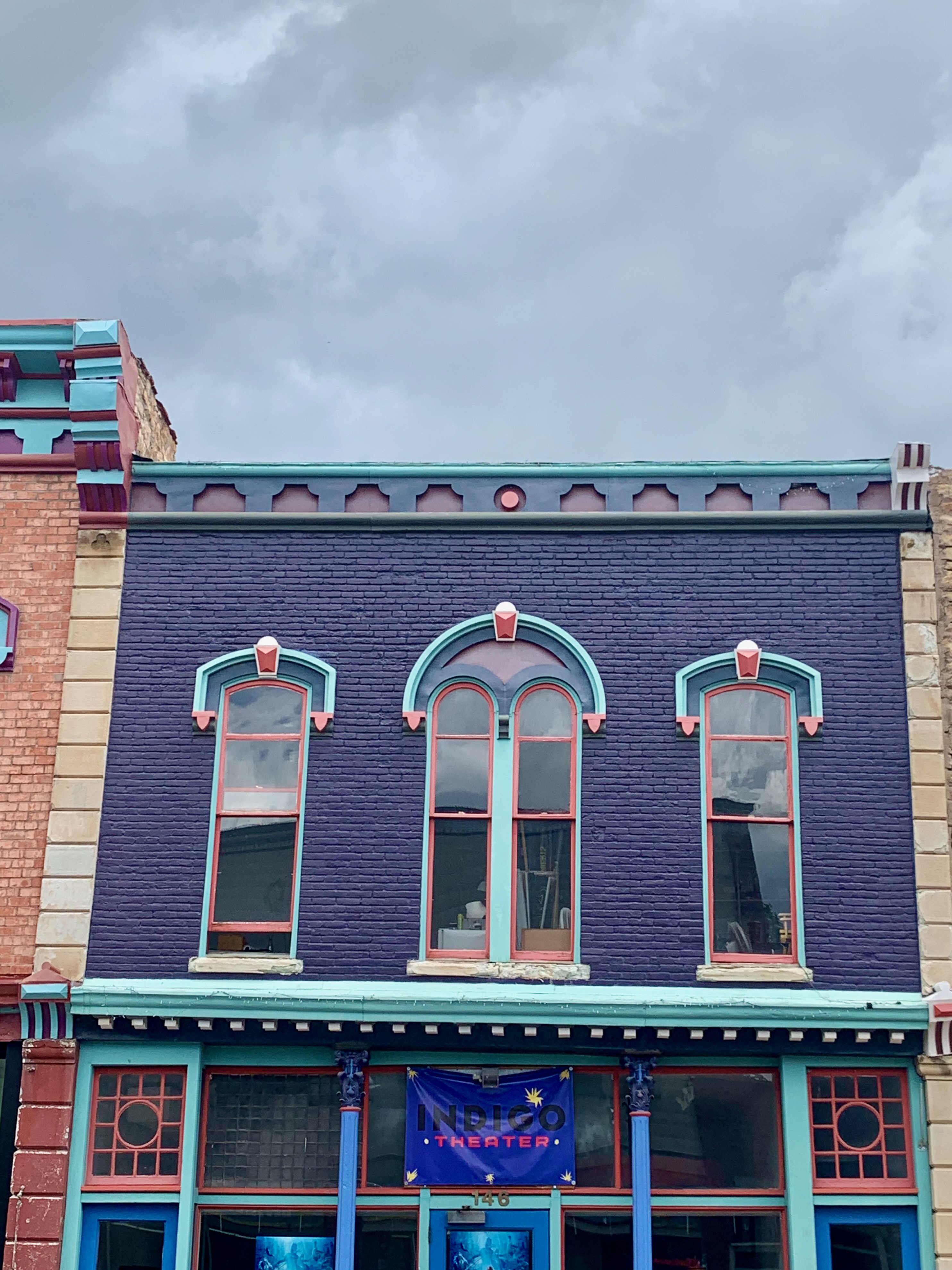
Opened as the Mutual Theater in 1912, the Kiva sadly closed in 2013.
Fortunately, there’s the Indigo Theatre across the street, currently playing Oppenheimer as of this post’s date.
A vibrant-looking cafe is always a good sign of activity in a small town, though as I was taking pix, an elderly local came up to me and asked, “What brought you to Las Vegas? There’s nothing going on here!”
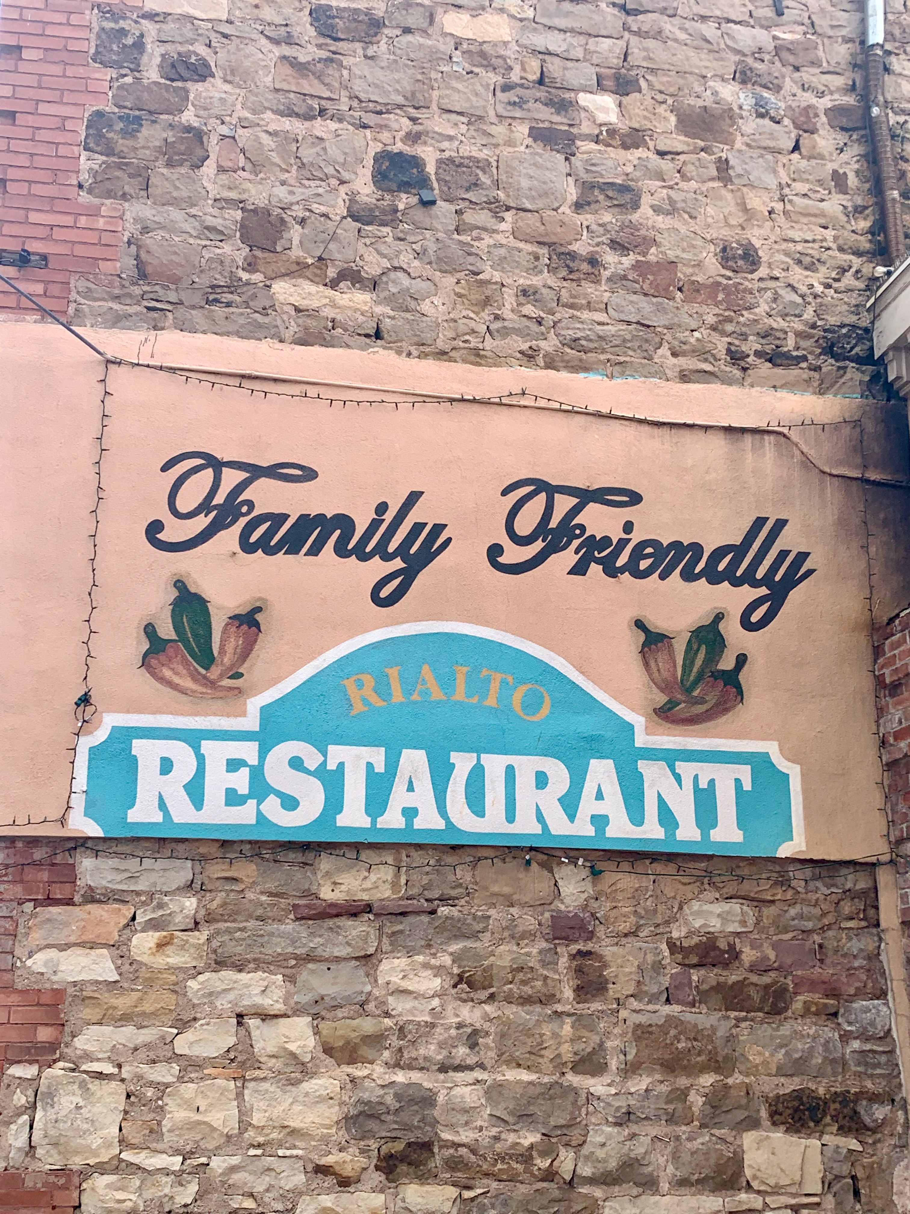
I would argue these pix are evidence of signs of life; it’s too bad the ultra-cool, stuck-in-time El Rialto was closed on Mondays.
Quintessential New Mexico for sure.
Paper Trail, a book and gift store is another vital sign. I was instantly drawn to this color-coded display.
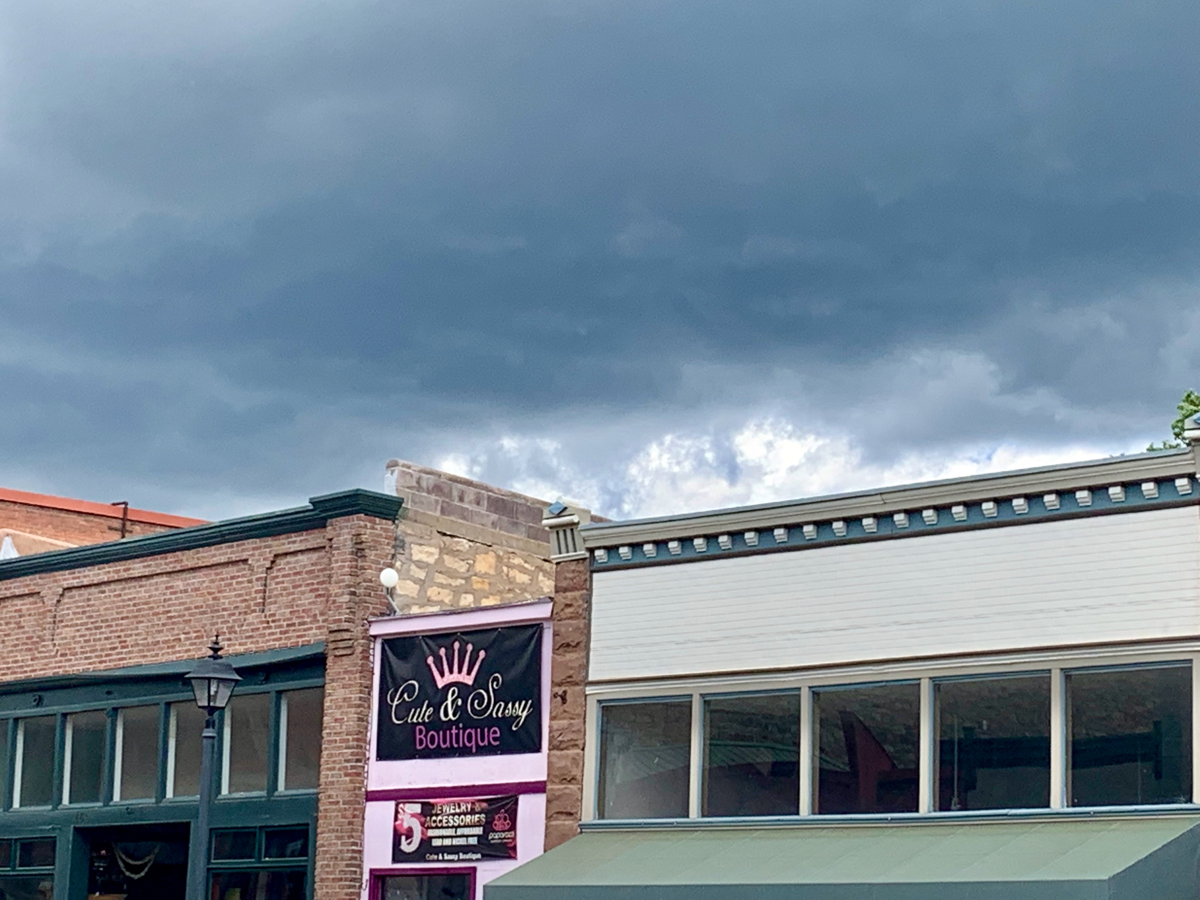
Ominous storm clouds surrounded Las Vegas during our visit but thankfully only produced a smattering of raindrops. Despite not much going on there, the town exhibited ample personality.
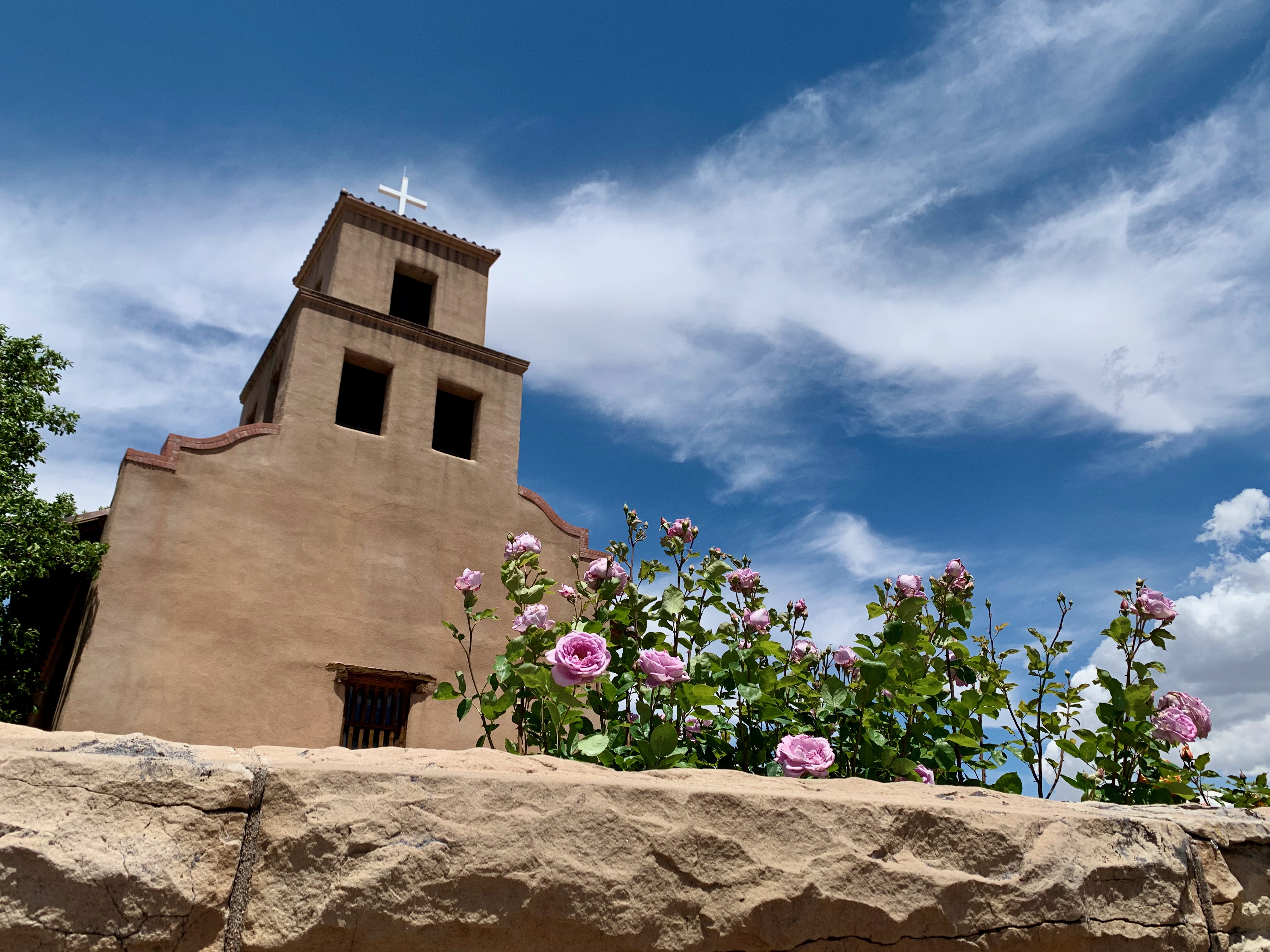
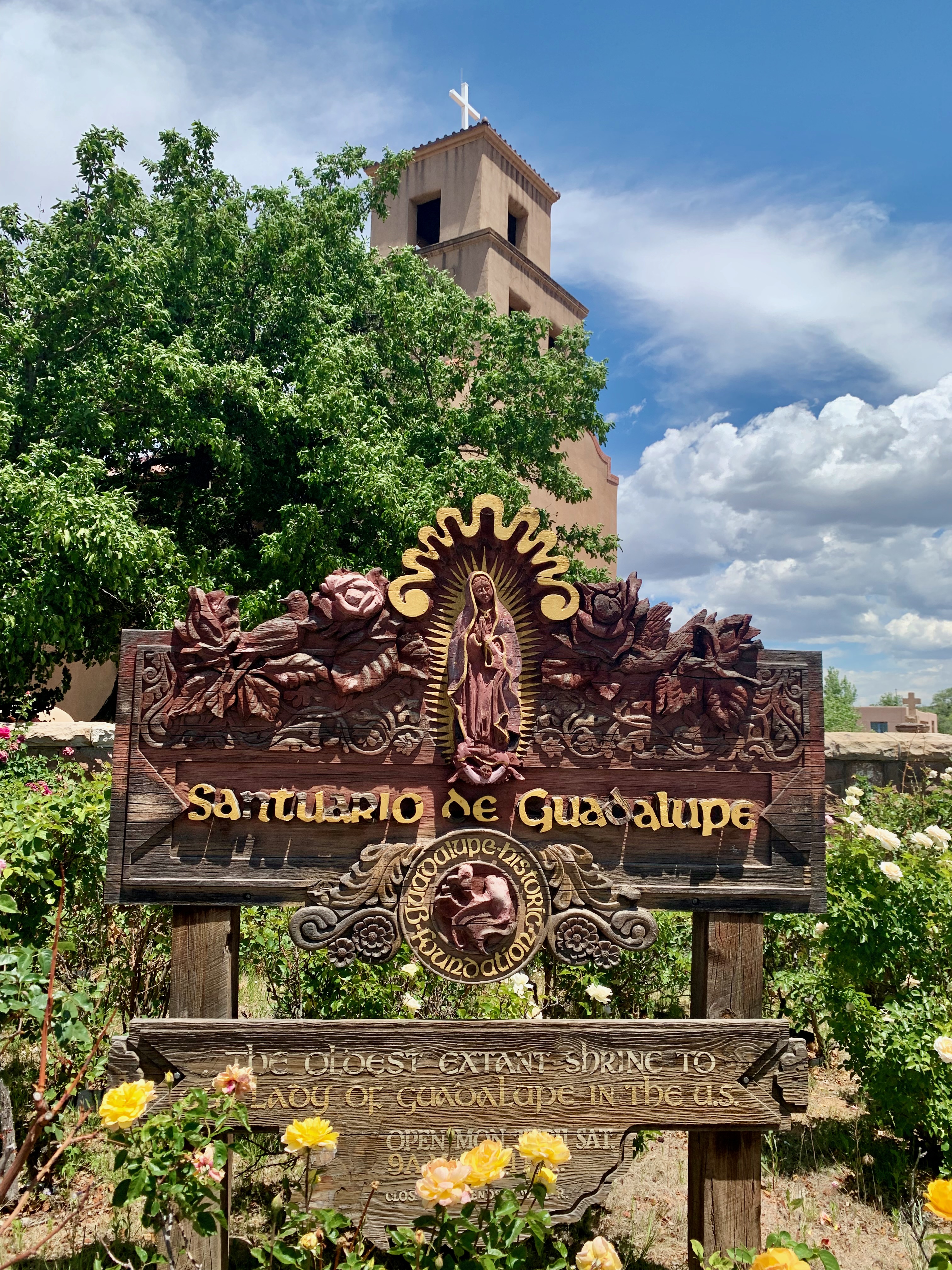
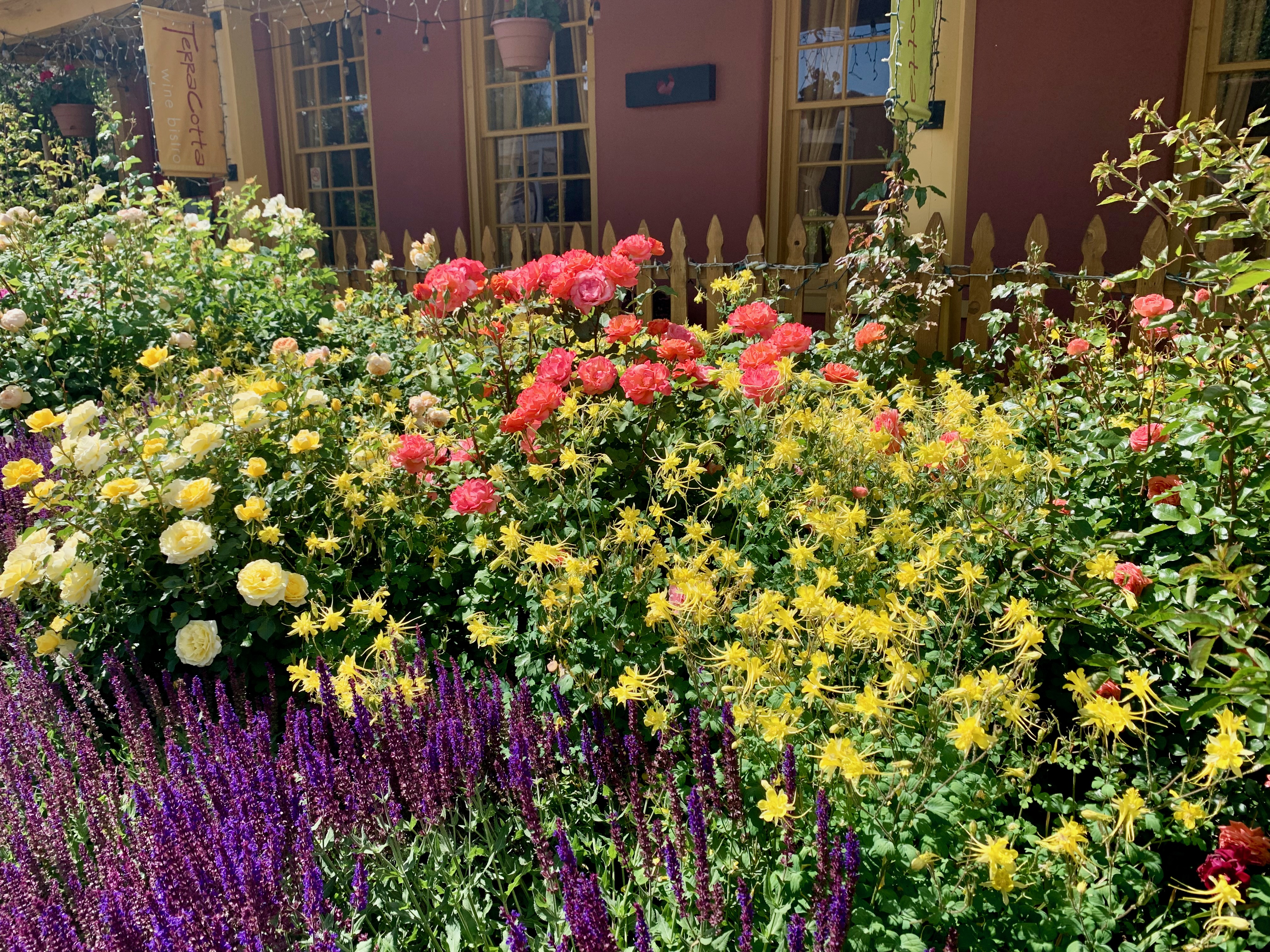
Until I saw so many of them in person last month, it didn’t even occur to me that I was visiting Santa Fe at the height of rose season.
I’d visited Our Lady of Guadalupe church and shrine on past visits (both in September) and was delighted to see the grounds decked out in roses this time. What a vivd array of color:
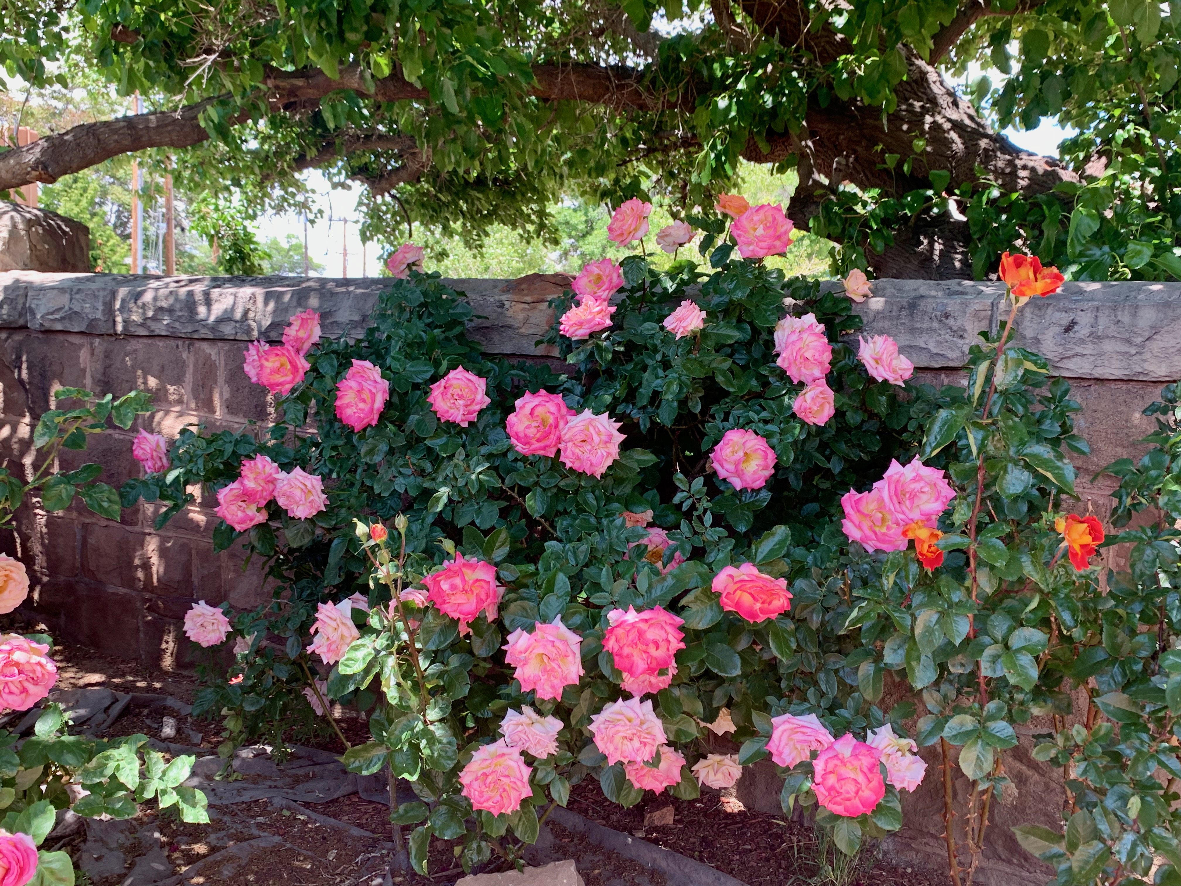
A few days later, I came across more roses in this sun-kissed residential garden a few blocks from the Plaza.
When I retire one day, I wouldn’t mind tending to my own bountiful front yard garden.
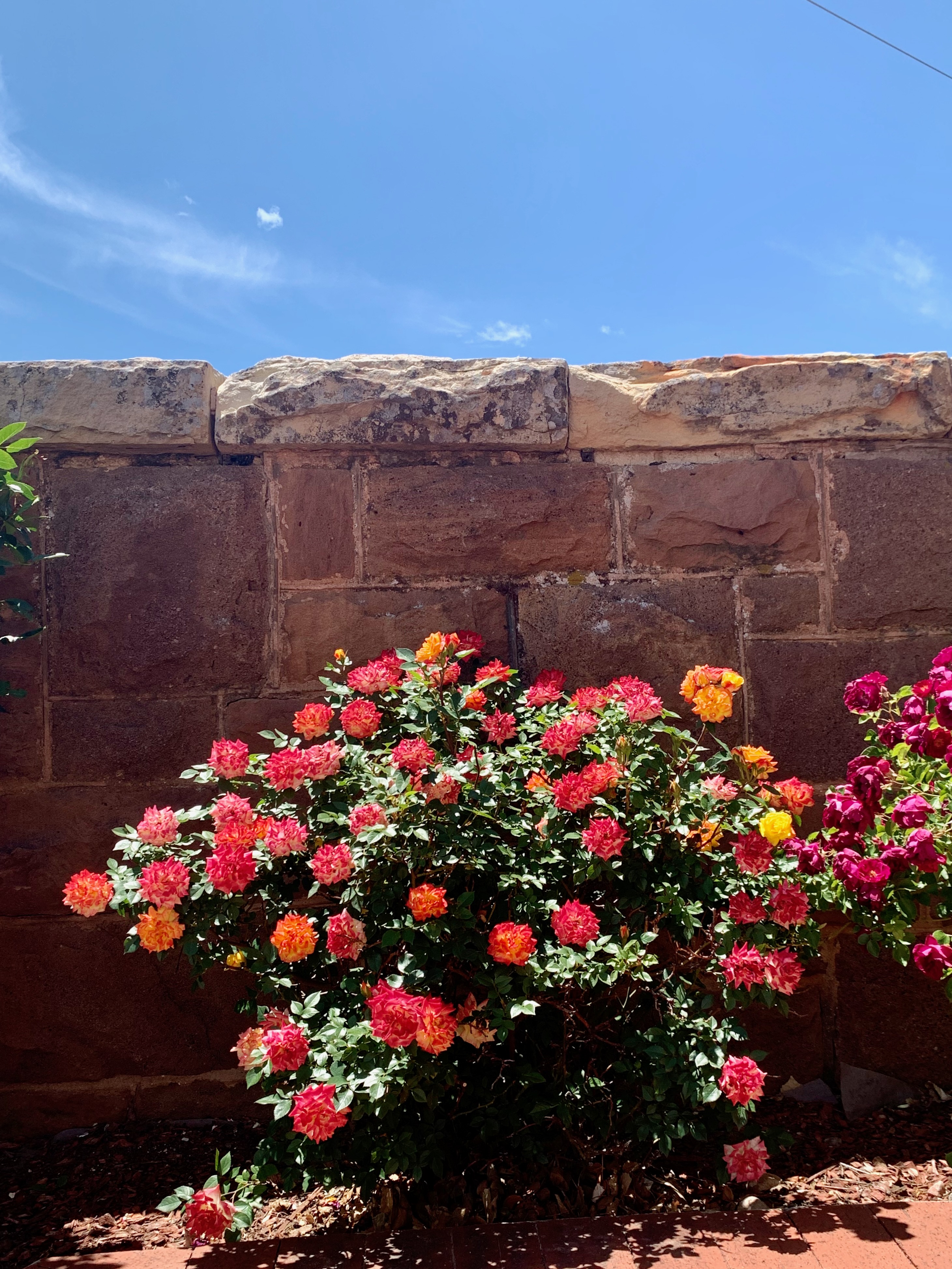
On the same block, bushes and bushes of red roses (along with strings of the ubiquitous-in-NM red chiles) flanked the Santa Fe School of Cooking.
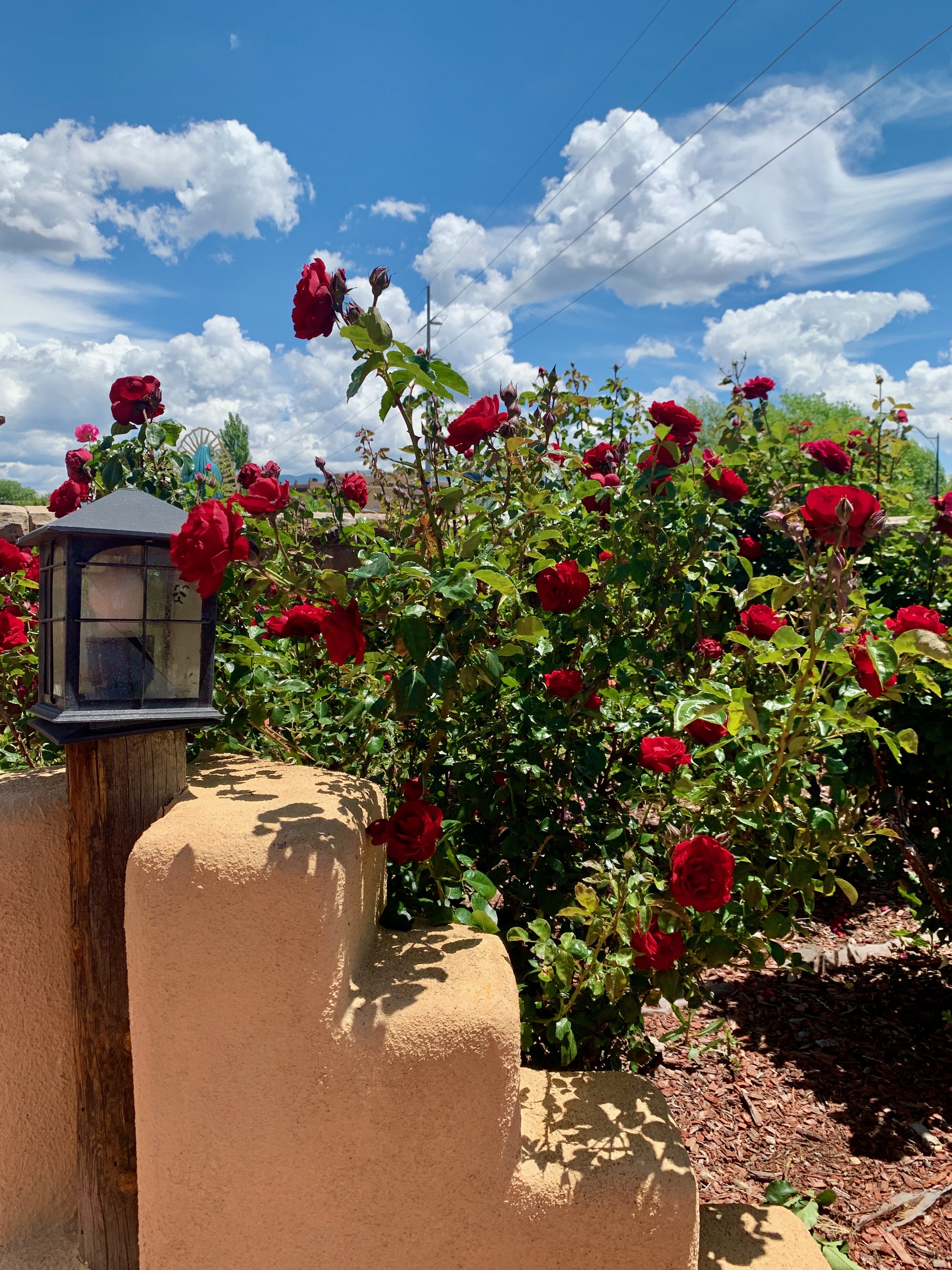
To quote the great Madeline Kahn in Blazing Saddles, “A Wed Wose… How Wovewy.”
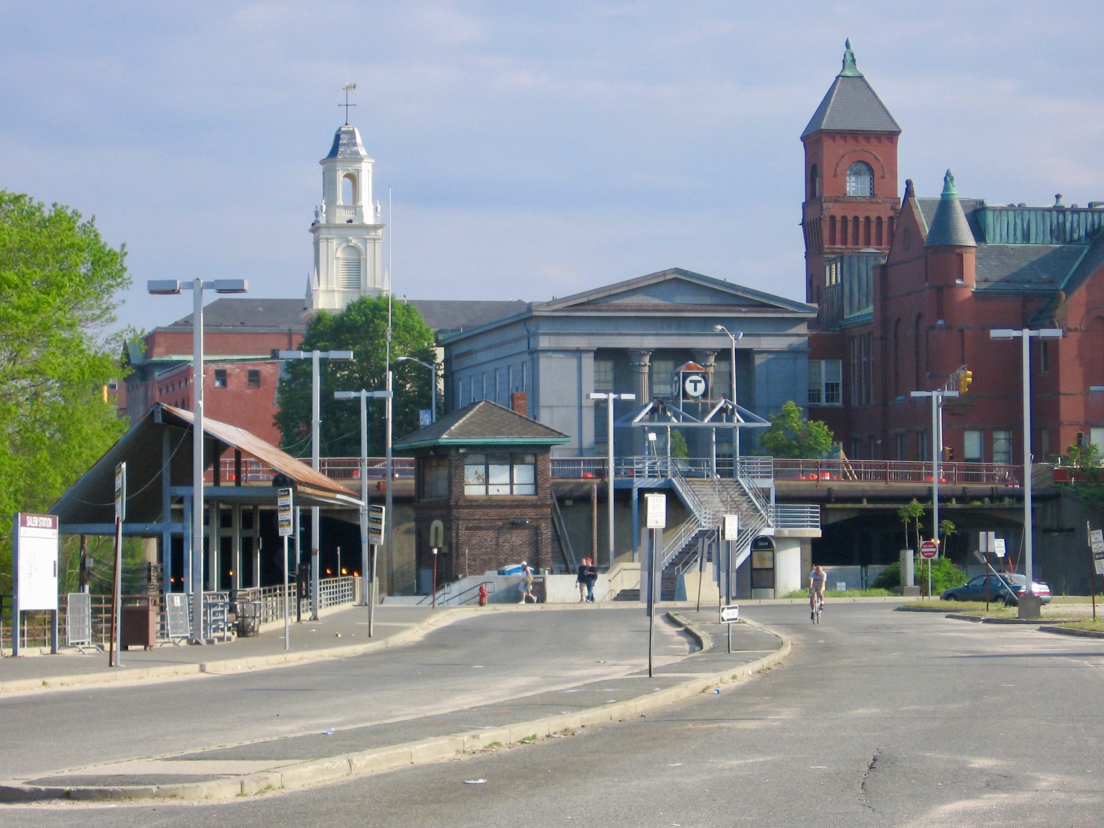
October may be an ideal time to visit Salem, Mass., but only if you adore navigating your way through the massive throng of tourists descending upon “Witch City” in the weeks leading up to Halloween. Myself, I prefer this town (less than 20 miles north of Boston) just about any other time of year (that’s not bone-chillingly cold outside.)
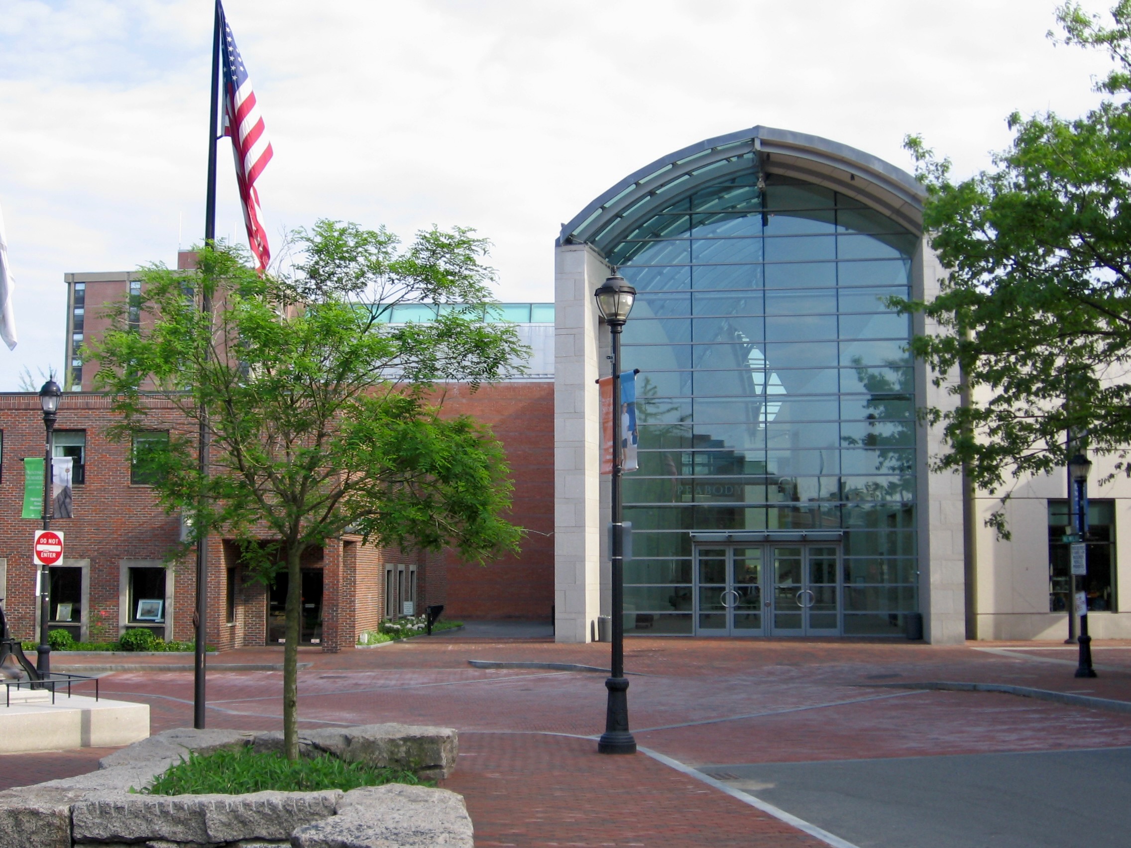
One Memorial Day in the mid-00’s, I took the commuter rail from North Station to Salem primarily to visit the Peabody Essex Museum (PEM). This newer wing above was completed a few years before.
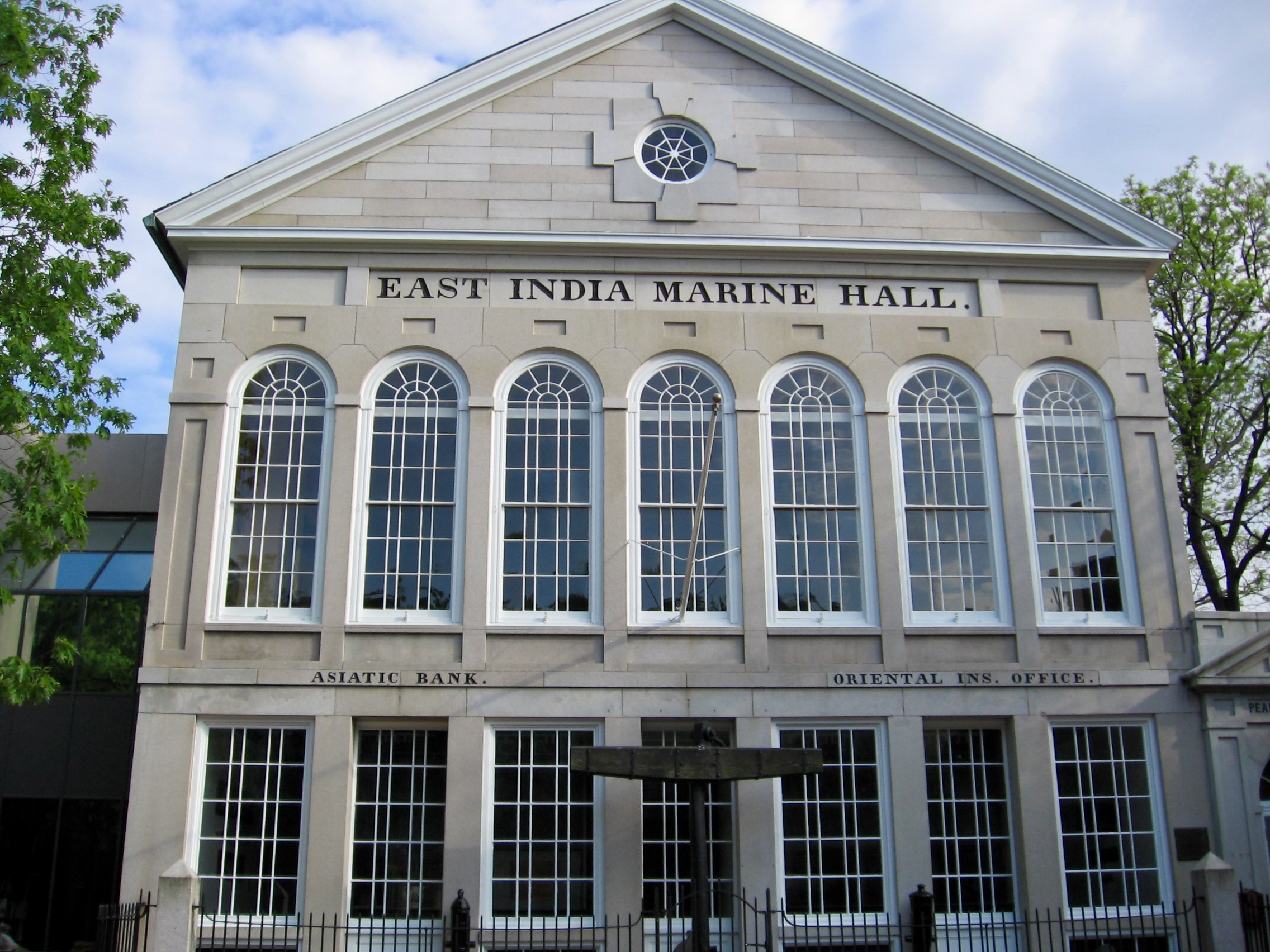
However, PEM dates back much further. This 19th Century structure houses a Maritime Art exhibition, one of my favorite sections of the museum mostly because where else are you going find so much of this stuff?
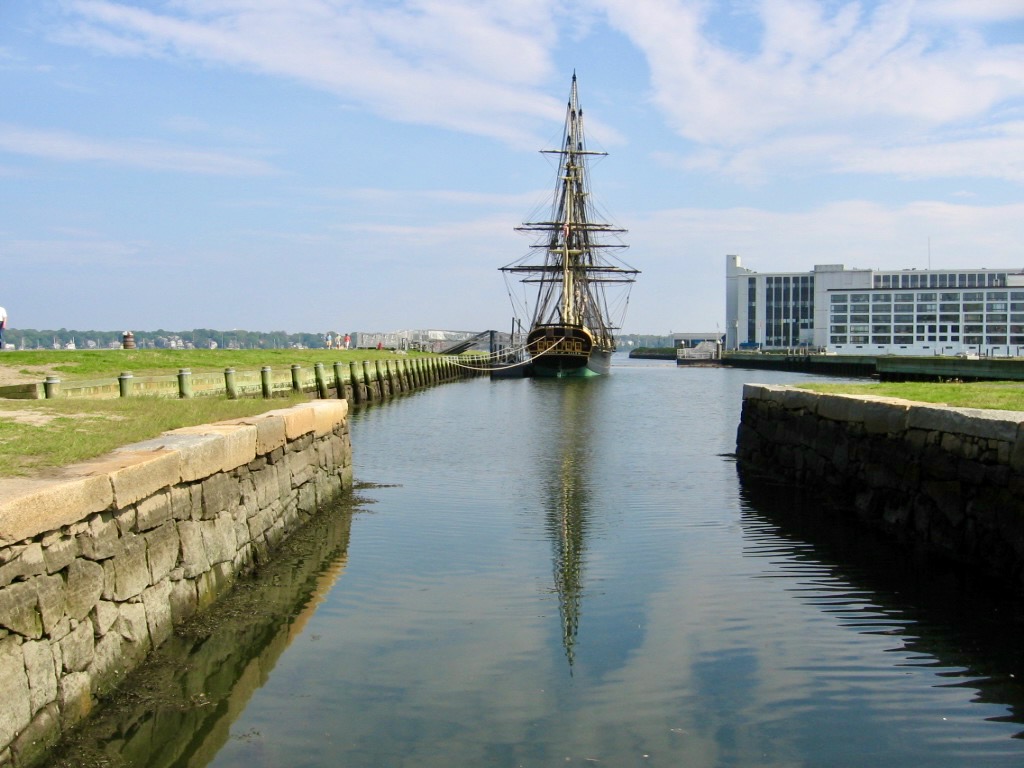
After PEM, I walked a few blocks over to the long and narrow Derby Wharf.
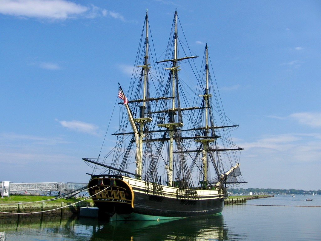
Although a modest square tower lighthouse sits at the end of the wharf, its chief attraction is the Friendship of Salem.
It may be a 1996-built replica of a 1797 vessel (one can view a model of the original at PEM), but it’s still a beautiful ship.
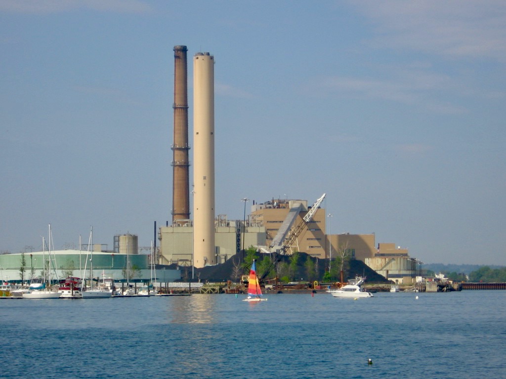
As one walks along Derby Wharf, signs of Salem’s industrial past and present are apparent.
This coal-powered station would be demolished and replaced by a new natural gas-fired one a decade after this was taken. Perhaps the small but colorful sailboat perched in front of it here was a premonition of sorts.
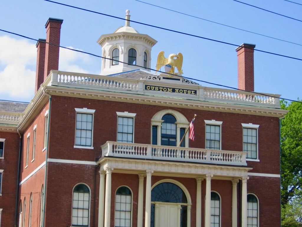
In addition to all of its witch-related culture, Salem has its share of historic buildings, like the 1815-built Custom House, located across the street from Derby Wharf.
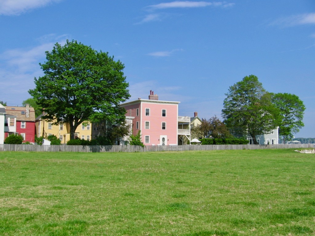
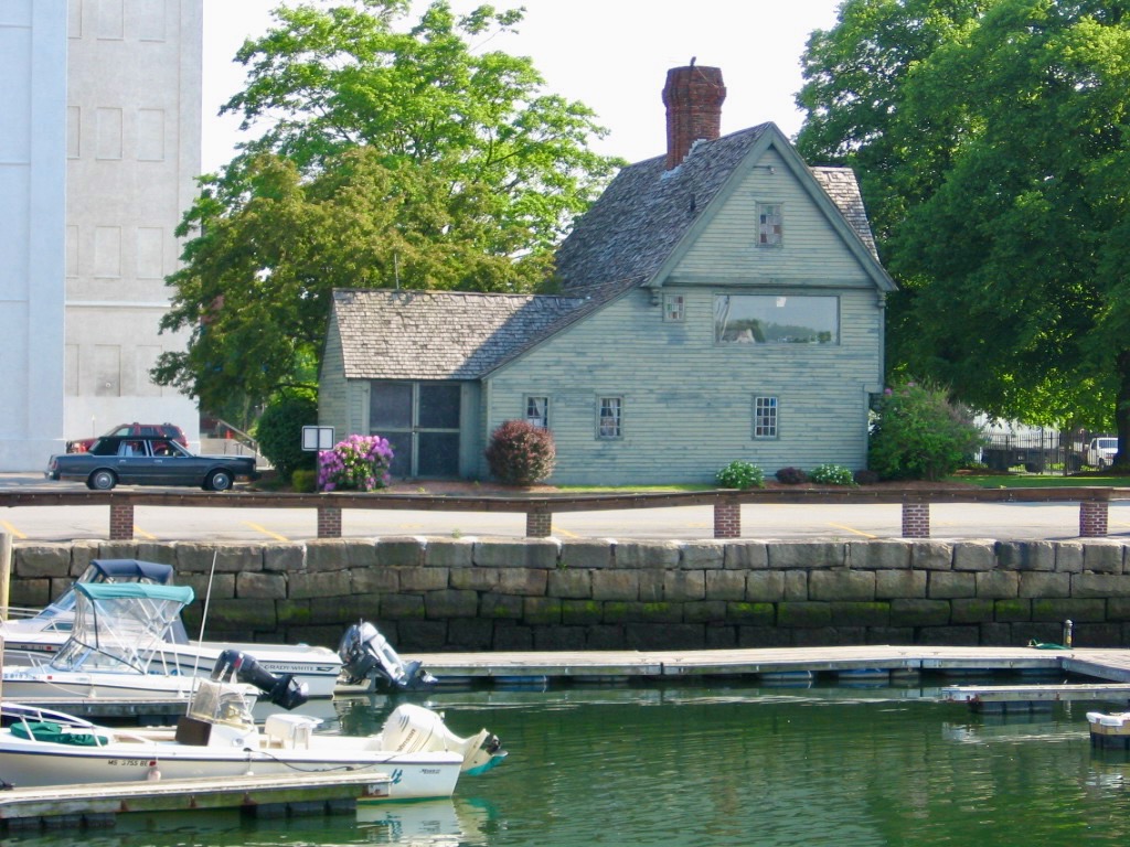
Also spotted from Derby Wharf: while not as old, the pink house above is just as interesting a structure to me.
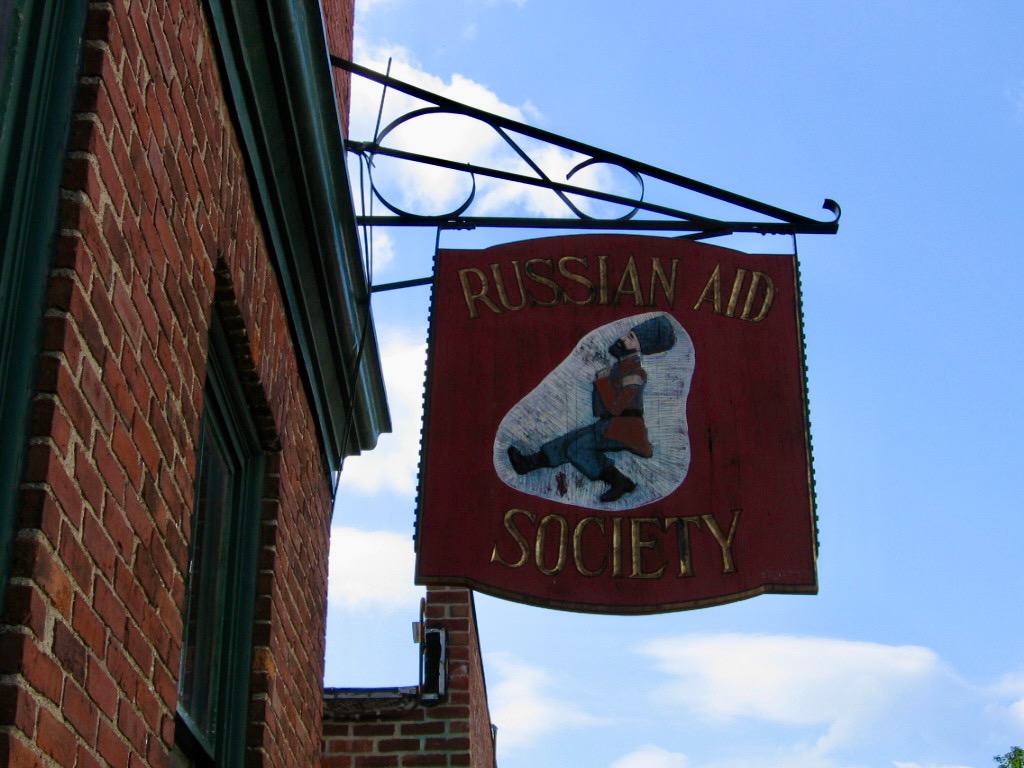
I could post a separate essay entirely devoted to Salem signage. For now, I give you the Russian Aid Society which I can’t find much about online. Salemites, does it still exist?
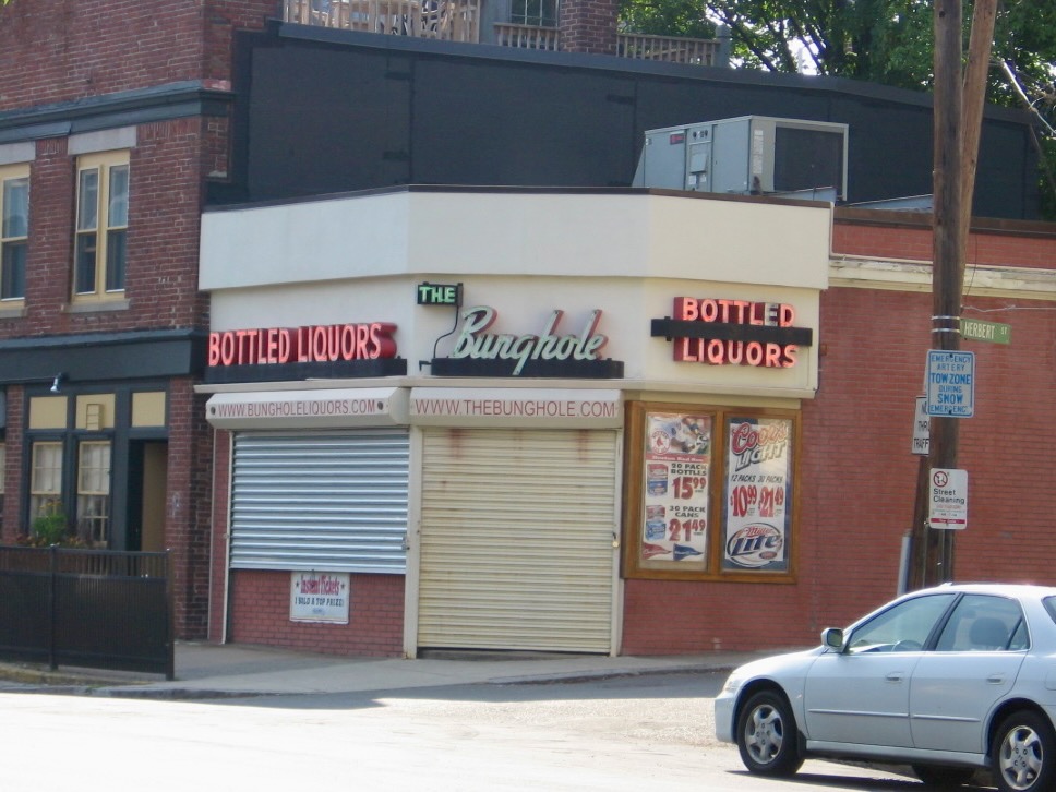
I know this business still exists–it might be the city’s most infamous and posted-on-social-media landmark, even if a “bunghole” is, according to Wikipedia, “a hole bored in a liquid-tight barrel to remove contents” and “not to be confused with Bumhole.” Still funny if you know the Beavis and Butthead reference, obv.
Closer to the center of town, the Pequot House is, alas, another recreation, built in 1930 to represent life in the Colonial era. It no longer seems to be open to the public.
So, if you do go to Salem in October, plan ahead and take the commuter rail but remember that spring is just as nice of a time to visit (and far less hectic to boot.)
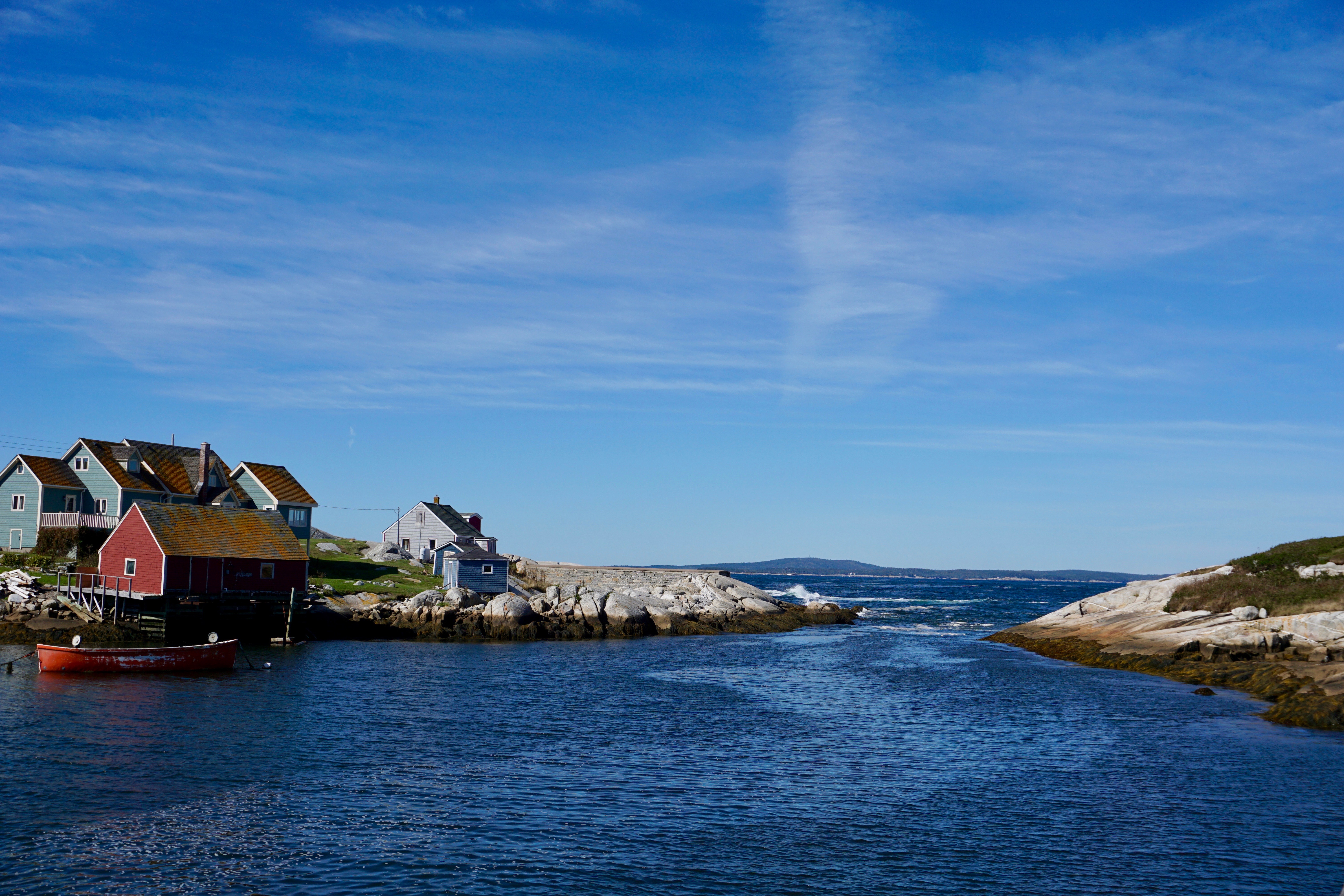
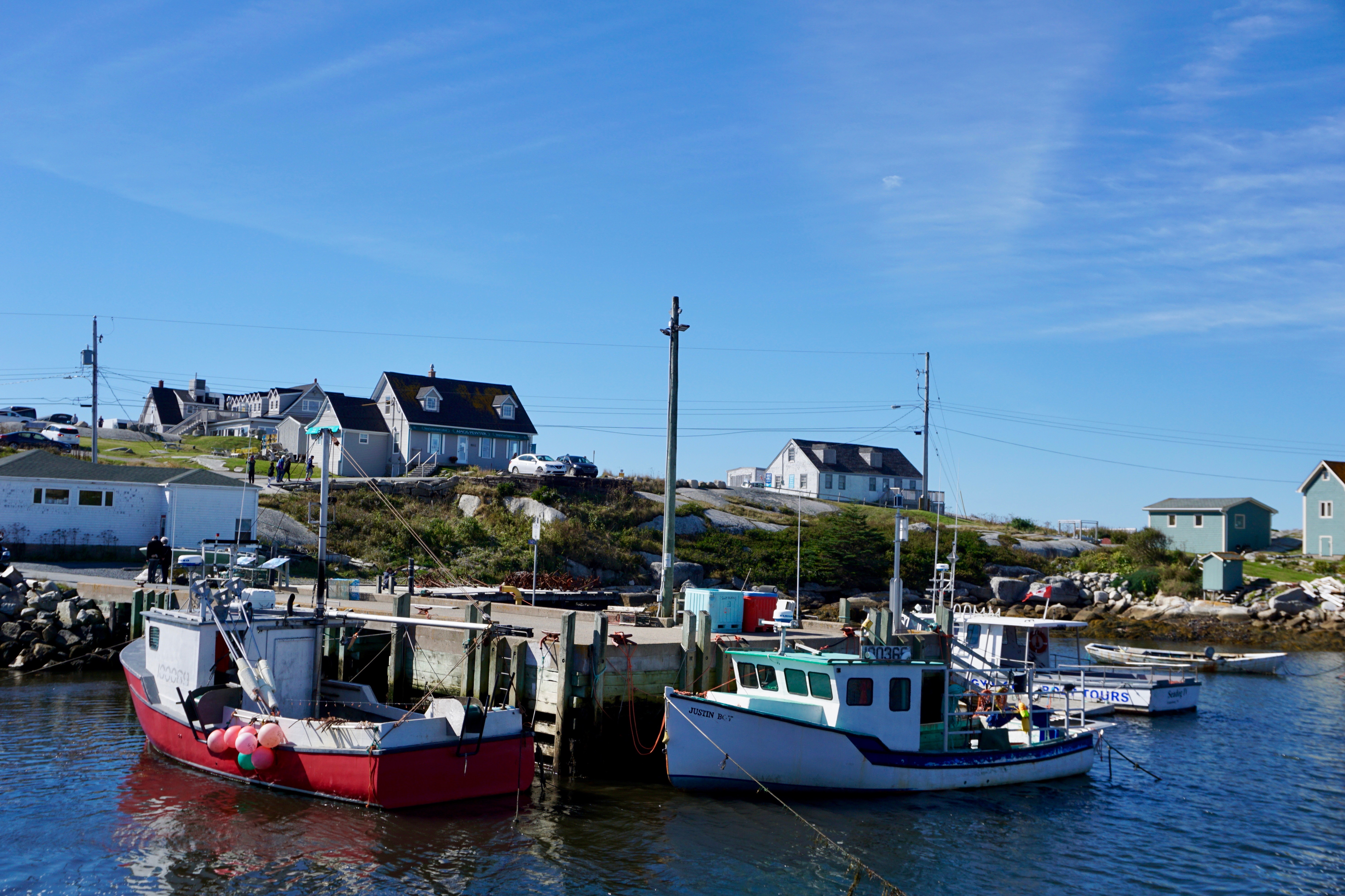
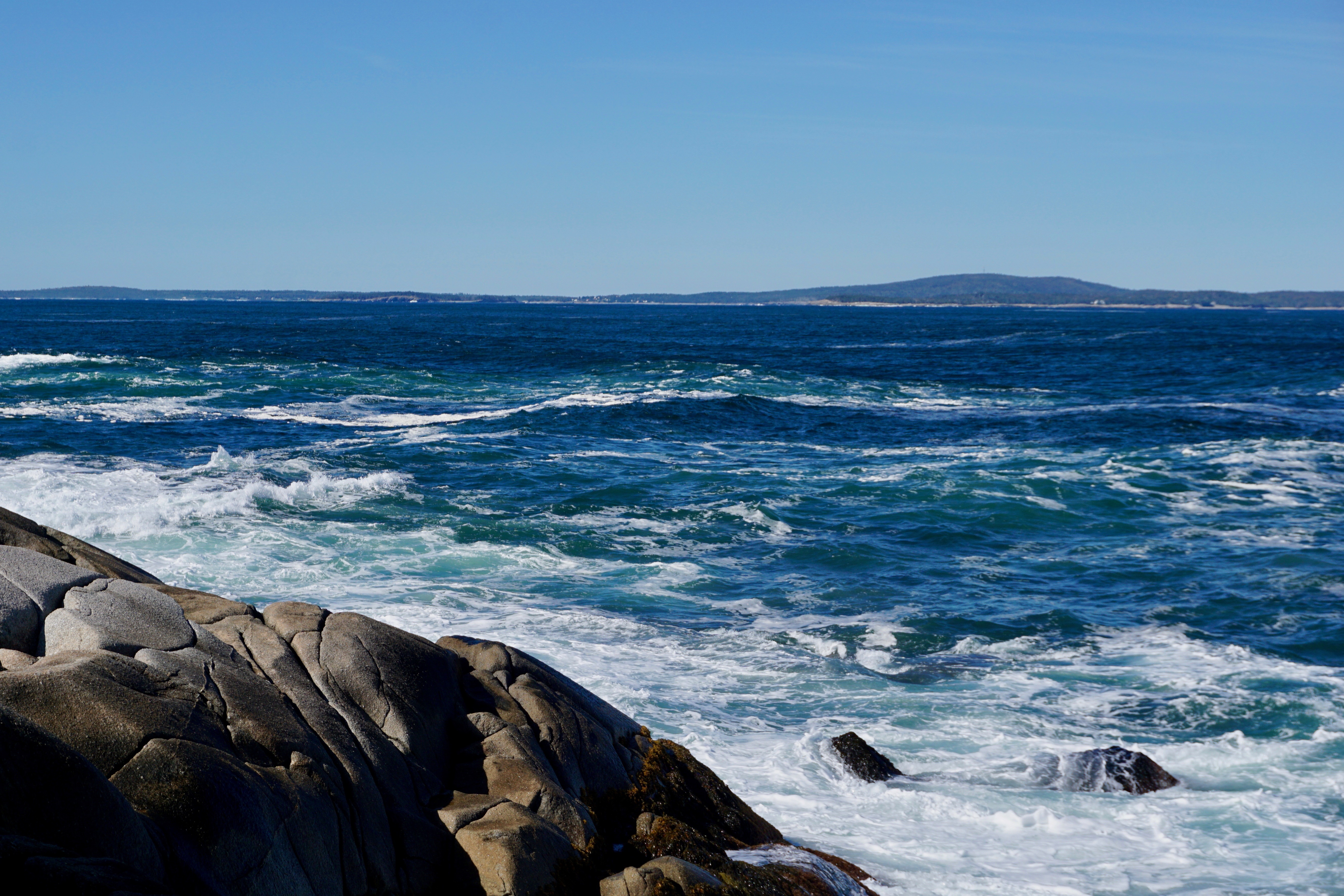
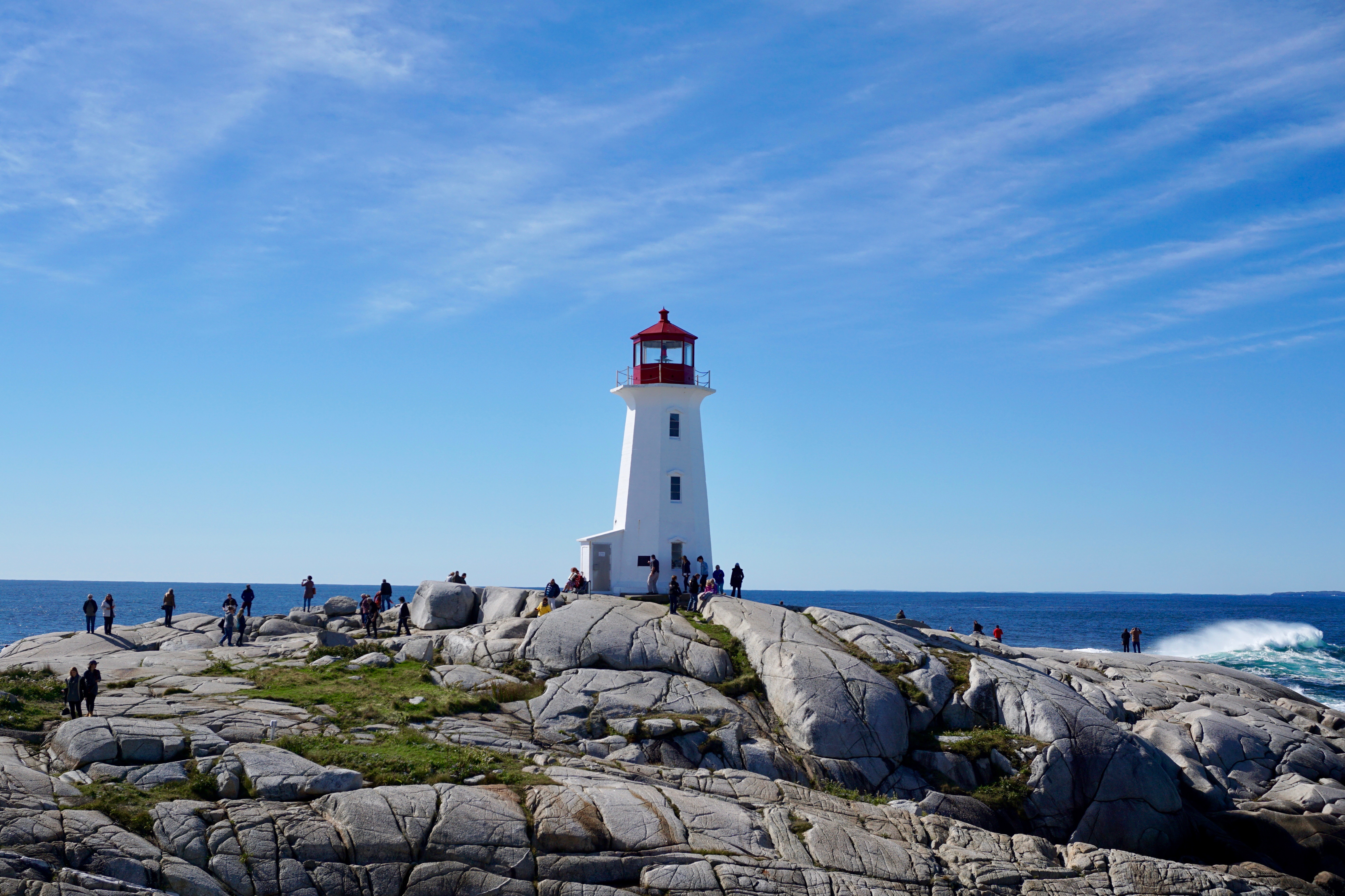
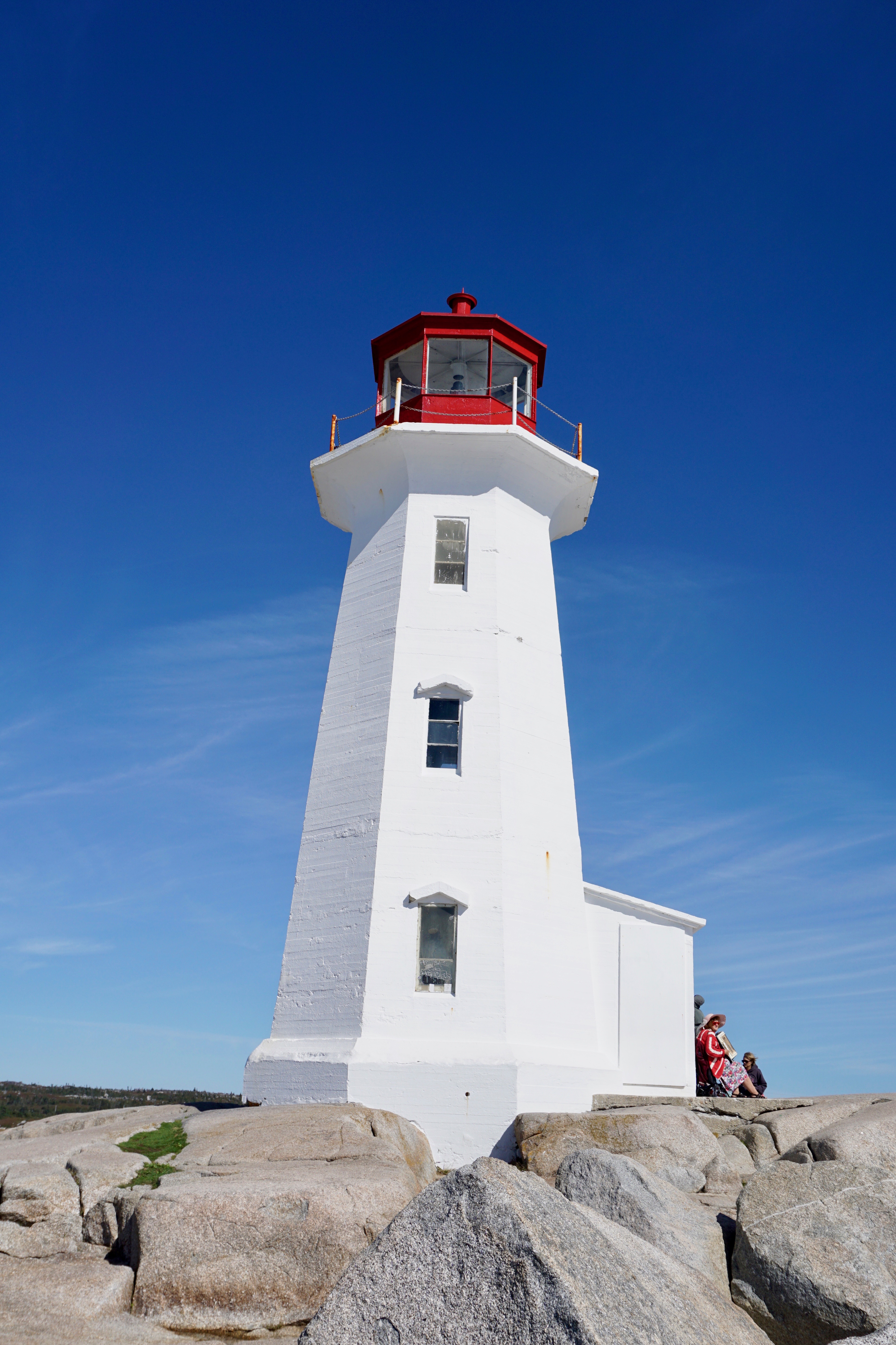
Peggy’s Cove is a small community 43 kilometers (26 miles) south of Halifax, Nova Scotia.
I was there on a bright, clear and crisp Saturday morning in October 2018.
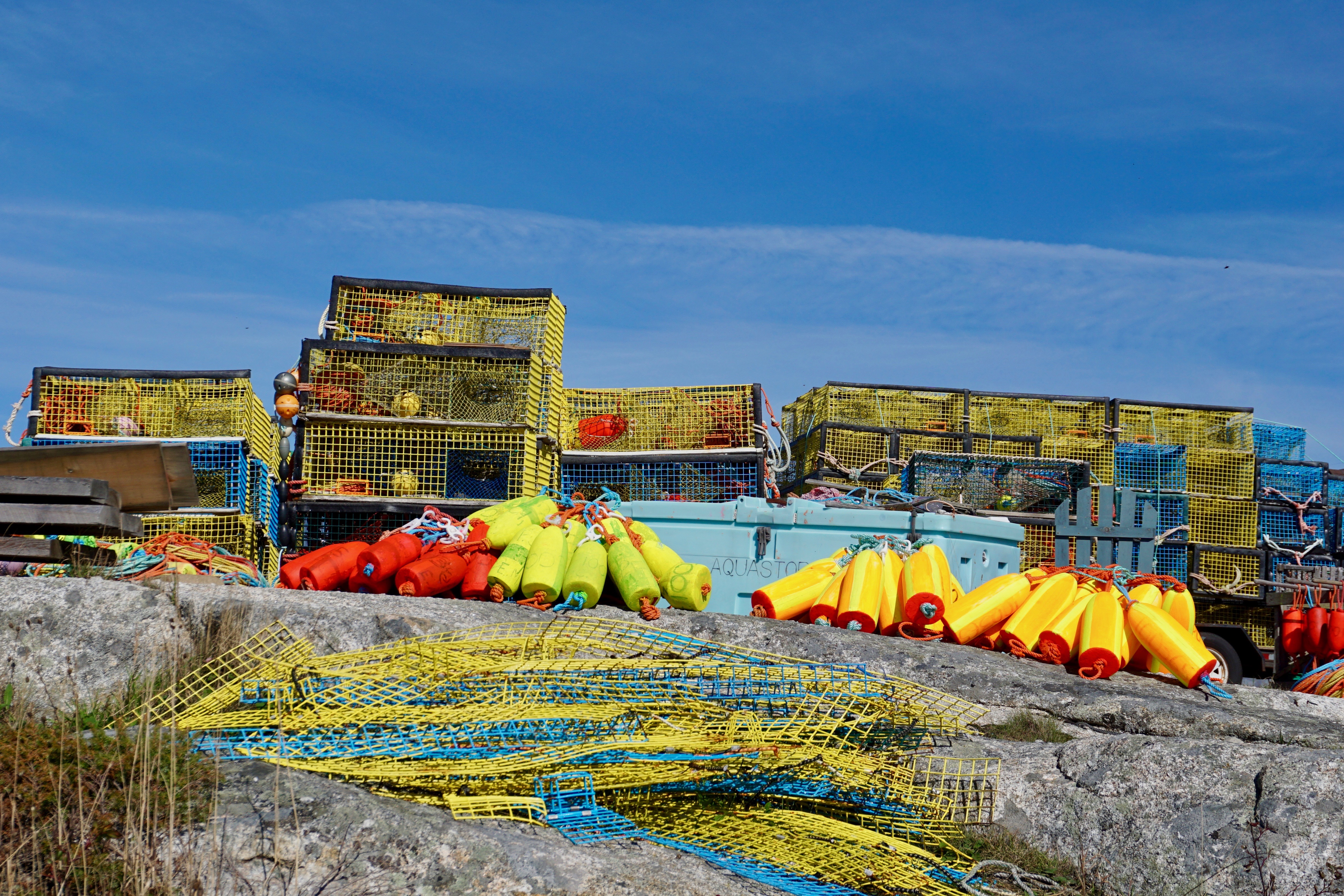
Lobstering seems to be one of the chief industries there (next to tourism.)
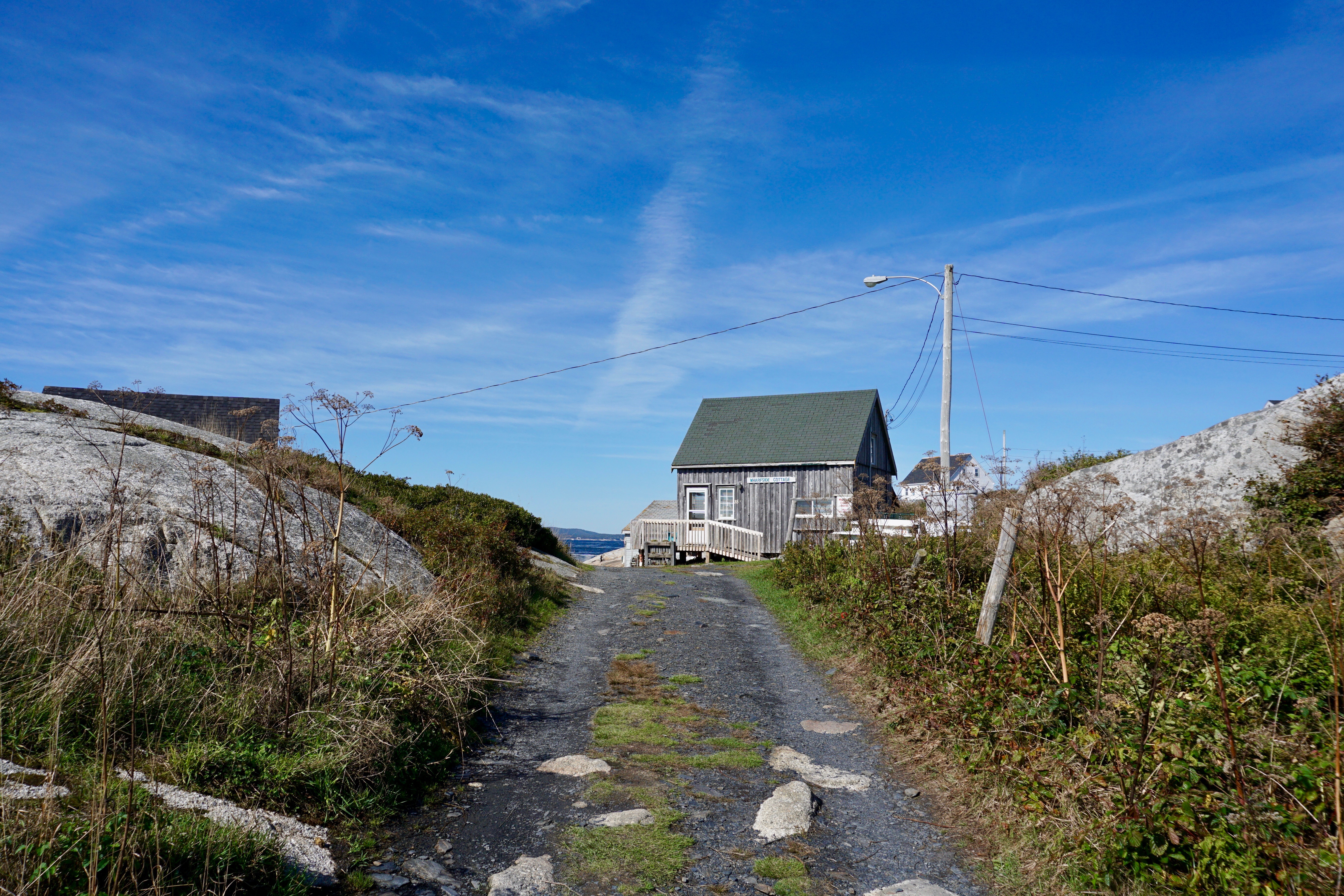
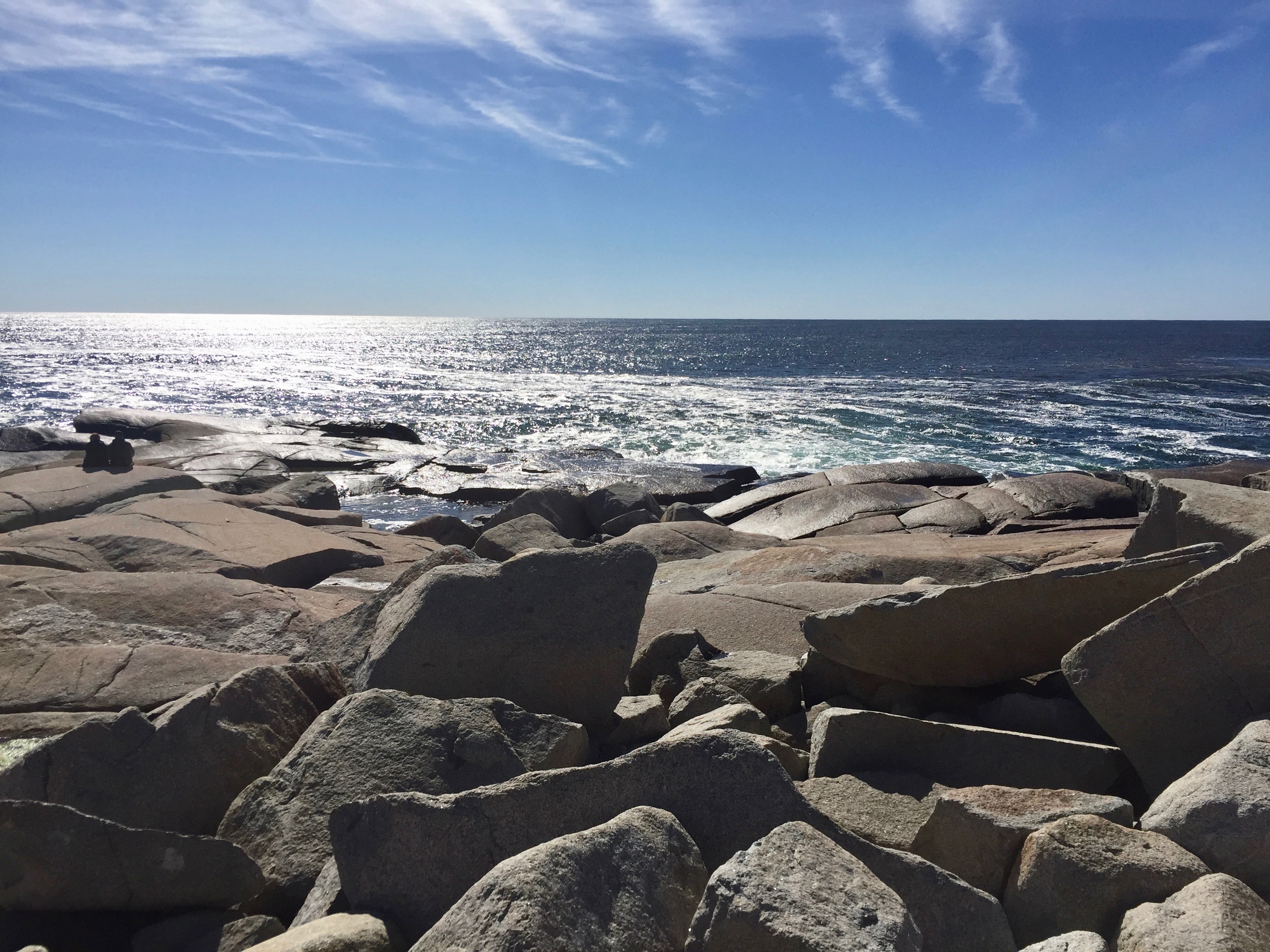
You have to walk a bit from the municipal parking lot to reach the coast.
It’s well worth the walk (and the drive.)
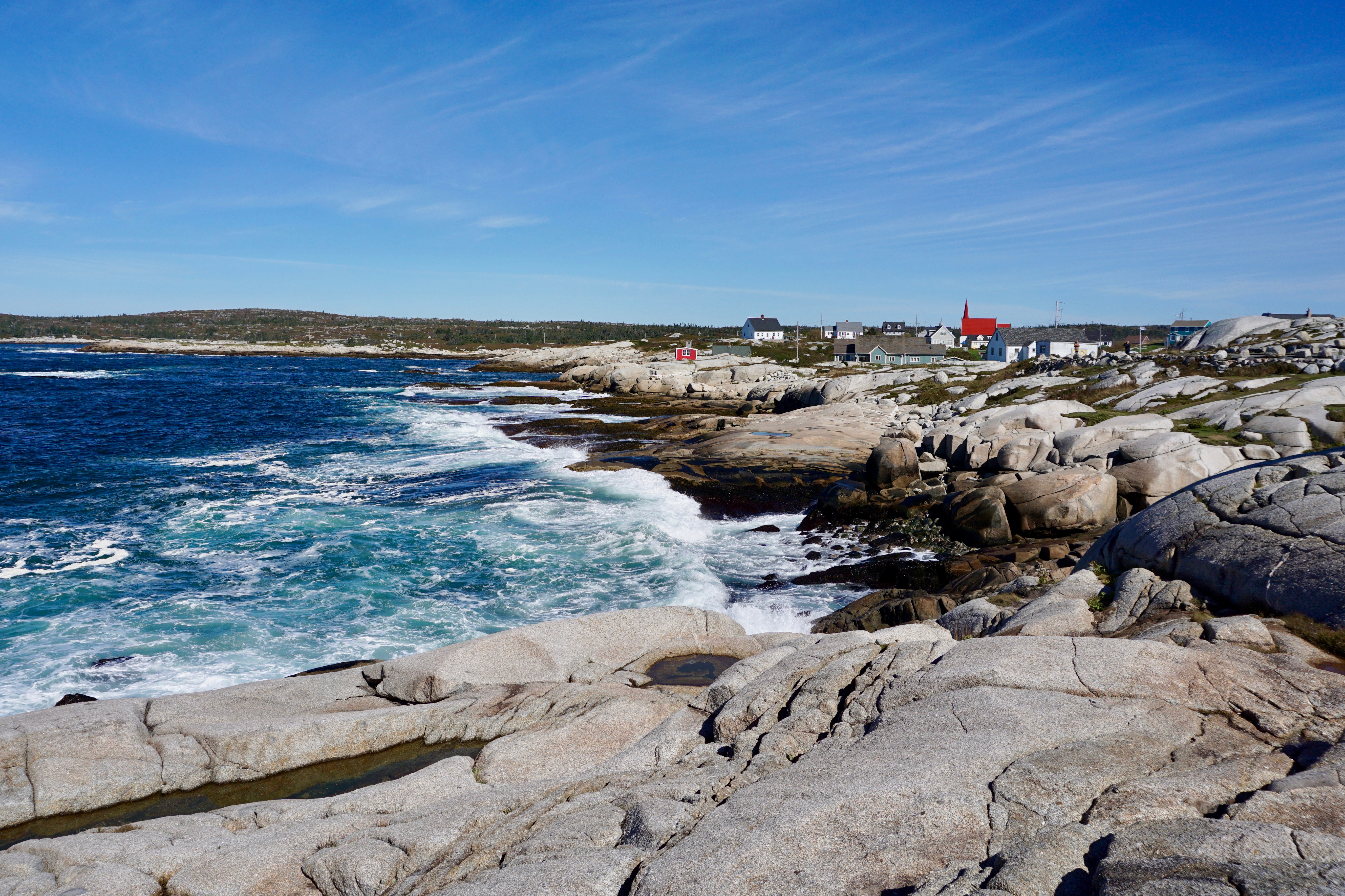
The community sits on the eastern shore of St. Margaret’s Bay.
Many travel here to see the lighthouse, along with these expansive, scenic views.
In the years since my visit, a 1,300-square-meter accessible viewing platform has been installed, although apparently people are still allowed to walk across the rocks. If I ever return, I kind of hope to see this accordion player perched right up against the lighthouse again.
Another great edge of the world. To quote Kate Bush, “We stand in The Atlantic, We become panoramic.”
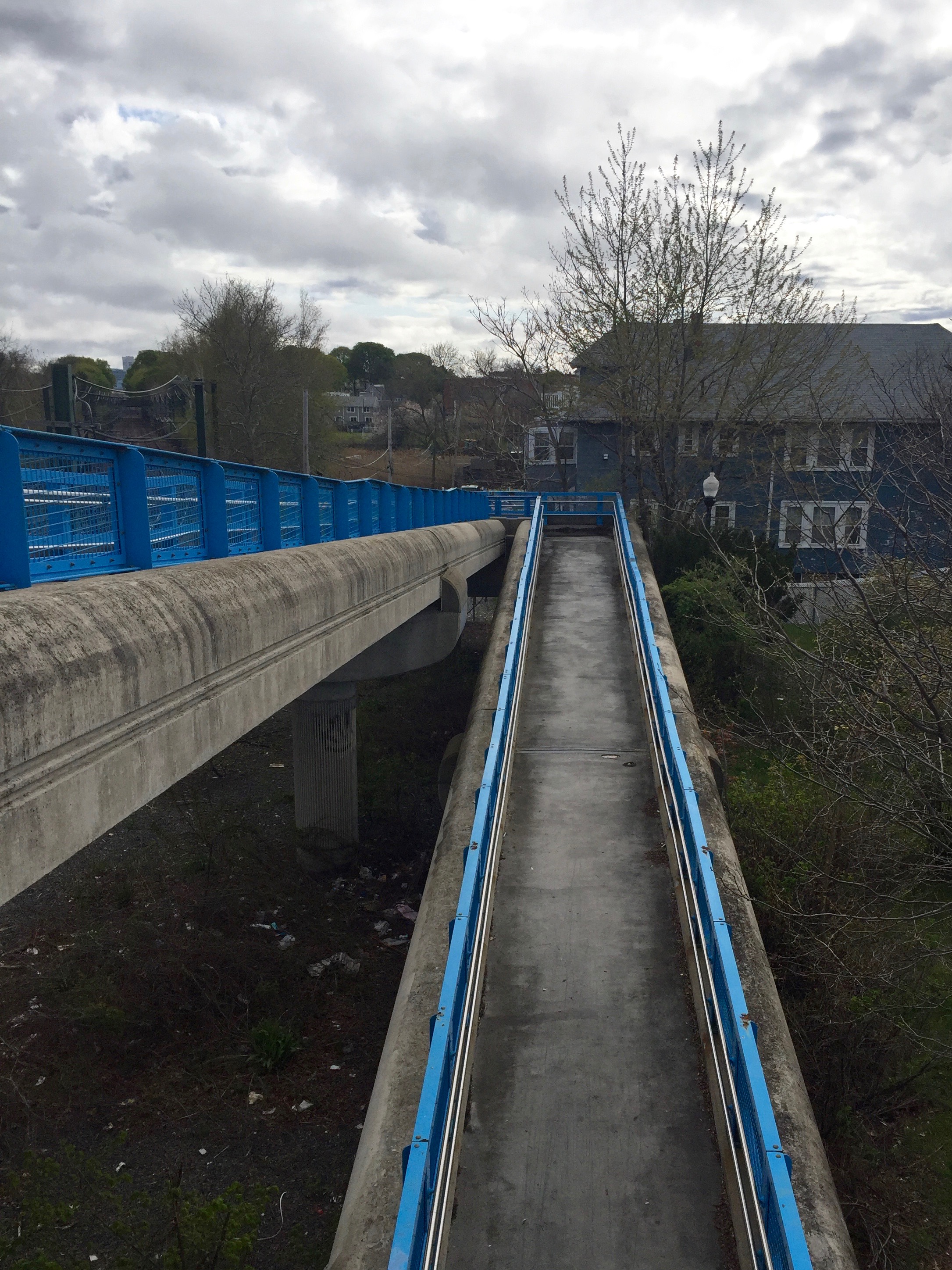
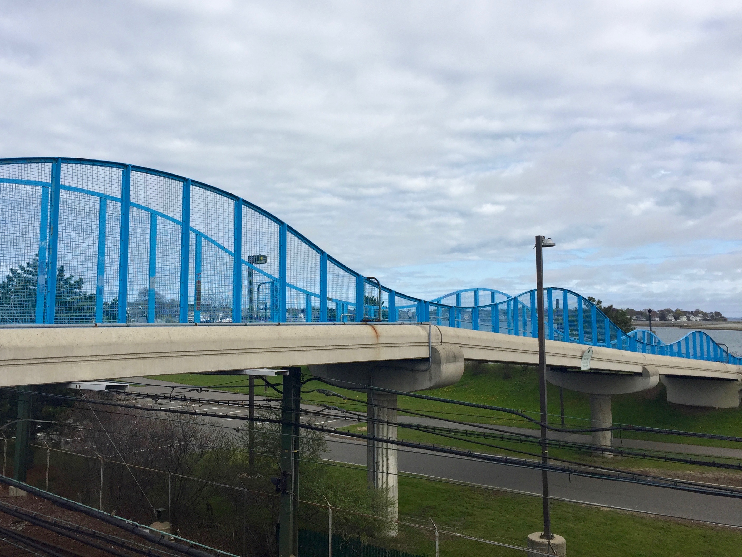
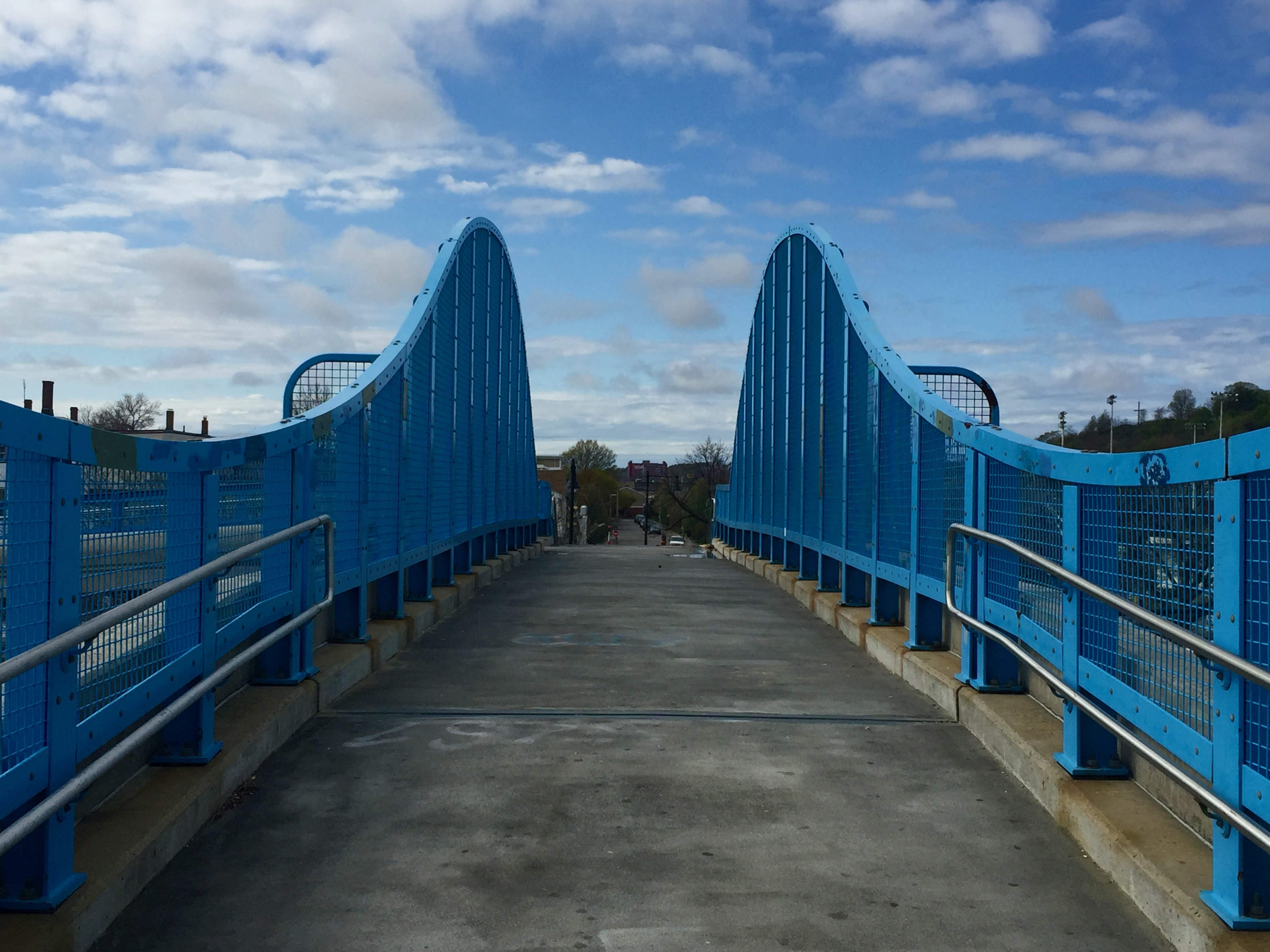
Getting there required crossing the Blue Line MBTA tracks via this suitably blue-lined overpass.
Walking up the overpass, I felt as if I was on a footbridge rollercoaster.
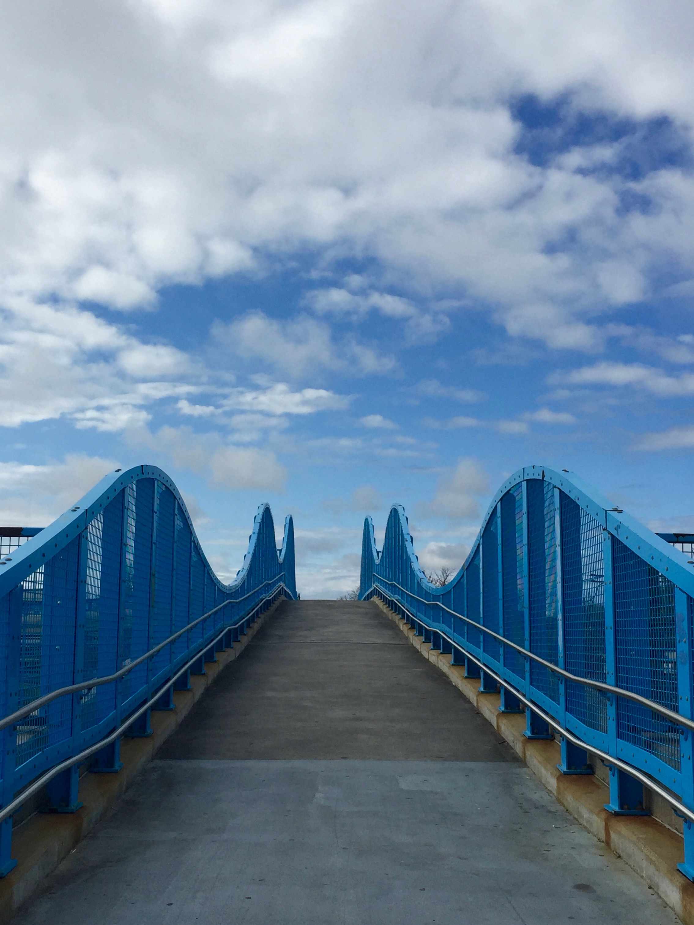
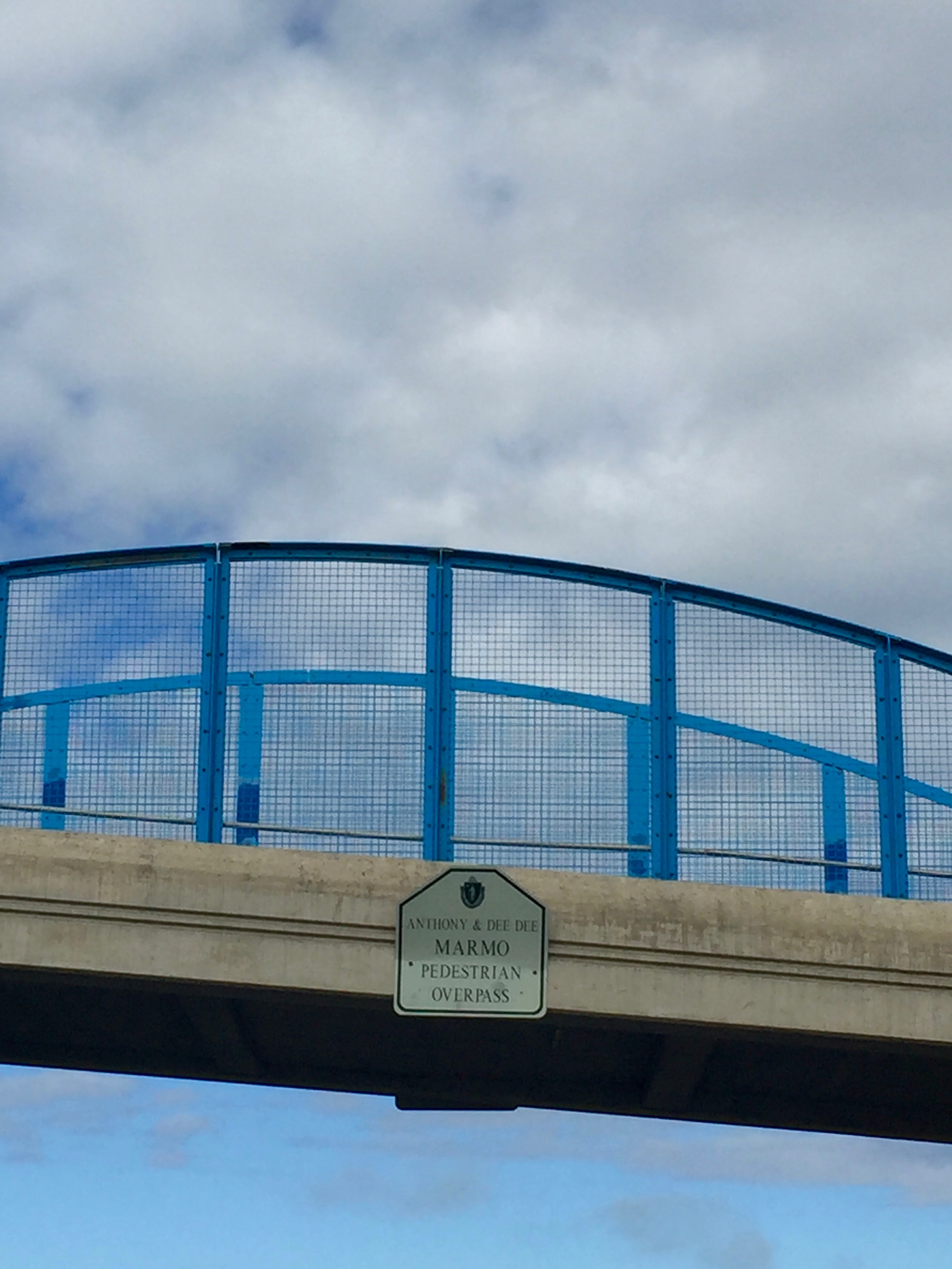
According to this, the overpass was opened and named for Anthony and Dee Dee Marmo in September 2001 (no conspiracy theories, please!)
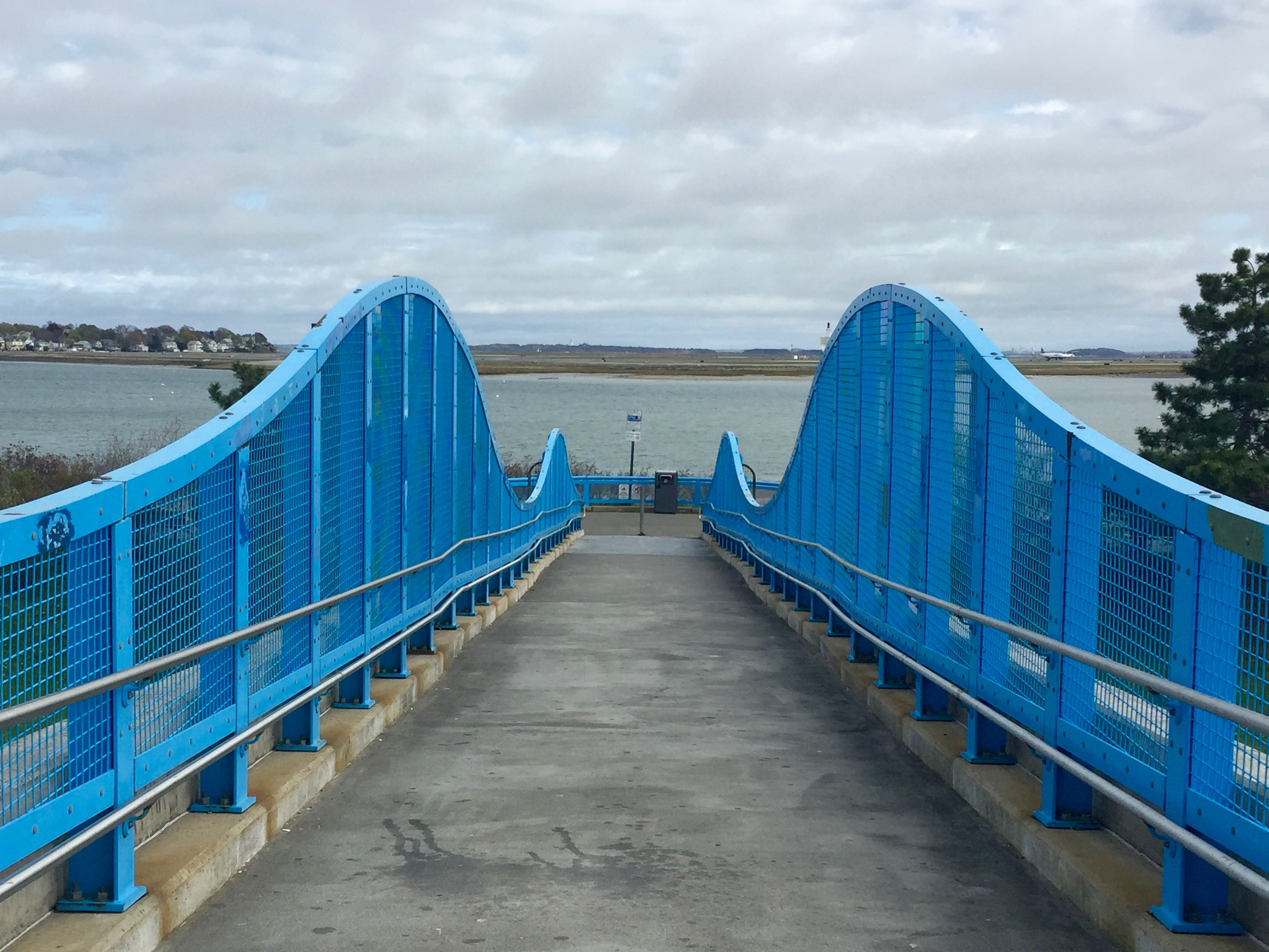
One but can’t help but notice its electric blue curves.
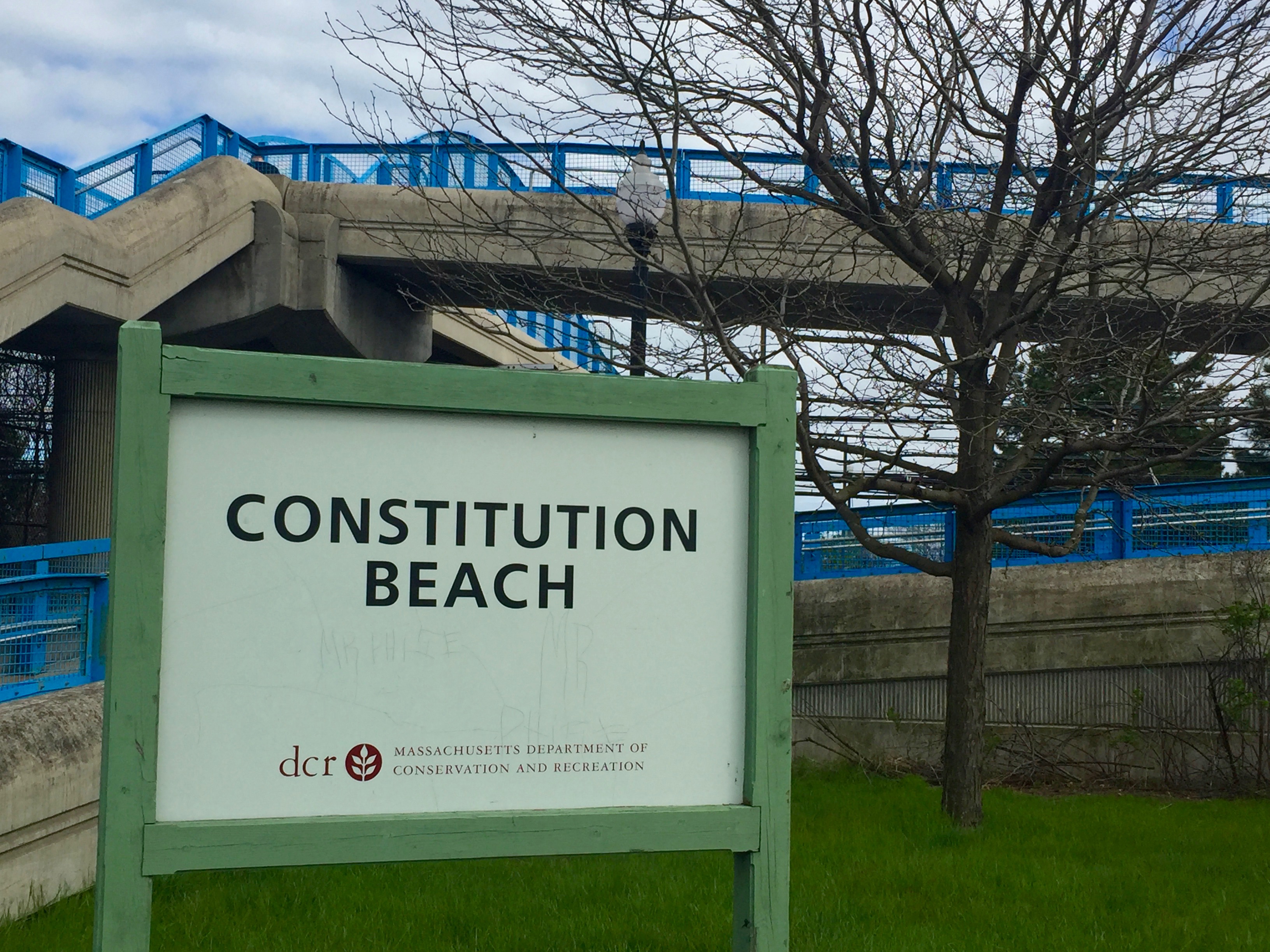
And on the other side of Marmo Overpass, it’s the beach!
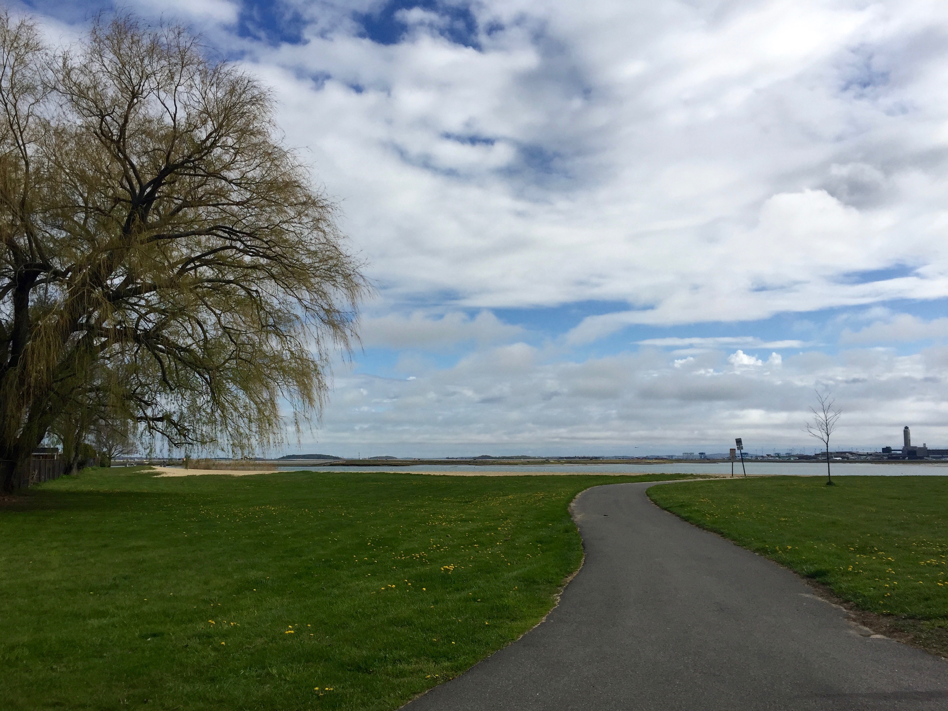
It was pretty deserted on an unseasonably chilly Friday in early May.
Although I would’ve liked to have seen more activity, I have to admit I appreciated the solitude.
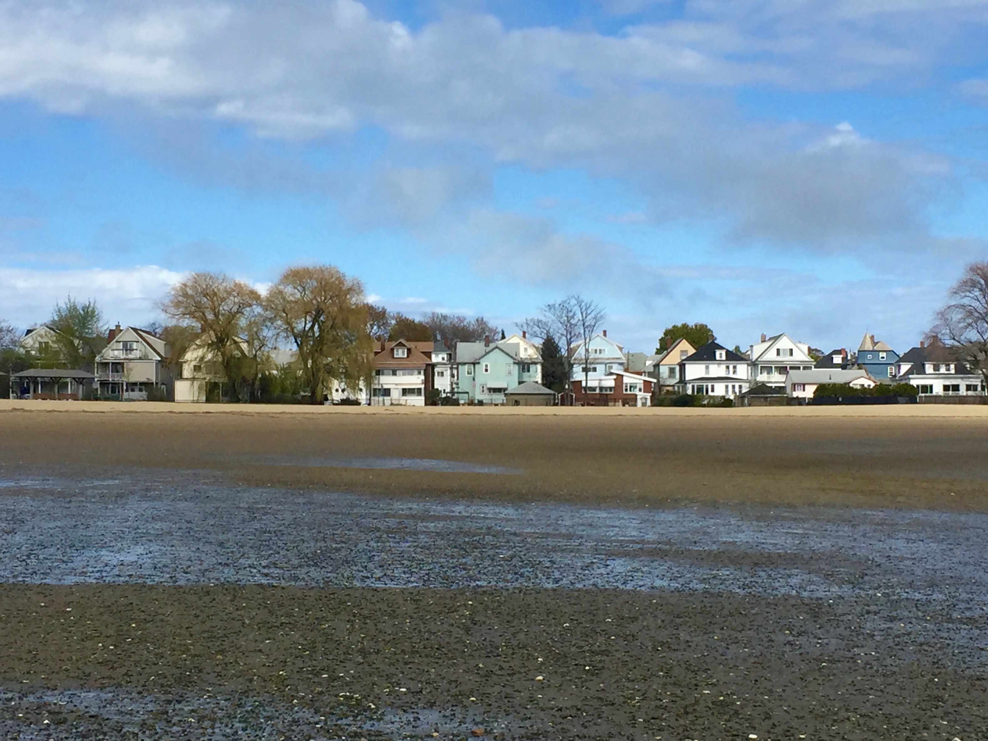
At the beach’s south end sits a residential neighborhood that juts out east towards the coastal suburb of Winthrop.
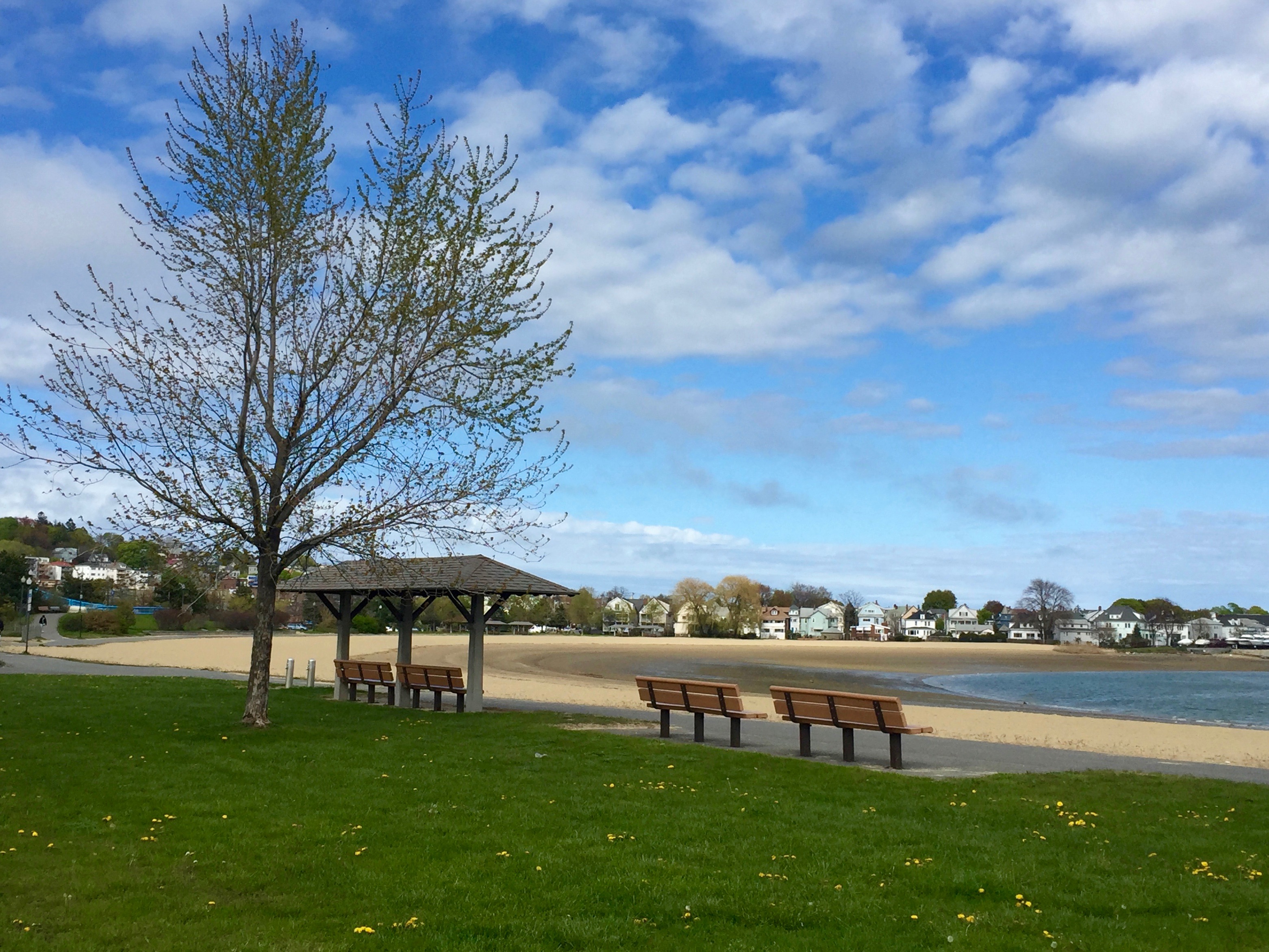
I must have arrived at or near low tide.
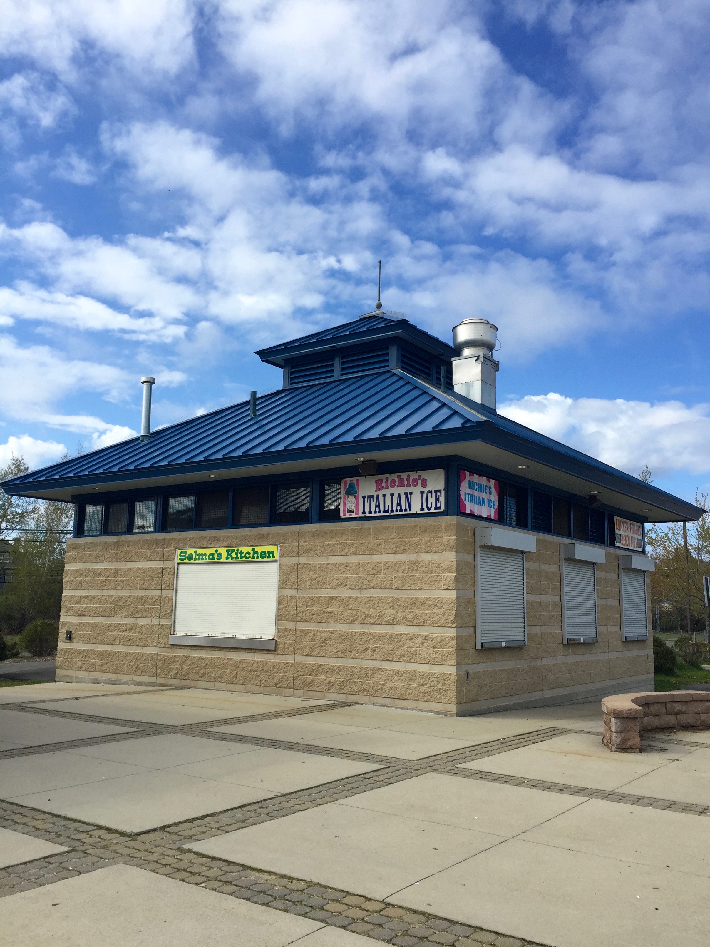
According to a municipal sign (not pictured), the beach is officially open from Memorial Day to Labor Day, so I was only weeks away from enjoying a hot dog from Selma’s Kitchen or a cup of Richie’s Italian Ice.
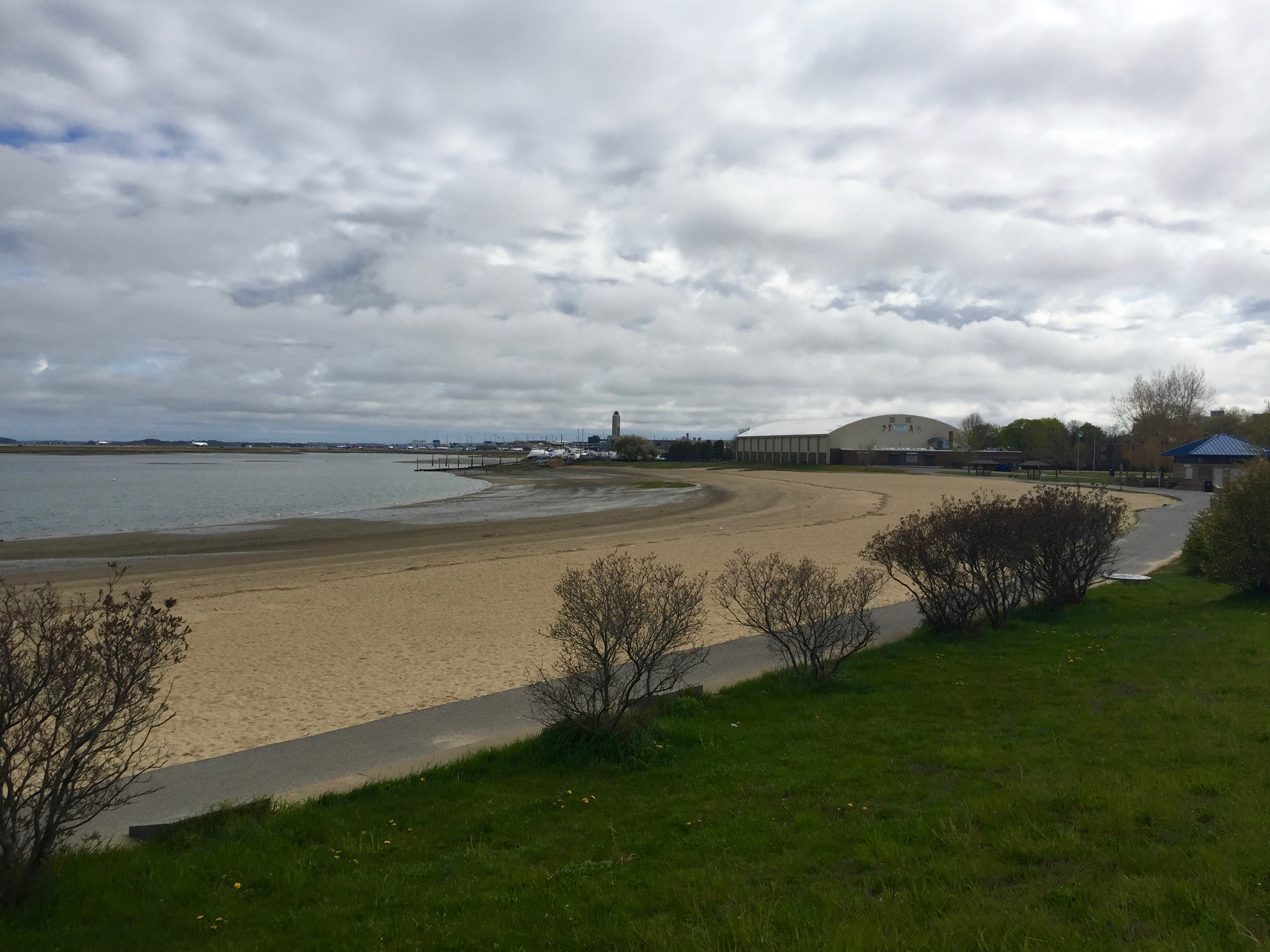
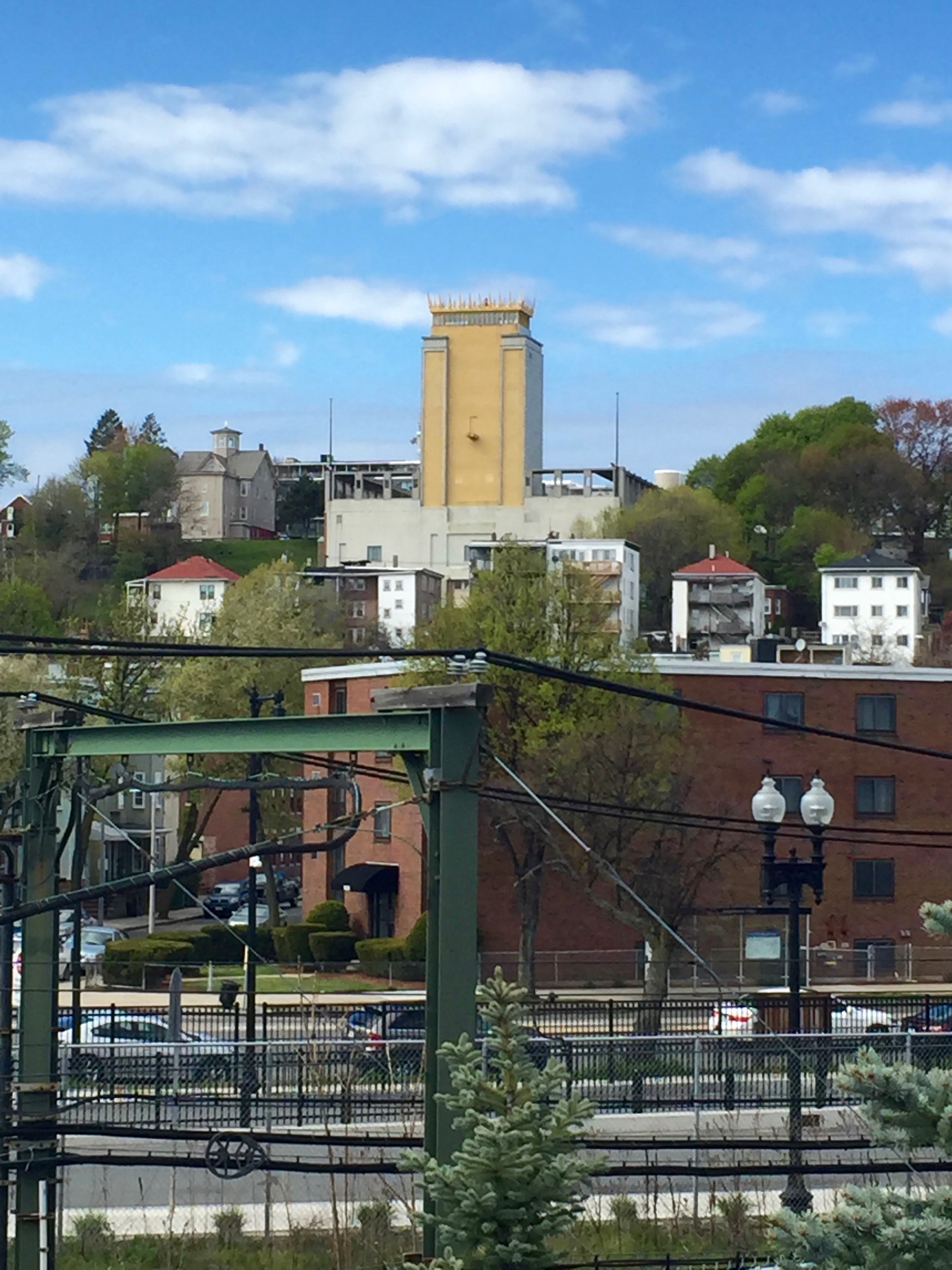
Looking south towards Porrazzo Skating Rink and beyond that, the familiar sight of Logan Airport Tower. In my last post, I mentioned I haven’t had a reason to return to Orient Heights (I live on practically the opposite end of Boston), but if I ever find myself out that way again, I’ll revisit Constitution Beach (that is, if it’s not too cold and windy.)
On a Friday afternoon in May 2016, I took a Blue Line MBTA train out to Orient Heights (according to Wikipedia, Boston’s northernmost and northeasternmost neighborhood) simply because I could. Having previously taken the line all the way to its terminus at Wonderland station in Revere Beach, I had never stopped anywhere along the way between it and Logan Airport.
If Orient Heights has a landmark, it’s the Madonna Queen of the Universe Shrine, the front of which is visible (albeit from a distance) from Route 1A; its back (the tall, narrow structure above) faces most of the actual neighborhood.
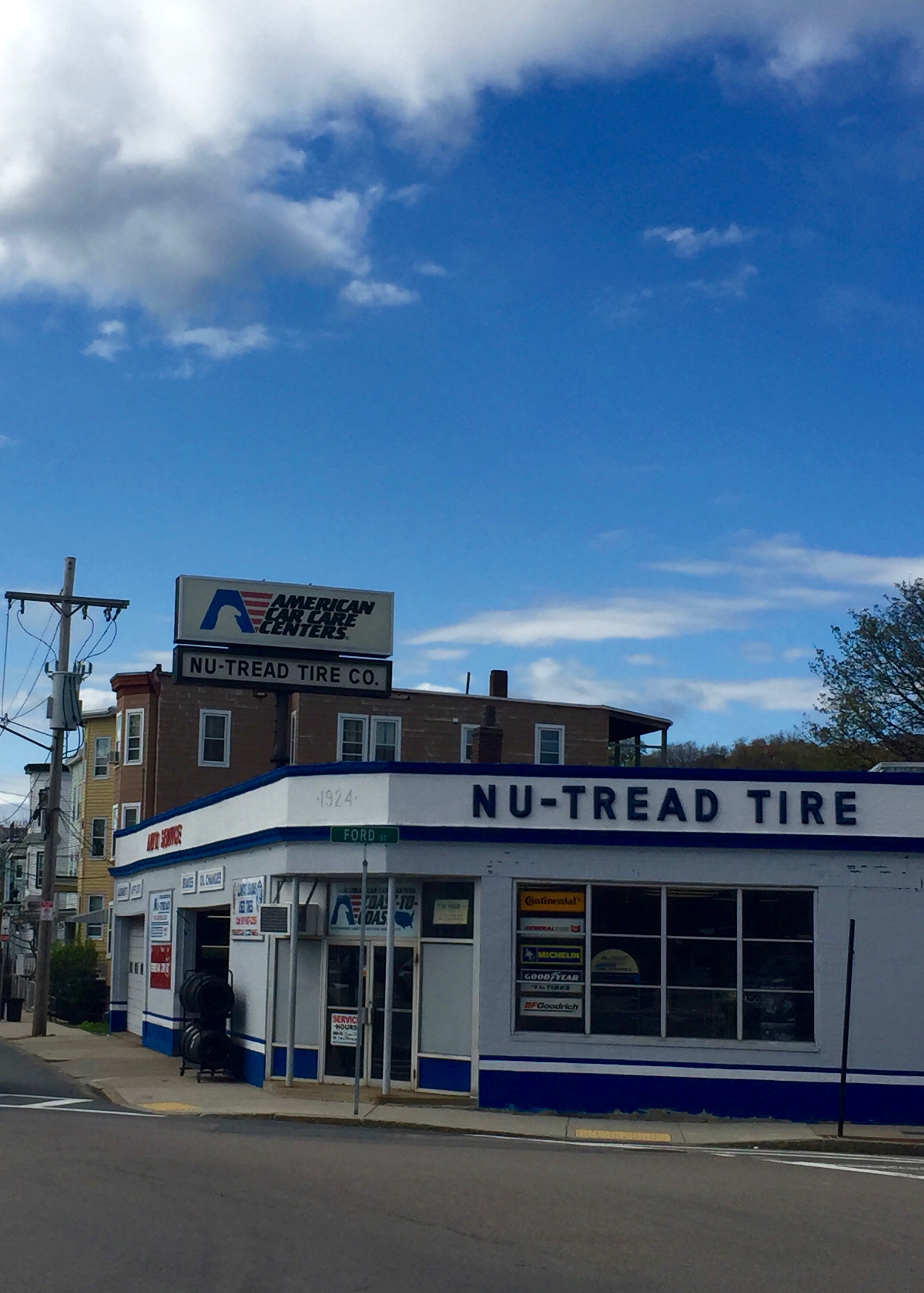
Otherwise, this is another average residential neighborhood accessible by T but not much of a magnet for tourists or visitors. (As of 2021, the tire shop with the vintage signage above is now a cell phone store.)
It’s an enclave mostly stuck in various past eras.
This antiquated siding is something you rarely see in Boston’s hipper neighborhoods (as well as business names with curiously placed periods.)
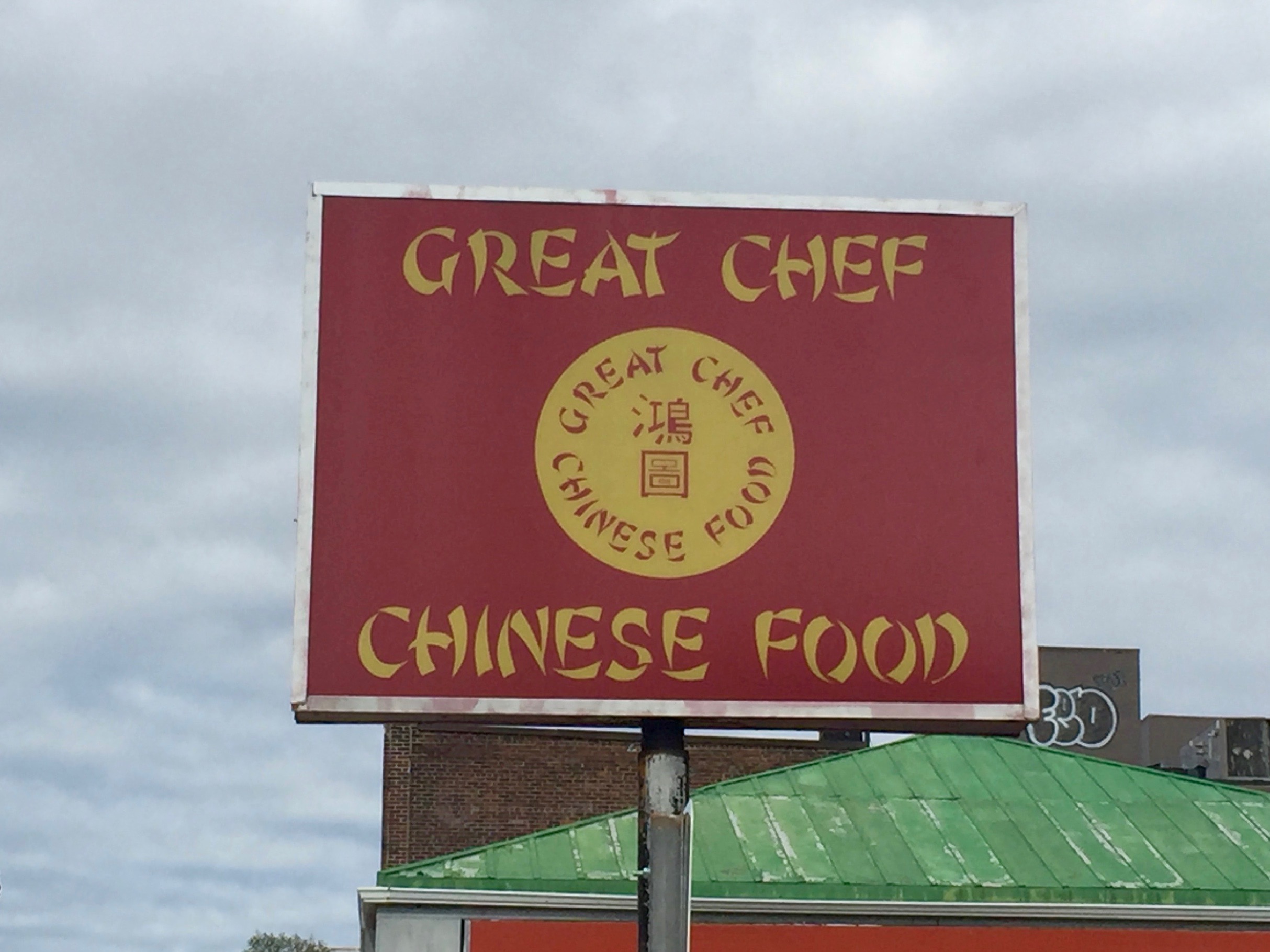
Of course there’s a Chinese-American restaurant with stereotypical signage and lots of red.
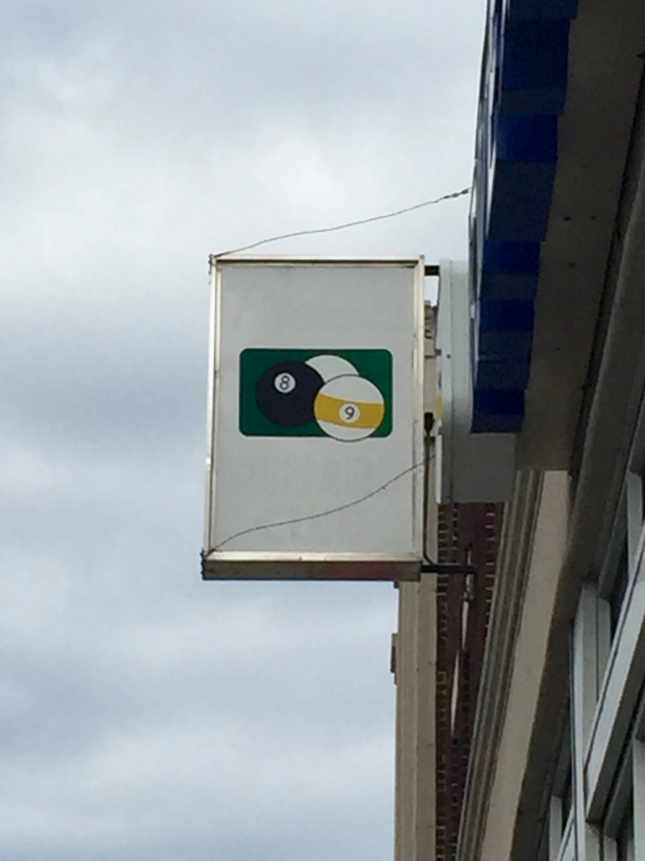
No name, just billiards, presumably.
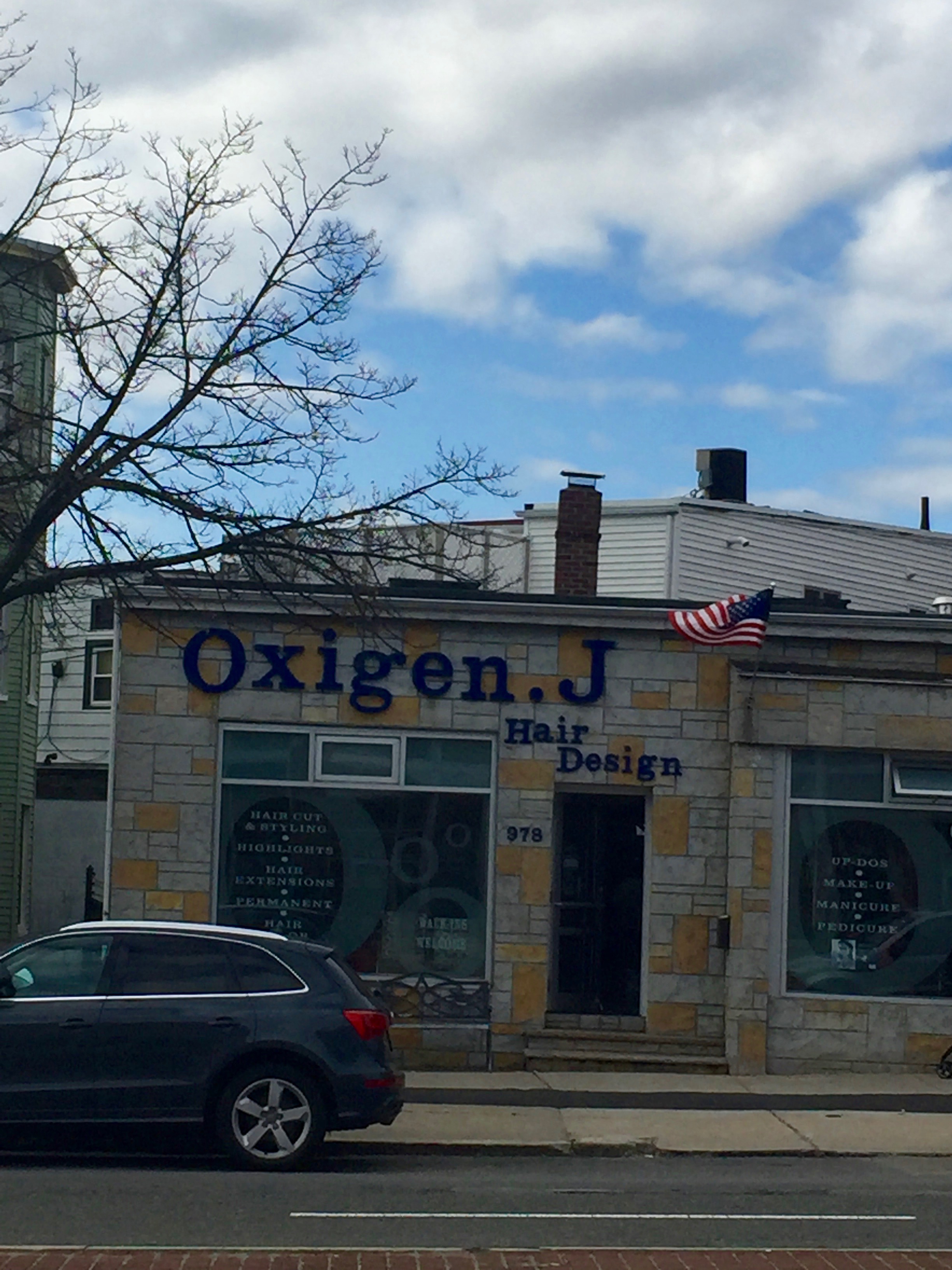
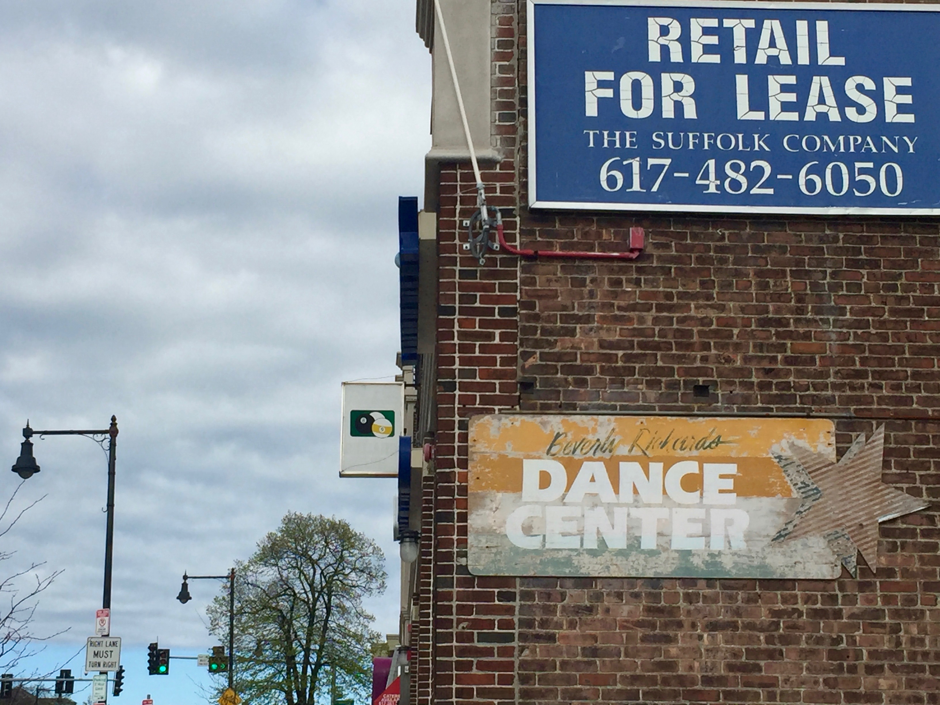
As of 2023, the Beverly Richard Dance Center is still in business (I wonder if there’s much crossover with the billiards place?), as is Oxigen.J and Great Chef.
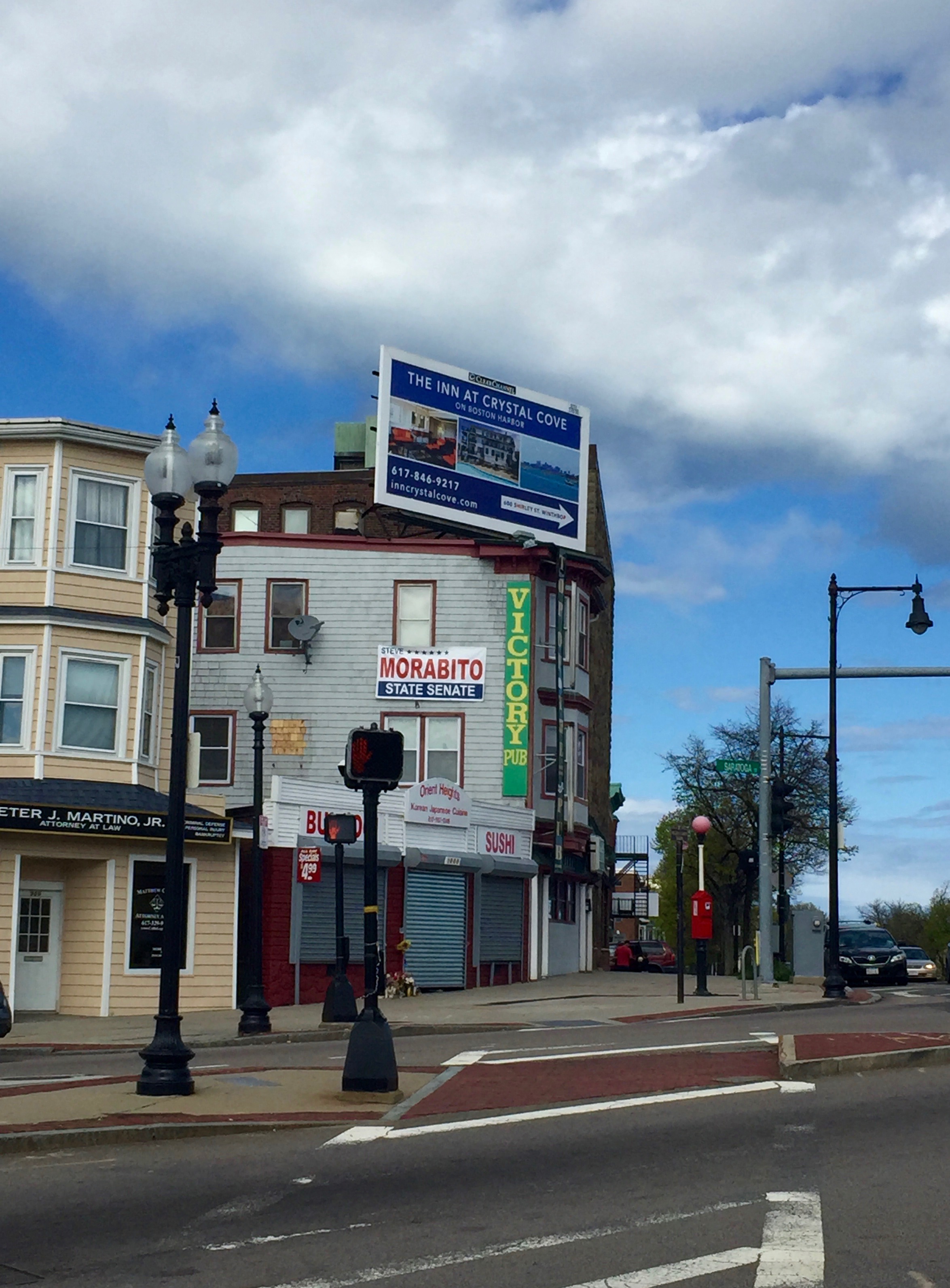
A look at Google Maps confirms Peter J. Martino, Jr. is still practicing (along with fellow Martino’s Nicholas and Justin) but the storefront to the right has been refurbished into the much brighter (if still Japanese) Sunny’s Cafe. Victory Pub is now called Renegade’s Pub and doesn’t appear to have changed much (at least on the outside.)
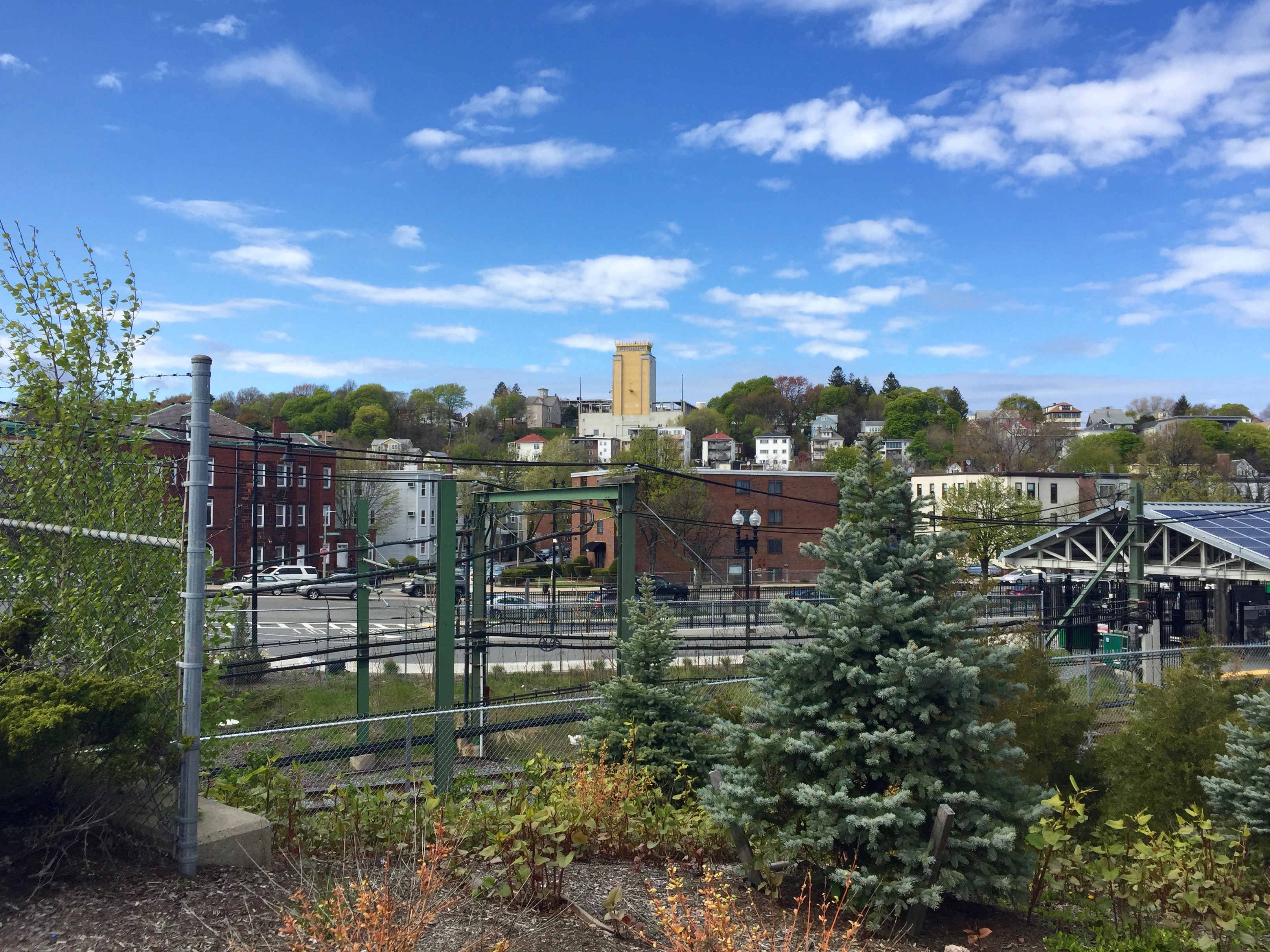
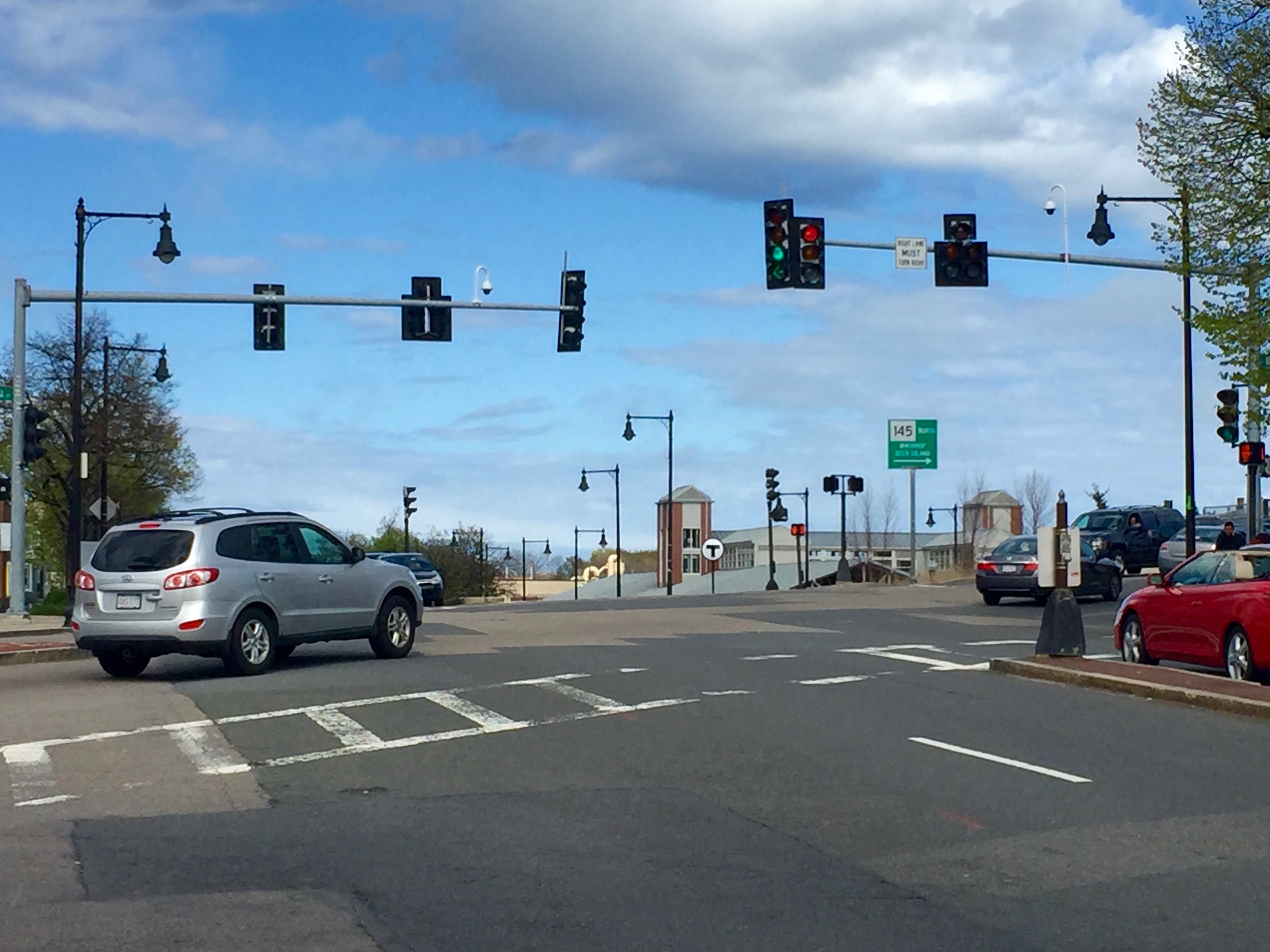
The intersection of Bennington and Saratoga Streets where Route 145 curves right from the former onto the latter with Orient Heights MBTA station in the distance. I haven’t had a reason to return to Orient Heights, although on that one visit I also came across an interesting piece of municipal architecture that I’ll post about next week.
I’ve always been a proponent of being a tourist in one’s own town; having taken many pictures documenting the city’s iconic spaces over the years, here are a baker’s dozen that you likely won’t find on a tourism map or website.
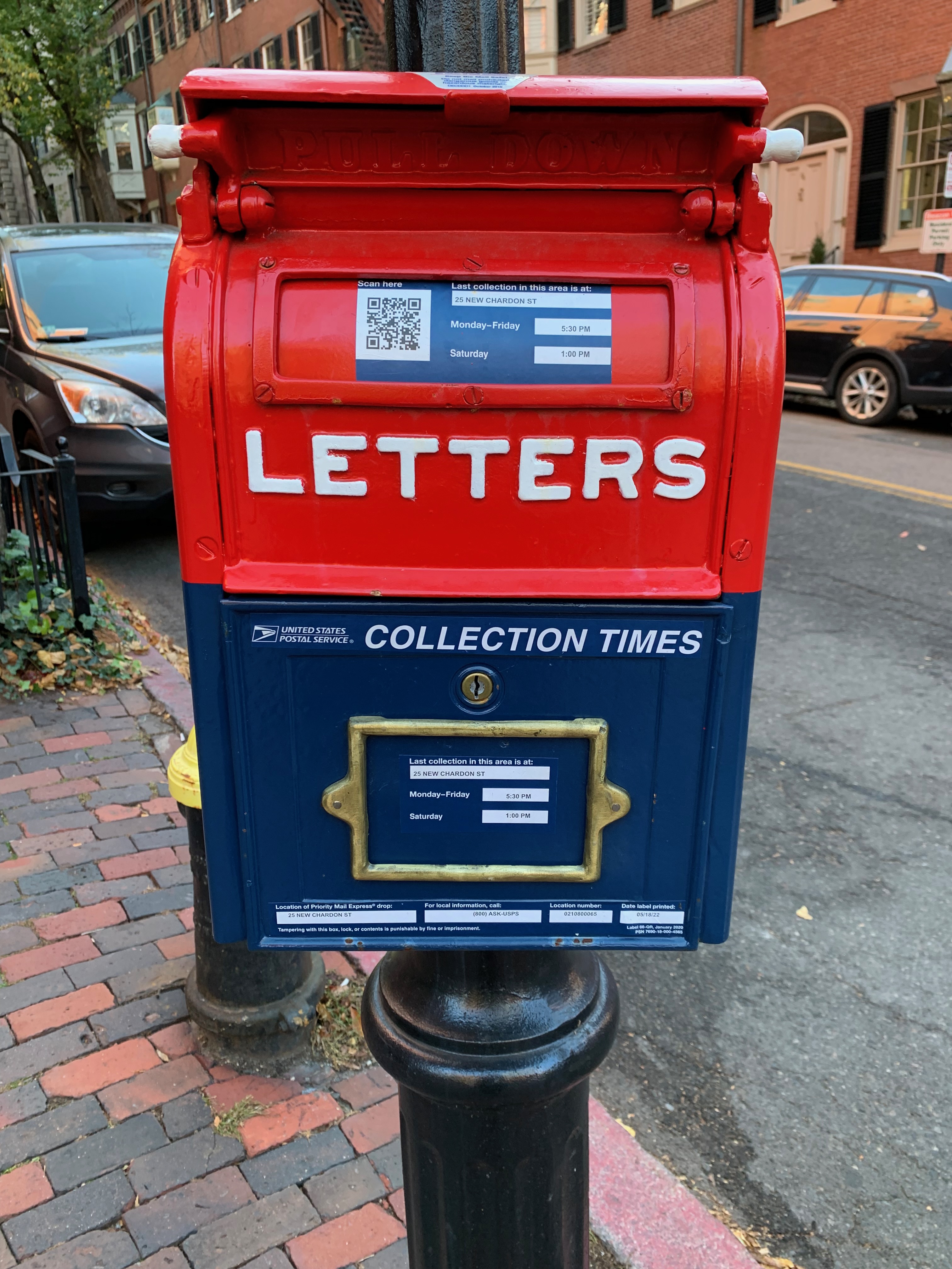
We begin in Louisburg Square, arguably the toniest enclave of Beacon Hill, the city’s toniest neighborhood. I don’t remember this old-fashioned mailbox always being there although it’s possible someone may have recently painted or gussied it up. Sitting along old row homes and cobblestone sidewalks, its antiquity fits right in.
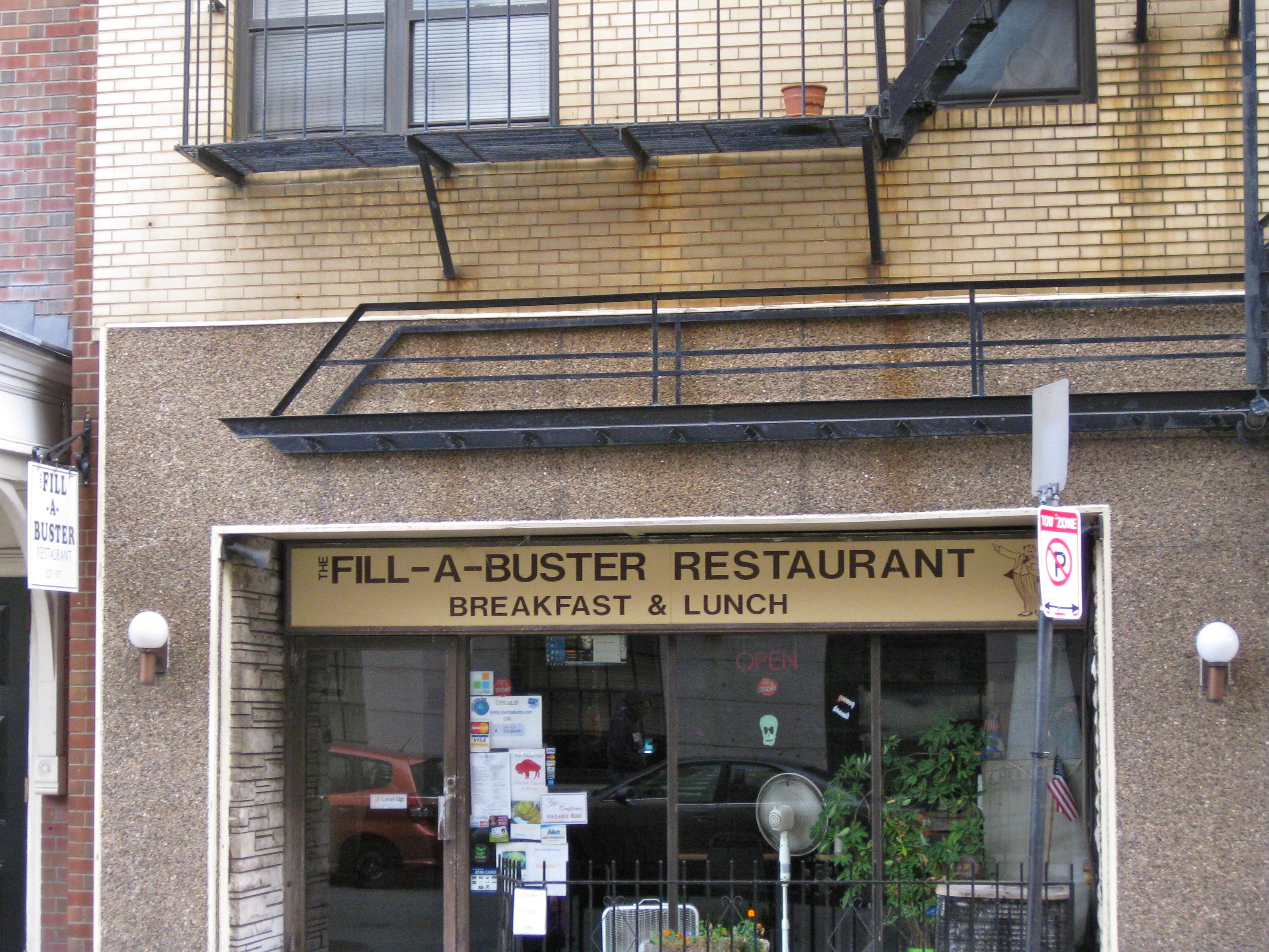
A couple blocks away on Beacon Street near the State House sits this somewhat dingy luncheonette which, at least from the outside hasn’t changed much since it opened in 1977. I haven’t tried it (as with most downtown eating places, it’s only open during working week hours) but I’d be sad if it ever closed for good as it’s part of a vanishing breed gradually being taken over by your Cavas, Sweetgreens and Chipotles.
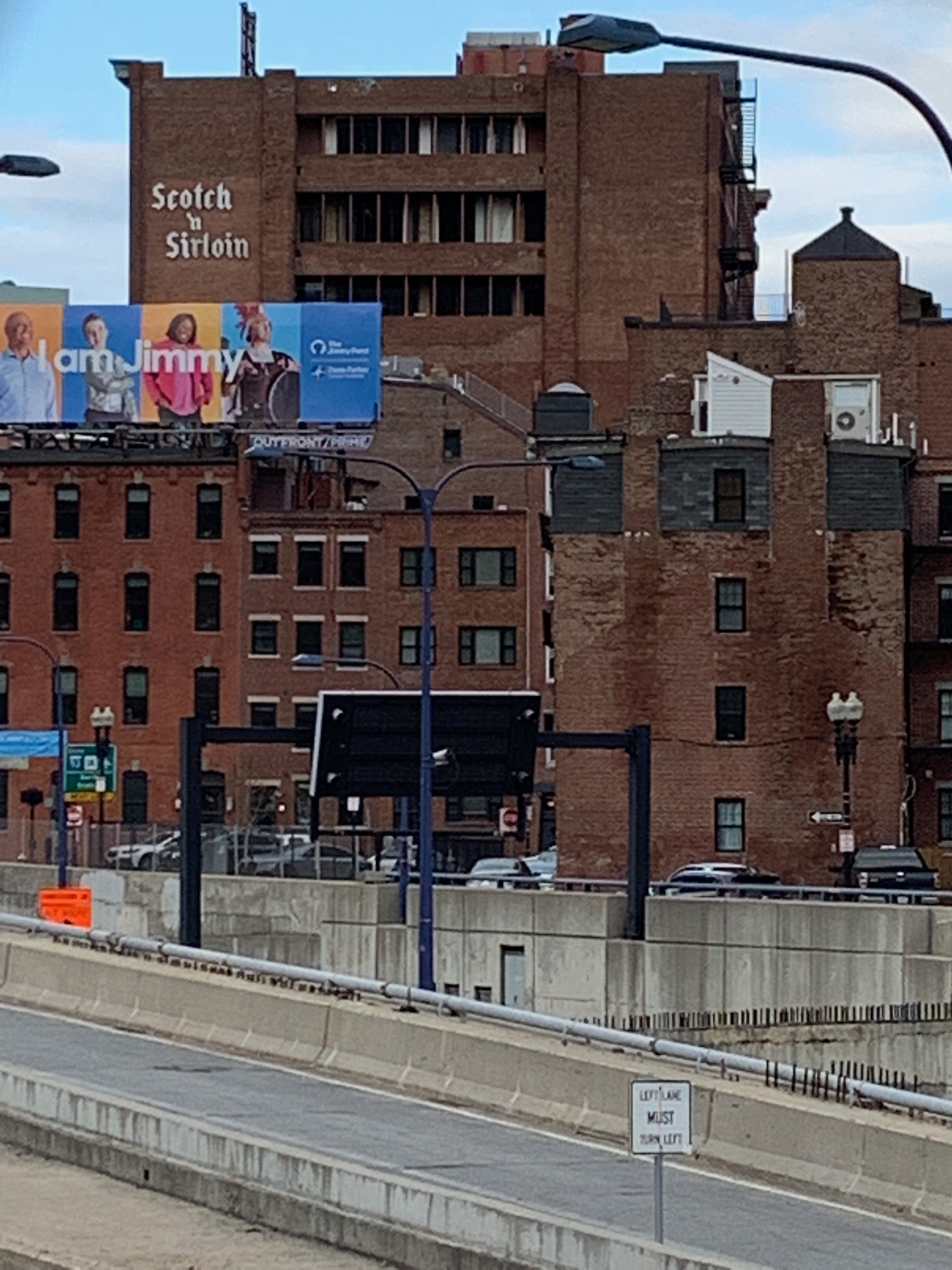
A Google search reveals that Scotch n’ Sirloin, a restaurant overlooking a stretch of I-93 that wasn’t entirely consumed by the Big Dig twenty-odd years ago closed in 1991 and yet the sign remains (the above photo is from December 2020) and likely will until the building gets rehabbed or torn down.
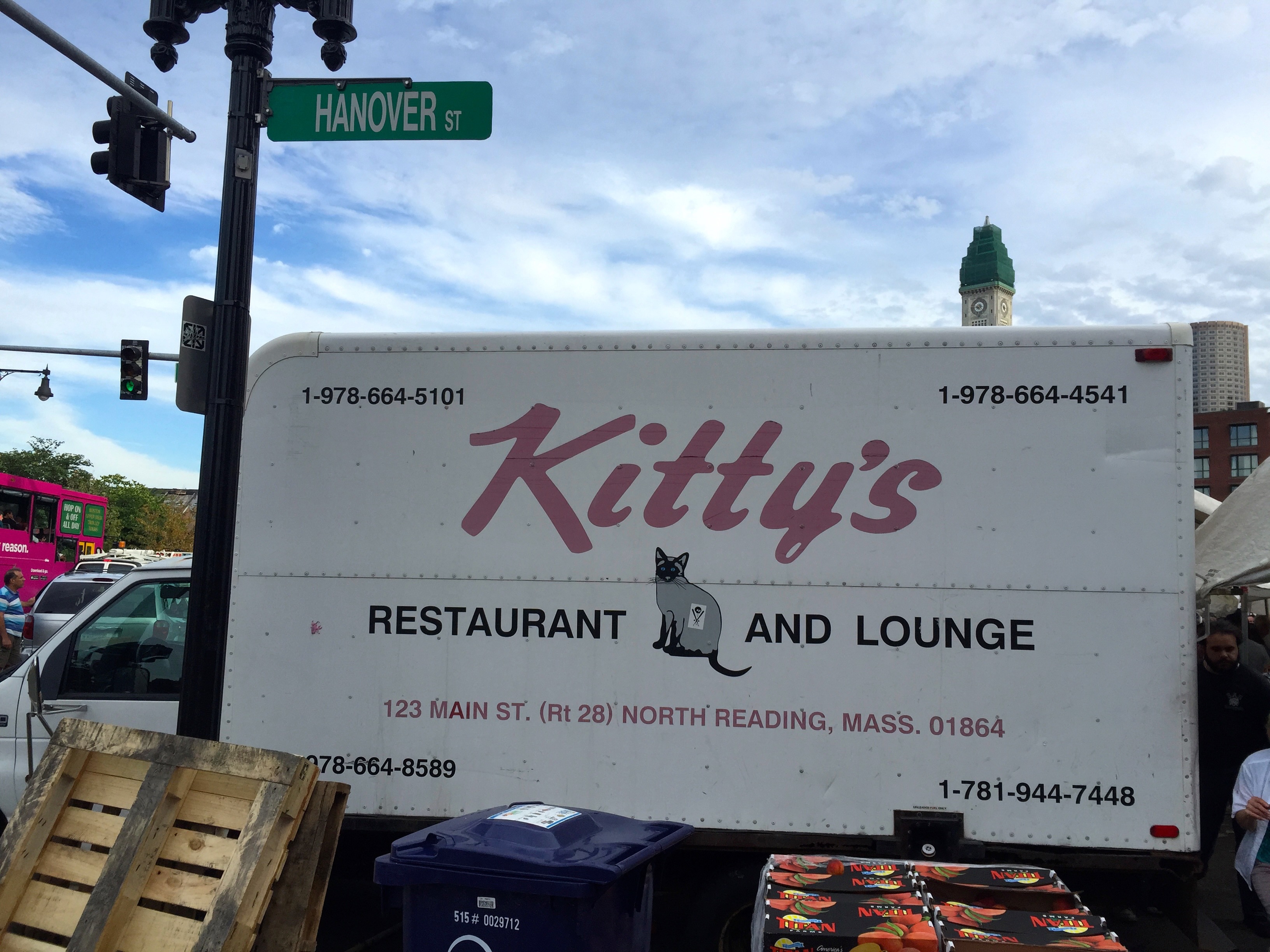
For years, this truck for Kitty’s Restaurant and Lounge in the far North suburbs has been a fixture at Haymarket. I don’t know why, exactly, but it’s always parked there and I rarely fail to notice its distinctive logo.
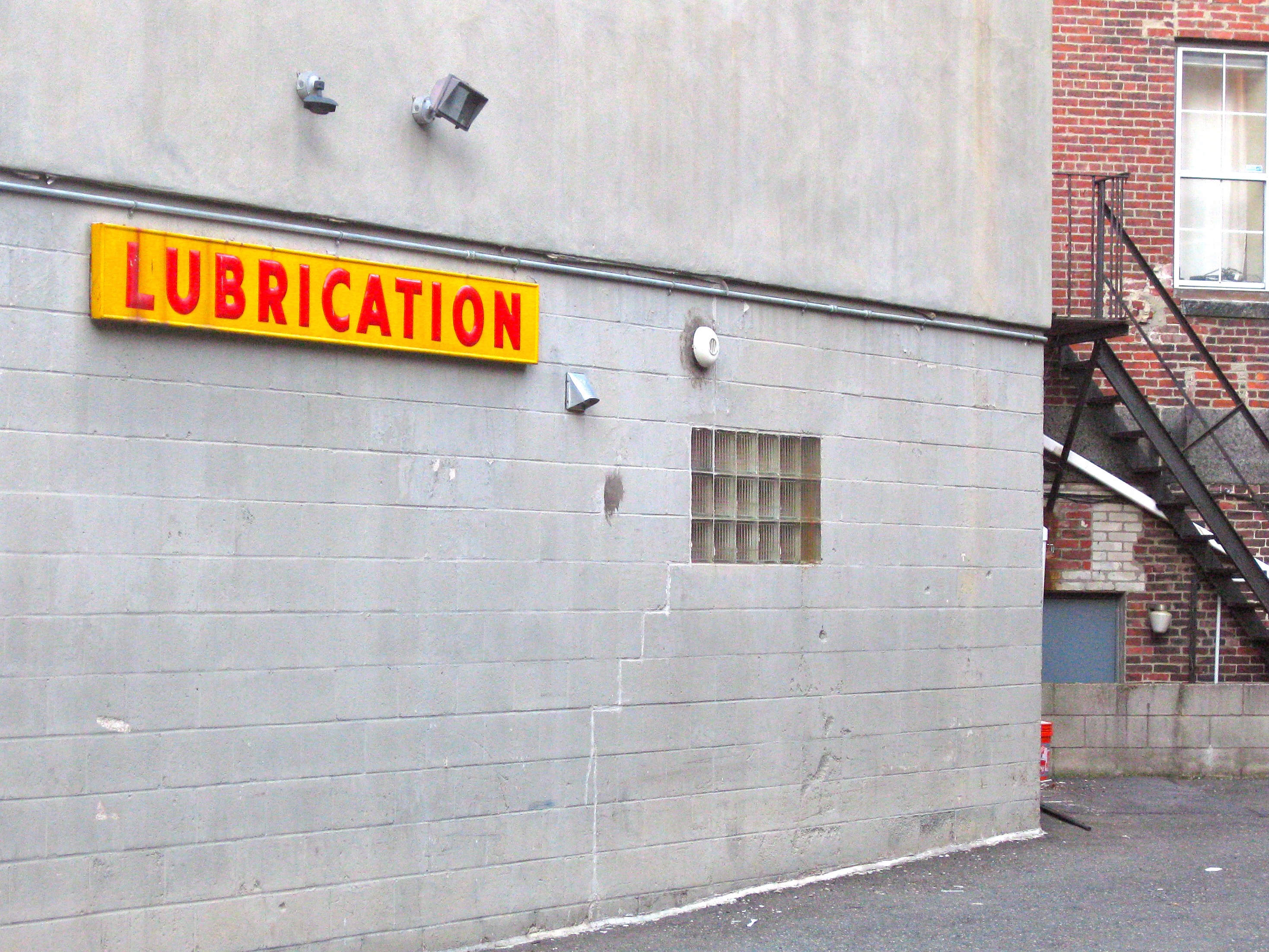
The North End is a tourism Mecca but out-of-towners tend to flock there for the restaurants, the Italian pastries, the Freedom Trail, etc. People actually live there too and occasionally need to service their vehicles (though let’s face it, the word “LUBRICATION” caught my eye more than anything else.)
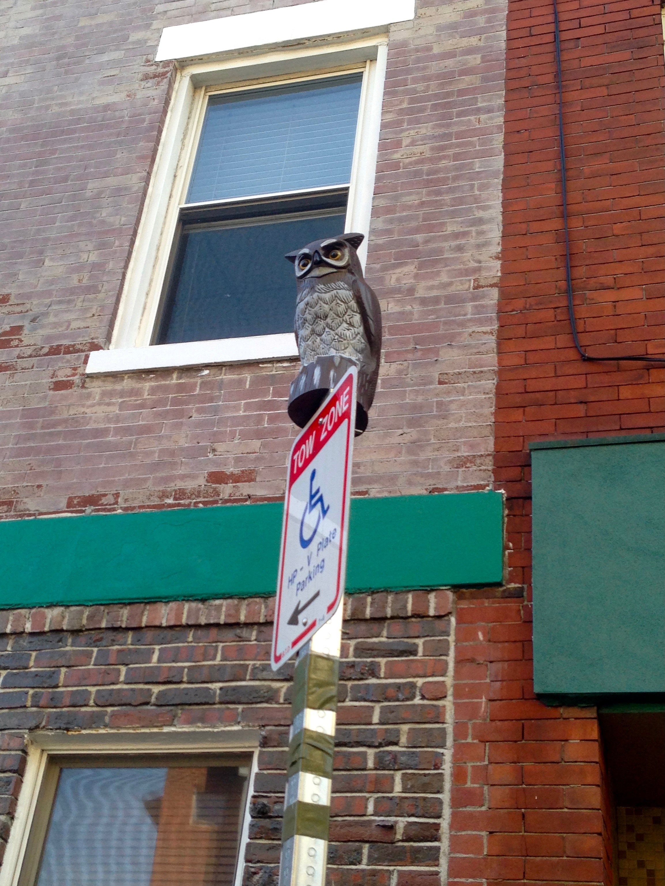
Also spotted in the North End: a fake owl on top of a tow-zone sign. I don’t get it, either.
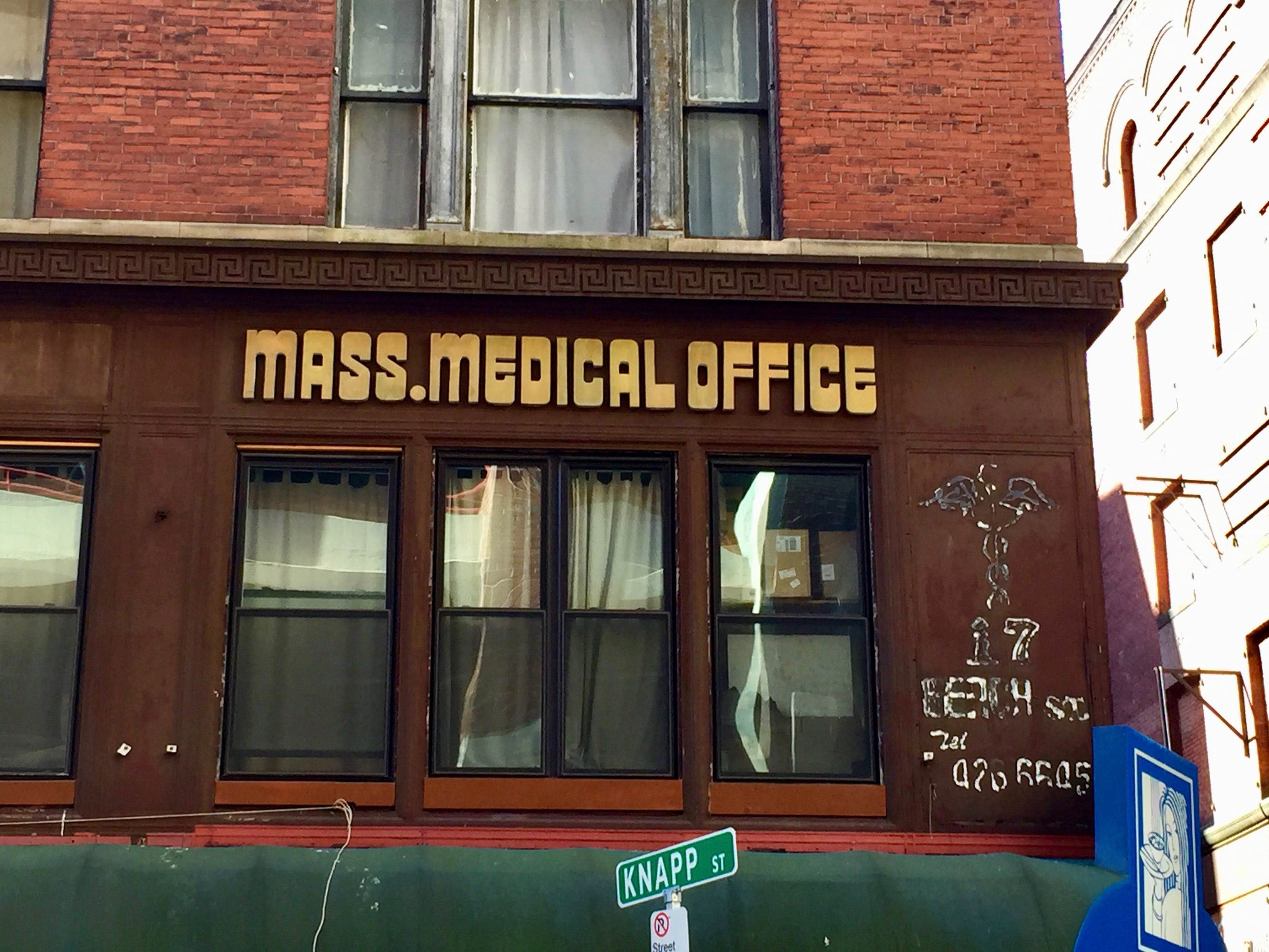
On the opposite end of downtown is Boston’s Chinatown, an ideal spot for Dim Sum but perhaps not so much for those seeking medical attention. My first thought upon seeing this unflashy dated signage in 2015 was, “Oh, really?”; according to Google Maps, work was being done on it as of 2020.
Speaking of dated signage, when Copley Place mall in the Back Bay began finally updating their 1980s-designed interior a few years ago, I knew I had to get a shot of this, located in hallway next to what was then Barney’s (and, long ago, a multiplex cinema with postage-stamp sized theaters) and is now Saks Fifth Avenue Mens’ Store.
A few blocks from the mall, probably on Marlborough St. or Commonwealth Ave. The neighborhood rivals (probably exceeds) Beacon Hill in terms of wealth, yet I tend to see the most elaborate (not to mention unsettling) Halloween decorations there every year.
Stepping away from Central Boston, it’s the Marmo Pedestrian Overpass in Orient Heights, a section of East Boston that I visited in May 2016 simply because I could (the Blue Line T goes out there.) It’s a pleasant, unremarkable neighborhood, most notable for Constitution Beach and this colorful footbridge. I posted a bunch of pix from there on my now-defunct Tumblr and maybe I’ll repost some of them here one day.
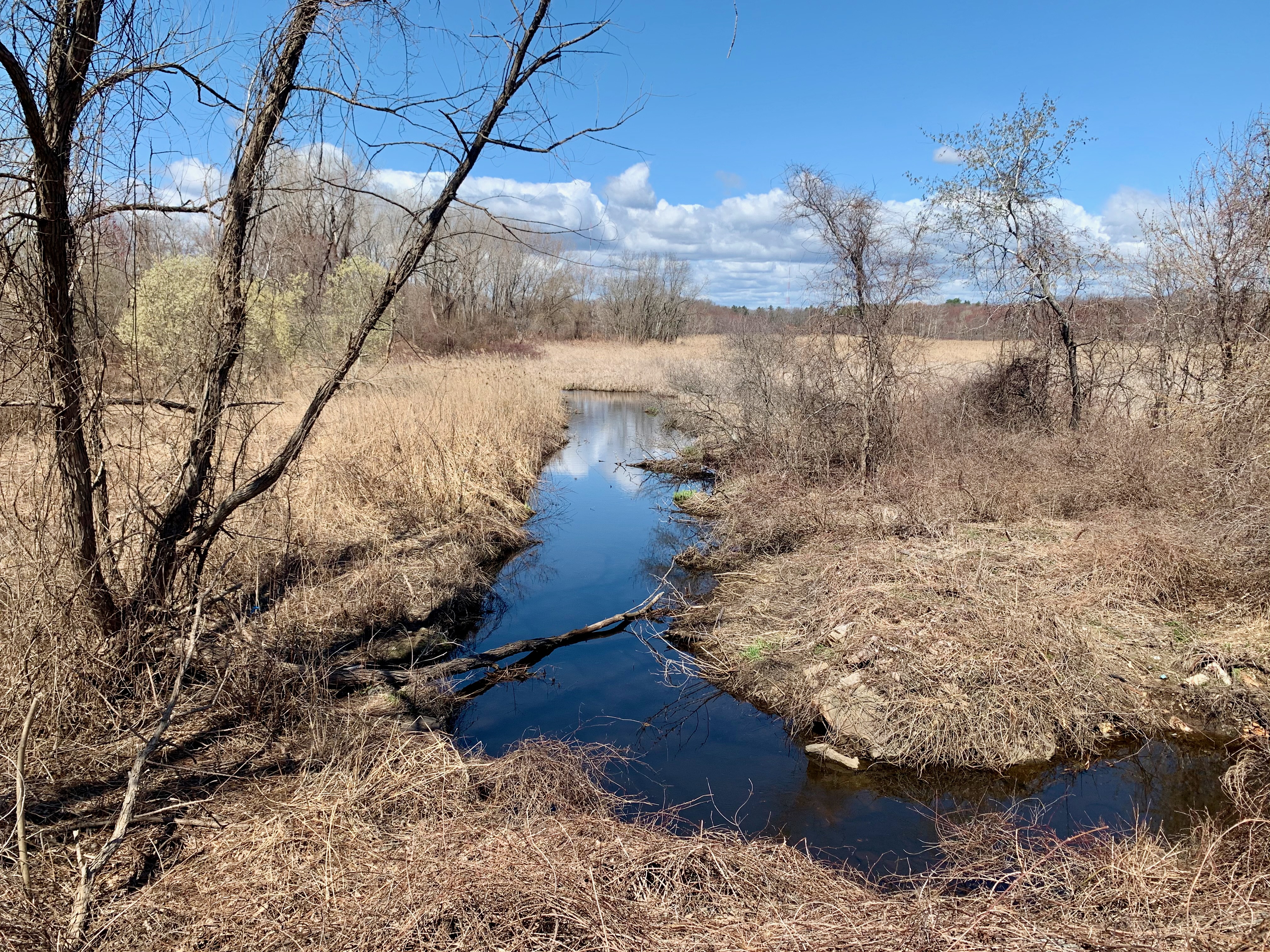
From East Boston to the city’s Westernmost boundary, which happens to be a ten minute walk from where I currently live. I’ll post an entire essay on West Roxbury some other time, but for now, here’s Sawmill Brook at Millennium Park, a vista I’ve taken dozens of shots of over the years; it’s almost as far West as one can go while staying within the city limits.
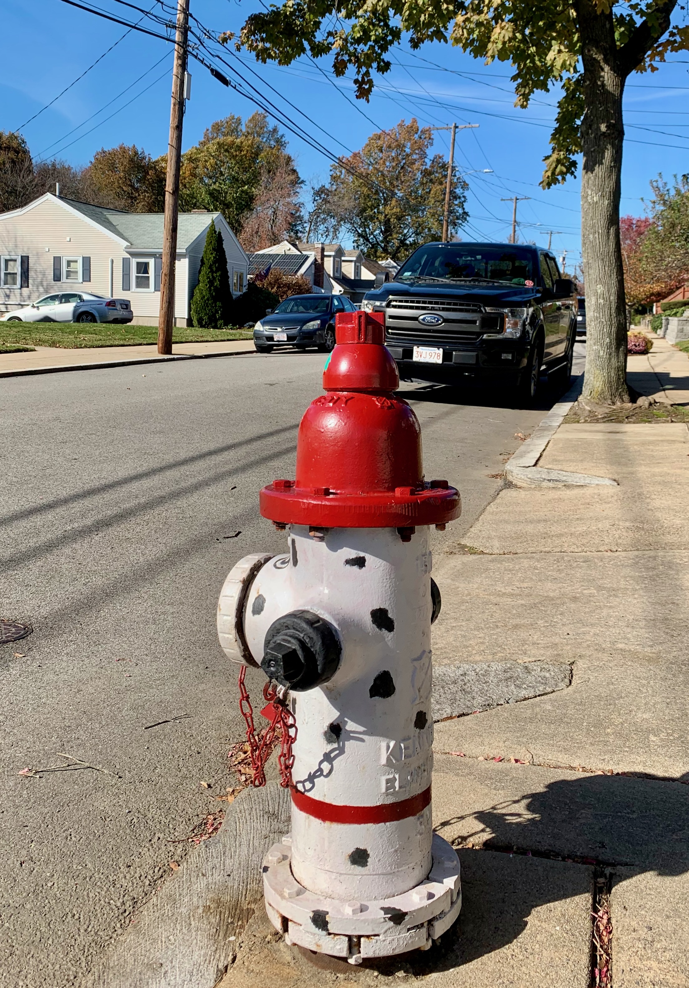
I was going to conclude with this whimsical hydrant on a residential West Roxbury street that I got to know well via many pandemic-era neighborhood walks.
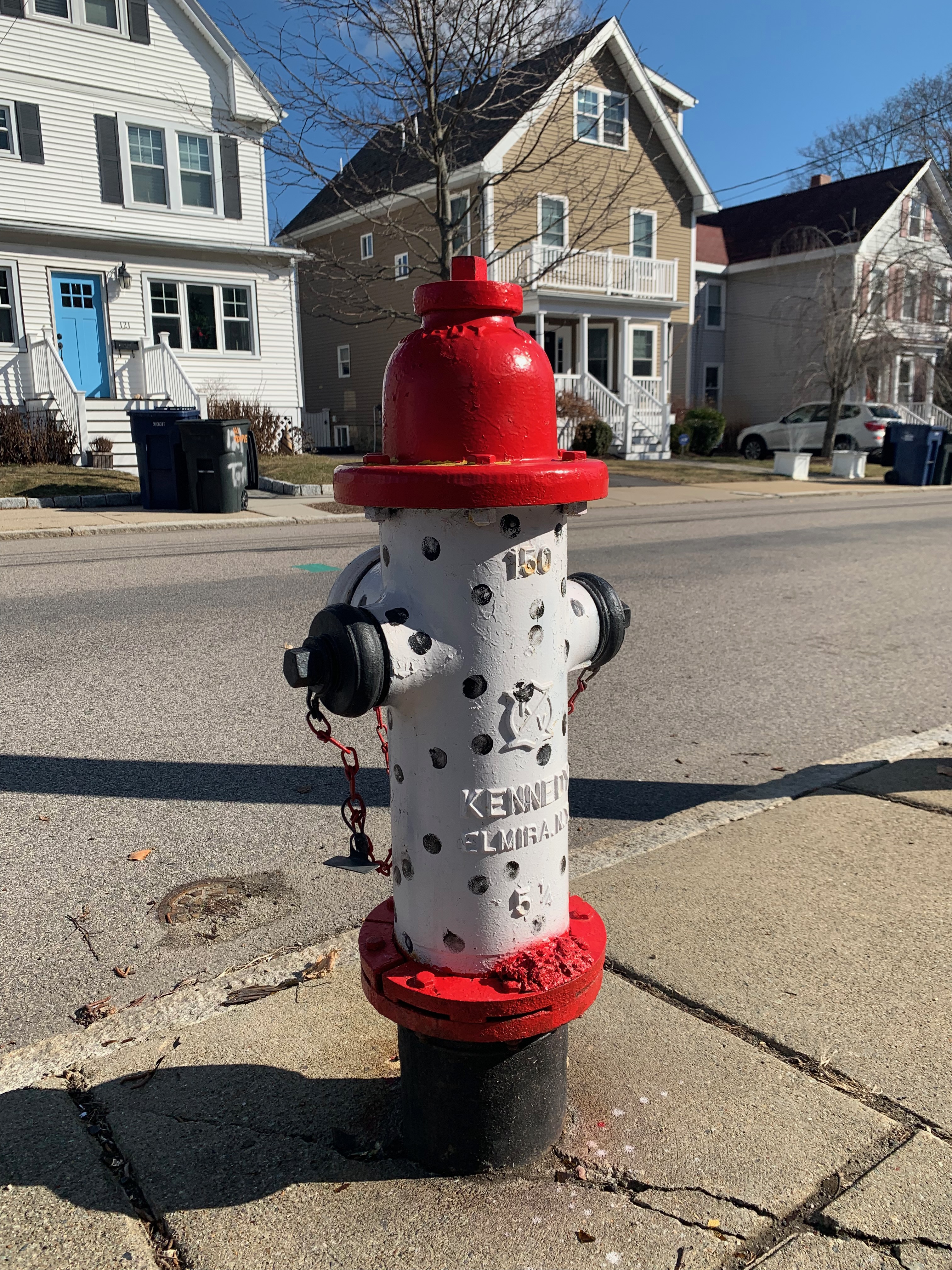
However, I spotted this twin hydrant one street over the other day. Now I’m curious as to whether others exist throughout this neighborhood and beyond. Stay tuned.