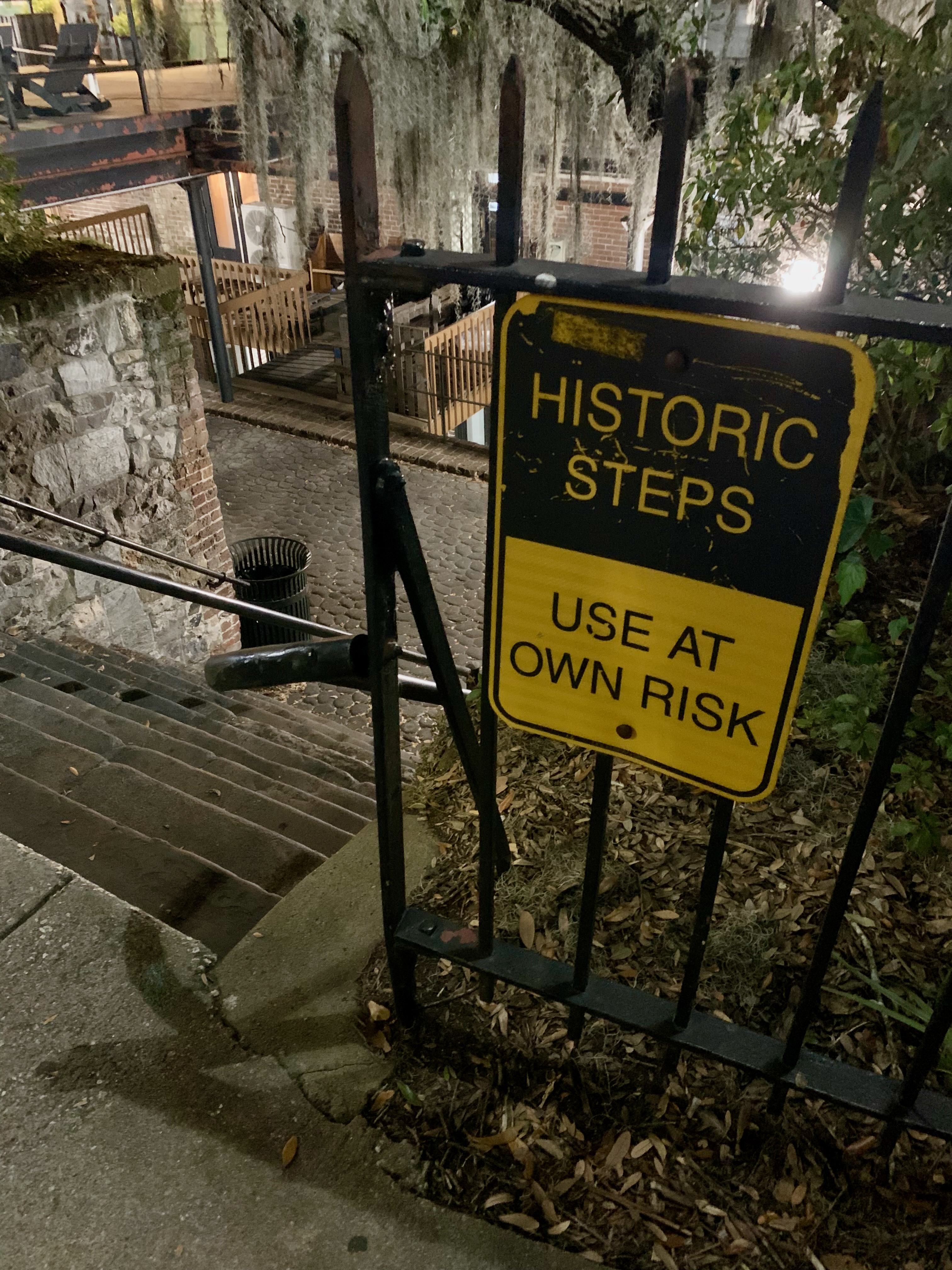
On my first trip to Savannah in two decades, I had forgotten about these “Use at Your Own Risk” stairs leading down to River Street (one of many sets of them, by the way.)
However, I remembered this awesome vintage motel sign the moment it came into view after exiting the Talmadge Memorial Bridge.
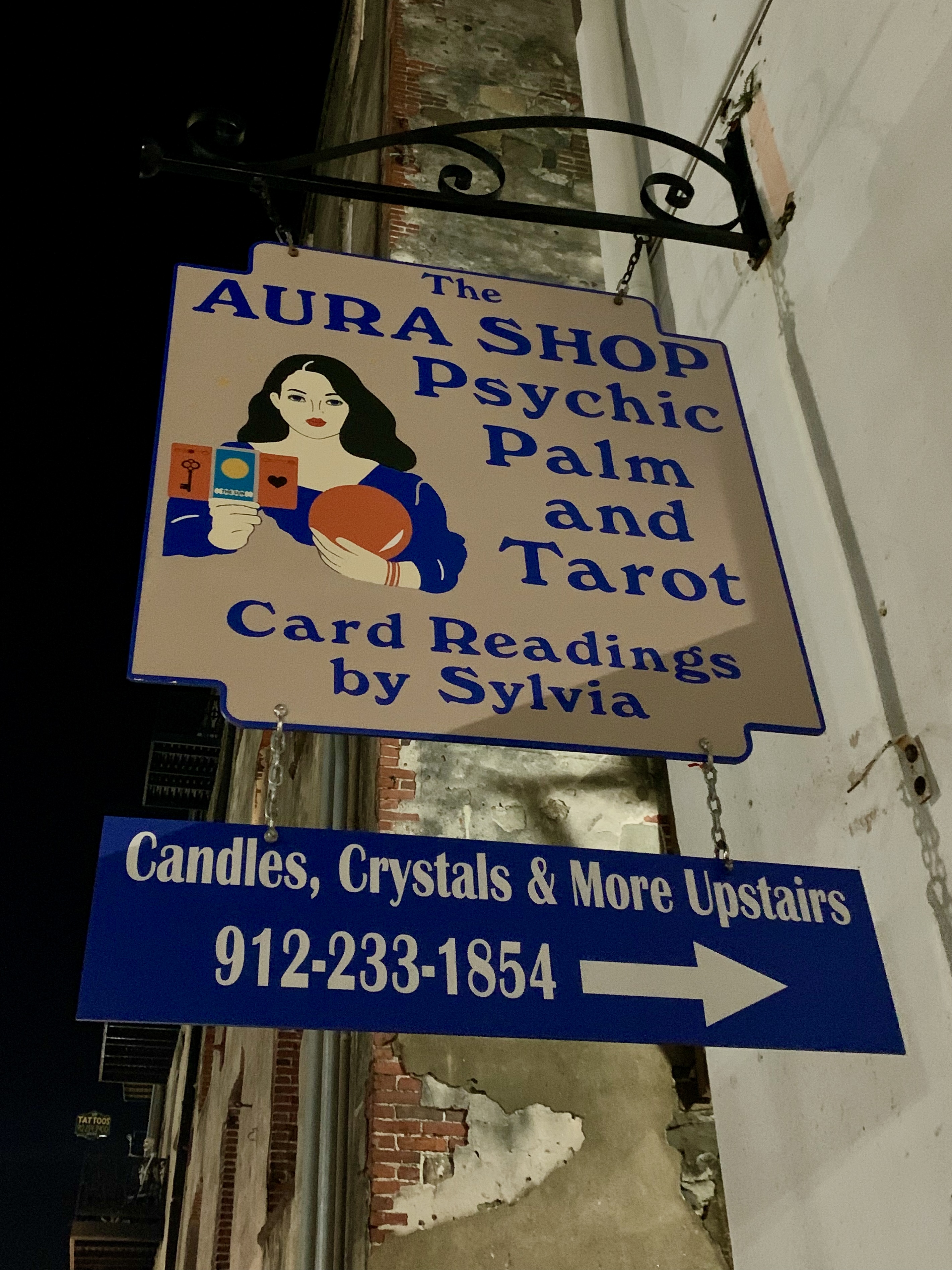
It’s comforting to see Sylvia the Psychic has endured among all the old and new tourist destinations along River Street.
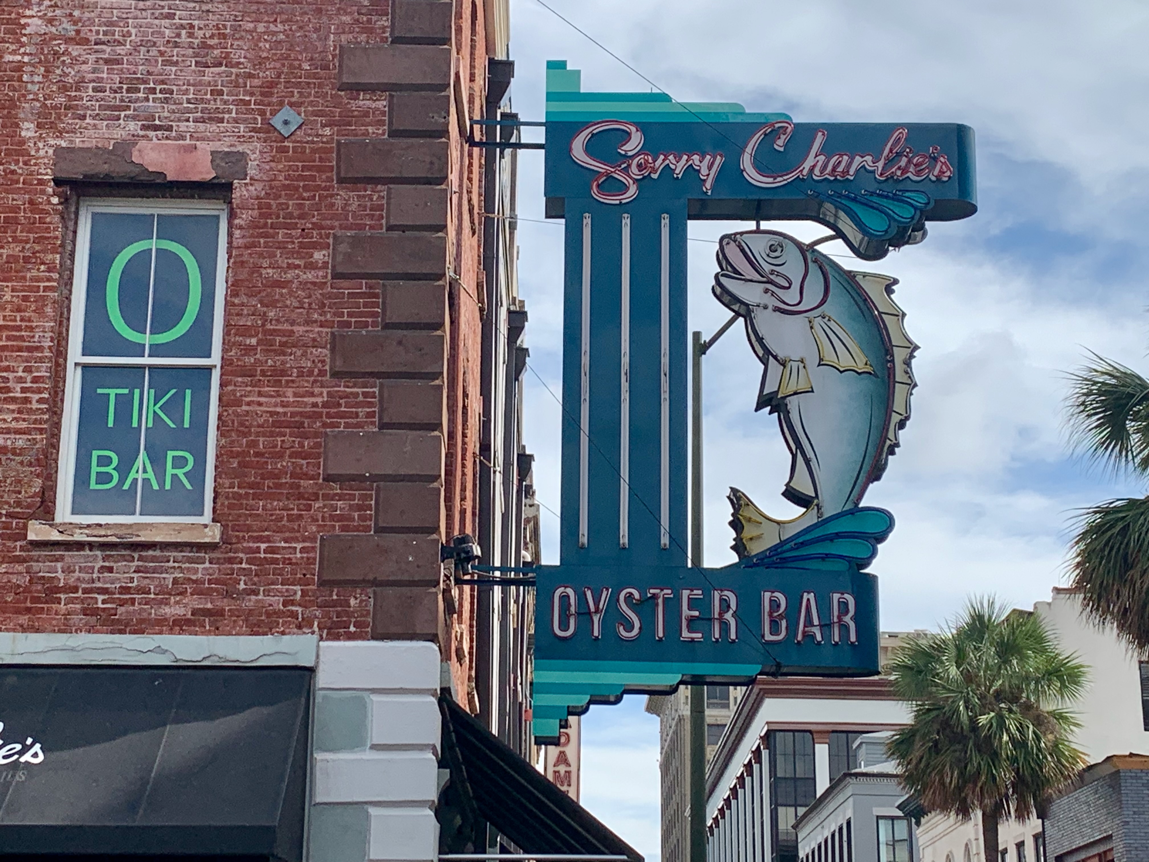
An Oyster Bar and a Tiki Bar? Both high on my list of places to visit the next time I’m in town.
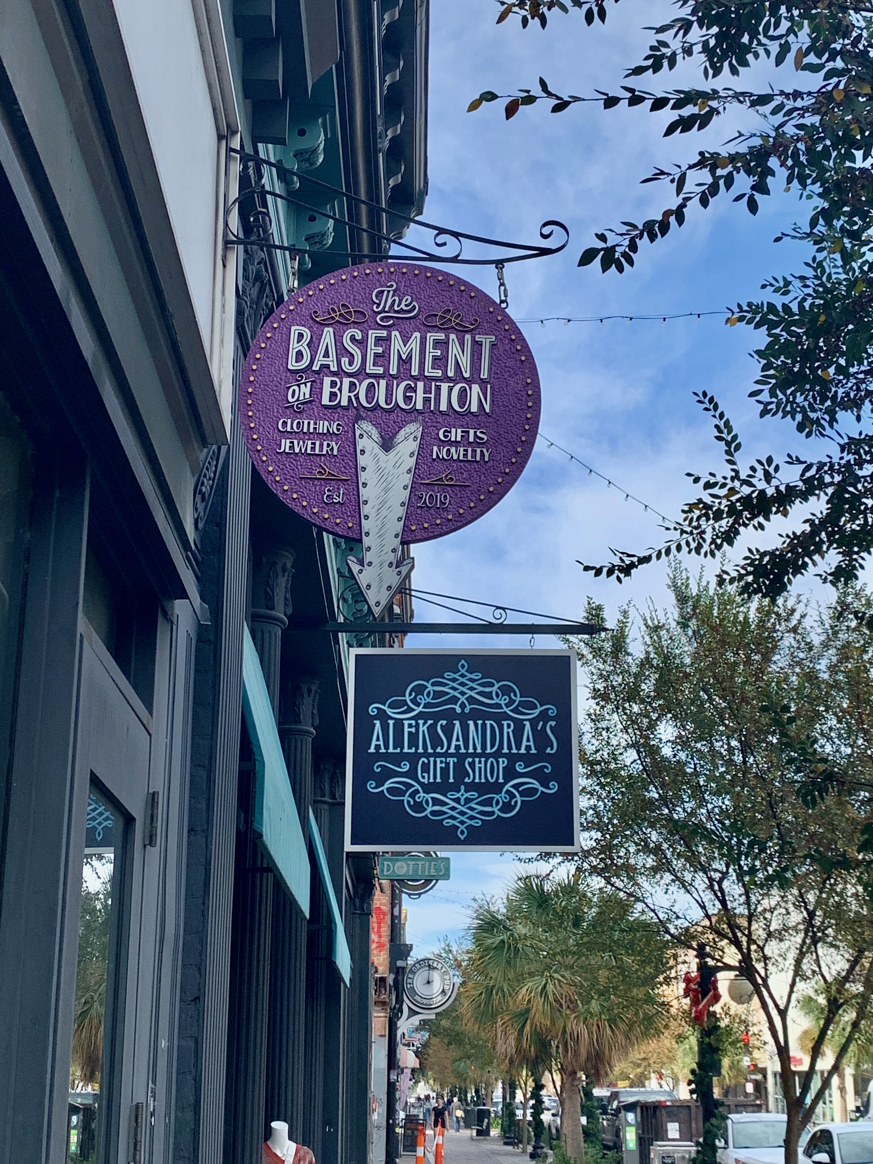
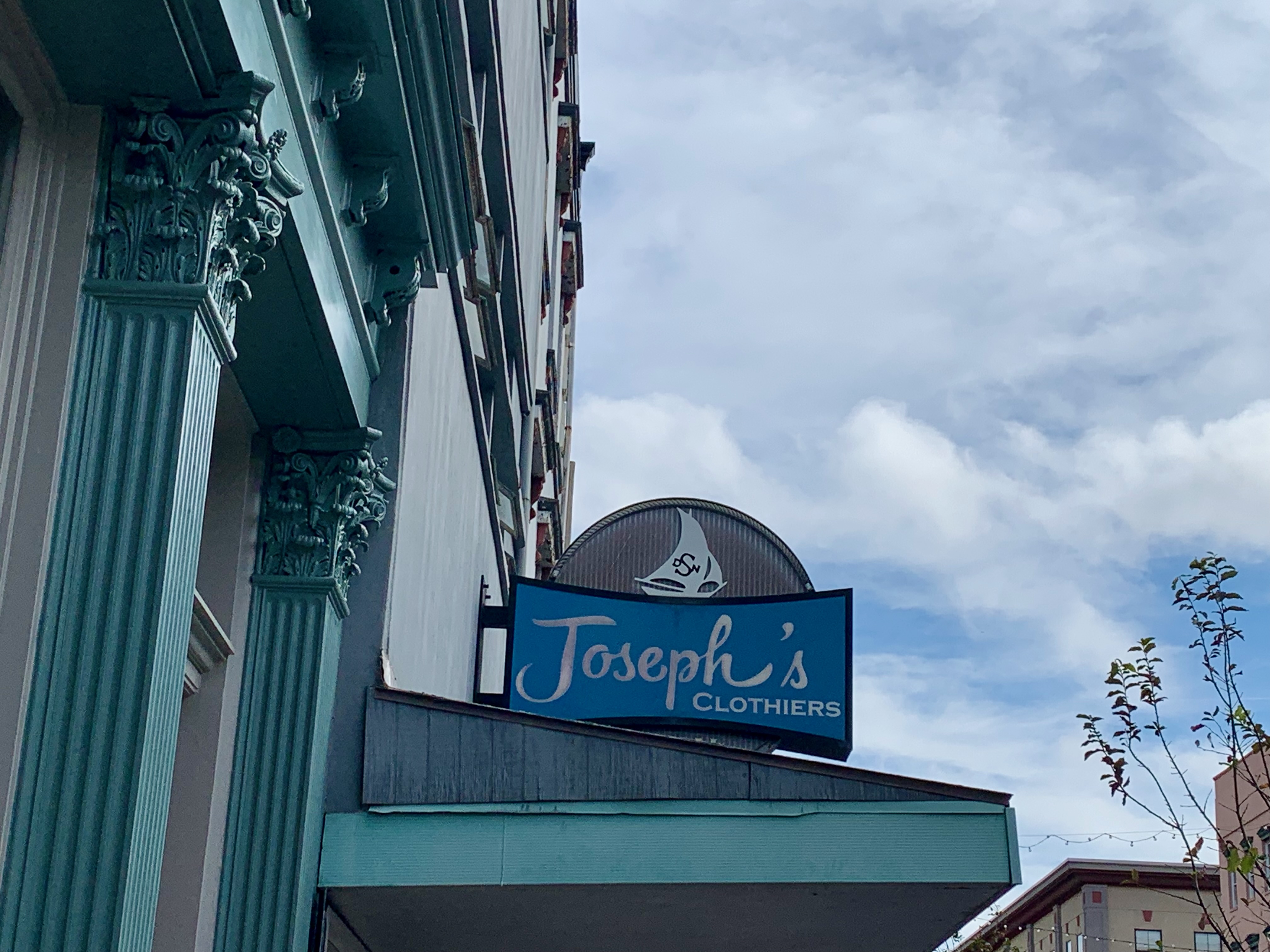
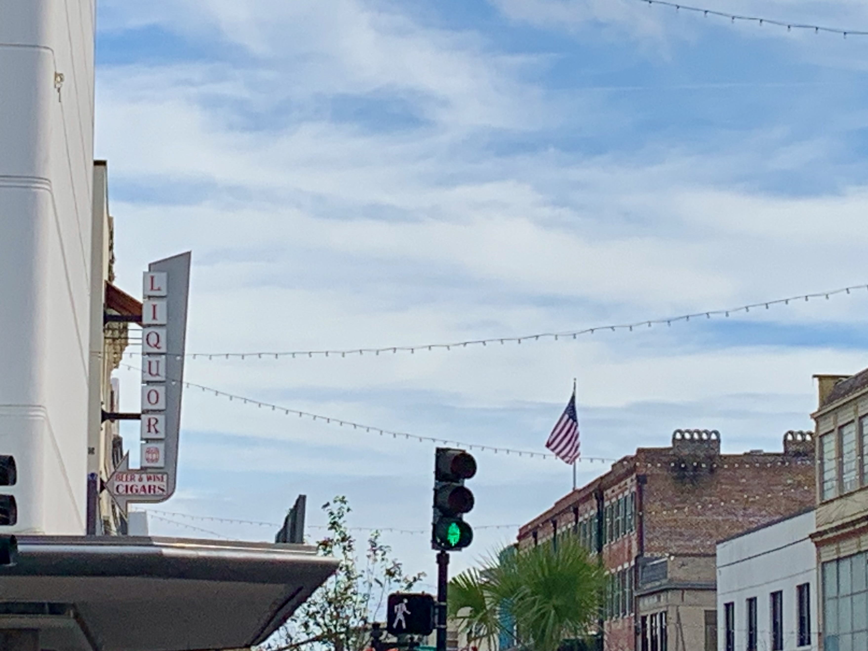
Broughton Street, downtown’s main shopping thoroughfare is resplendent with cool signage.
The ratio of vintage-to-modern (or made-to-look-vintage) nearly favors the former here.
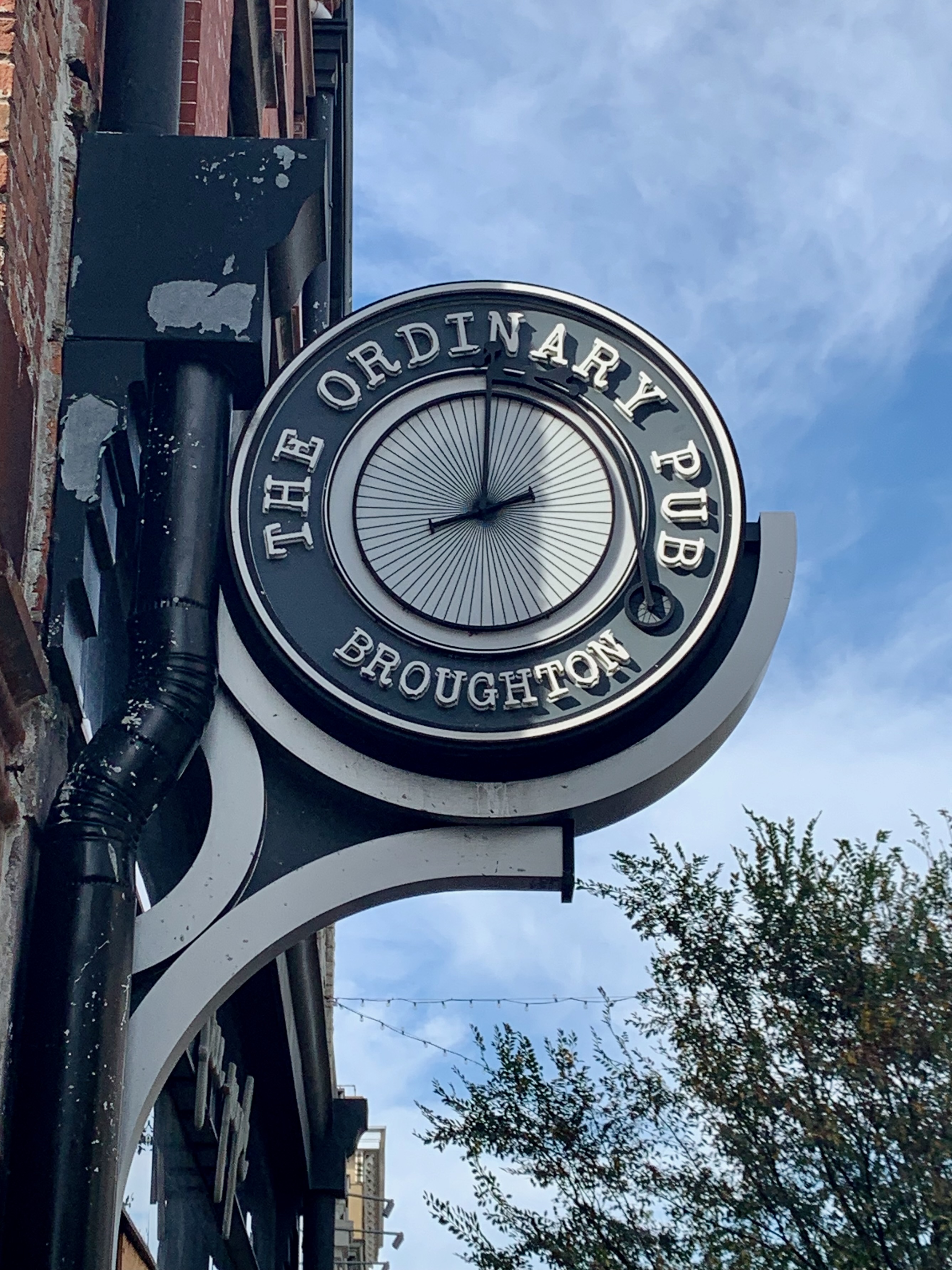
I appreciate some of the modern signs, particularly the more whimsical ones.
We need to bring back vertical signage, whether it’s genuinely vintage…
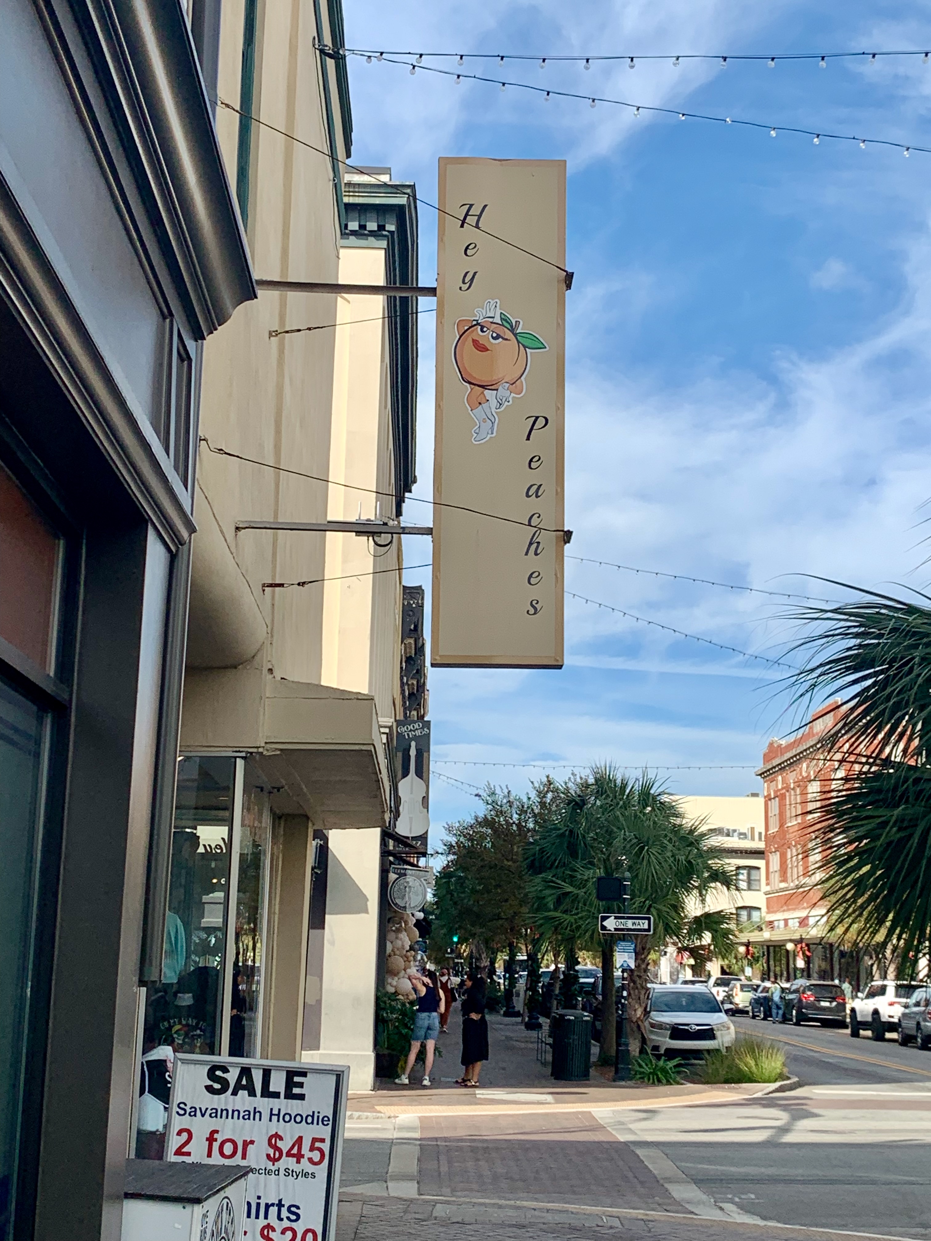
…or contemporary but playful in spirit (if you’re in Georgia, you will see peaches.)
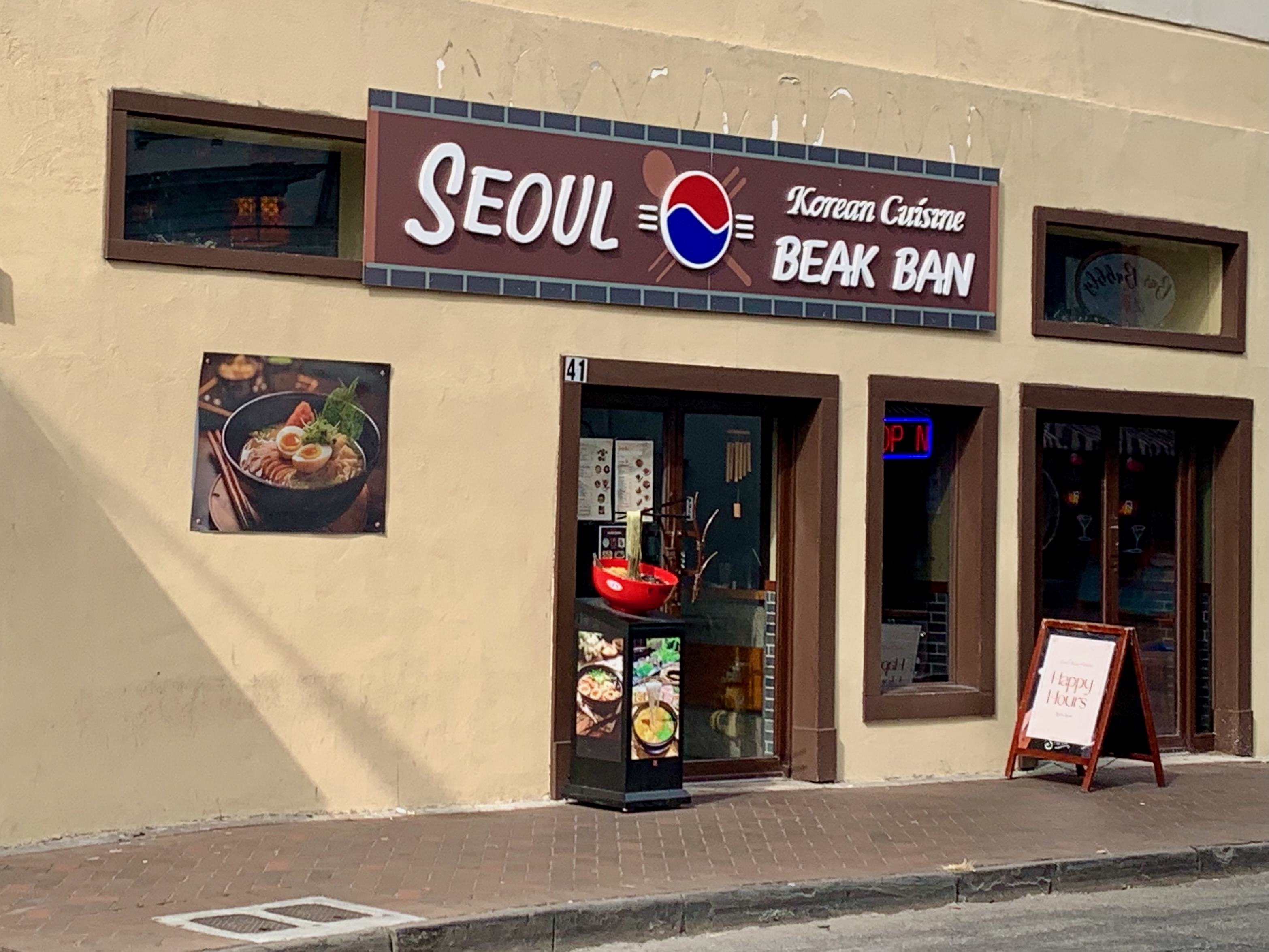
Just off Broughton on Whitaker Street, this Korean restaurant fits in aesthetically while also standing out.
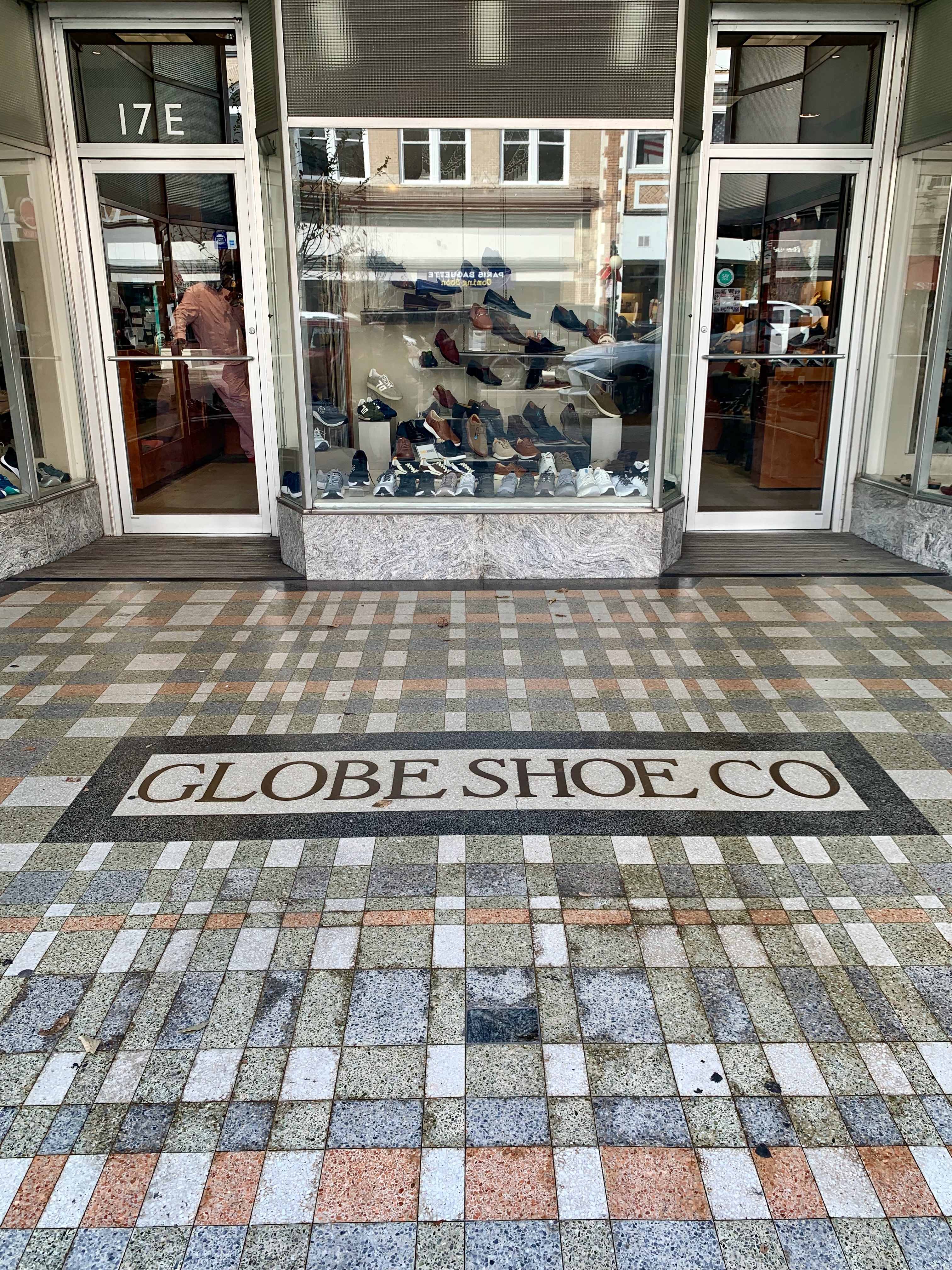
Many storefronts along Broughton contain remnants of historic tenants in their tiled floor entrances. In this case, happily, the Globe Shoe Company still occupies this space.
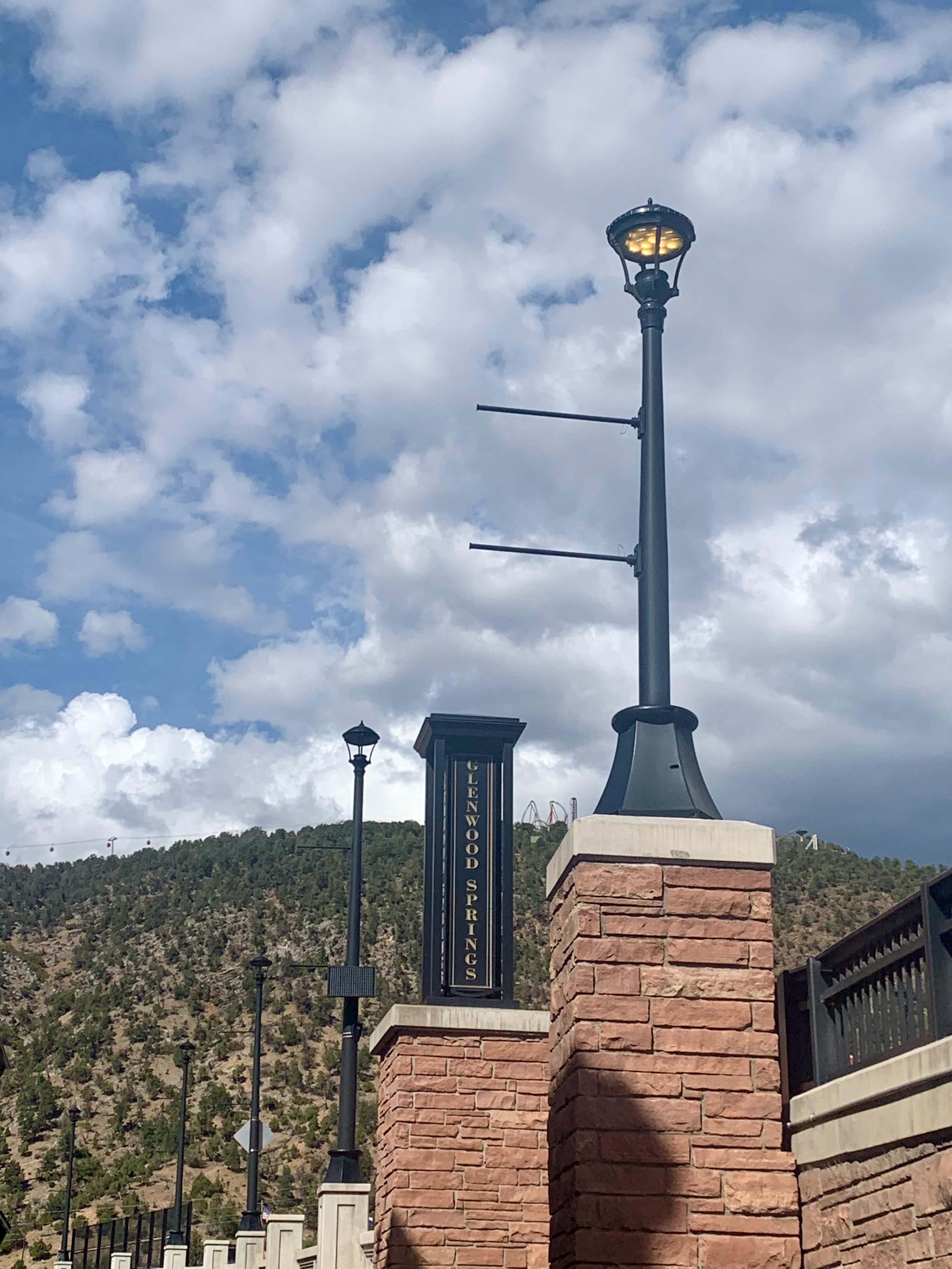
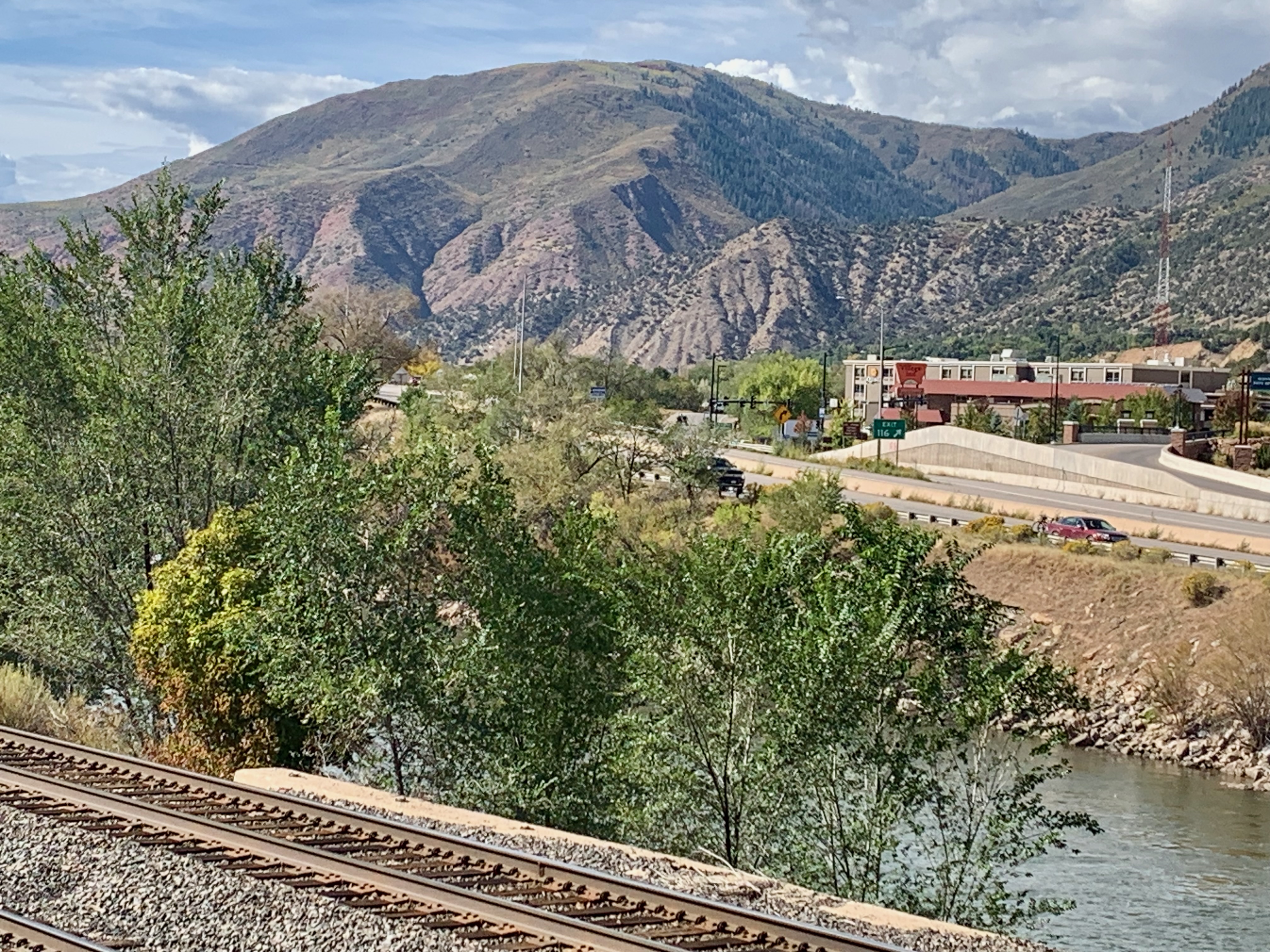
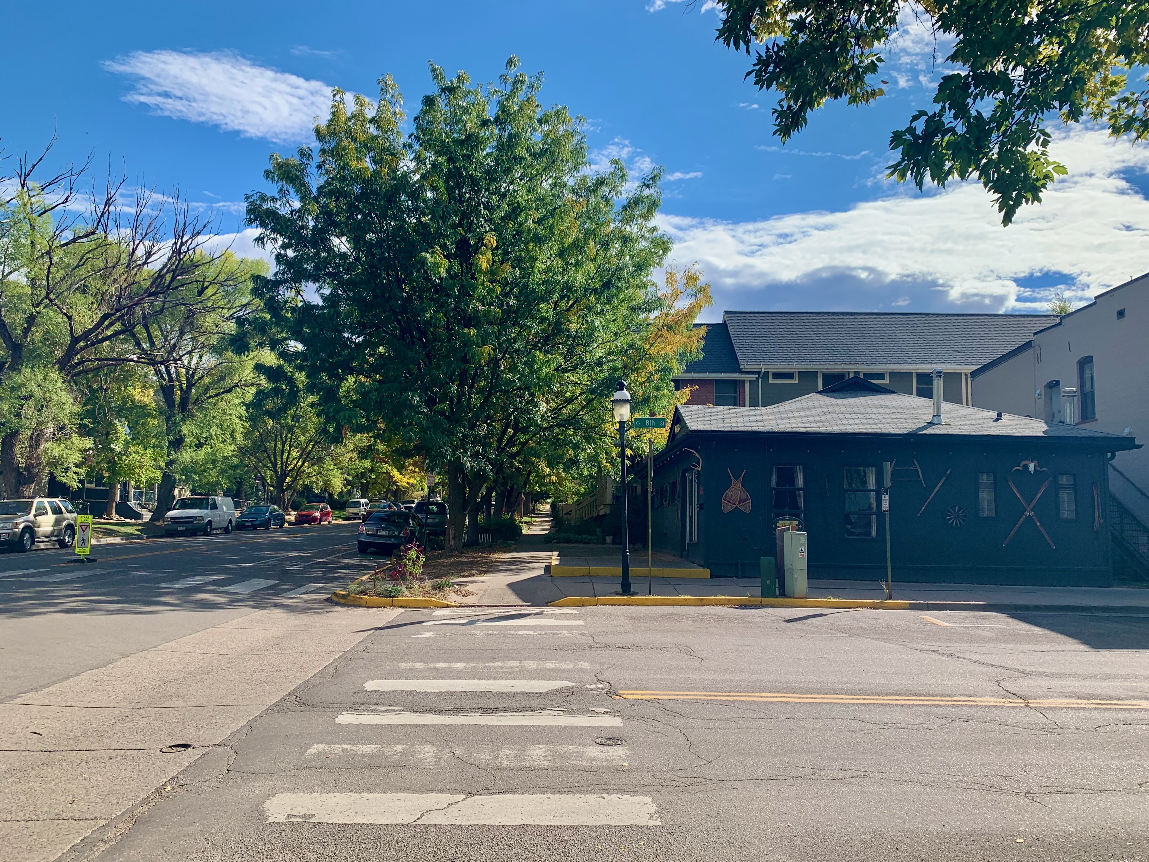
One has to pass through Glenwood Springs, Colorado to reach points south like Aspen and Maroon Bells.
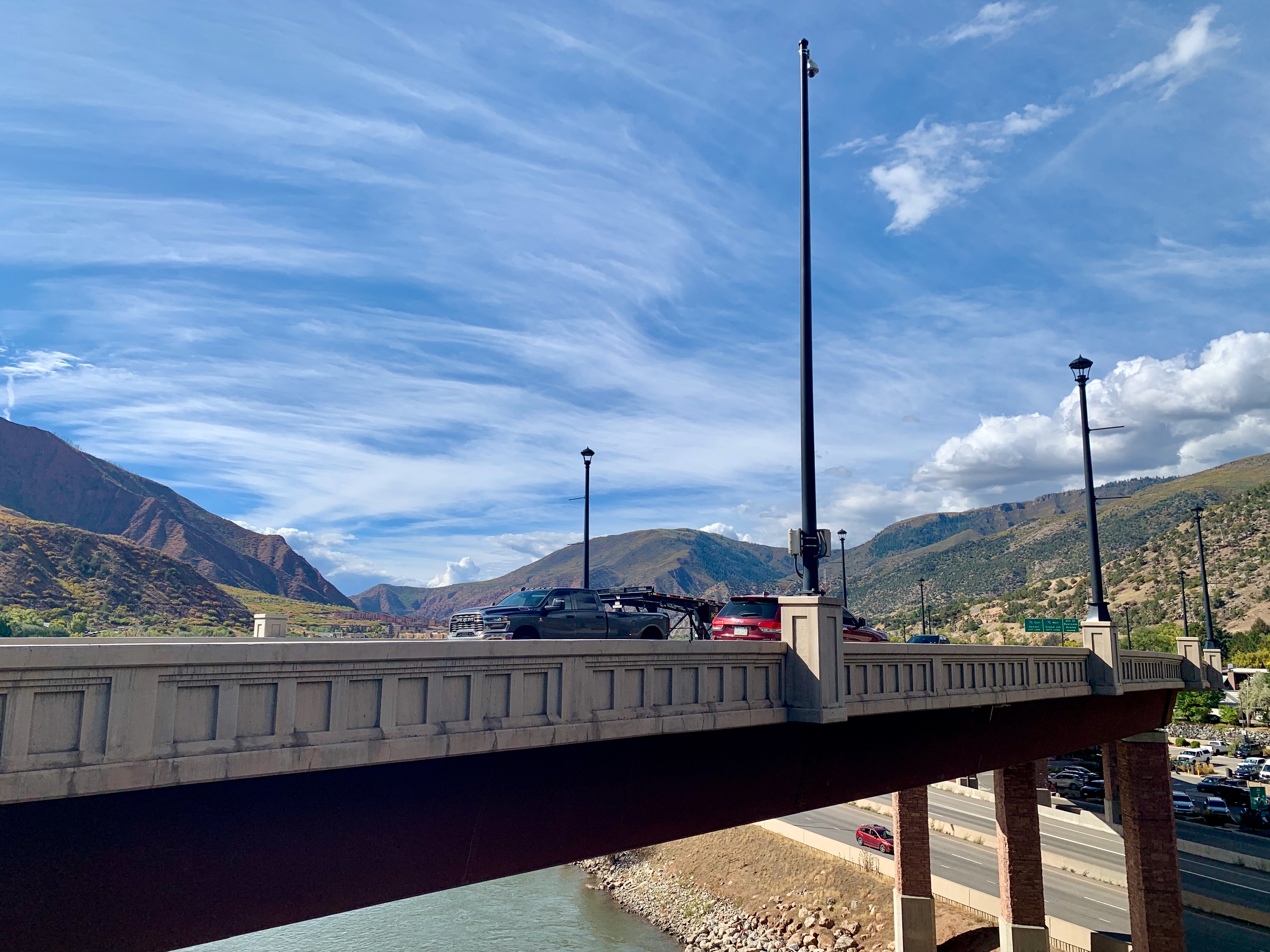
A city of just under 10,000 people, Glenwood Springs sits at a crossroads. The Colorado River and I-70 cut through it from east to west, while Highway 82 South leads one into its downtown via an overpass bridge. This was taken from an adjacent pedestrian bridge.
To the west, an expanse of motels, radio towers and nearly monochrome mountainous terrain.
To the east, comparatively much more color and texture. On I-70, one must pass through the thrilling, precarious Glenwood Canyon to arrive here.
The town is mostly renown for the Glenwood Hot Springs which sprawl to the north of the river and interstate. We briefly considered checking them out but they were a little expensive for our taste.
More lush greenery to the east along I-70, but something red stands out to the right.
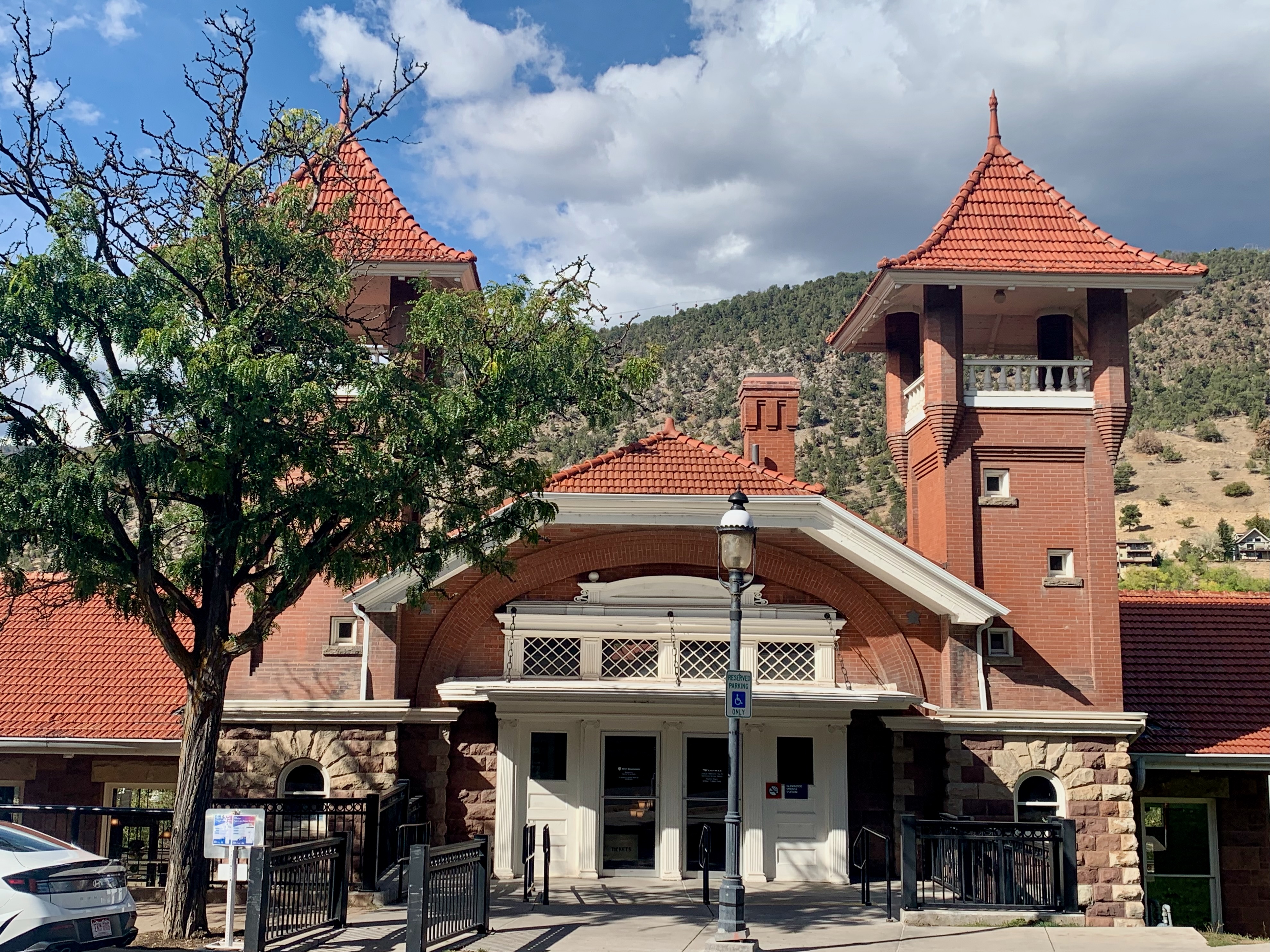
The town’s historic train station where Amtrak’s California Zephyr line still stops.
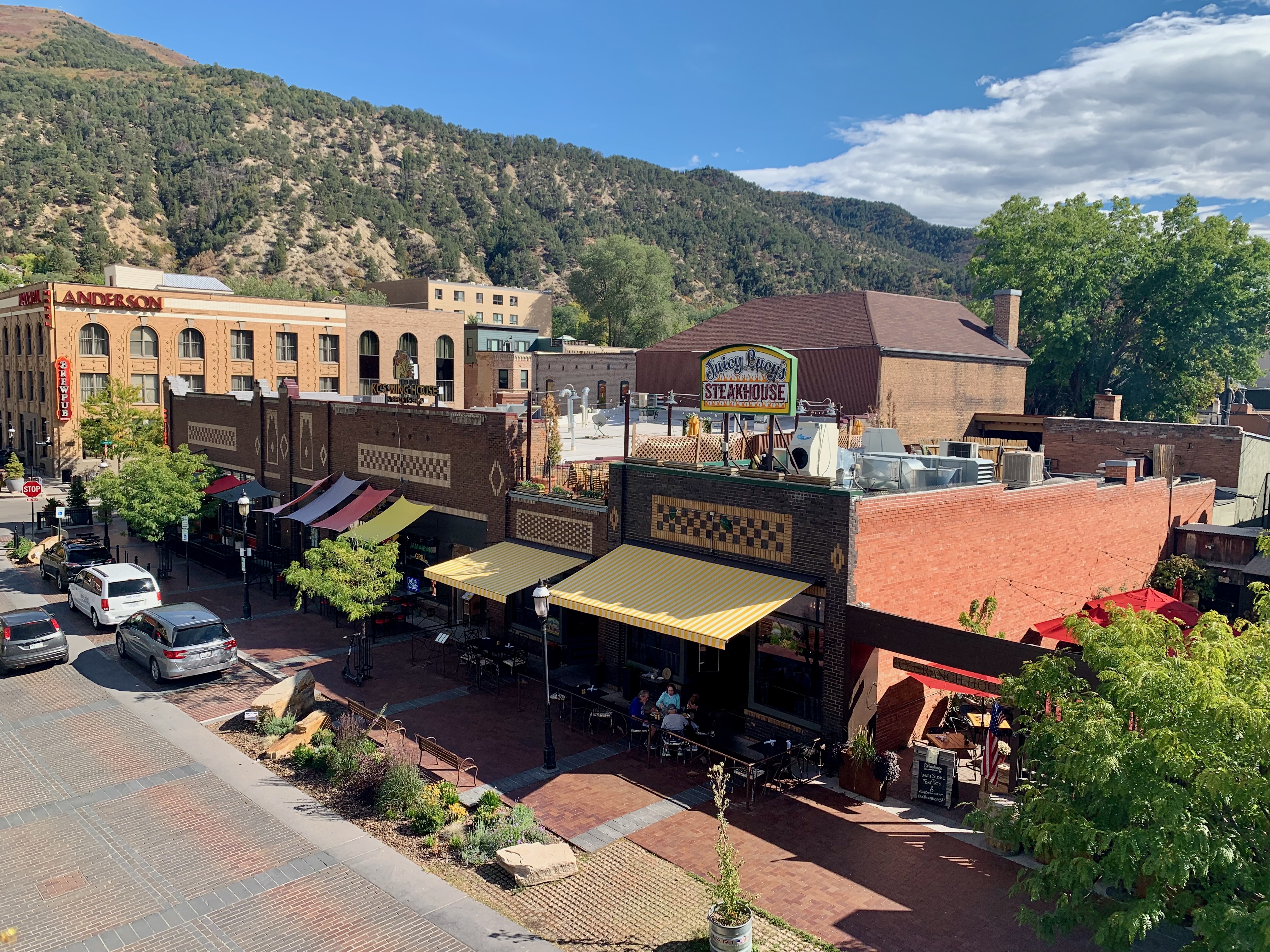
Initially, we feared the town itself was nothing more than a tourist trap given its proximity to the Hot Springs.
While ideally positioned to attract out-of-towners like us, the town also has an agreeable laid-back homey vibe nestled within all of its scenic beauty.
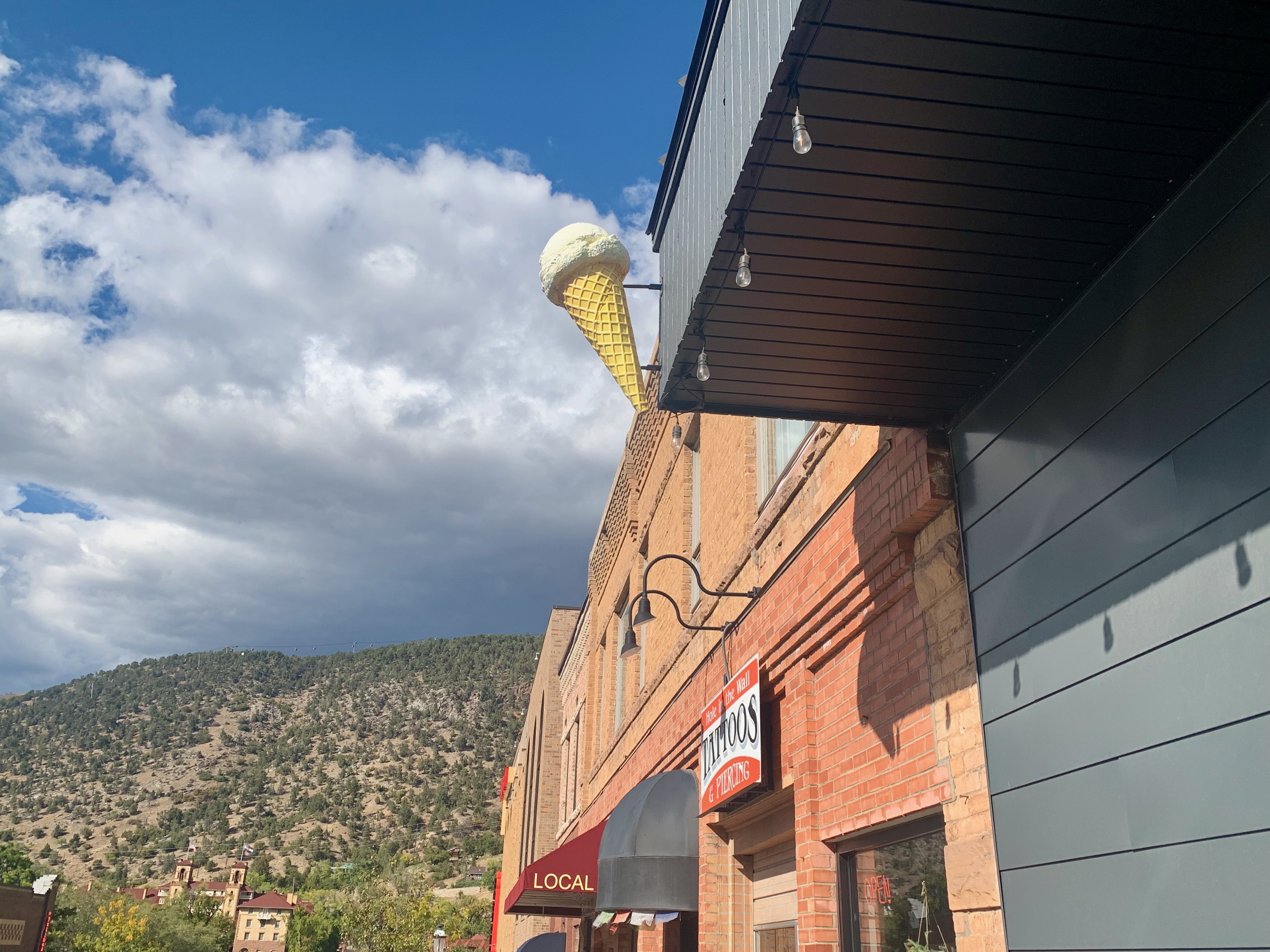
Not to mention a little whimsy here and there like this oversized ice cream cone.
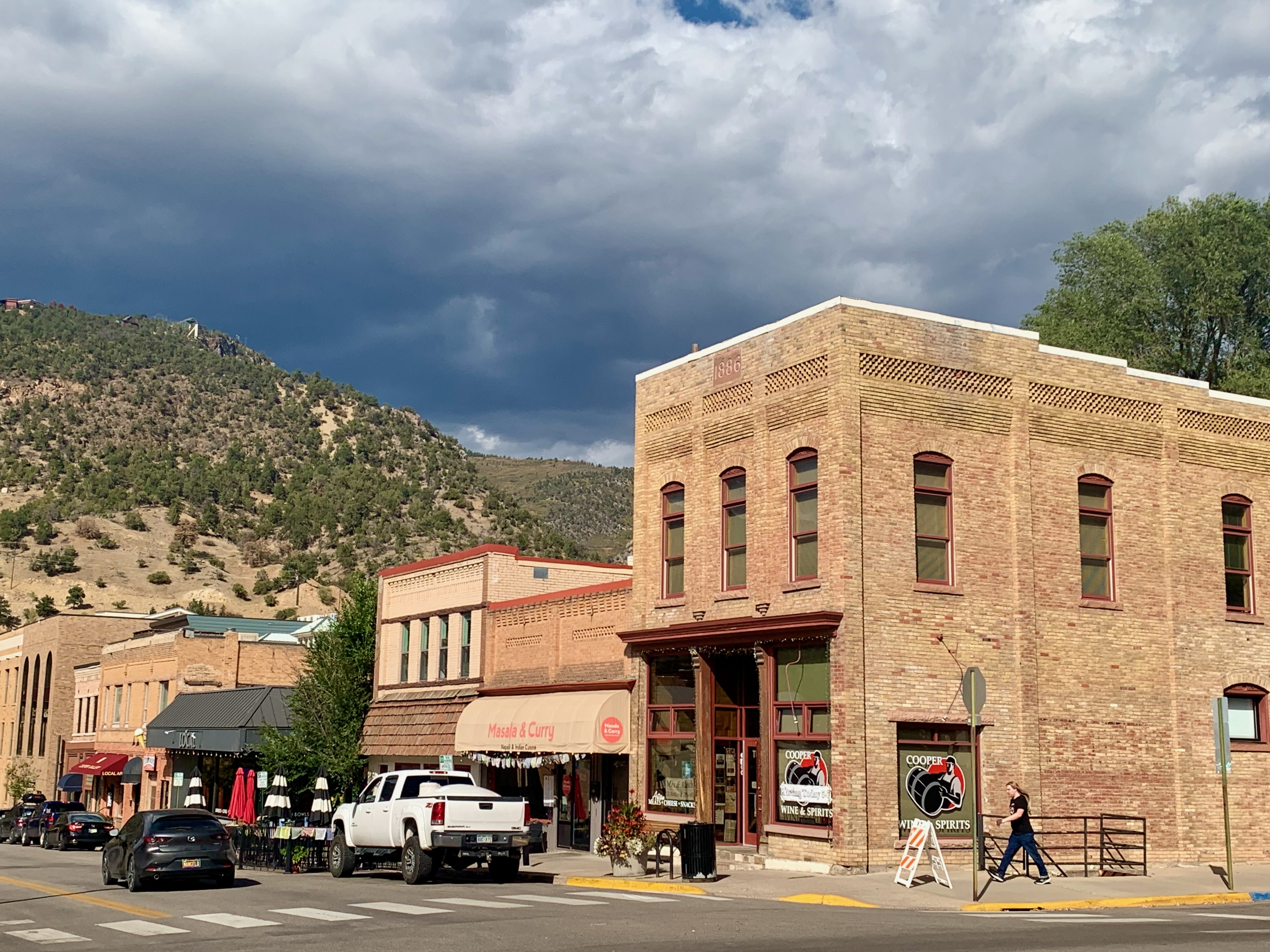
Downtown has an excess of vintage architecture; I could’ve spend an entire day walking around taking photos.
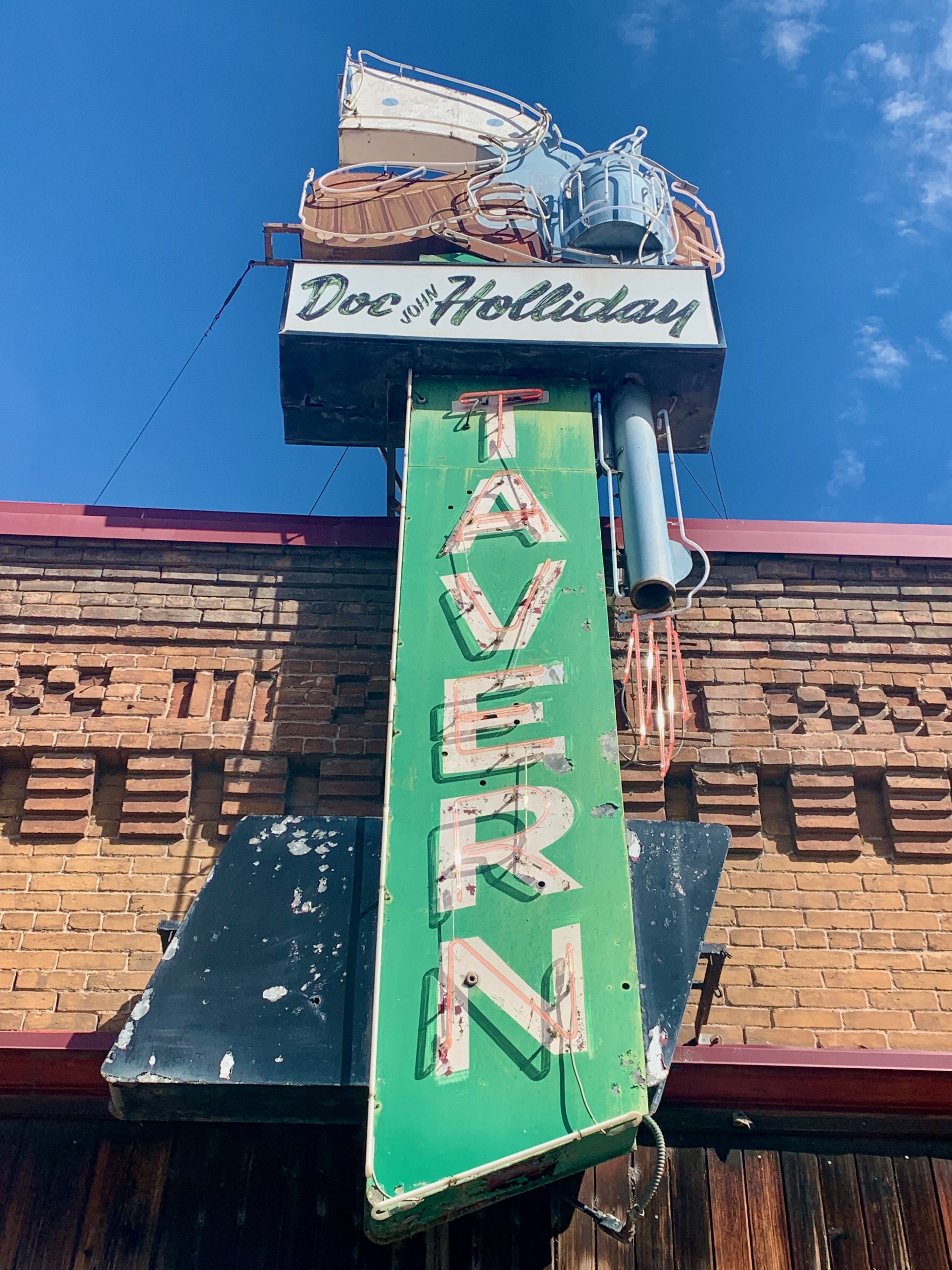
Perhaps its other claim to fame (besides the Hot Springs) is that it’s where Doc Holliday died. I’d recently watched Tombstone (featuring Val Kilmer’s justly celebrated performance as Holliday) without knowing I’d end up here just a few months later.
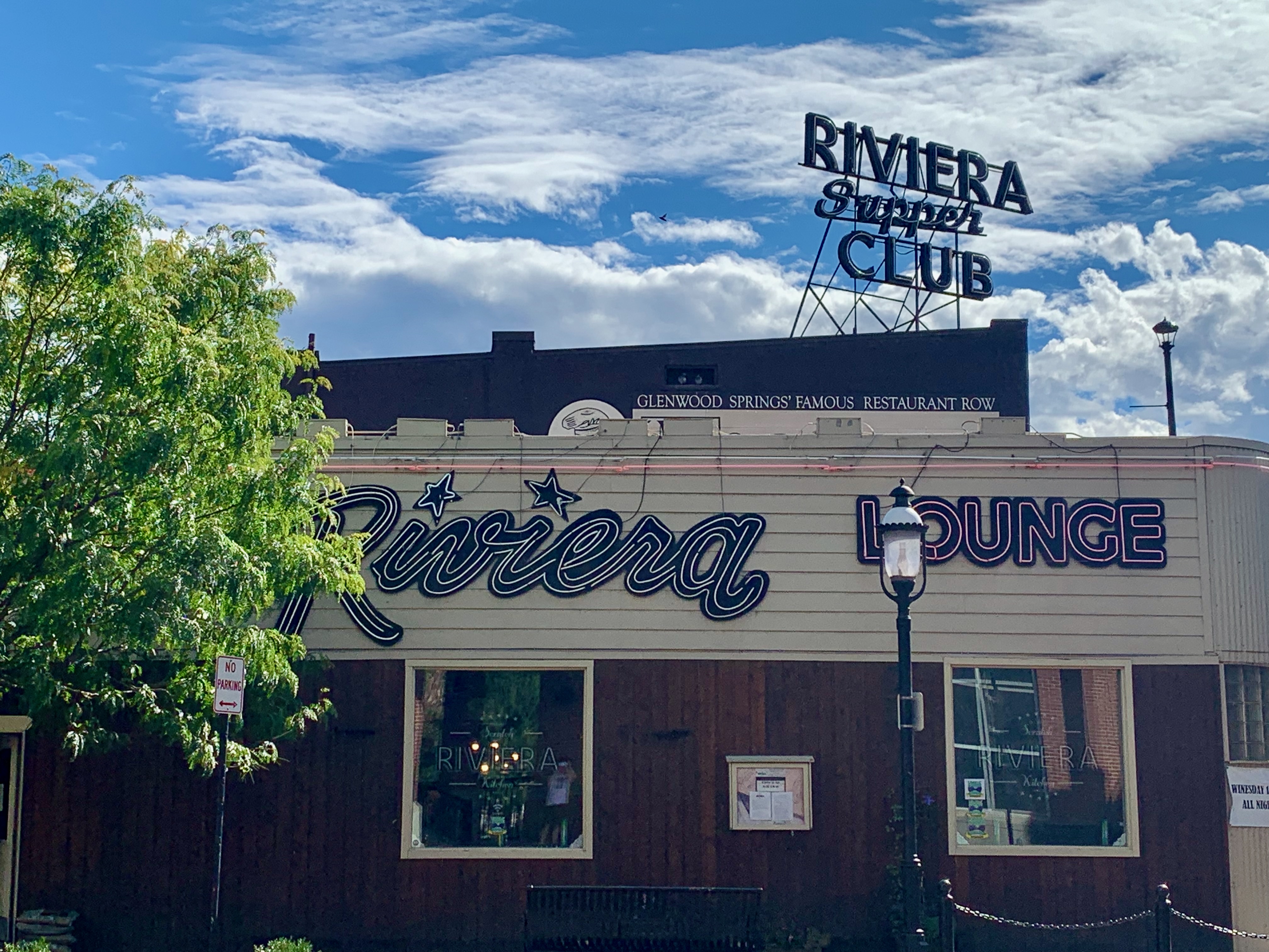
I’m not sure how vintage this Riviera Lounge signage actually is, but I love it regardless.
A few blocks from downtown, I walked through a residential neighborhood on a lovely, warm September afternoon. The sign (and architectural design) of Gene’s Lock & Key immediately caught my eye.
As did this Masonic Lodge down the block, likely appearing exactly as it did 50 or 70 years ago.
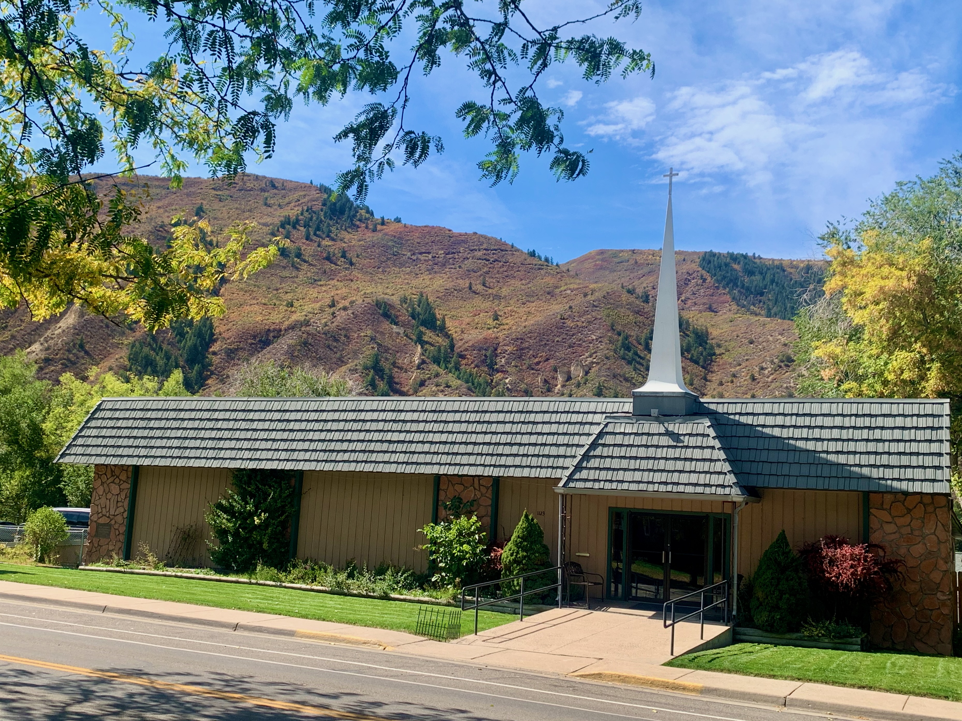
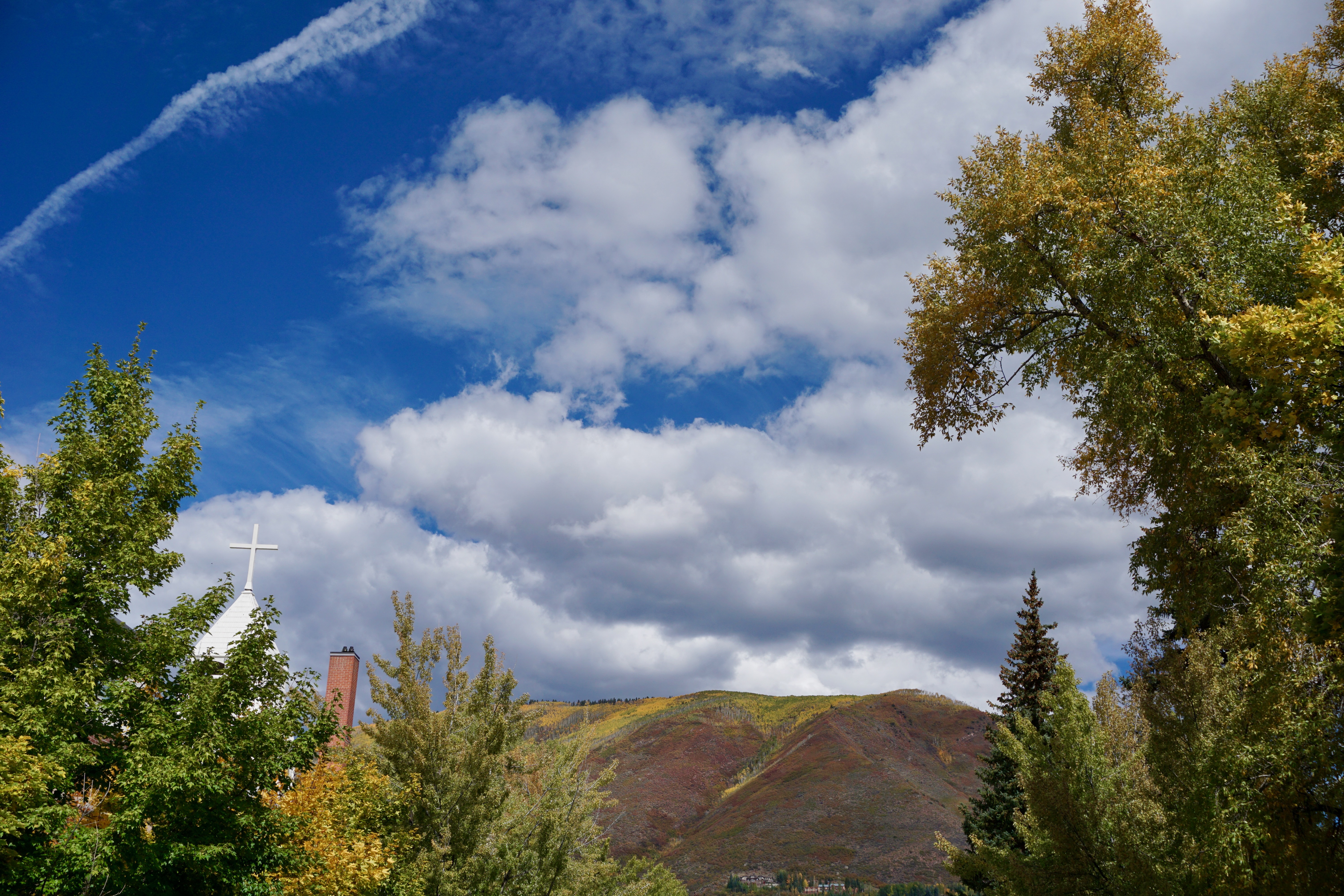
One doesn’t see many mid-century structures anymore where I live like this church. Here, it looks picture-postcard perfect against the mountains to the west.
As I strolled through this neighborhood, I increasingly thought what a nice place it would be to live in if I ever grow weary of being in a big city.
There’s something odd but also charming about coming across a house displaying skis and snowshoes along its side exterior.
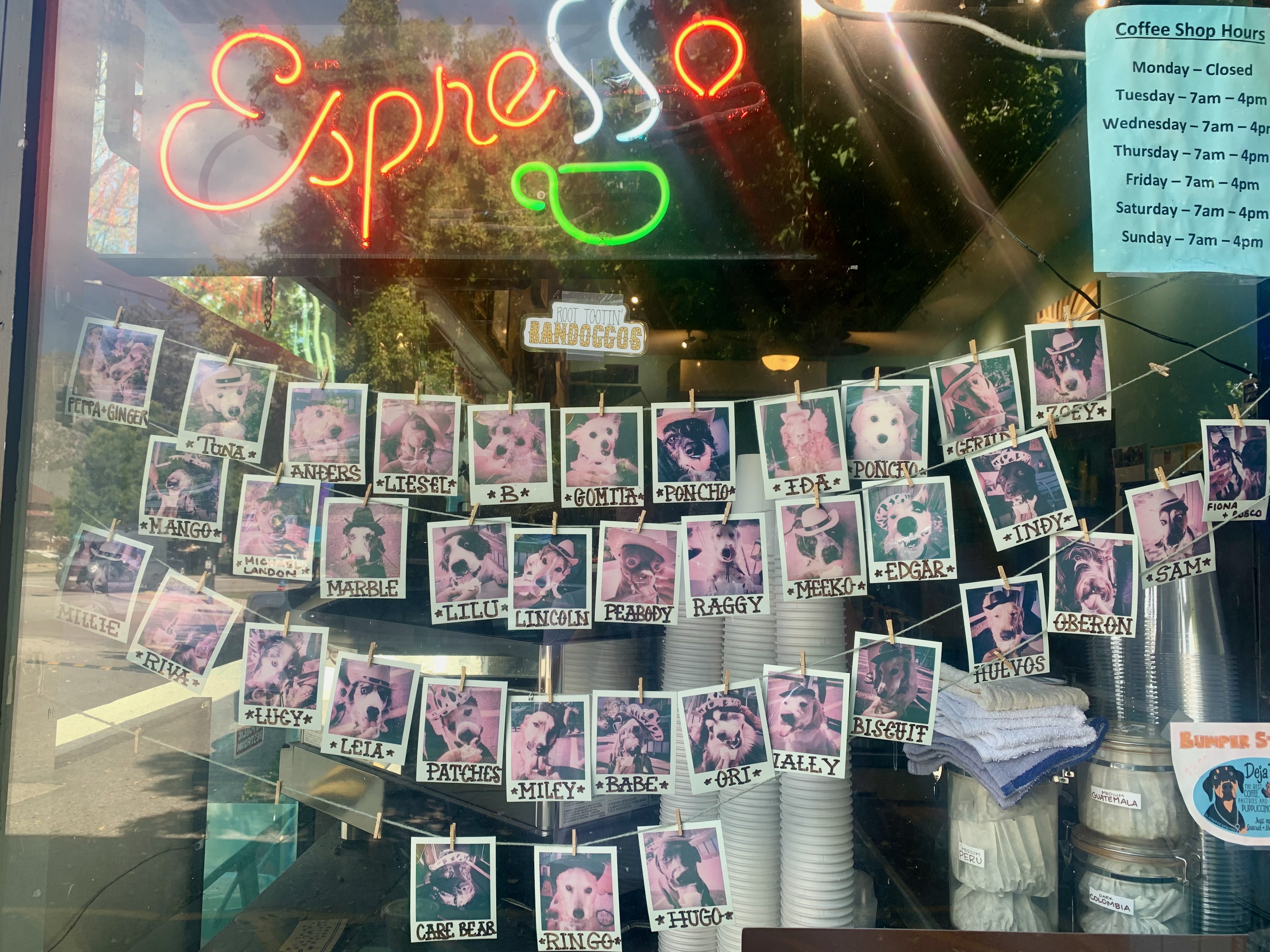
These strings of dog polaroids in the window at Deja Brew coffeehouse on Highway 82 are nothing but charming.
Downtown sports colorful signs with this slogan all over the place. Between stuff like this, the unexpected number of rainbow flags I saw in assorted businesses and the natural beauty surrounding it all, Glenwood Springs was a gem of a place to spend an afternoon.
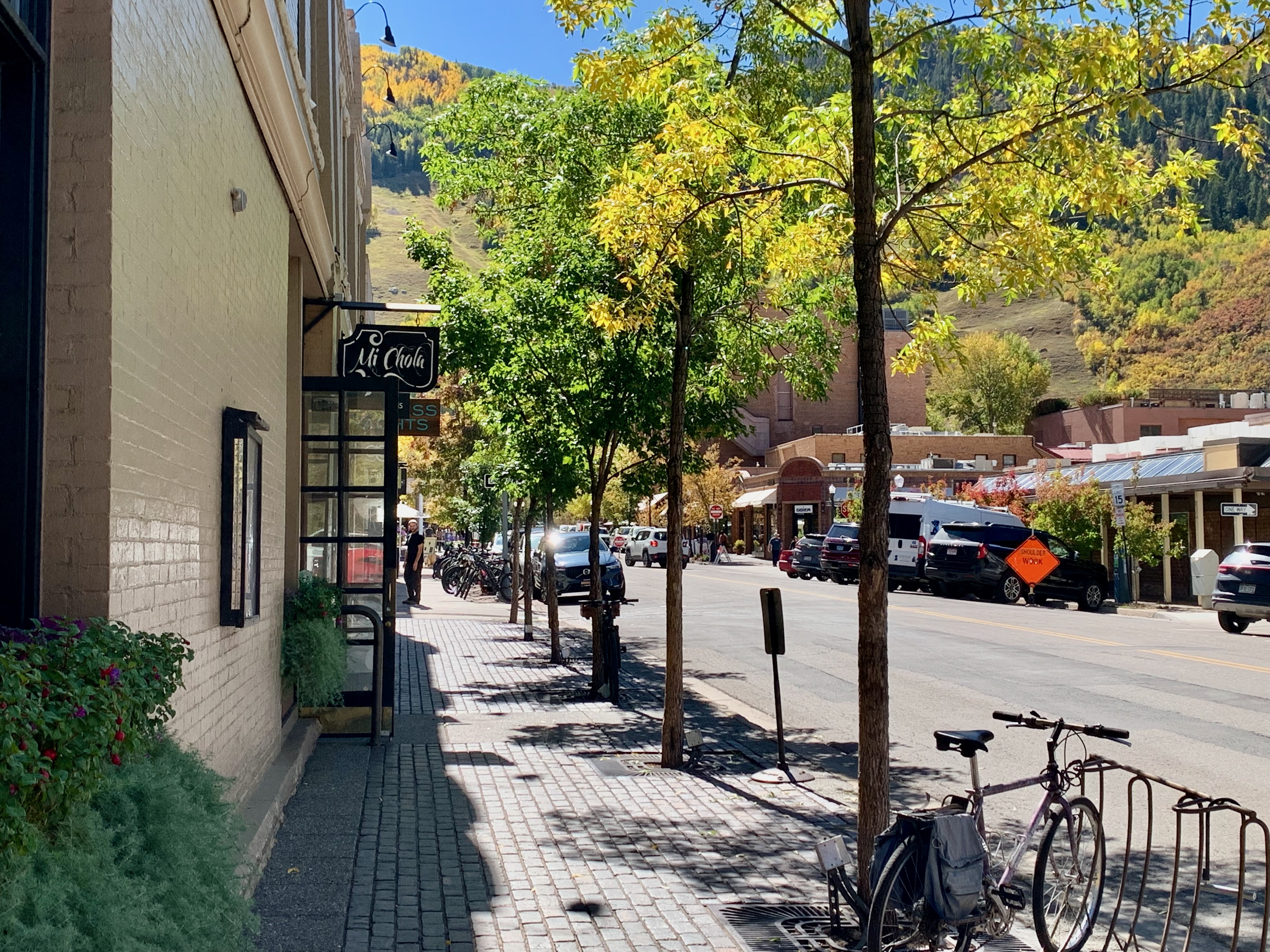
Aspen, Colorado has a reputation as a wealthy ski resort town and it’s not unearned.
The high-end boutique count on most blocks is likely close to that of Boston’s Newbury Street.
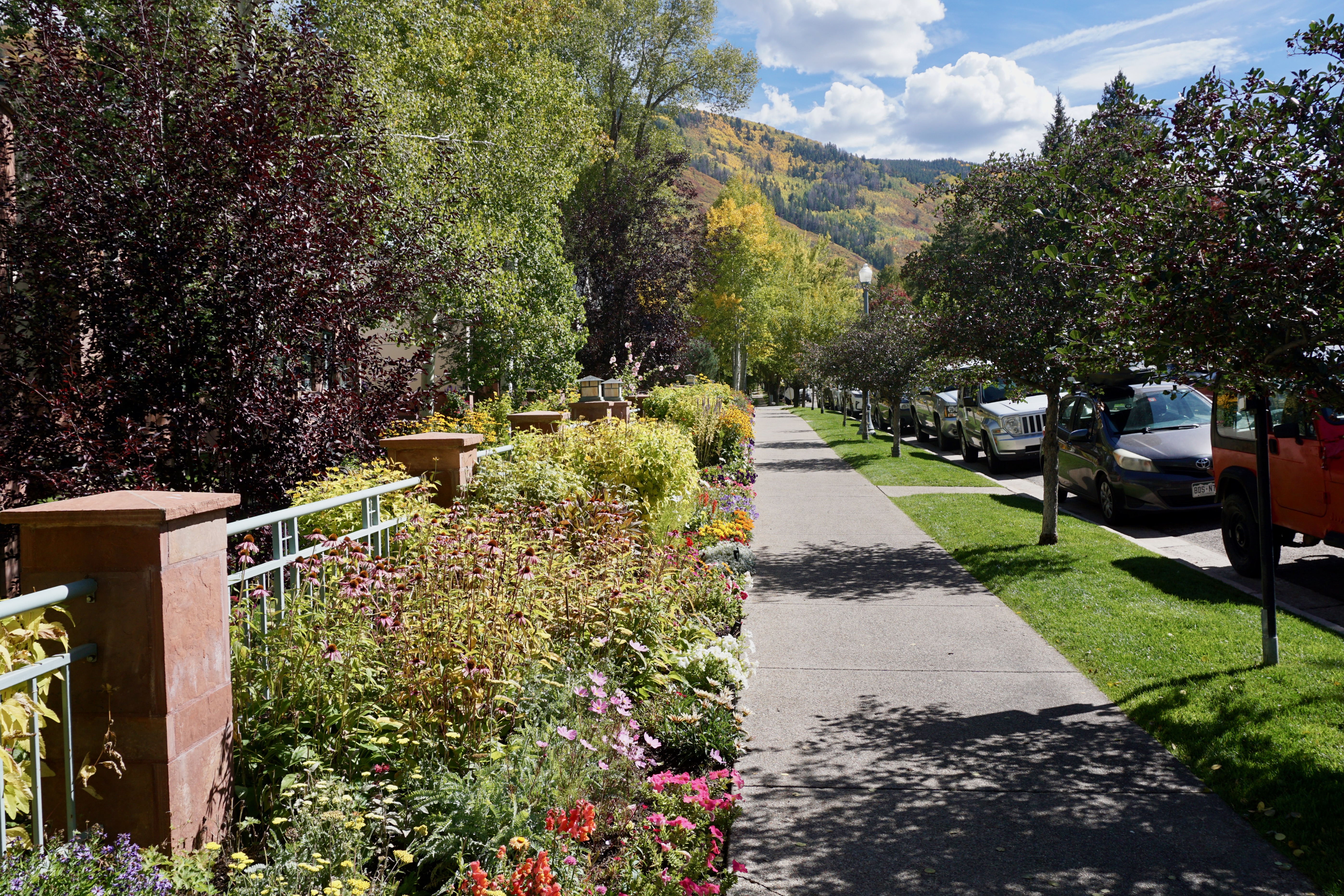
However, if you walk away from the town center through flower-lined residential blocks, there remains a constant in the landscape.
Beyond steeples, chimneys and treetops, Aspen is surrounded (engulfed, even) by mountains.
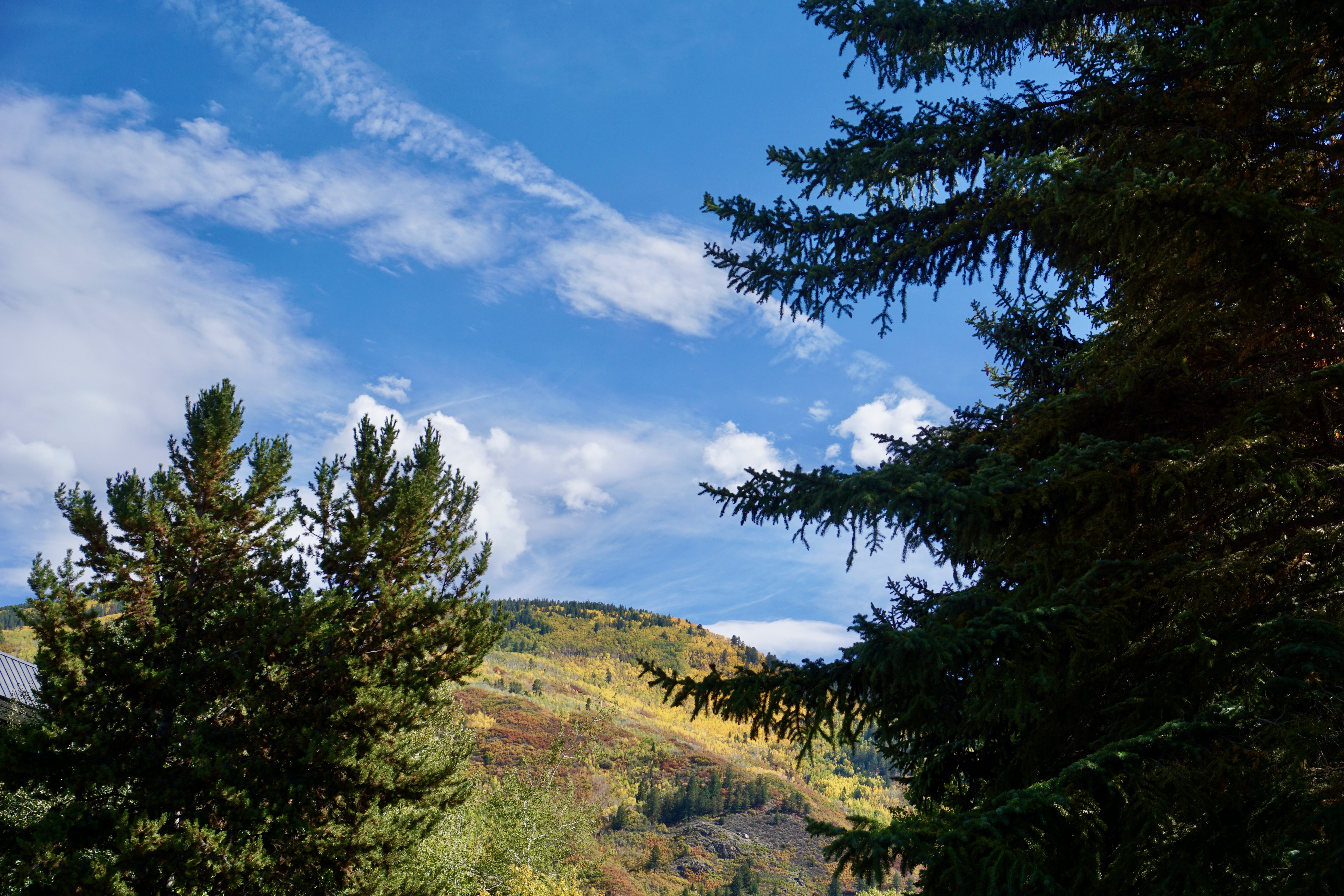
It’s especially striking in late September near peak Autumn foliage.
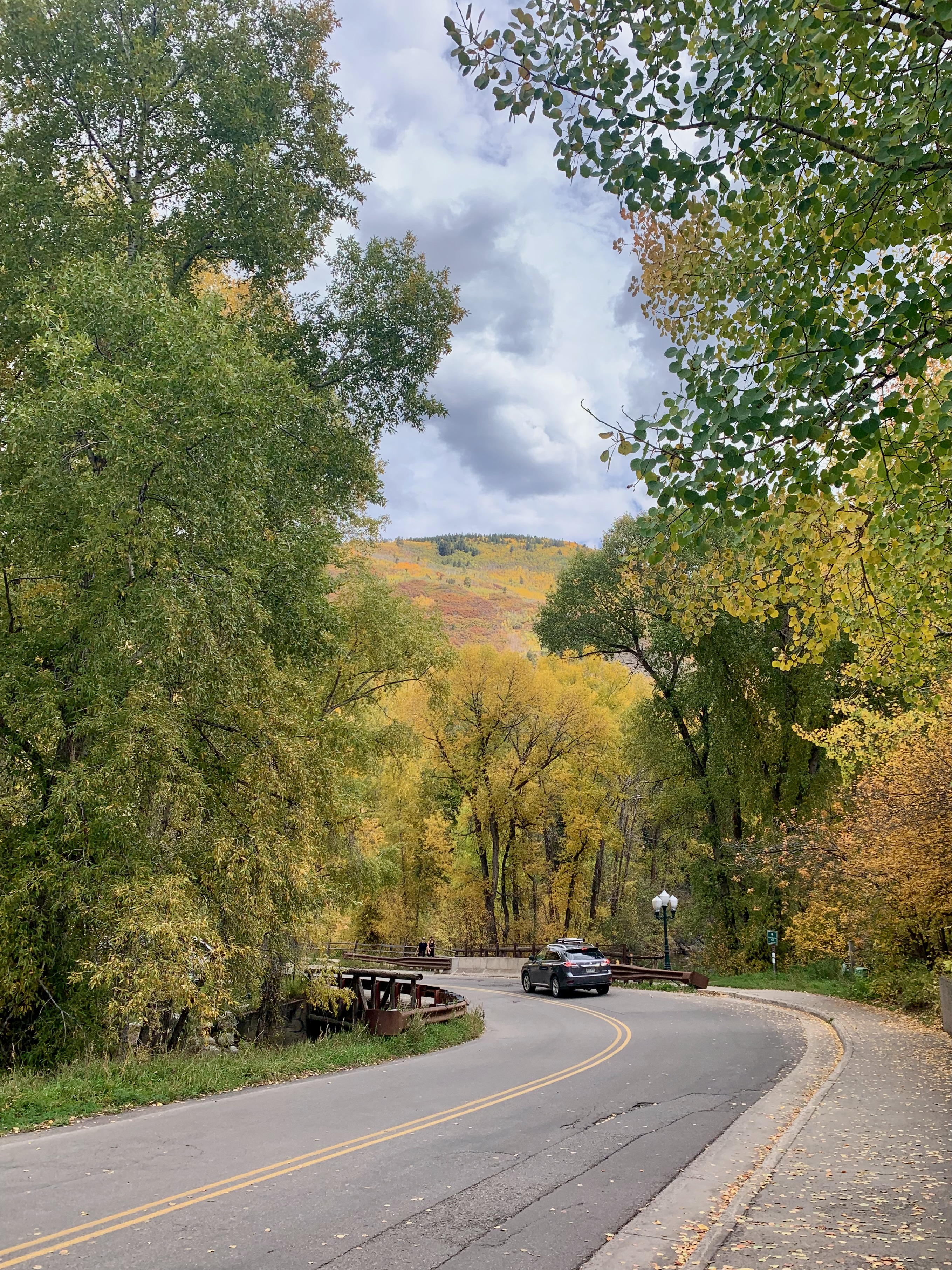
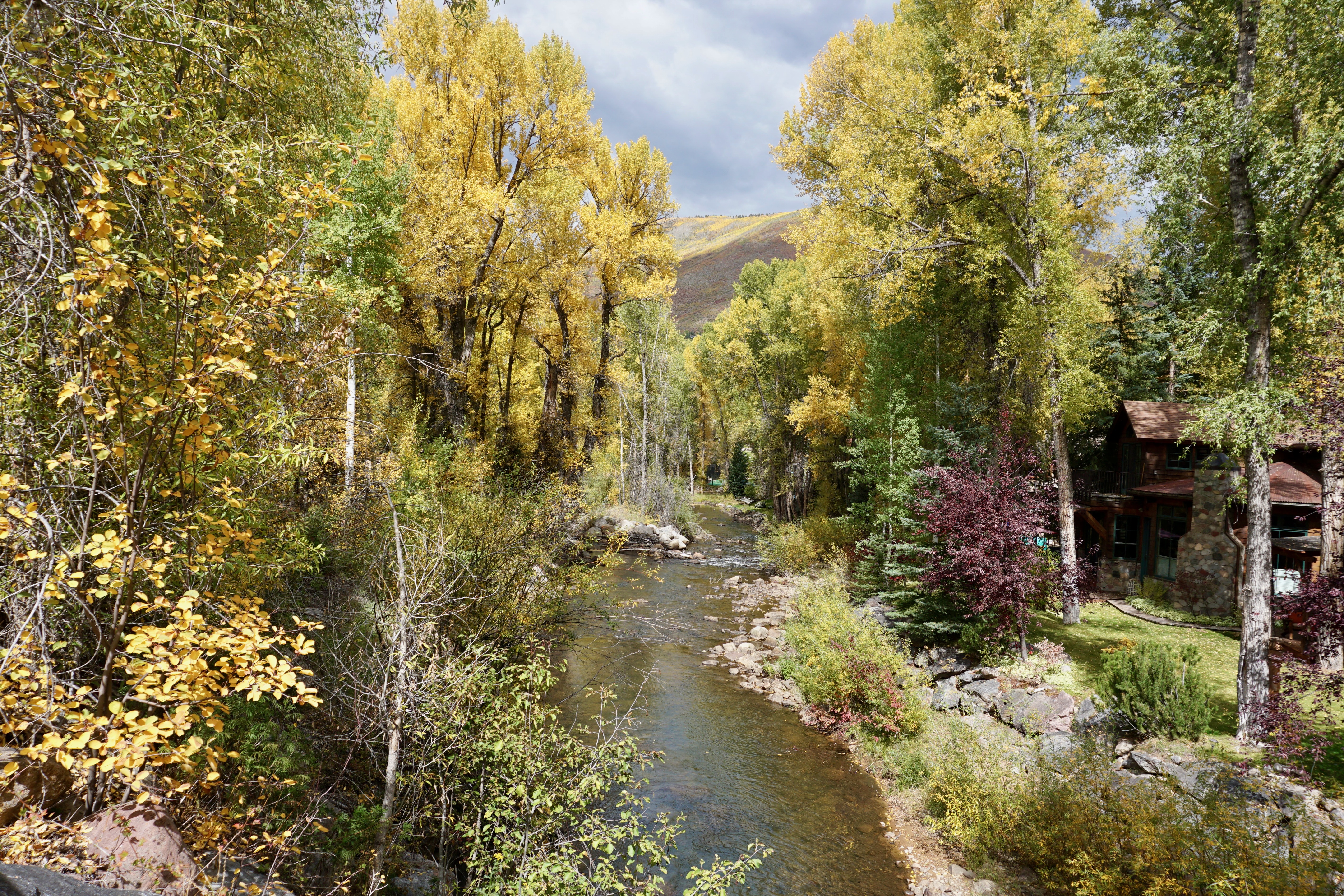
Looking down Neale Avenue as it crosses the Roaring Fork River is almost akin to witnessing a real-life painting.
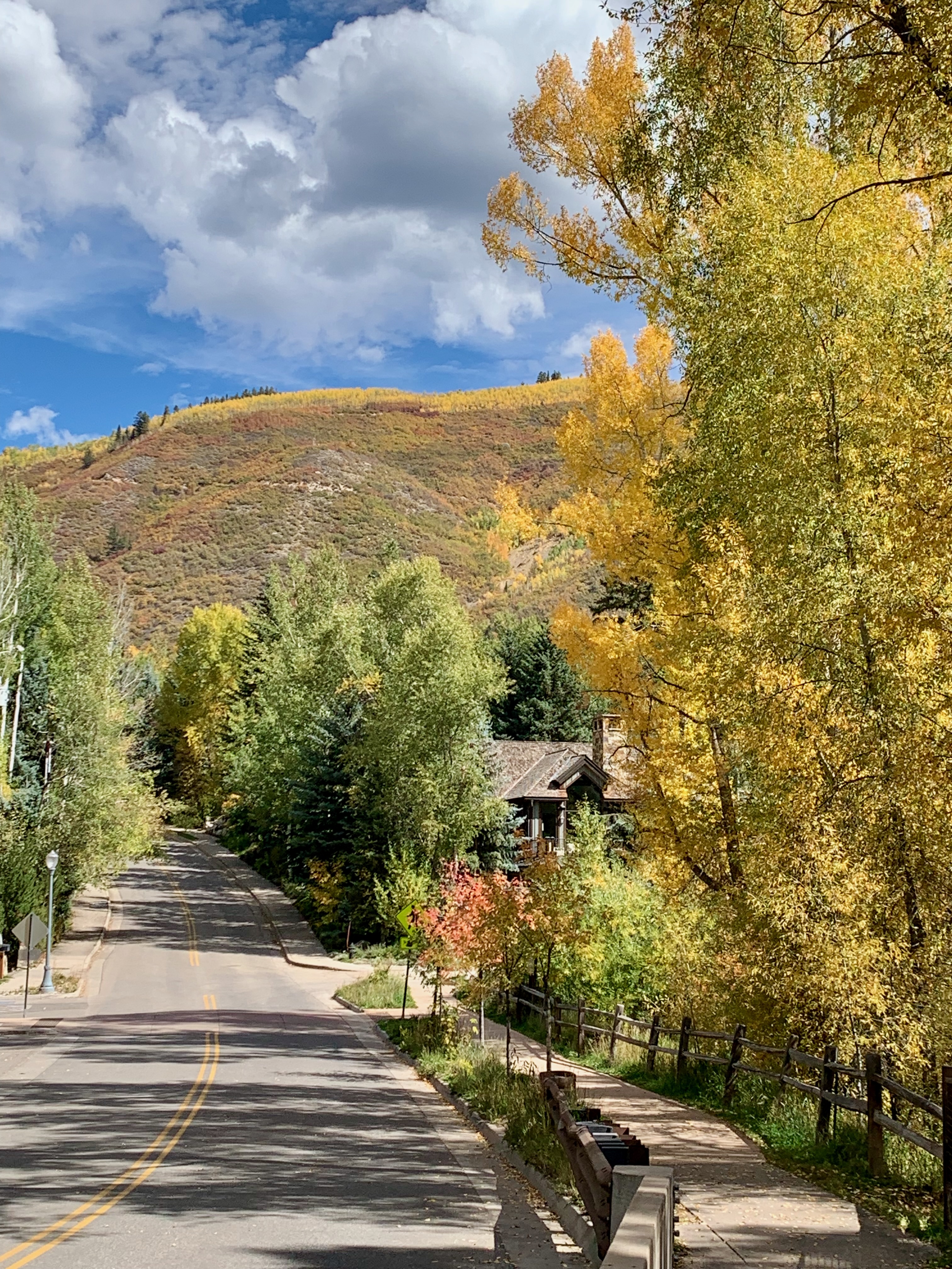
Walking further north on Neale crossing the river, one sees nothing but blue skies (and mountains) ahead.
Steve and I could have taken the “No Problem Joe”, a short dirt connector path that runs along the river and seems more notable for its quirky name than anything else.
Instead, we opted for the well-travelled Rio Grande Trail, which begins at Herron Park off Neale and runs for 19 miles all the way to the town of Emma (not far from Basalt, which is where we stayed.)
We didn’t take the trail nearly that far but did have one destination in mind, which we located from its unofficial back entrance near the river.
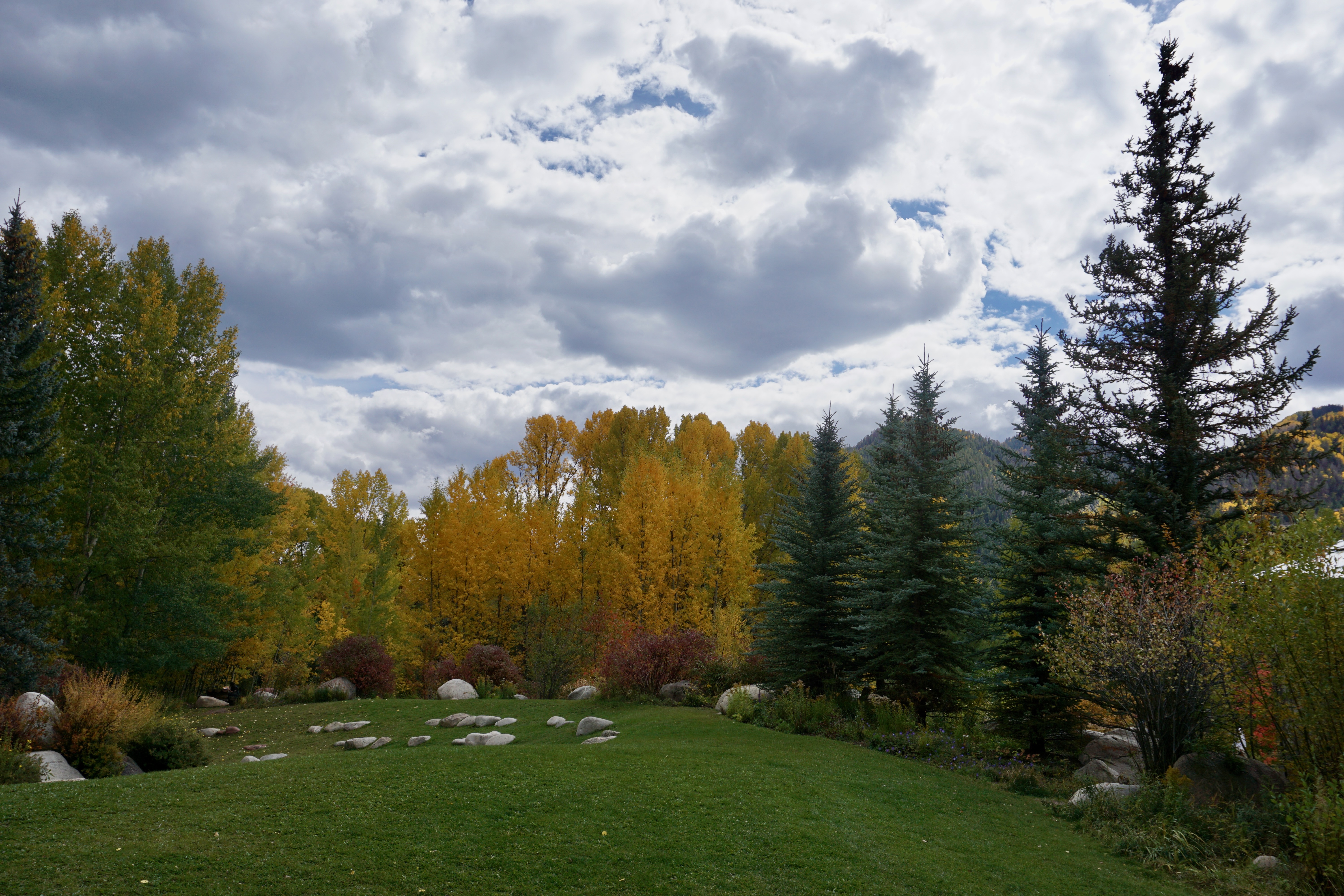
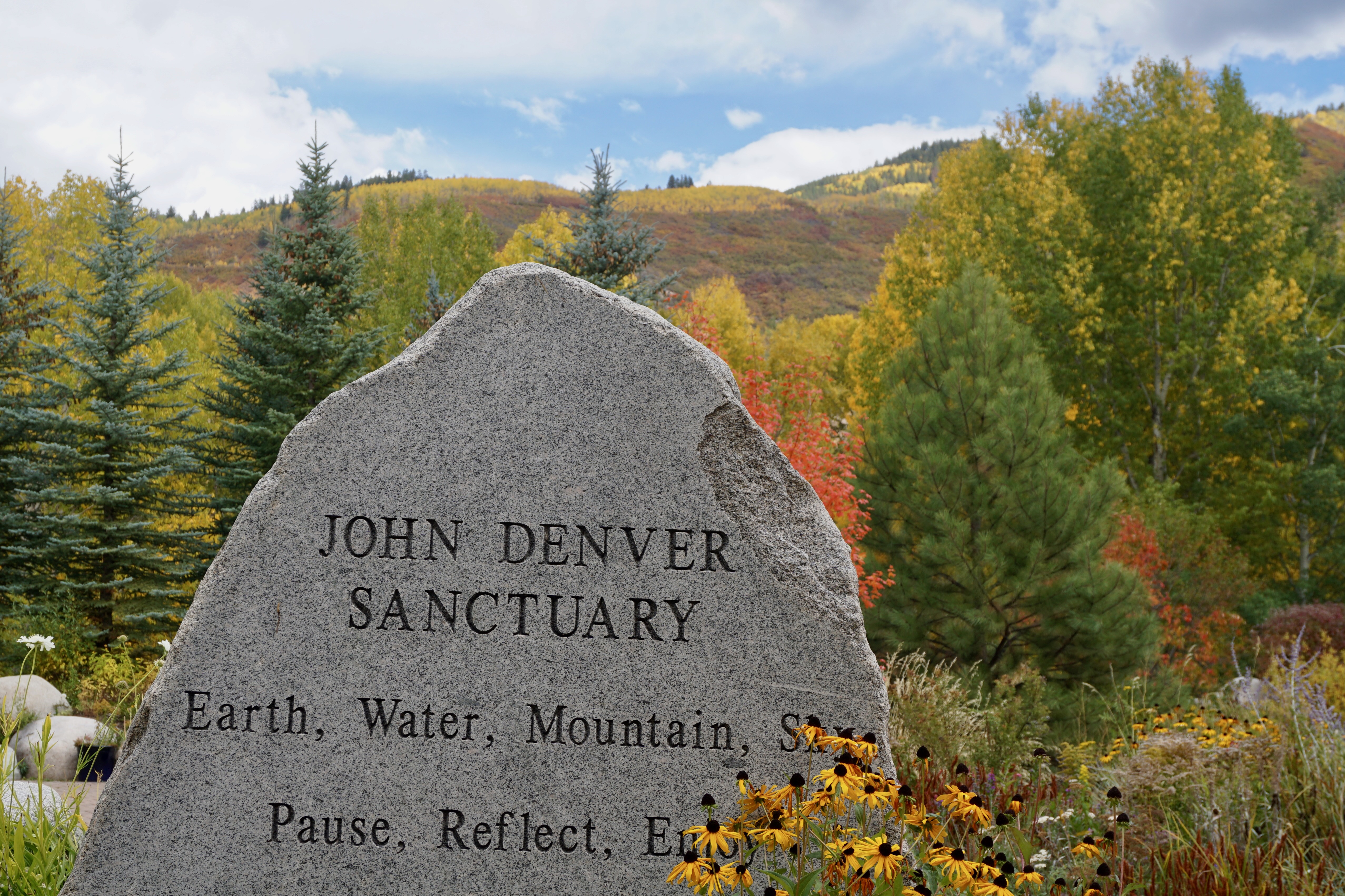
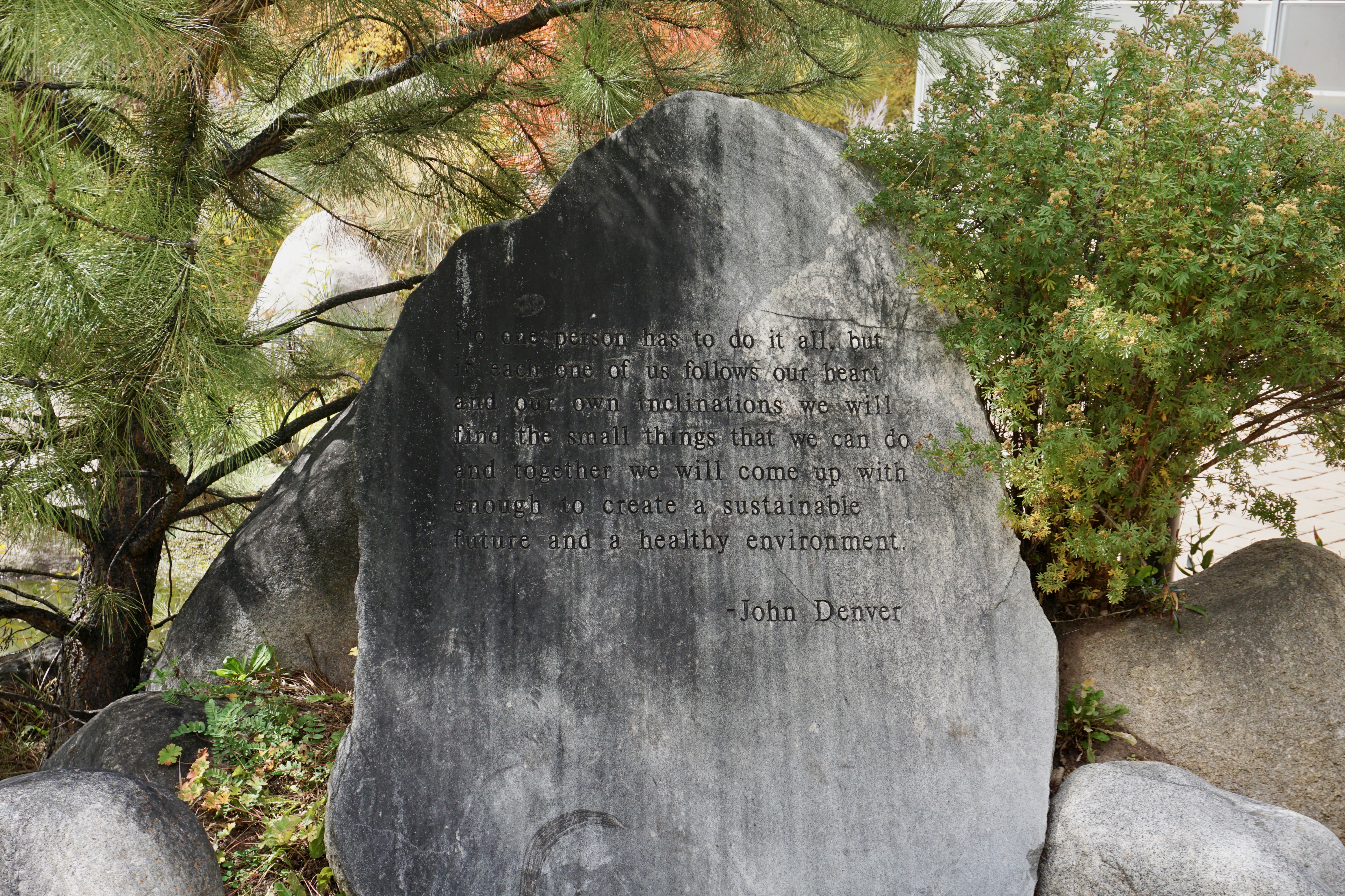
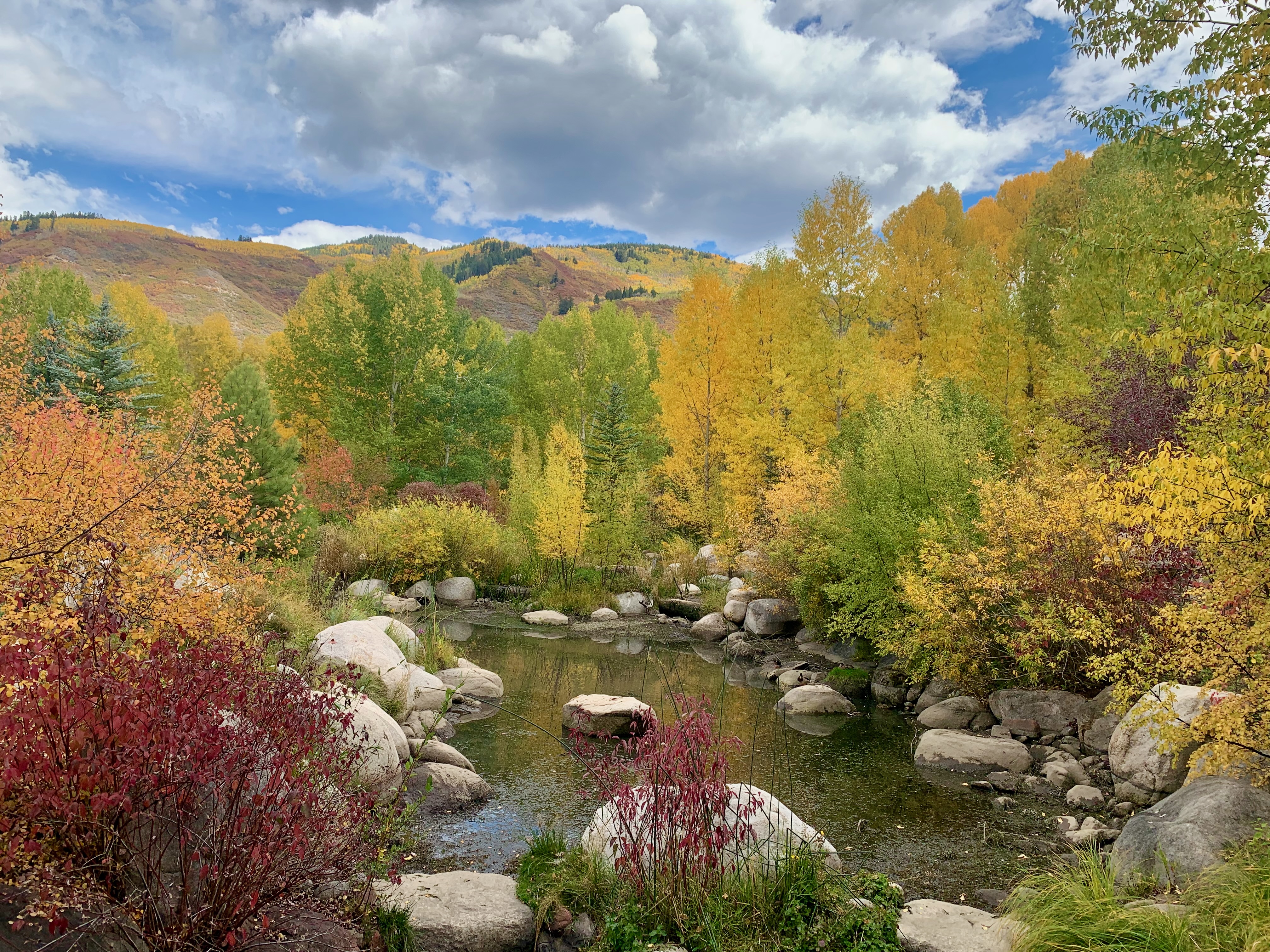
If Maroon Bells was the most beautiful place we visited in Colorado, the John Denver Sanctuary in Aspen was a close second. I don’t know how well Denver is now remembered by Millennials and generations younger than that, but he was a big presence in my early childhood, especially through his collaborations with Jim Henson (I’ve barely forgiven my parents for not hanging onto my vinyl copy of 1979’s immortal John Denver and The Muppets: A Christmas Together.)
Officially dedicated a year after Denver’s 1997 death, it features a “song garden” full of small boulders inscribed with his lyrics.
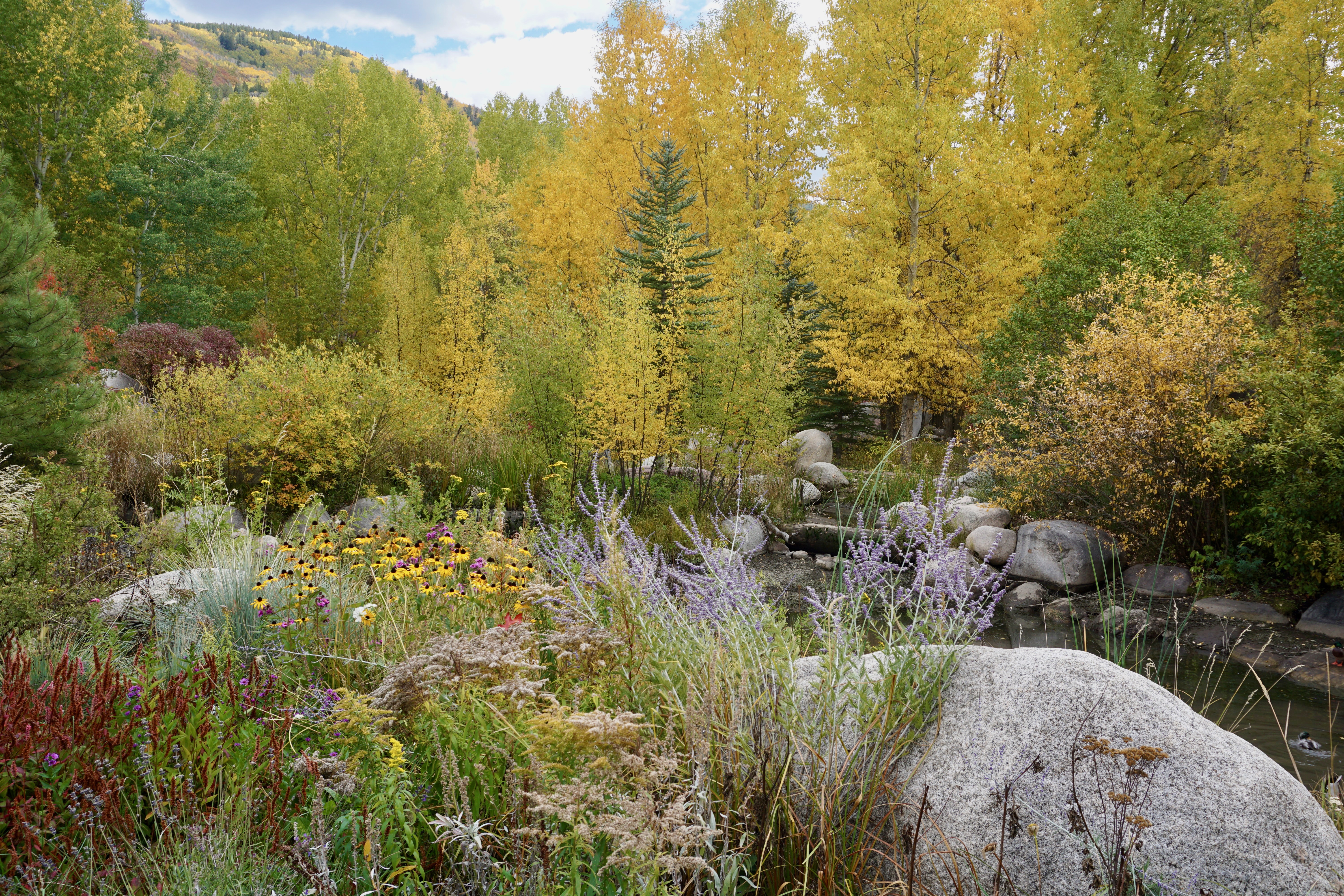
My favorite part of the sanctuary was this wetland area–as gorgeous and serene as anything I’ve ever seen.
You don’t even need to bring along a recording of “Rocky Mountain High” or “Annie’s Song”: you’ll likely end up humming them to yourself.
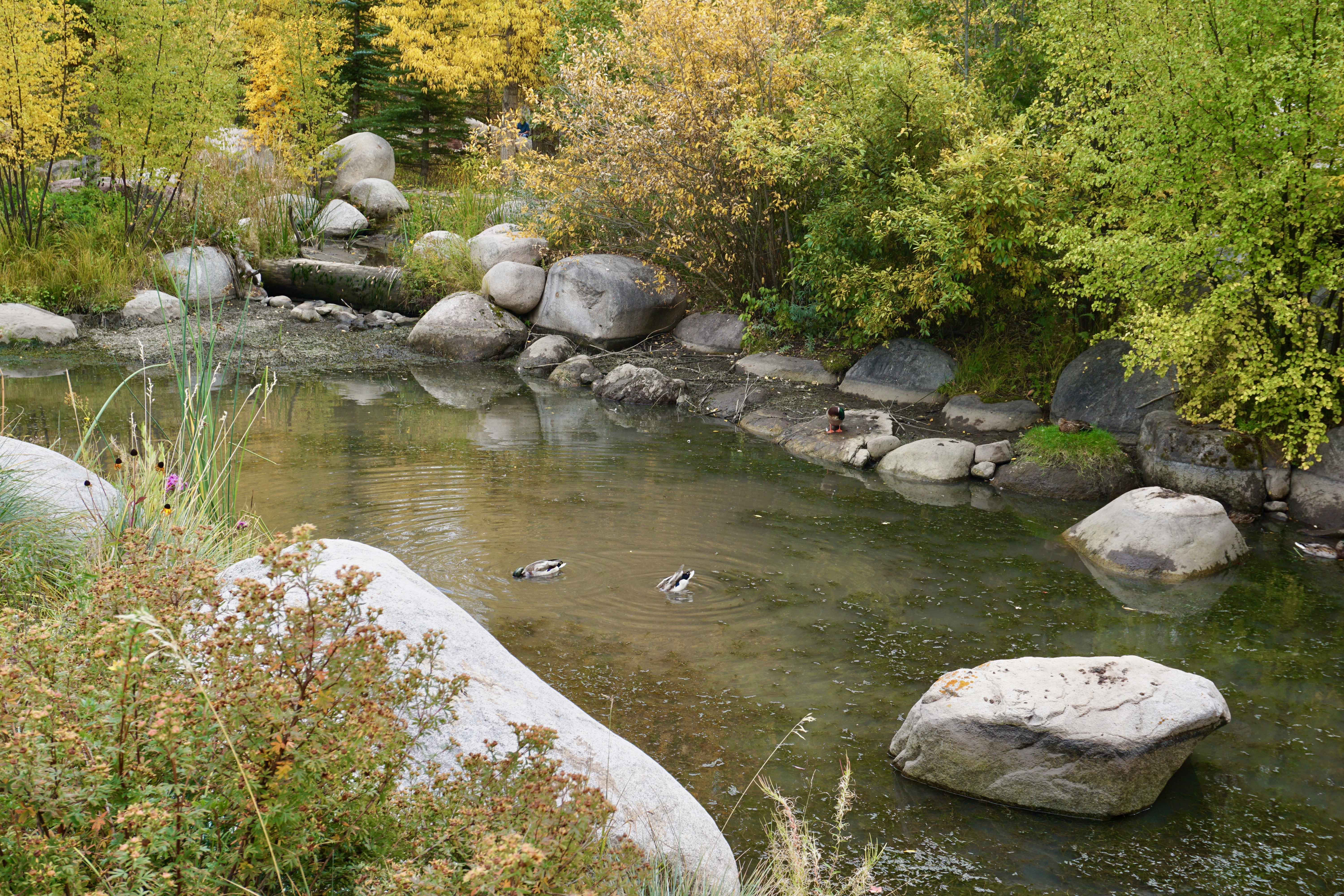
One of the best features of any sanctuary is the wildlife drawn to it like these drinking ducks.
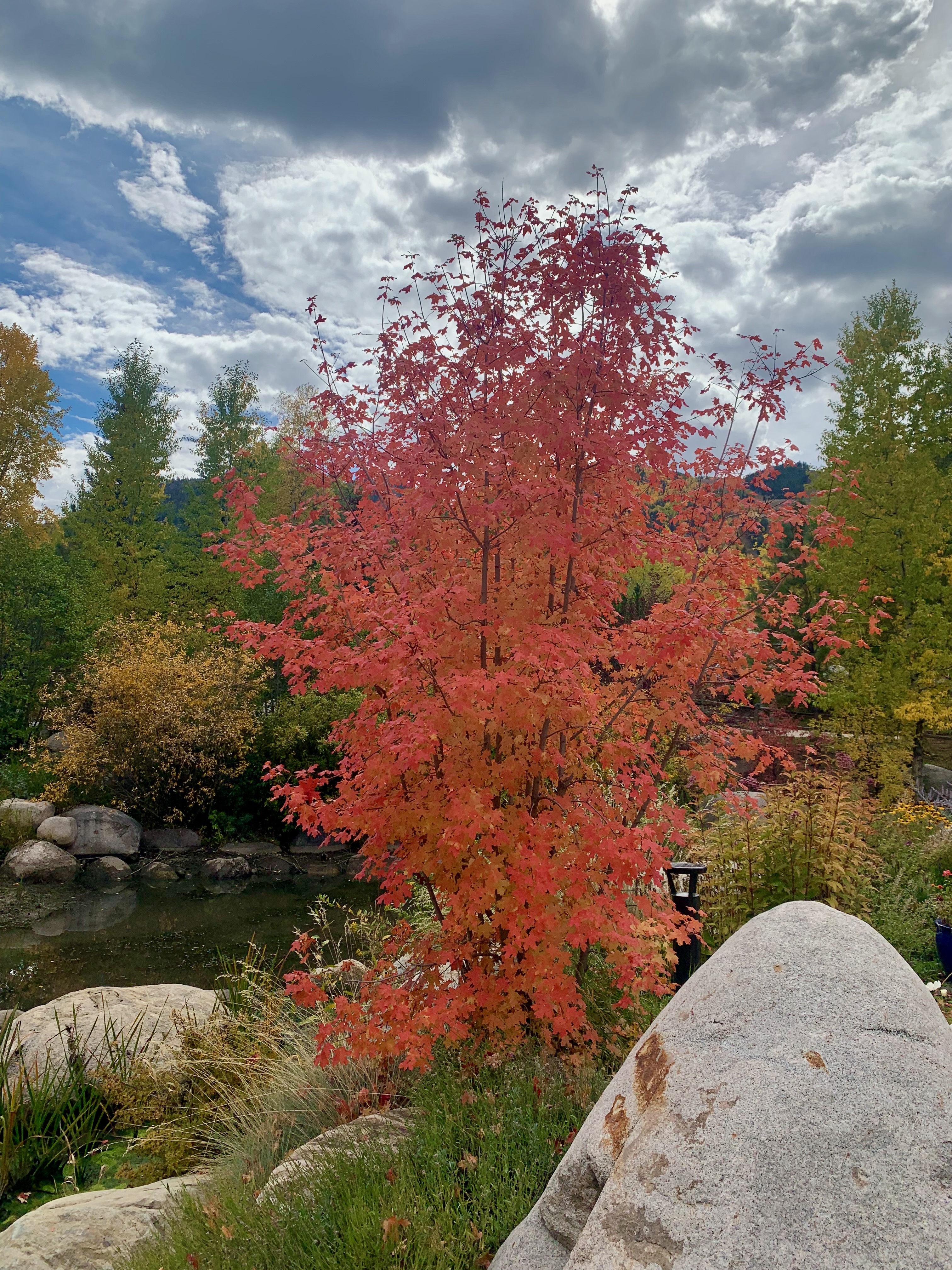
We didn’t see a ton of bright reds like this amongst the Colorado foliage, so it appeared more vividly whenever we spotted some.
Walking further down the Rio Grande Trail, we came across many bridges and some public art.
Many bikers use this path and if I had access to one in Aspen, I surely would’ve ridden along it.
The trail is full of beautiful scenes such as this family of blue spruces among the river and rocks.
We could have taken the trail further to Hallam Lake and Aspen Institute but were ready for rest. We ended up back on North Mill Street towards the town center where we parked. I suspect Aspen can be pretty in the Winter but I’m grateful we were able to see it in early Autumn.
A quarter-century ago this month, I returned to my hometown for a friend’s wedding and, for the first time, felt like a stranger there. Since relocating to Boston three years earlier, my parents and a few good friends had moved to other states, so I no choice but to rent a car and a hotel room for a weekend.
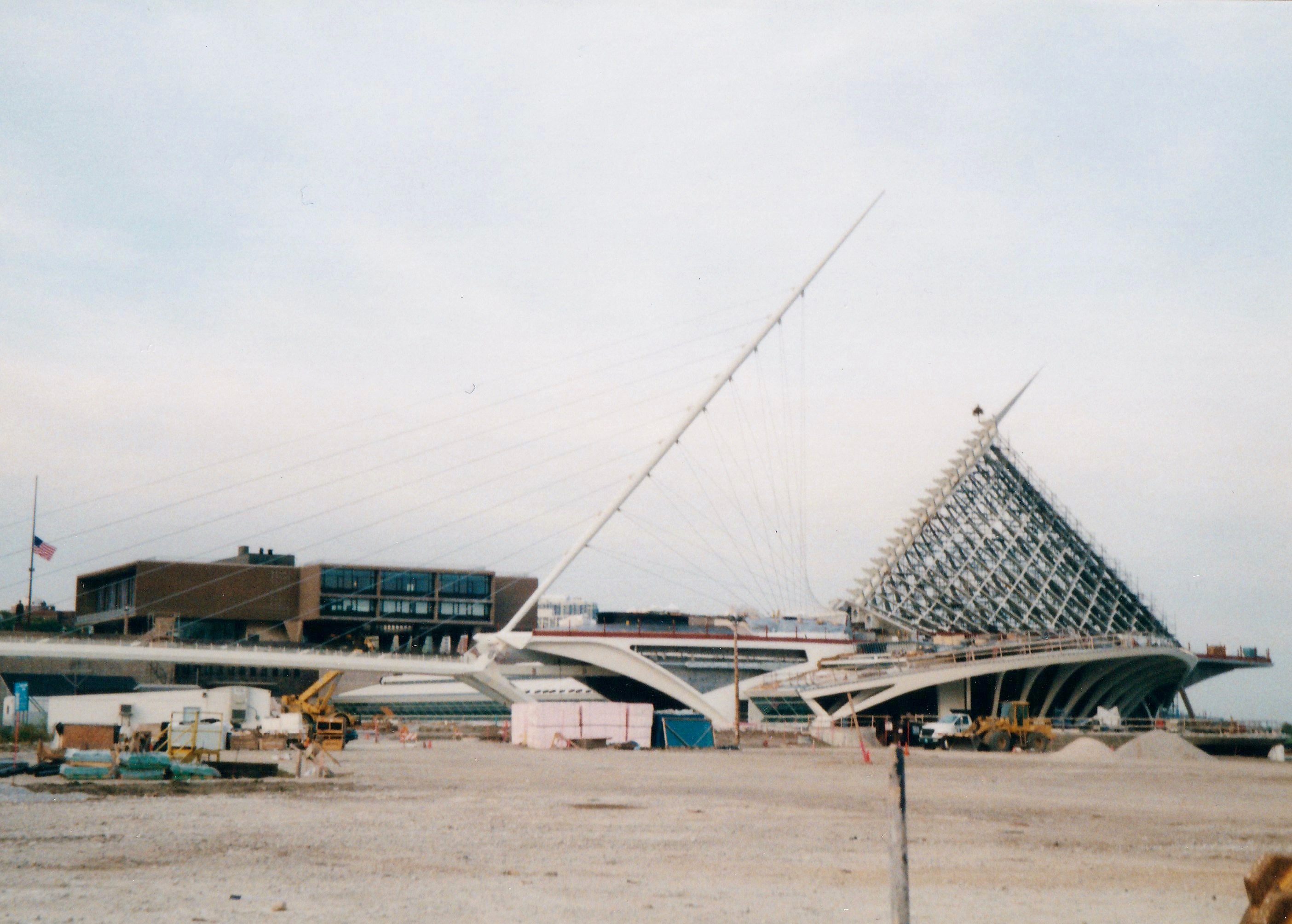
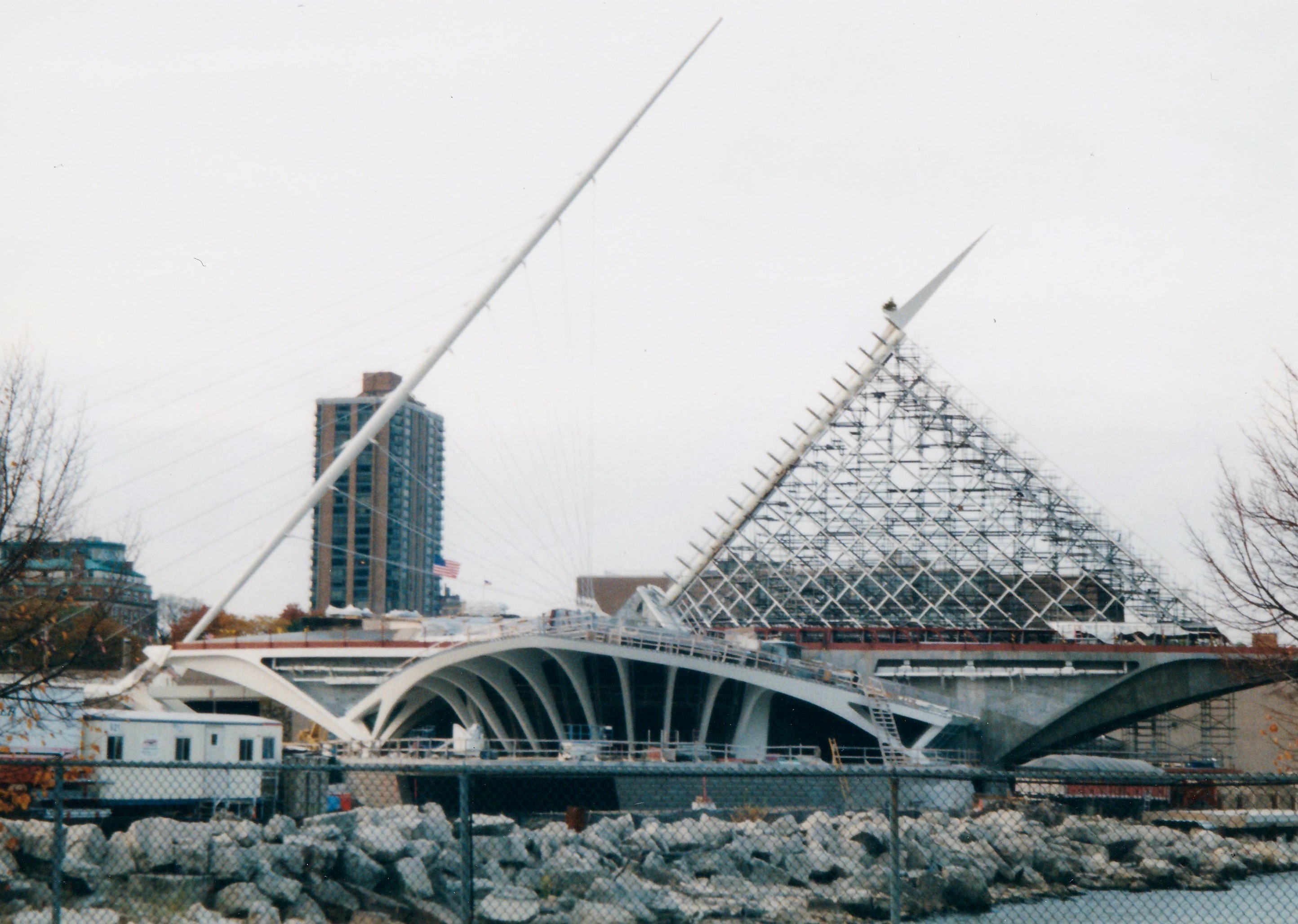
I feel there’s a long essay here but I’m still piecing it together. In the meantime, I came across some photos I took during this trip of the Milwaukee Art Museum as its Santiago Calatrava-designed addition was under construction. It was a big deal for the city, having been announced back when I was still living there. It was originally expected to be completed the year before my visit but this had been pushed back to 2001.
Upon my arrival downtown, I stopped by the construction site to see what progress there was. Behind a chain-link fence, the new Quadracci Pavilion with its retractable wing-shaped roof was far from finished. One can just make out the Eero Saarinen-designed War Memorial Center in the background (which sits atop the bulk of the original museum) beyond the rubble and the new architectural touchstone rising from its ashes.
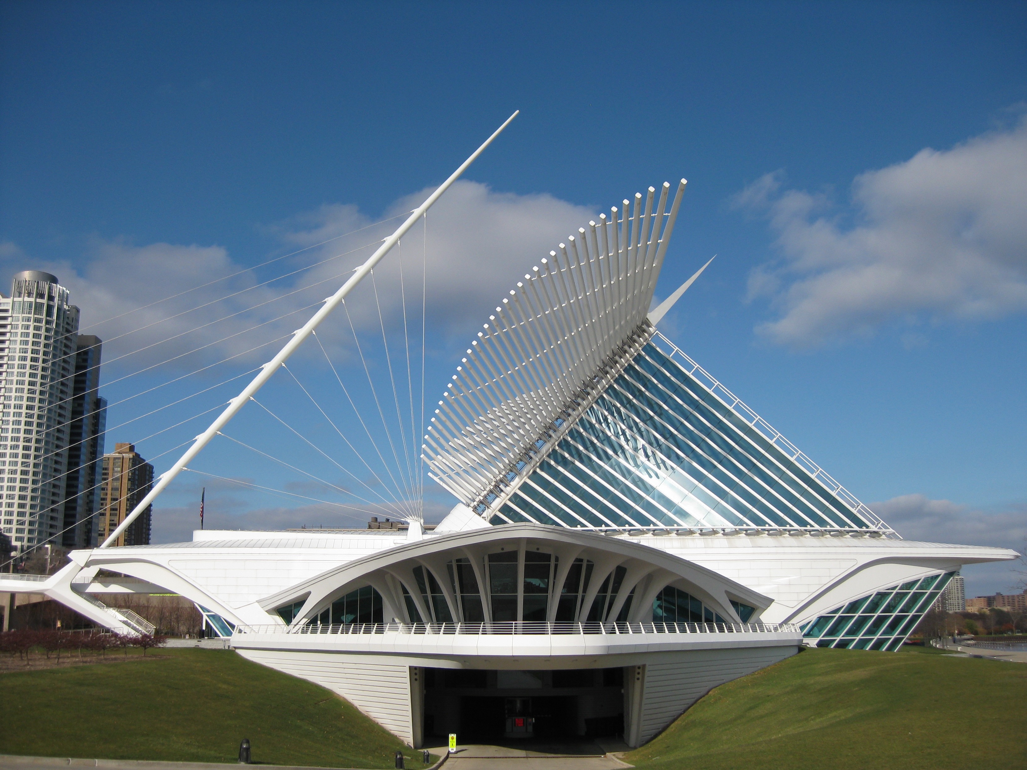
My next trip back was two years later. I visited the museum and its completed addition with an old friend who herself had moved back to town. Whenever someone asks me, ‘What is there to do in Milwaukee?”, I tell them to get a Friday fish fry at Kegel’s Inn, some frozen custard from Kopp’s and to spend an afternoon at the Milwaukee Art Museum.
Quadracci Pavilion under construction, October 2000Quadracci Pavilion, November 2008
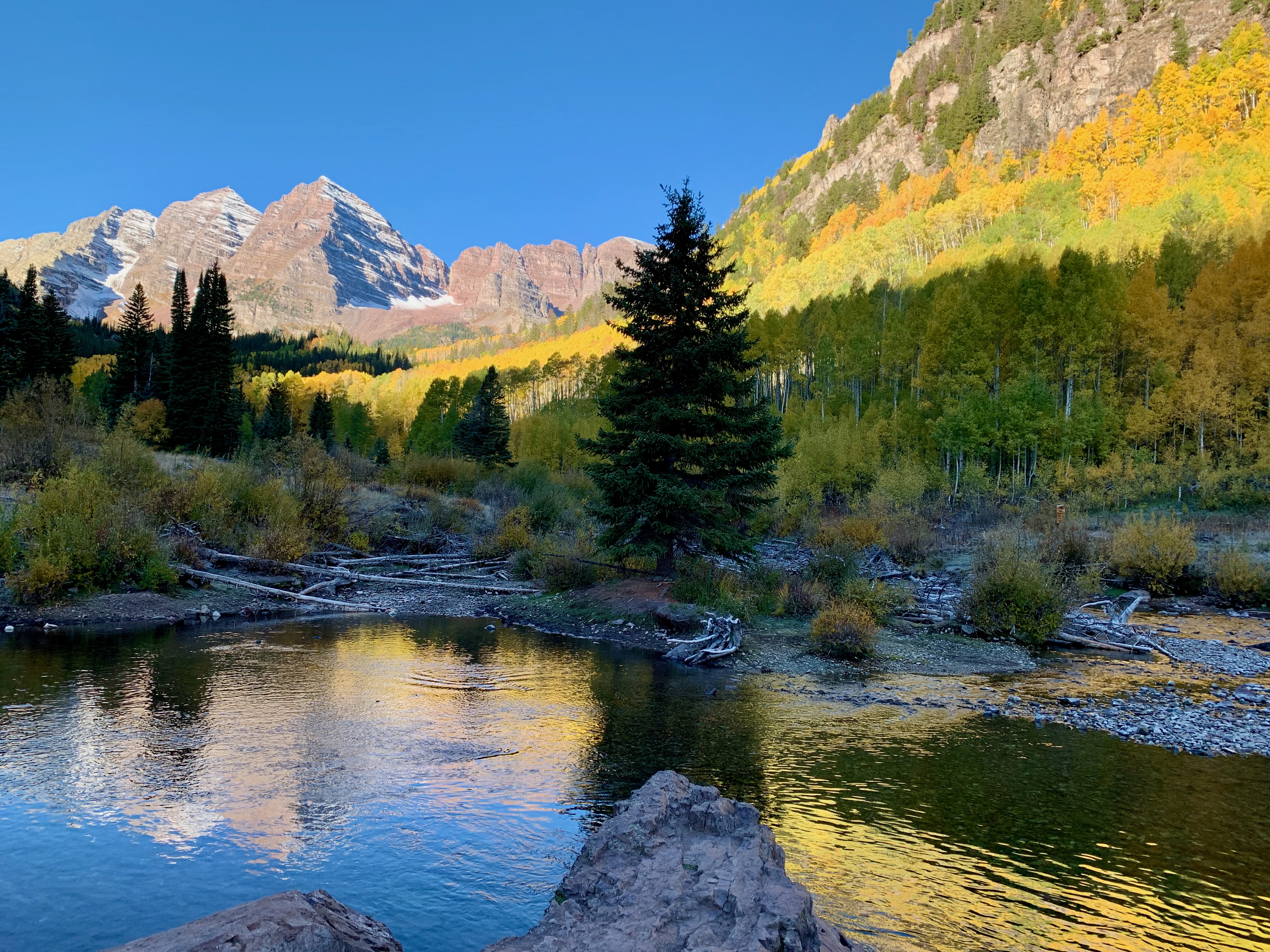
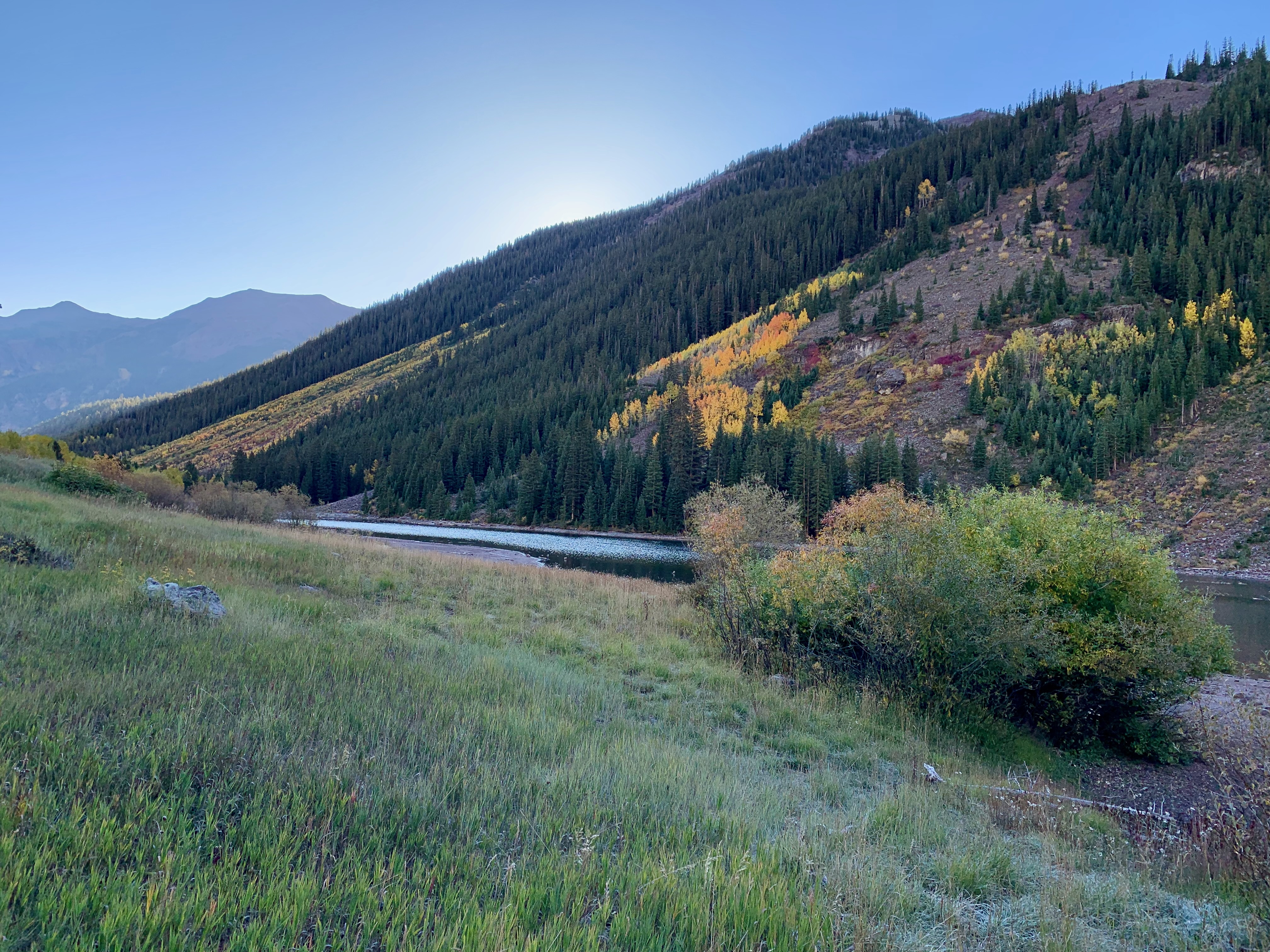
We returned to Colorado for the first time in a decade. One highlight of our trip was a visit to Maroon Bells-Snowmass Wilderness, which is located in the White River National Forest.
It’s easiest to get to this remote locale by a shuttle bus near Aspen; we booked our tickets for the bus two months in advance given that we’d be there close to peak fall foliage.
For near-optimal viewing conditions (and to avoid large crowds), our bus was at 7:30 on a Thursday morning. Even for late September, it was so cold that there was some frost on our rental car; I’d also wished I brought mittens along for my freezing fingers.
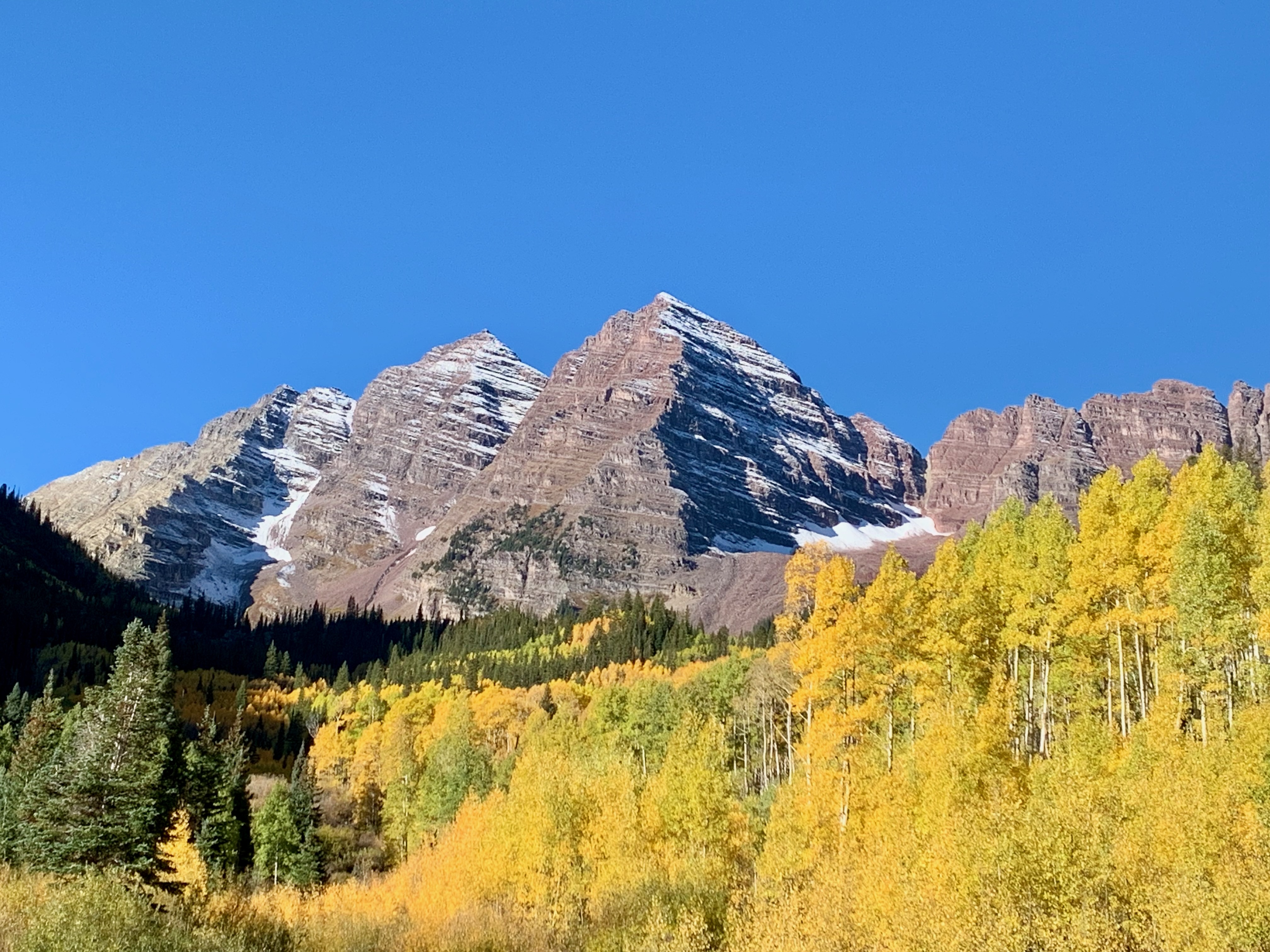
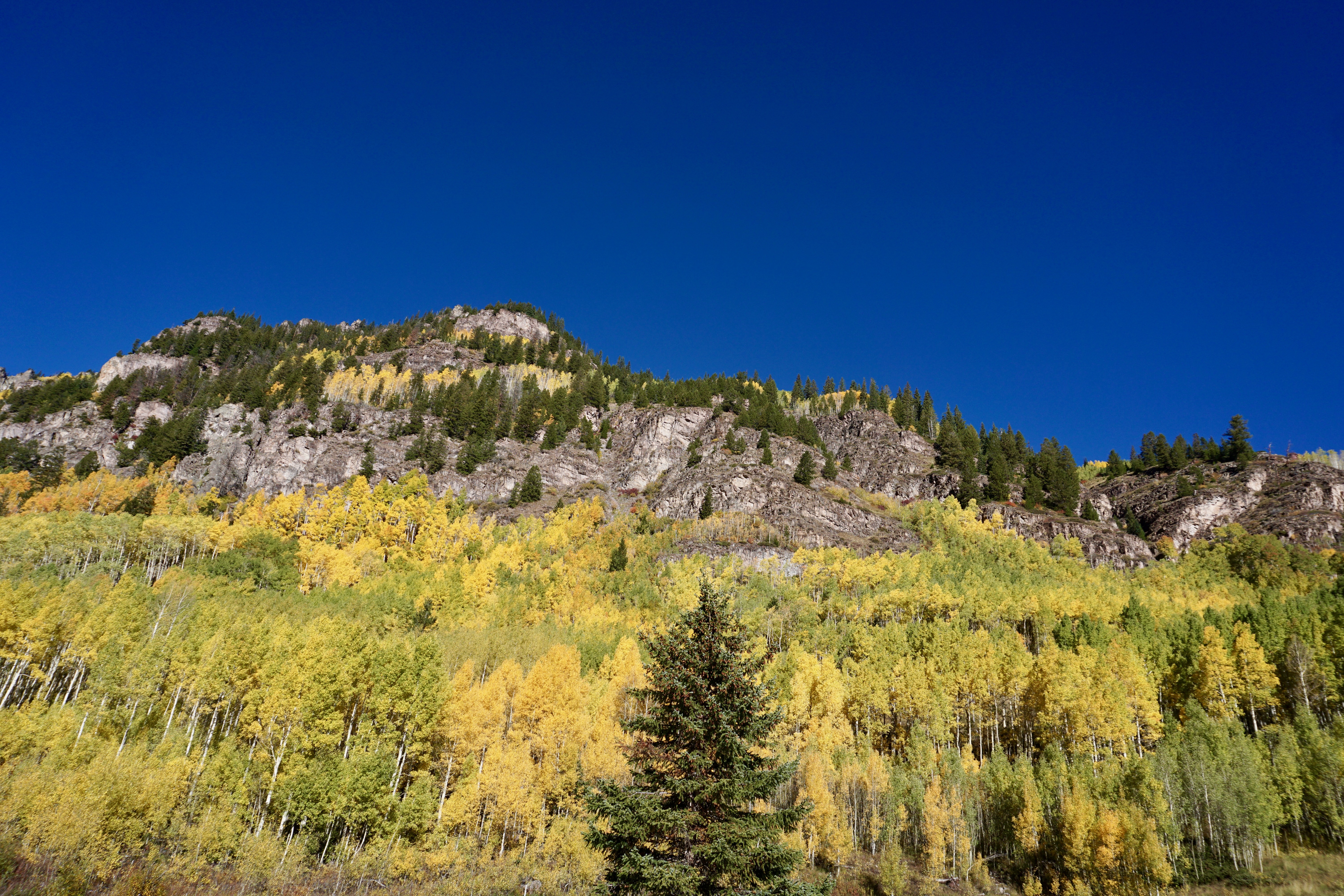
It was all worth it. So named for their shape, the two peaks that make up Maroon Bells were gorgeous, especially against all the yellows of the surrounding aspen trees.
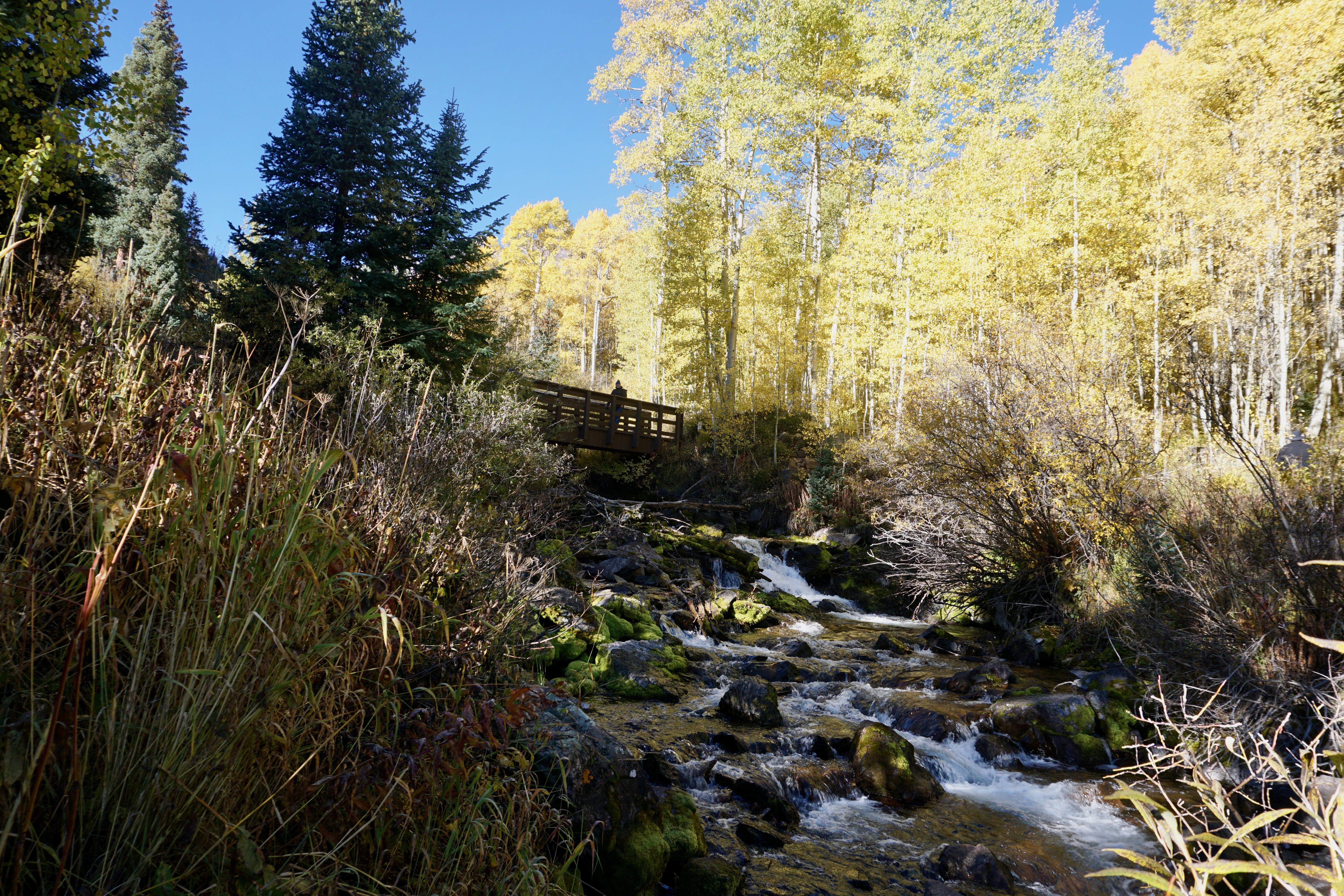
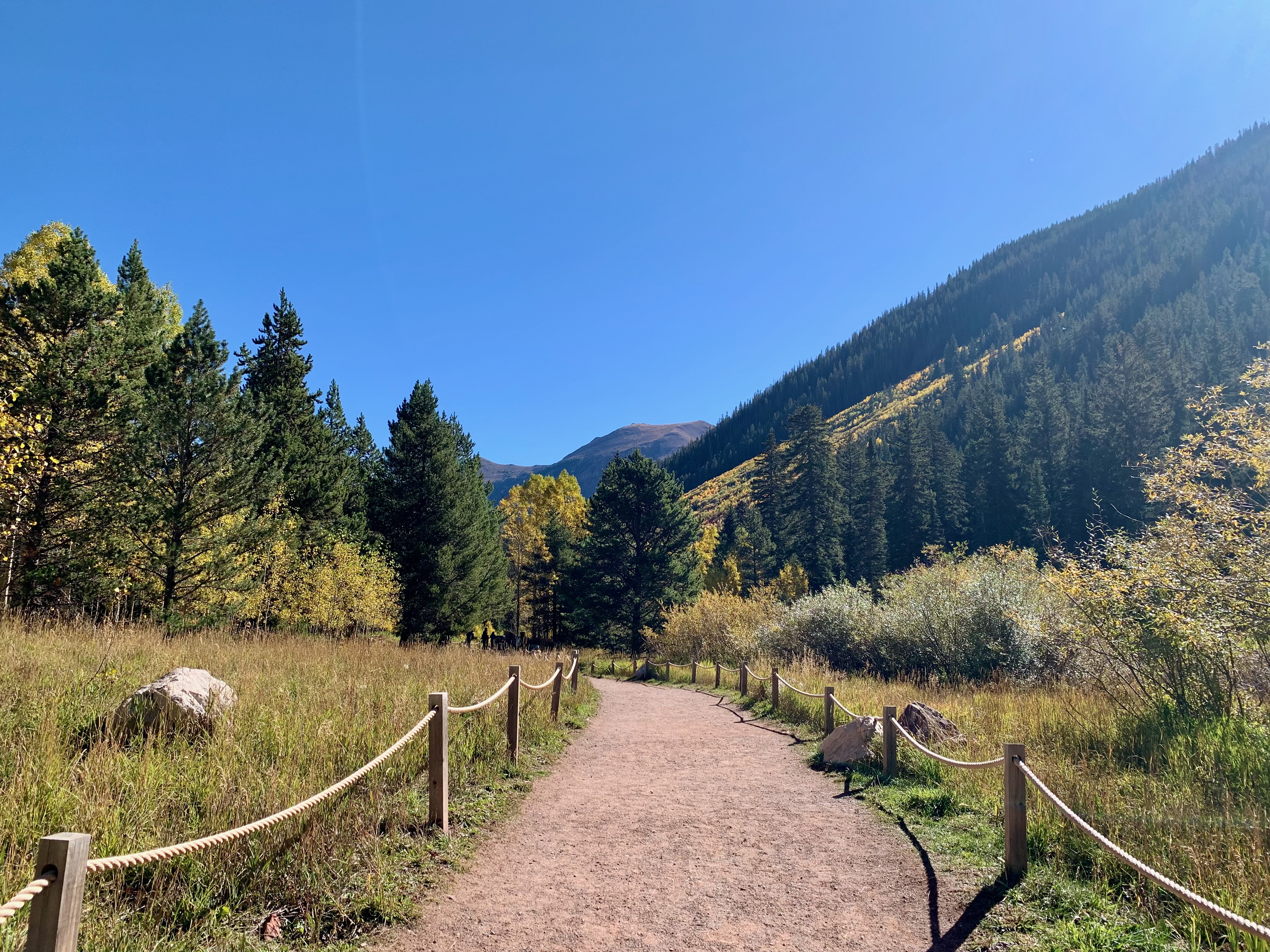
Rather than attempt a more strenuous hike deeper into the woods, we stuck to the basic “scenic” path, a loop whose furthest point is the bridge pictured above.
Viewed from that bridge, the tableau is straight out of a painting.
I could stare at this view in person all day (and luckily, the temperatures rose considerably throughout the morning.)
I’m sure this would’ve looked perfectly lovely without the changing leaf colors, but still–this was a treat to see.
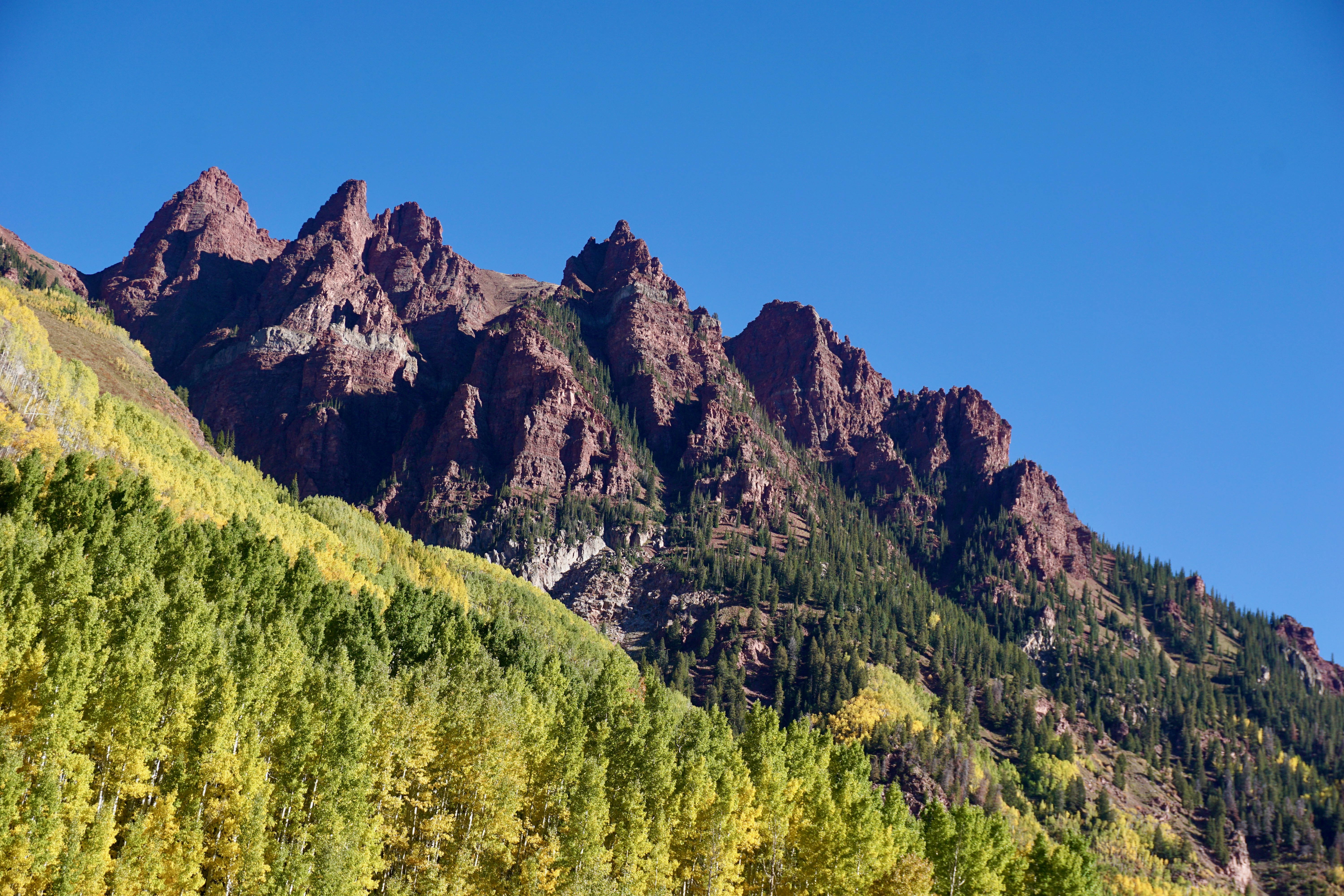
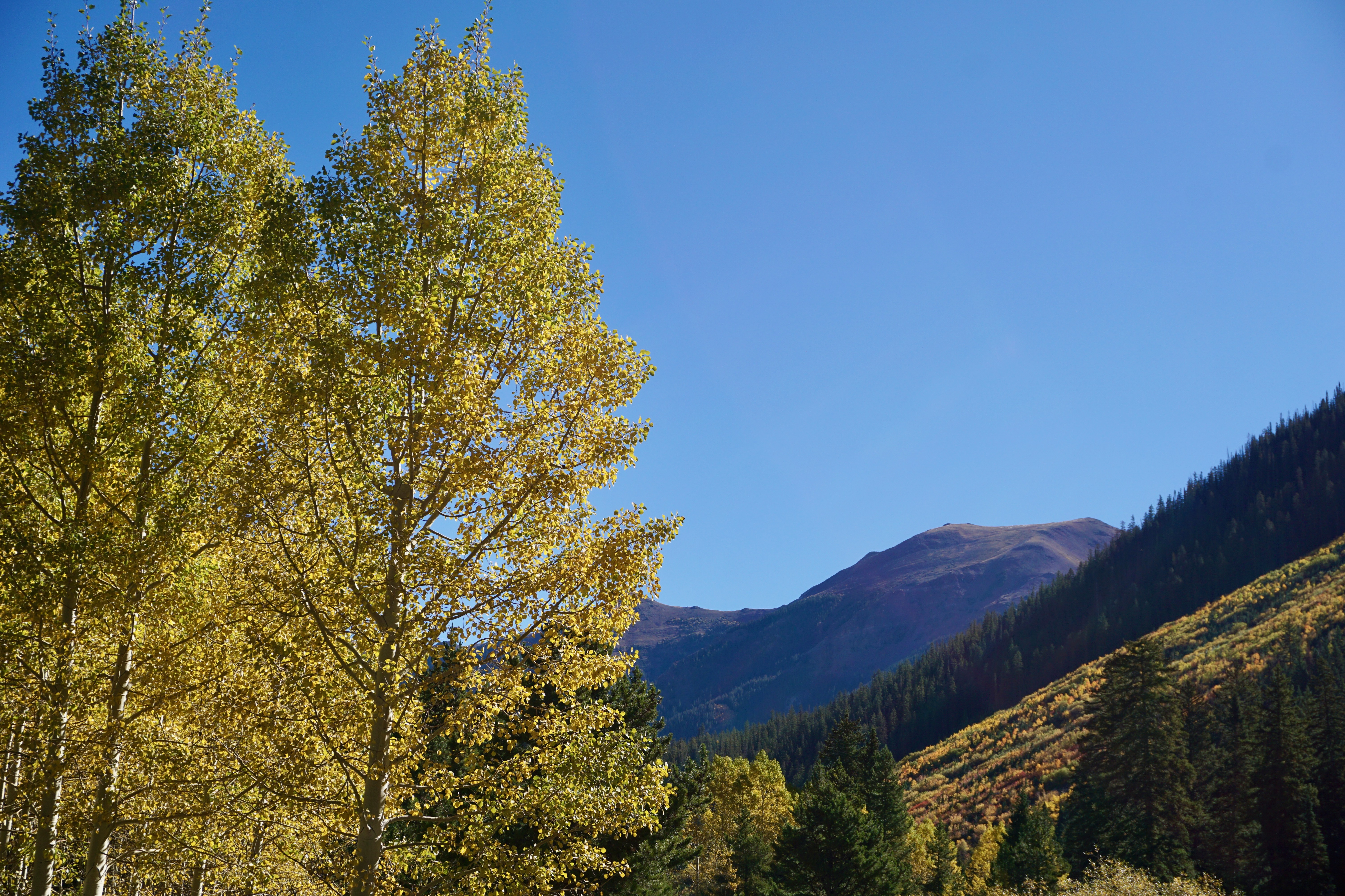
The two peaks are the park’s main attraction, but other mountain ranges are visible in most directions.
We lucked out with such bold, blue skies.
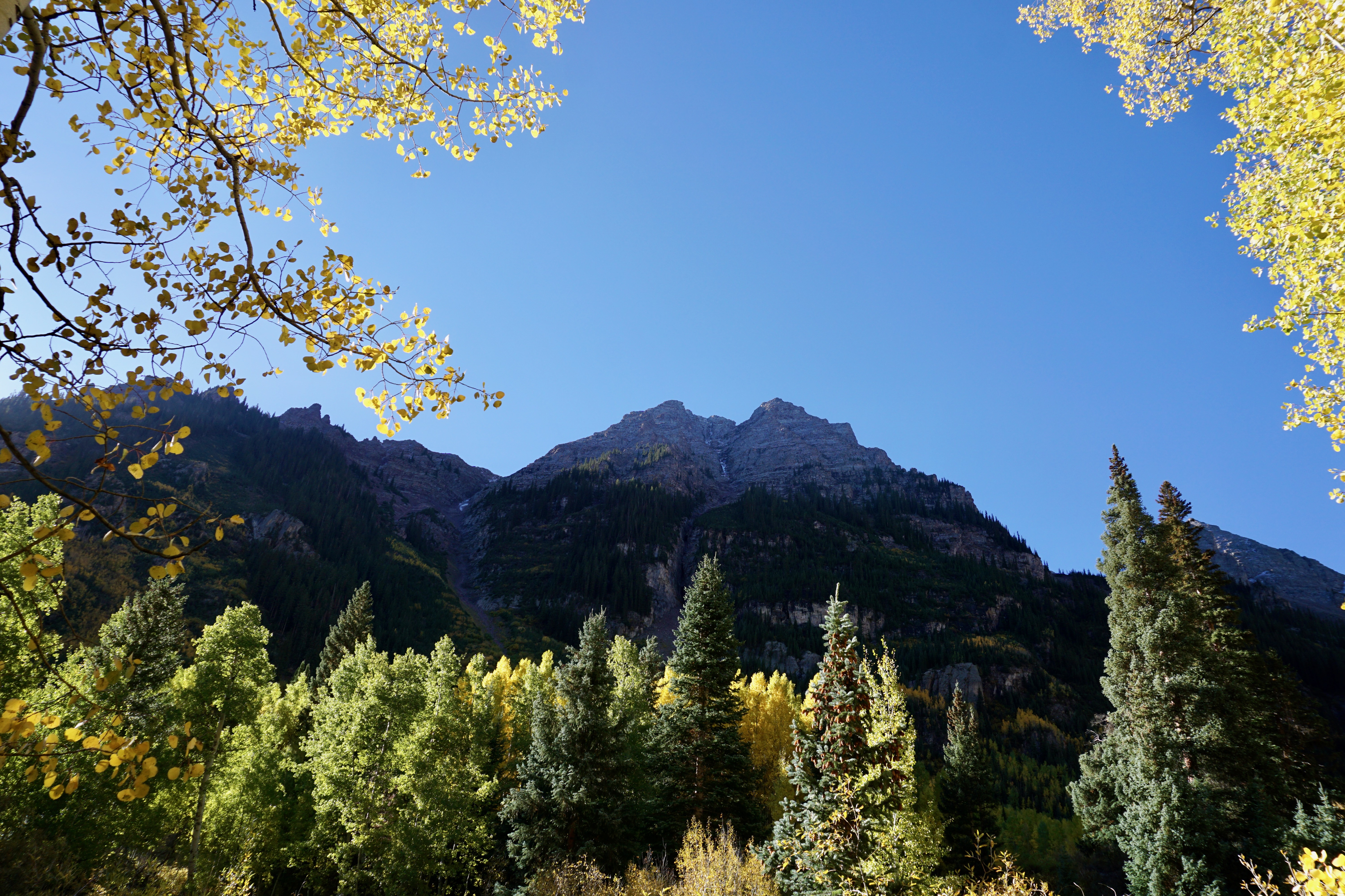
Back towards the loop’s beginning later in the morning, the foliage practically popped against the tall pines and the rocks and dirt of the mountains.
The trail back to the starting point, around 10 AM. A full day of possibilities awaited us.
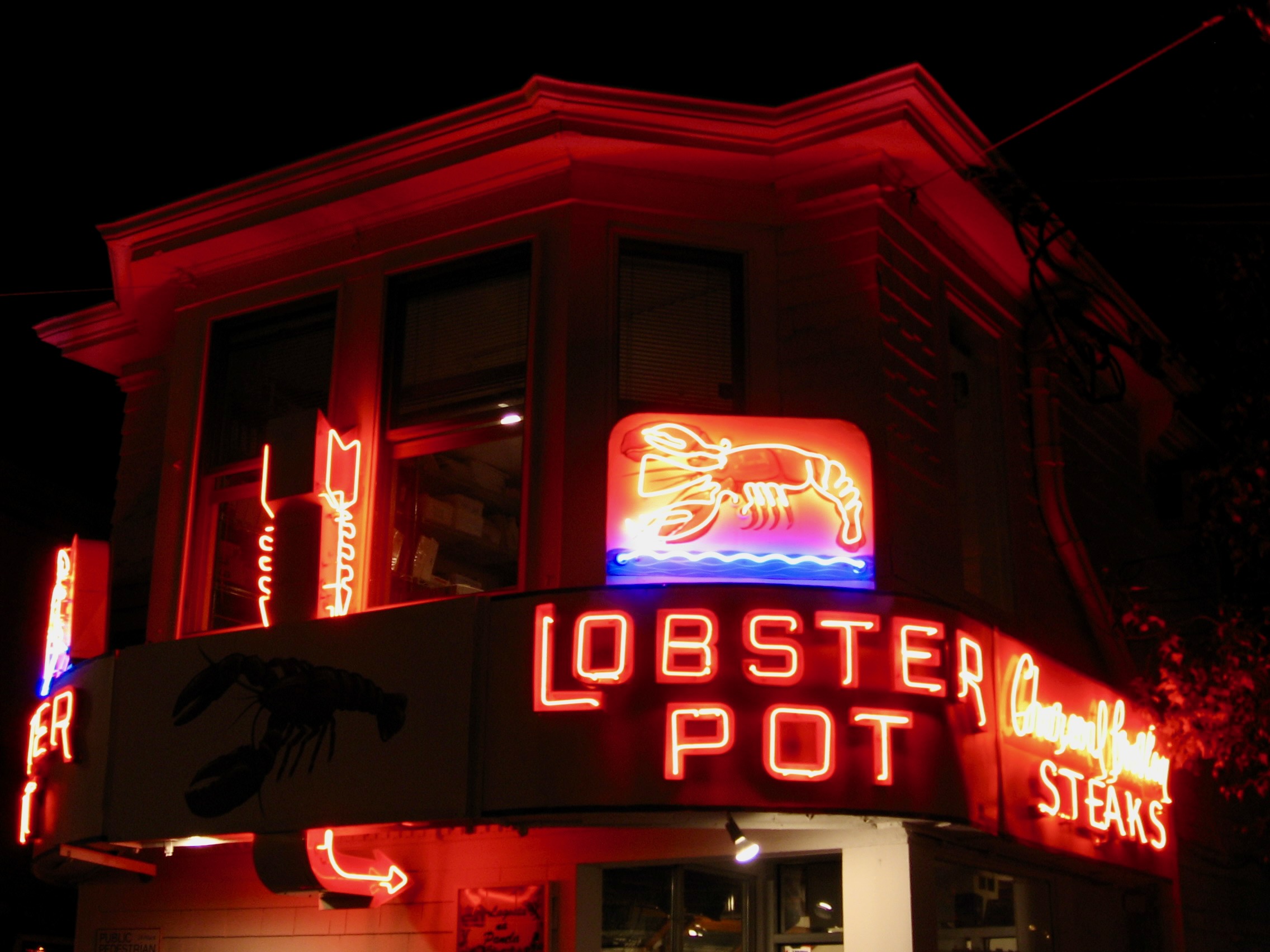
1. The Lobster Pot in Provincetown, Mass. Commercial Street is unimaginable without its piercing red glow.
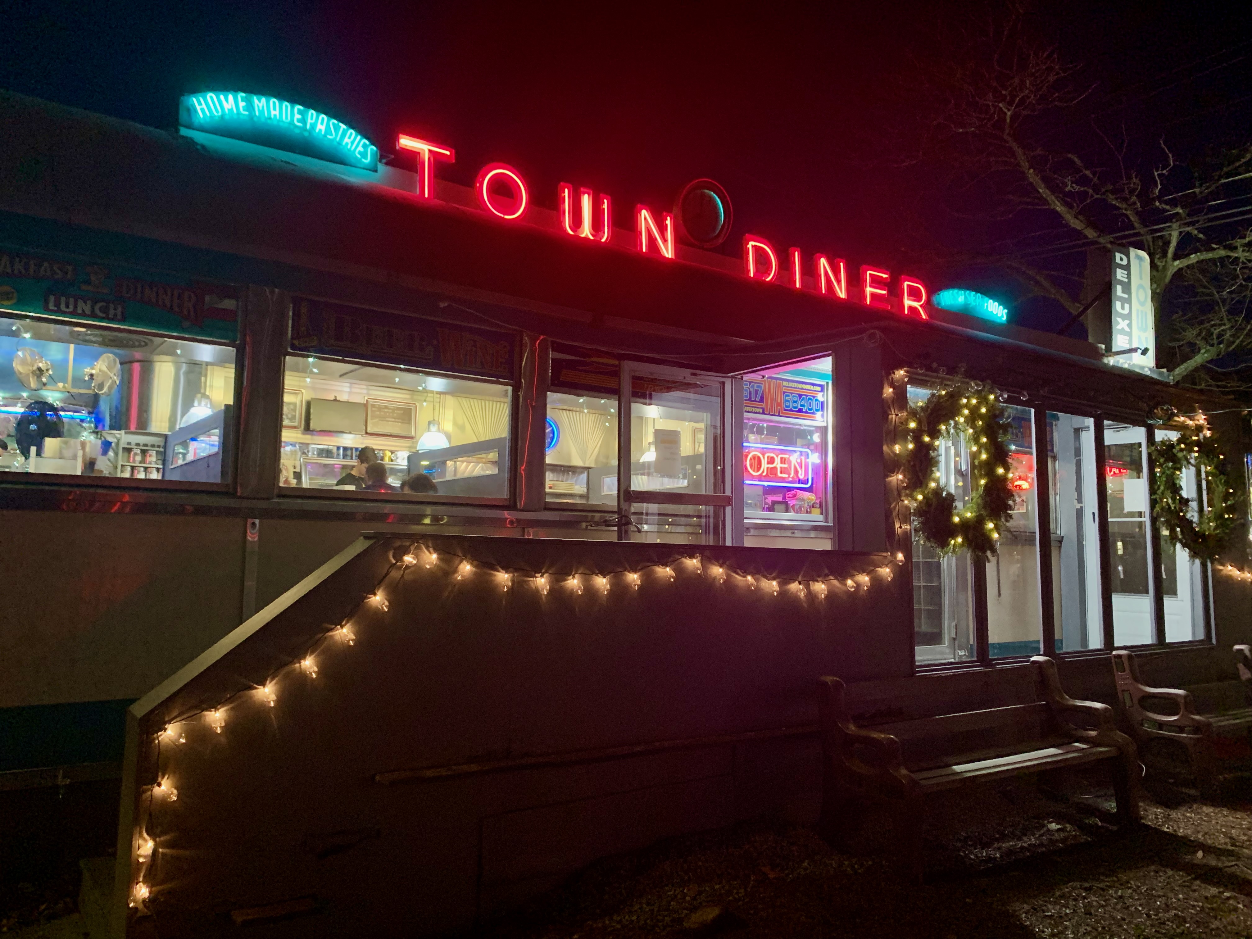
2. Deluxe Town Diner, Watertown, Mass. I lived a ten minute walk away in the early 2000’s and can still sense the delicate taste of their sweet potato pancakes.
3. Rosebud Bar & Kitchen, Davis Square, Somerville, Mass. Now the fancy front of a restaurant attached in the back, I ate this a few times back in the day when it was merely a diner (and the food was never as good as the Deluxe Town Diner’s.)
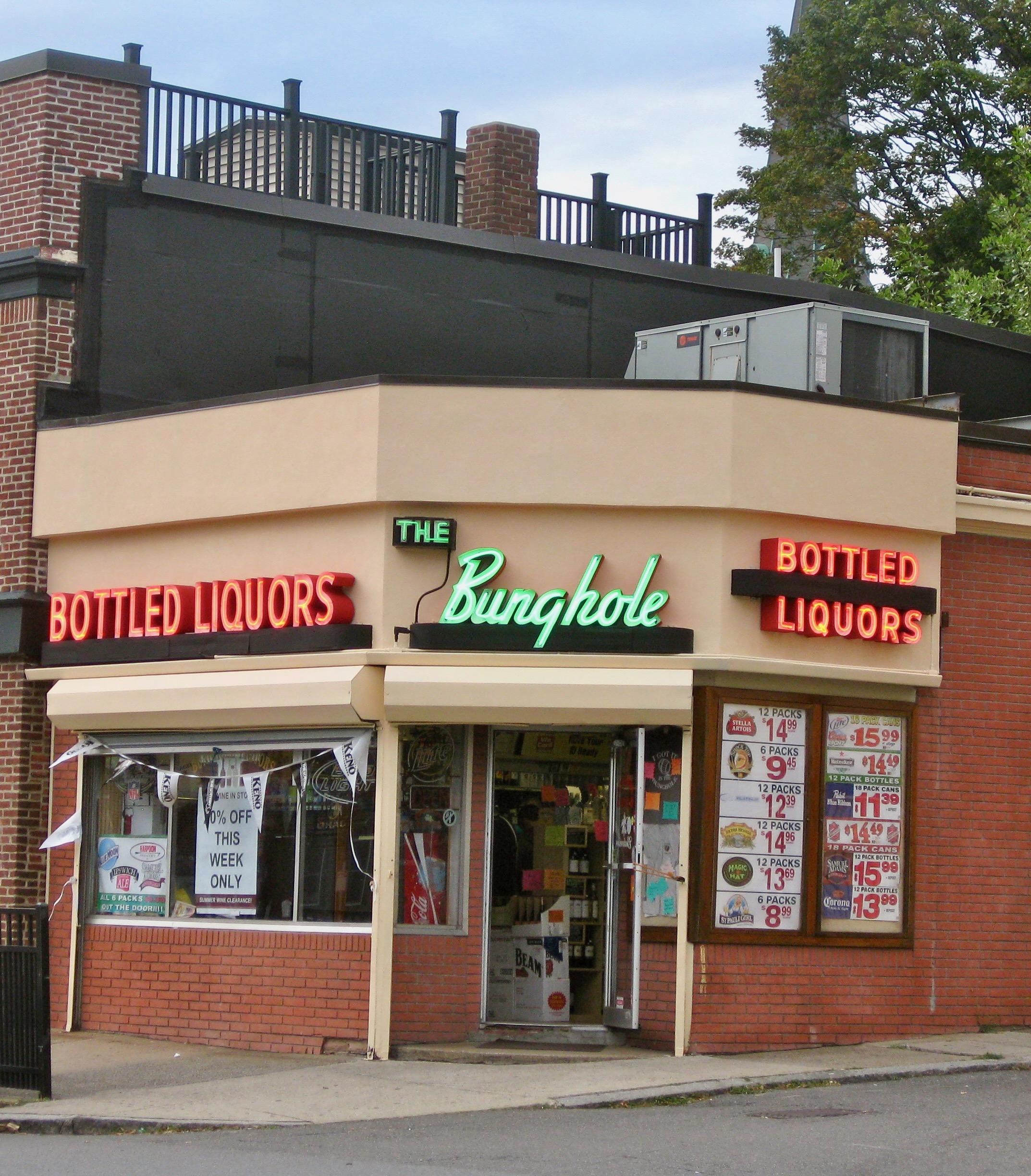
4. Bunghole Liquors, Salem, Mass. A favorite of weird-and-naughty-signs-aficionados far and wide.
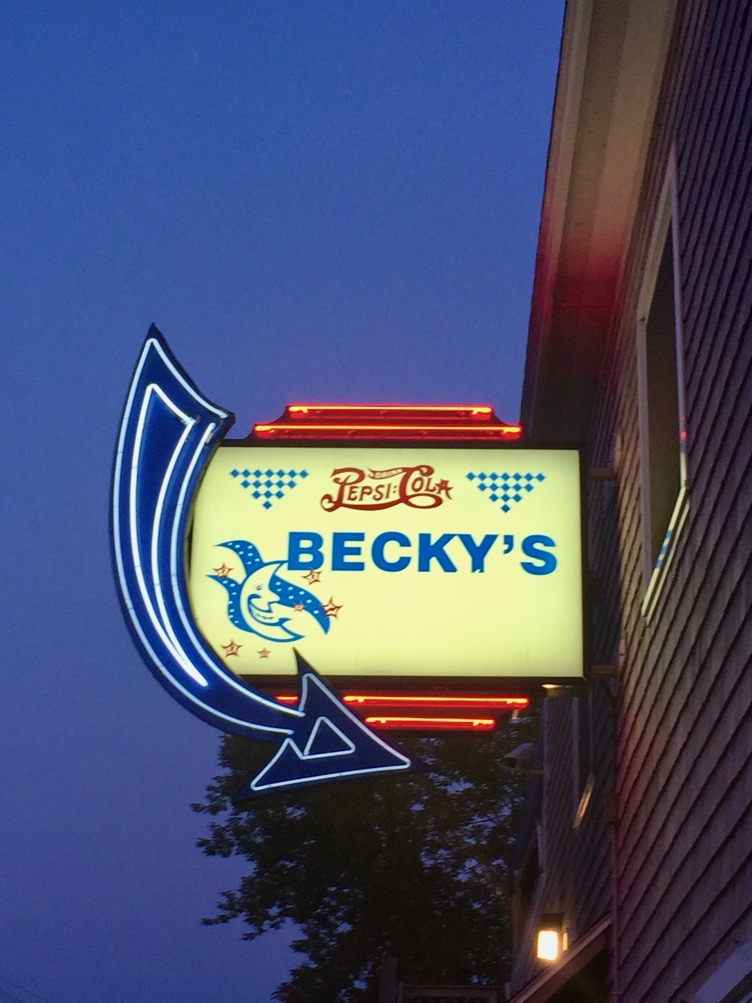
5. Becky’s Diner, Portland, Maine. Not sure how vintage the arrow is, but it is undeniably beautiful.
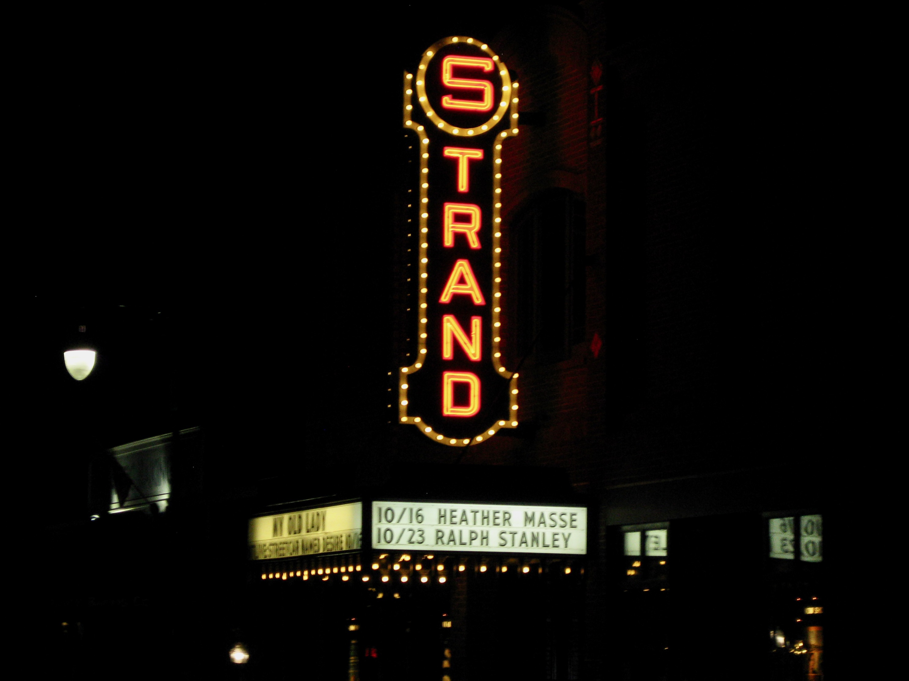
6. Strand Theater, Rockland, Maine. I’ve never been inside but this sign is an exclamation point on this coastal city’s downtown strip.
7. Leon’s Frozen Custard, Milwaukee. I could write a whole essay on the frozen custard stands of my hometown. It’s probably the third-best in terms of taste but certainly number one in design.
8. Miller High Life, some random bar on Kinnickinnic Avenue in Bay View, Milwaukee. Of course it’s Milwaukee!
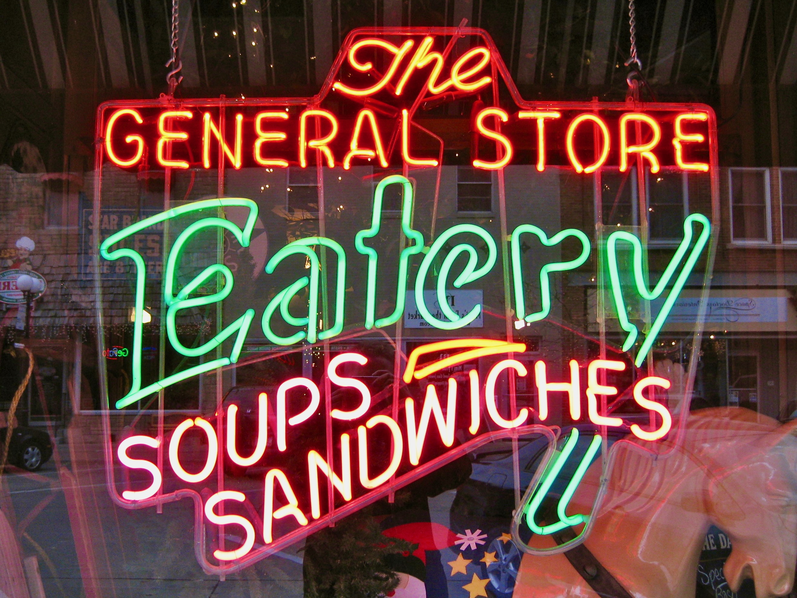
9. The General Store, Valley Junction, West Des Moines, Iowa. Spotted on one of my last visits when my parents lived there.
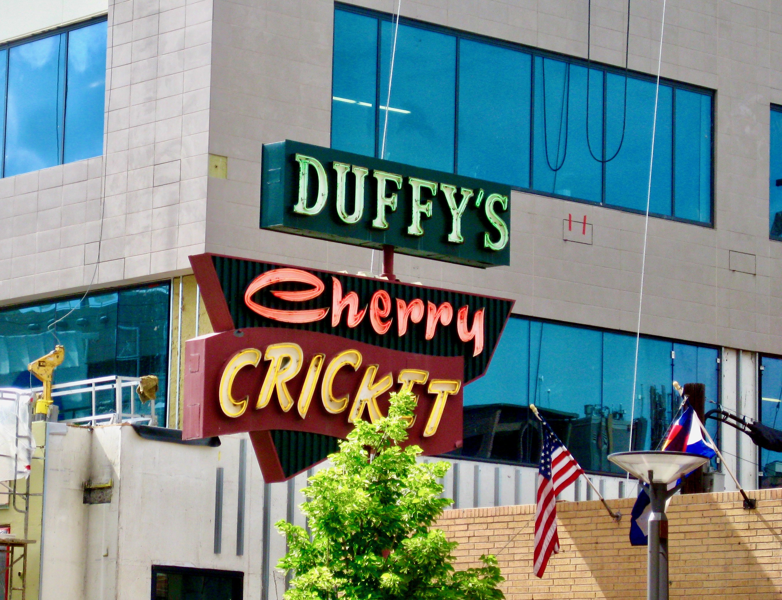
10. Duffy’s Cherry Cricket, Denver. Ate at a restaurant nearby on a visit a decade ago. Maybe I’ll check it out when I’m back there a few weeks from now.
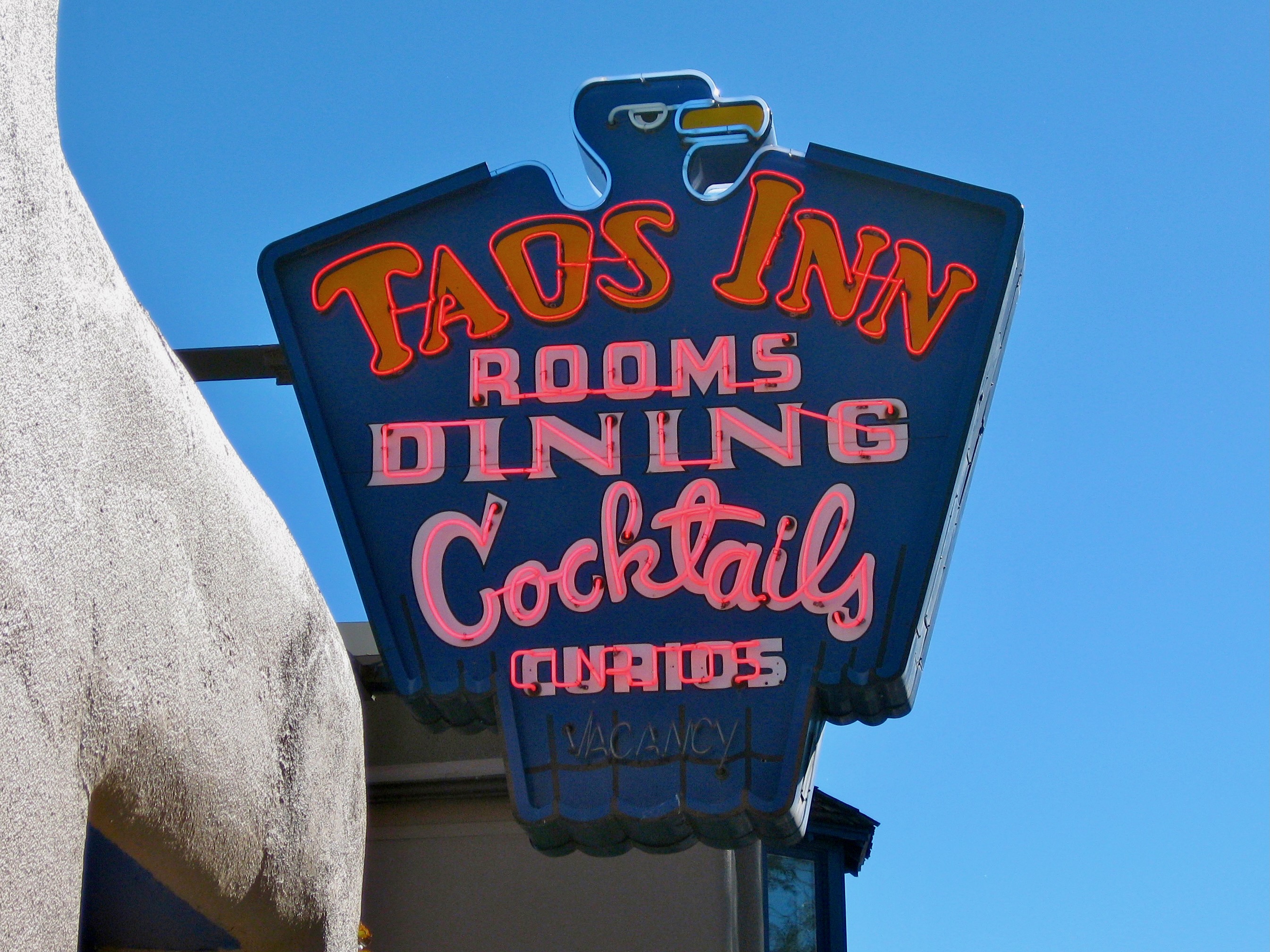
11. Taos Inn, Taos, New Mexico. Probably my favorite neon sign of this group. Respect the eagle!
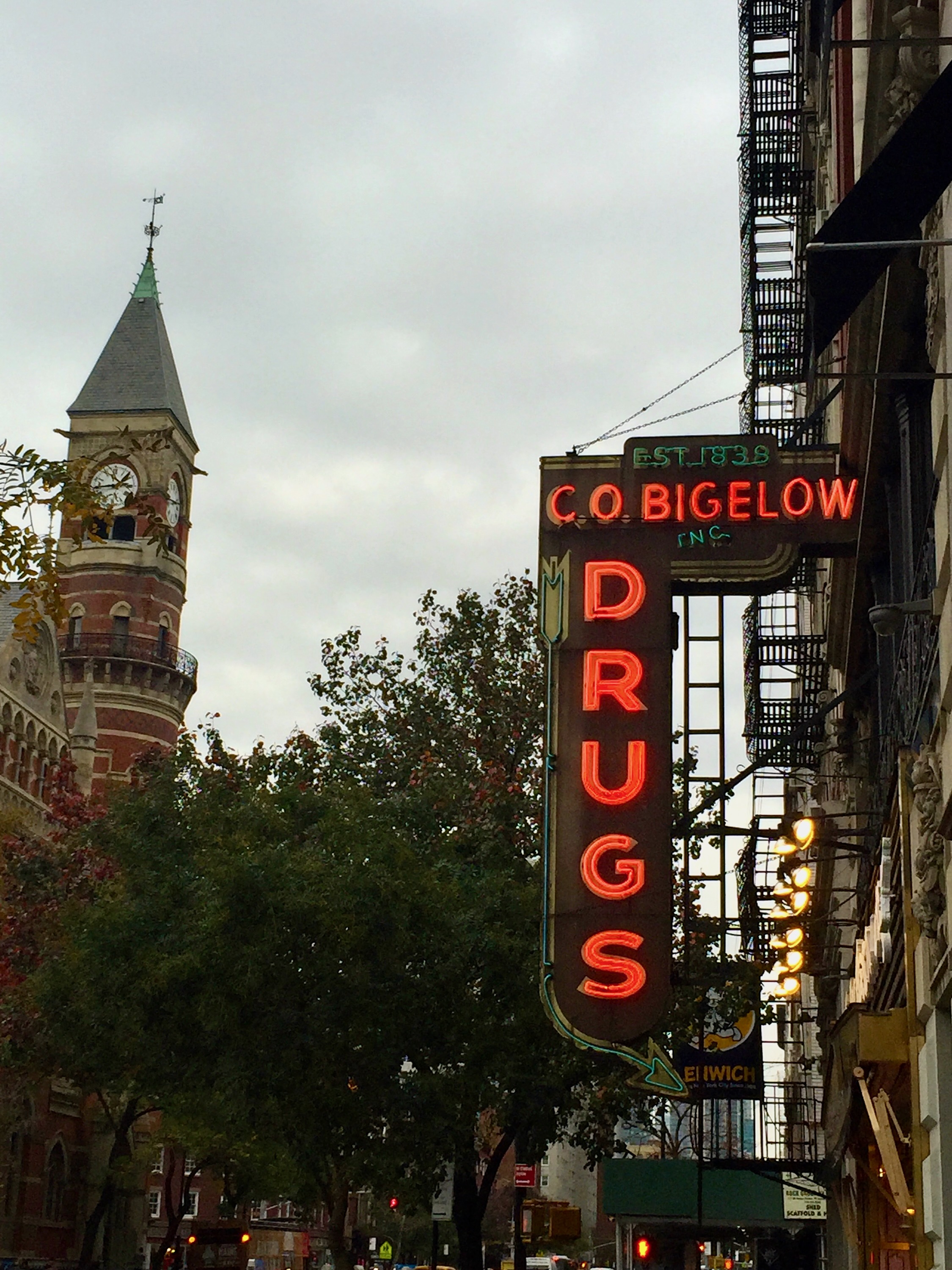
12. C.O. Bigelow Drugs, Manhattan. No trip to NYC for me is complete without a stop here.
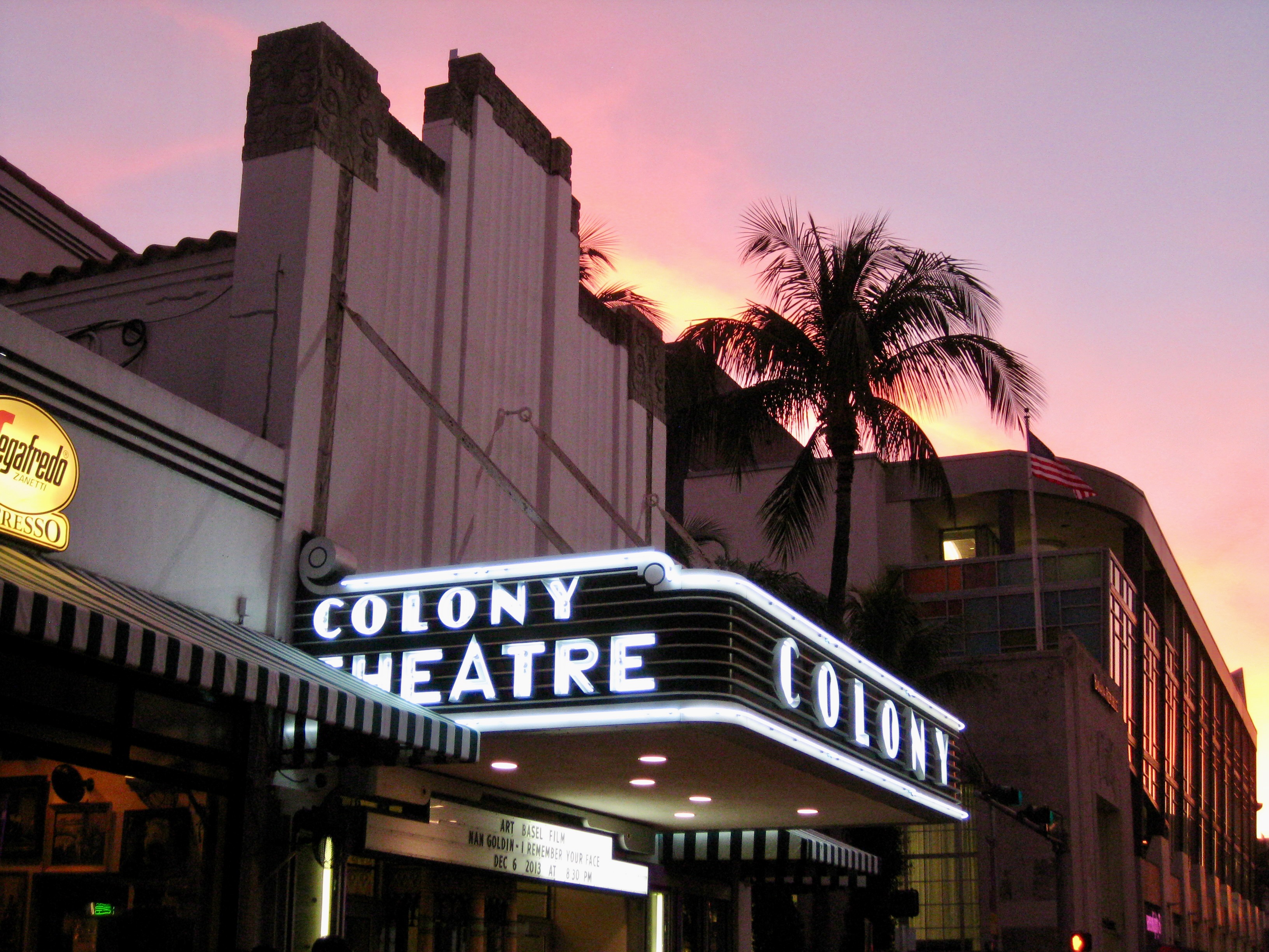
13. Colony Theatre, Miami Beach. Have not seen inside and I fear it would not fully live up to this exterior, taken on a December Thursday evening.
14. Southern Cross Hotel, Key West. One doesn’t see so much yellow-greenish neon; it’s stunning.
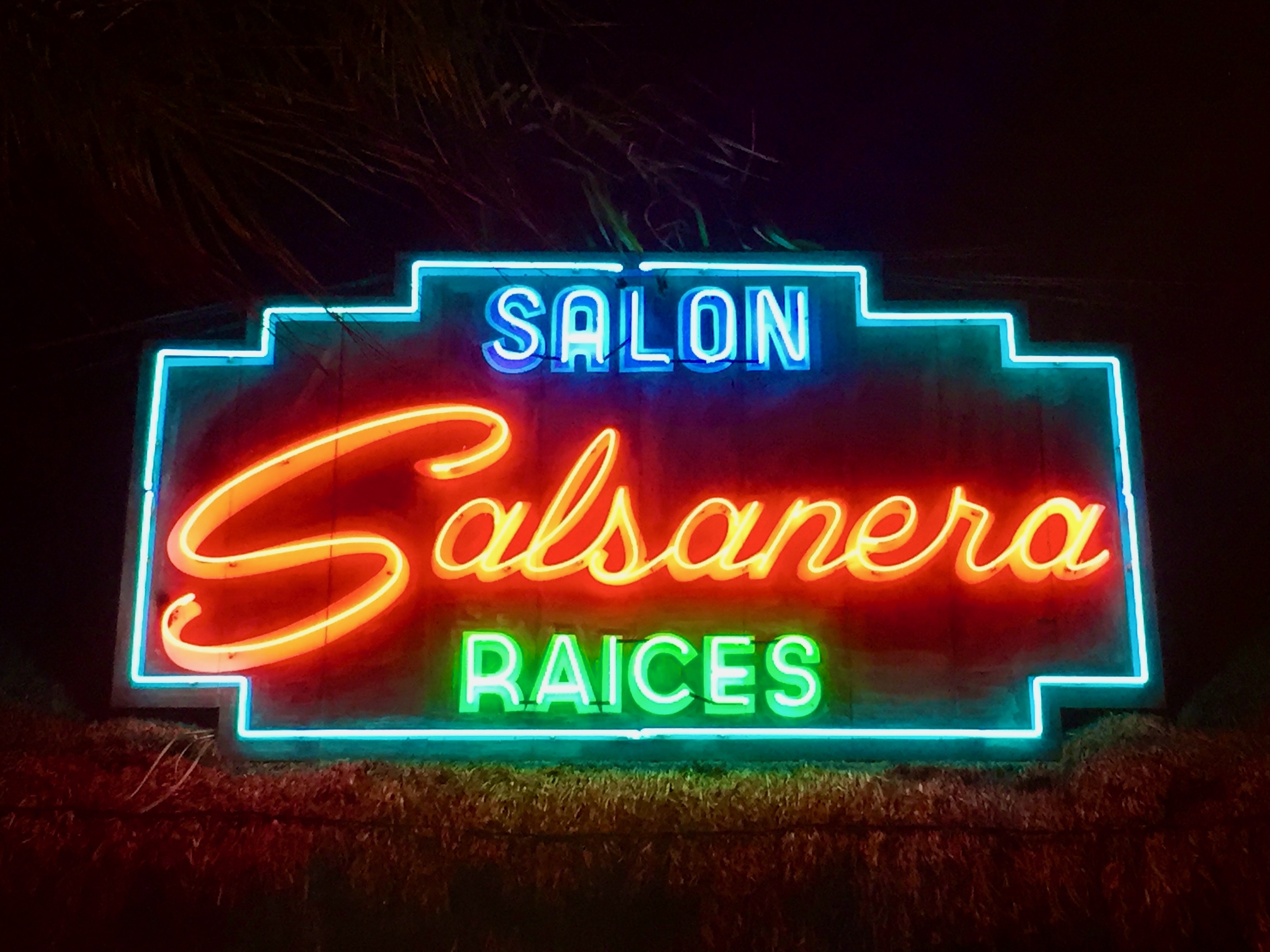
15. Salsanera, Playa Del Carmen, Mexico. This stopped me in my tracks on a visit nearly ten years ago; no way was I going to walk by without a snapshot of it.
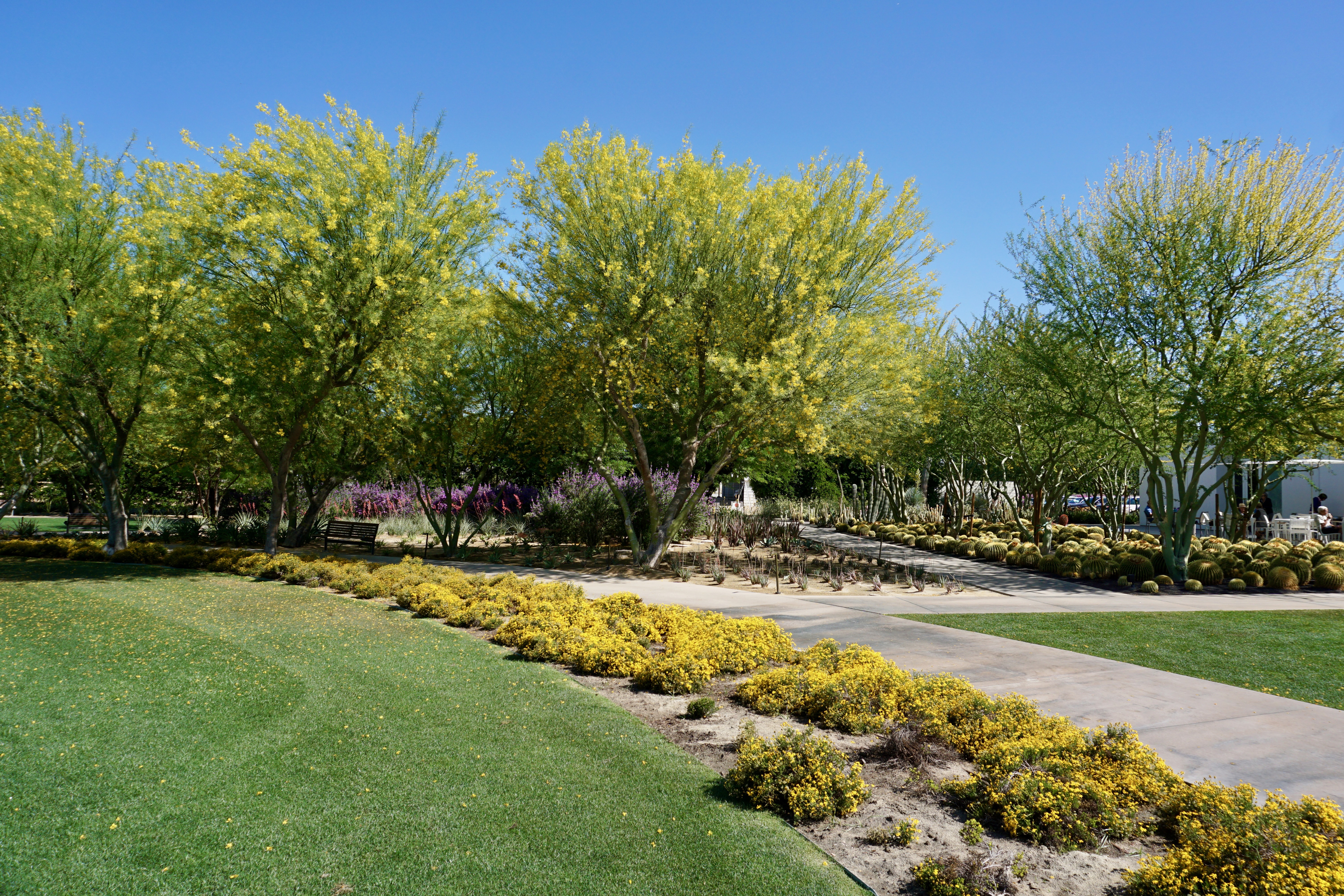
On the last full day of our Palm Springs trip in April, we visited Sunnylands.
Located in nearby Rancho Mirage, the property houses the former Annenberg Estate. While we didn’t buy tickets to tour the entire estate (including a historic house), we did spend an hour or so walking around the gardens which are free to the public.
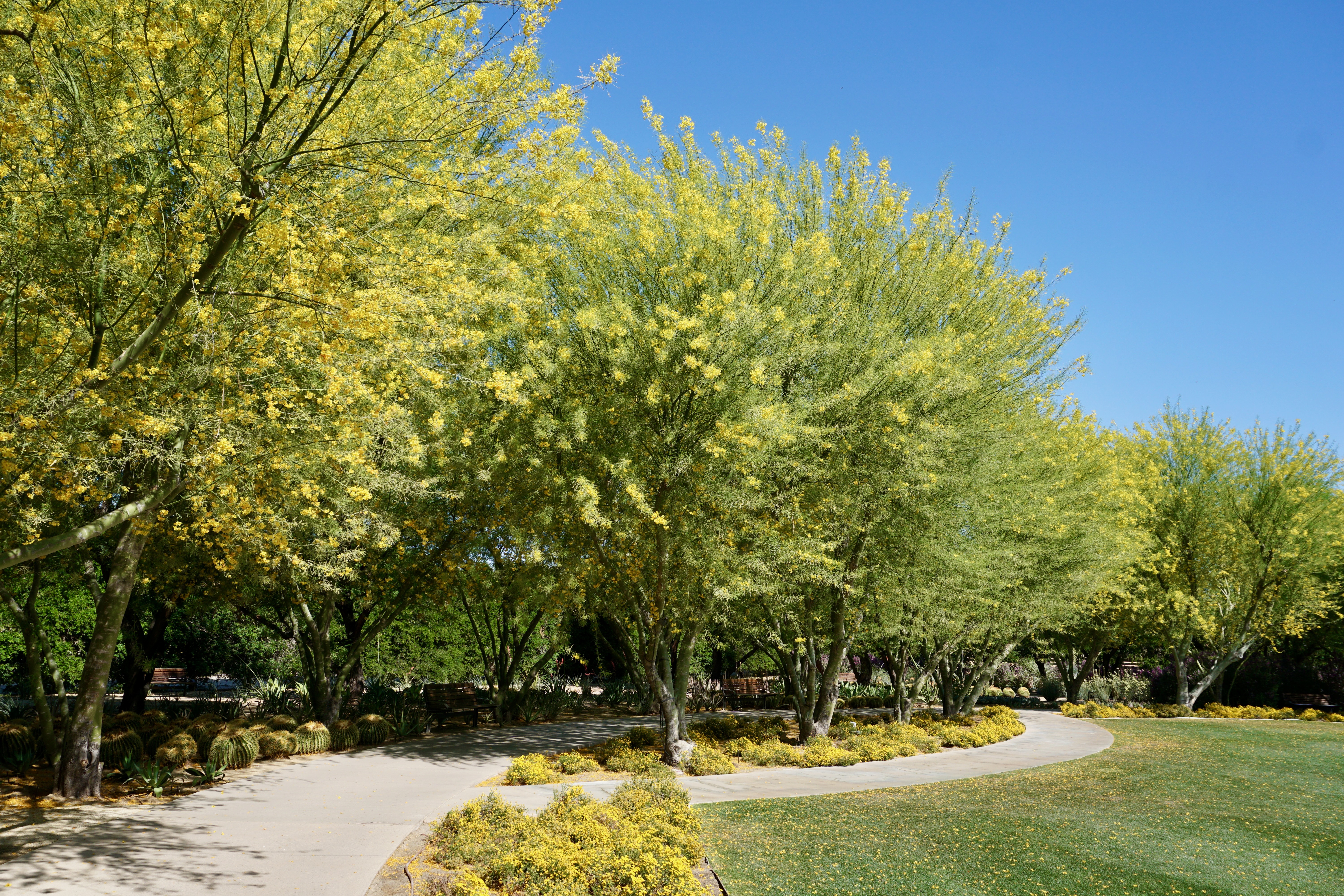
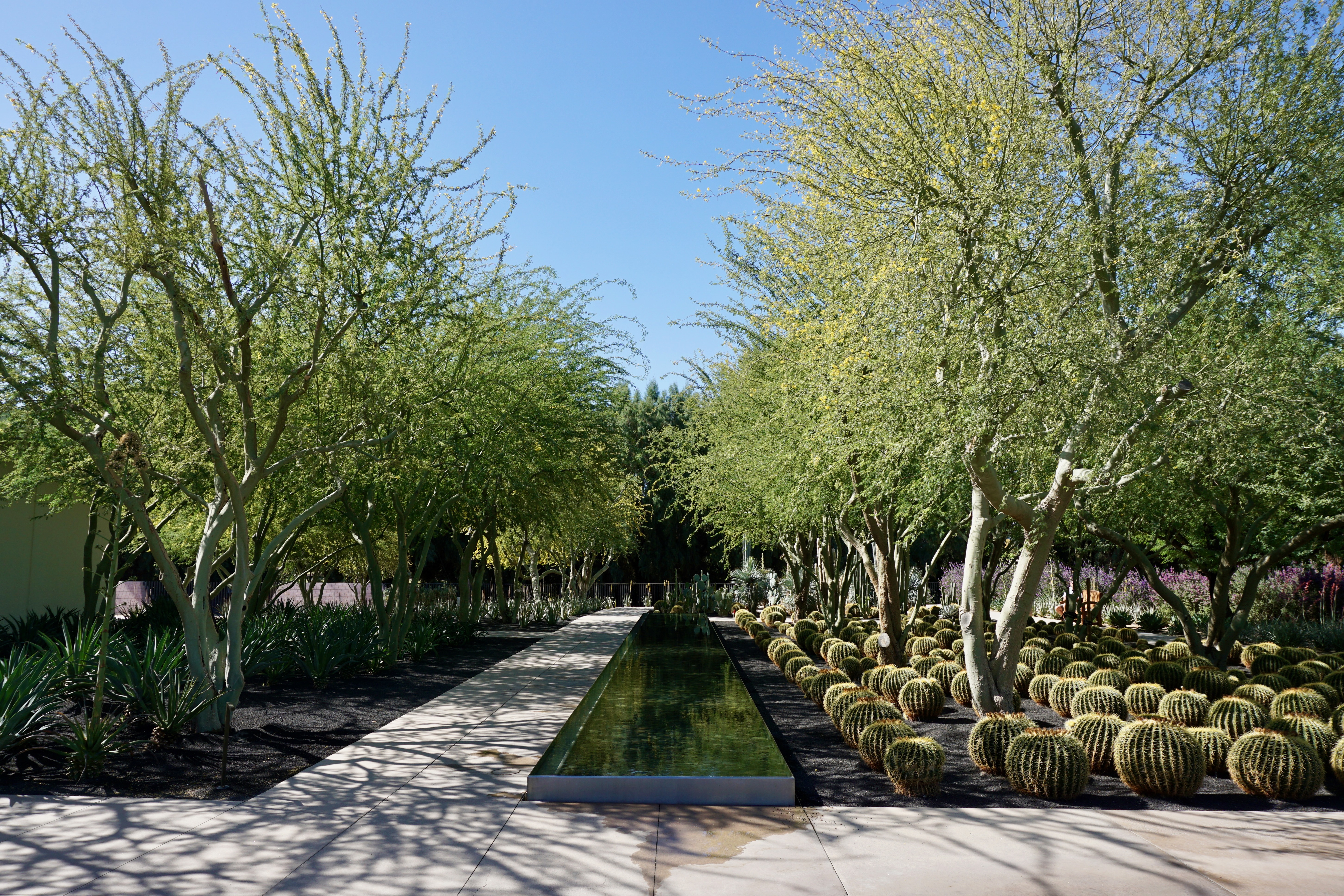
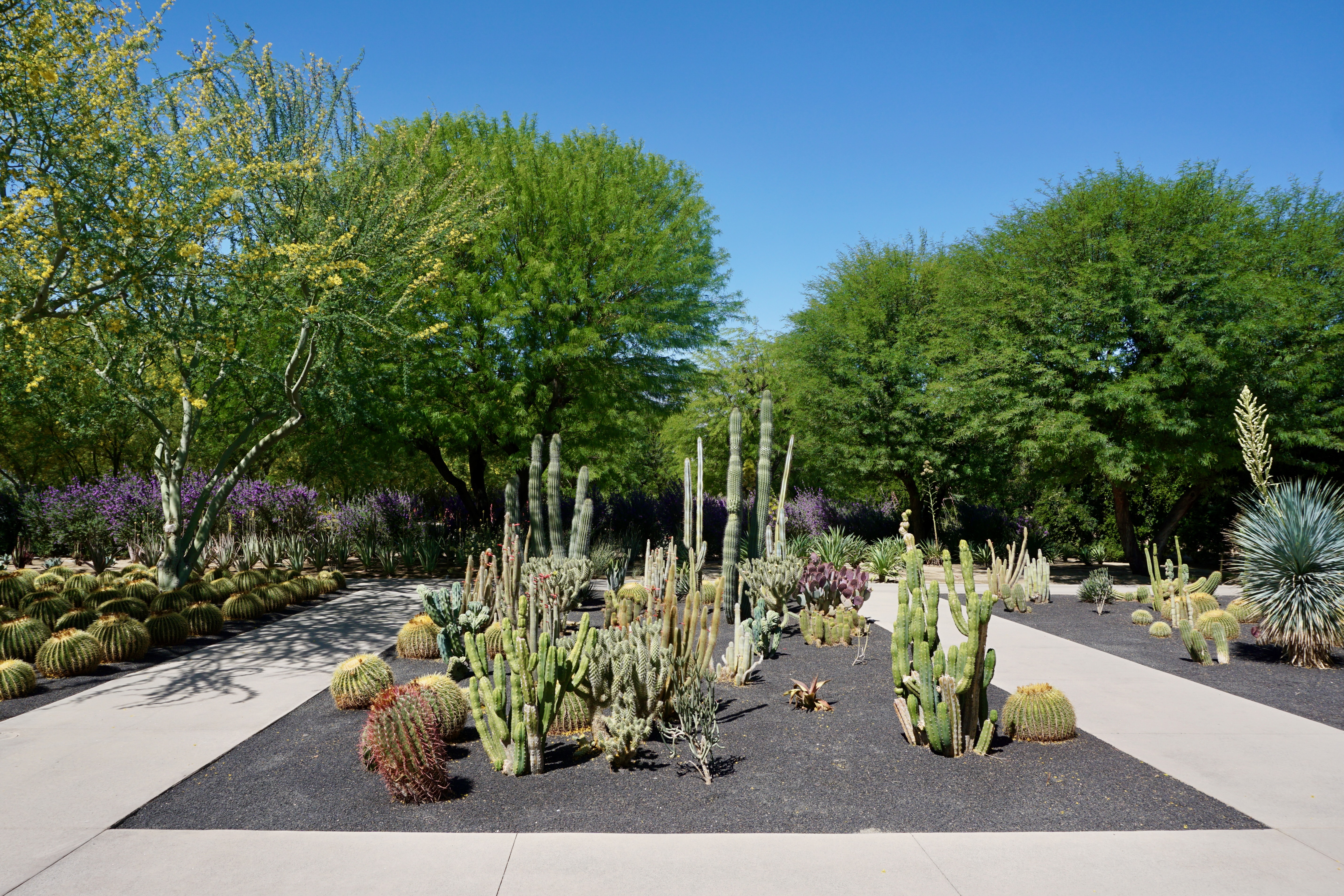
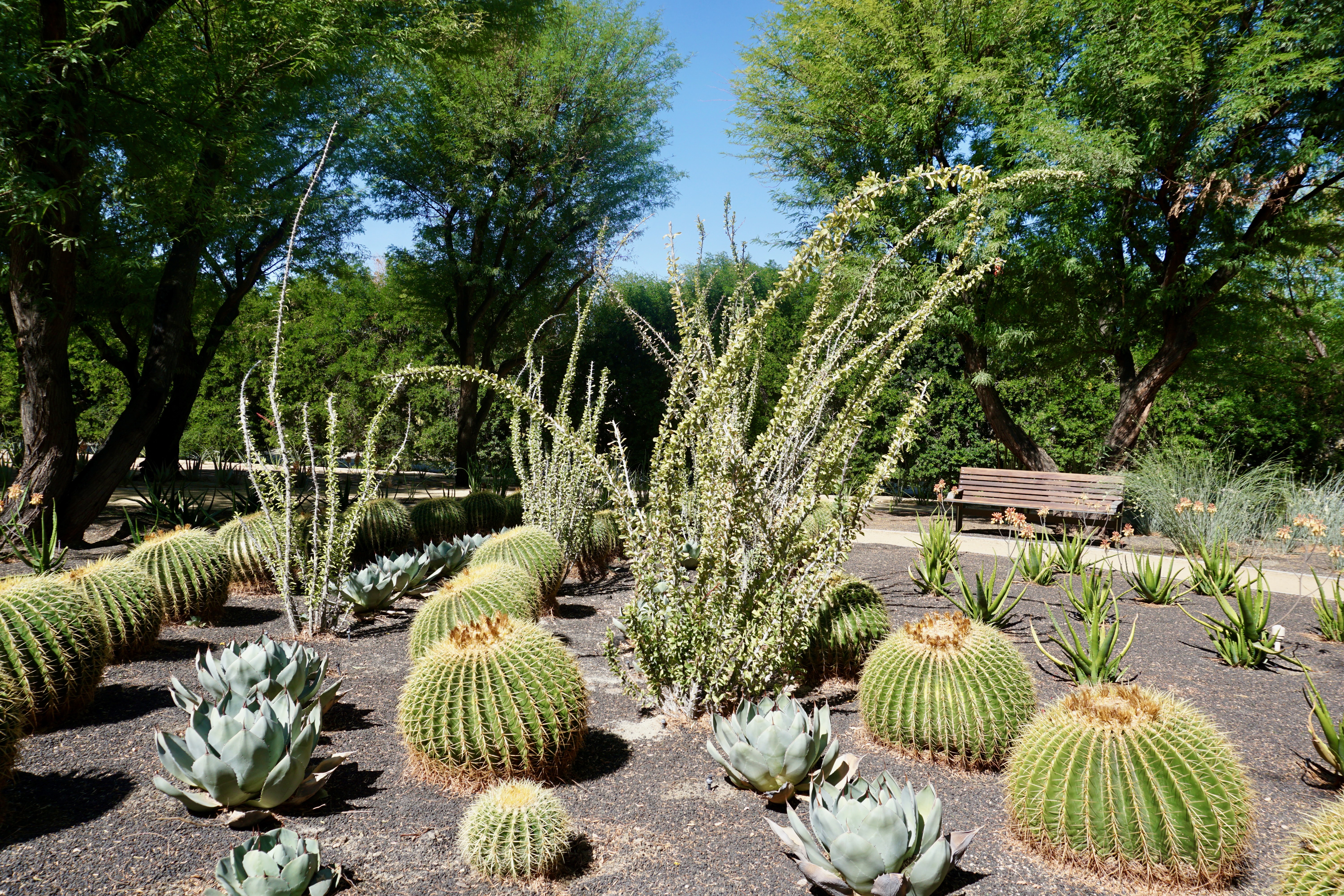
As a longtime fan and supporter of botanical gardens, I hadn’t seen one quite like this.
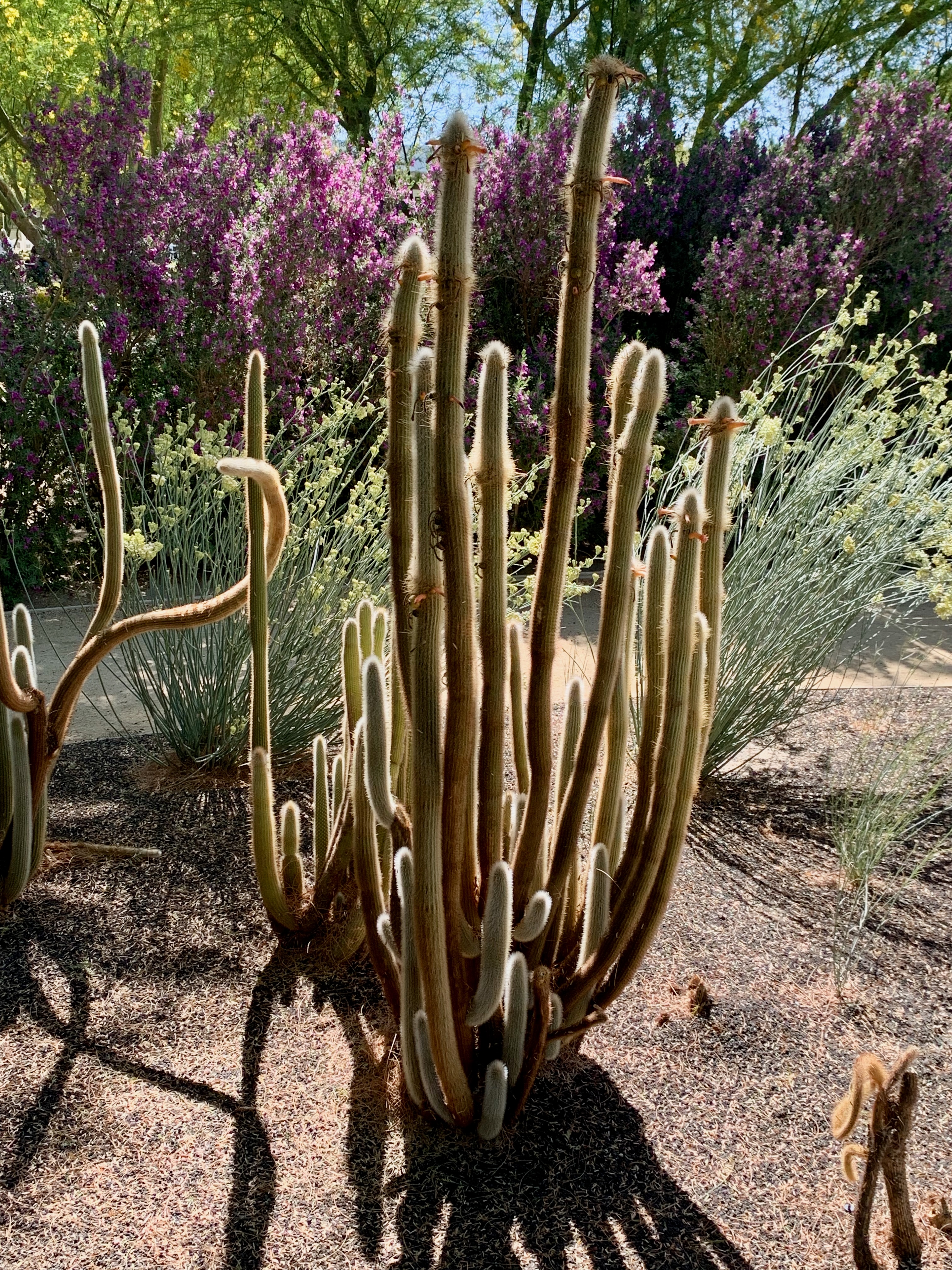
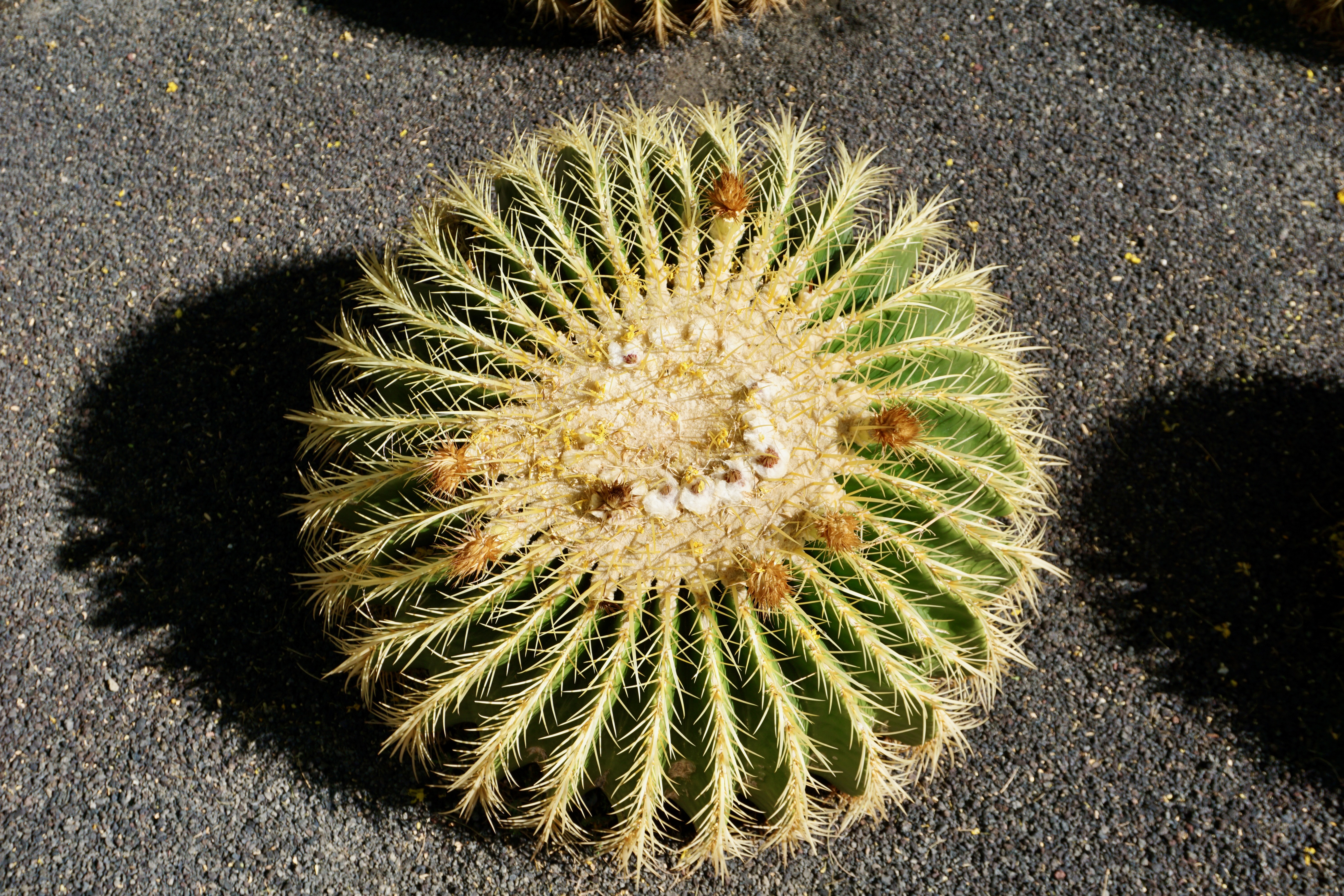
Given the Southern California desert climate, these gardens are heavily succulent-oriented. Here are an array of cacti:
Good Morning!
Watch where you sit.
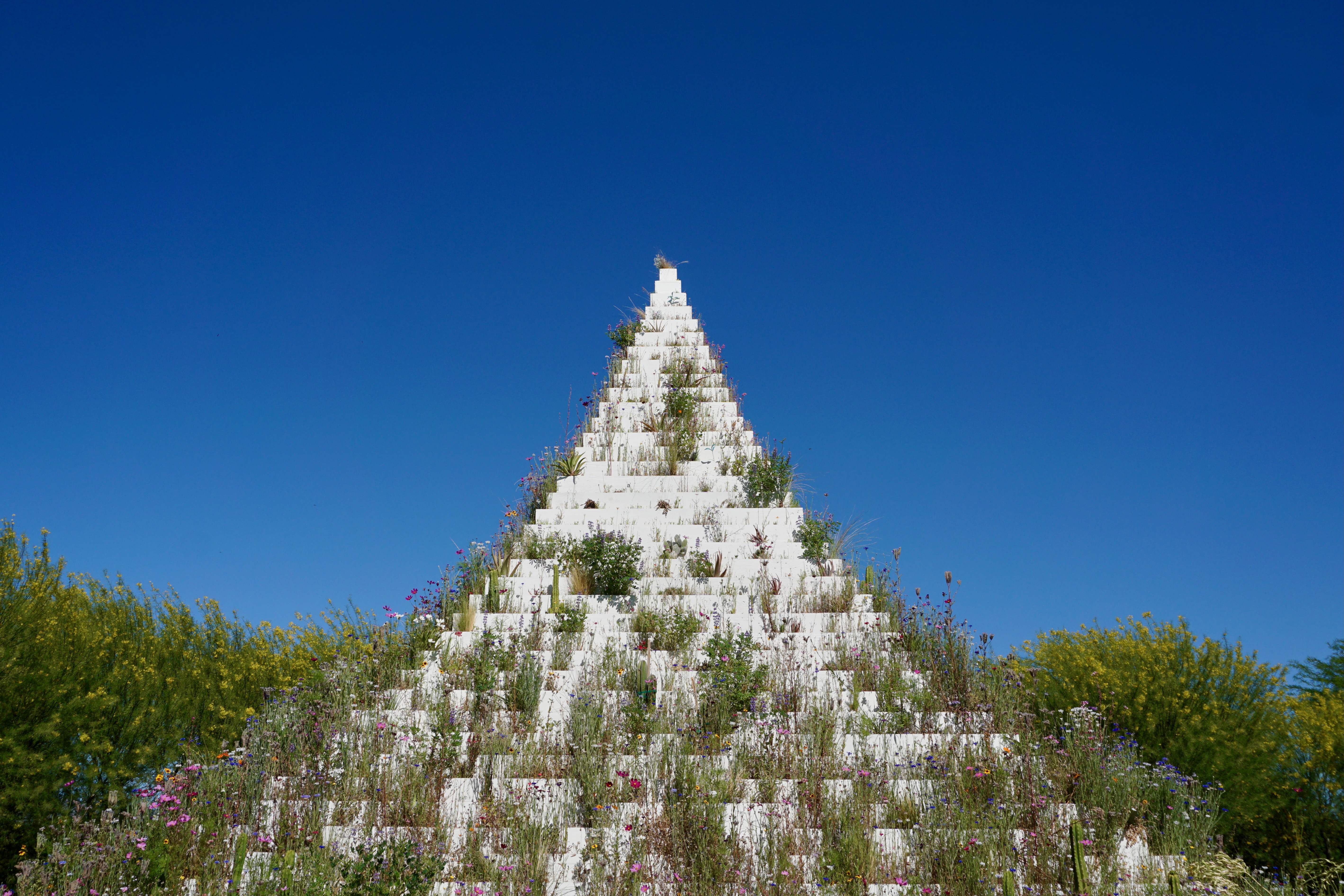
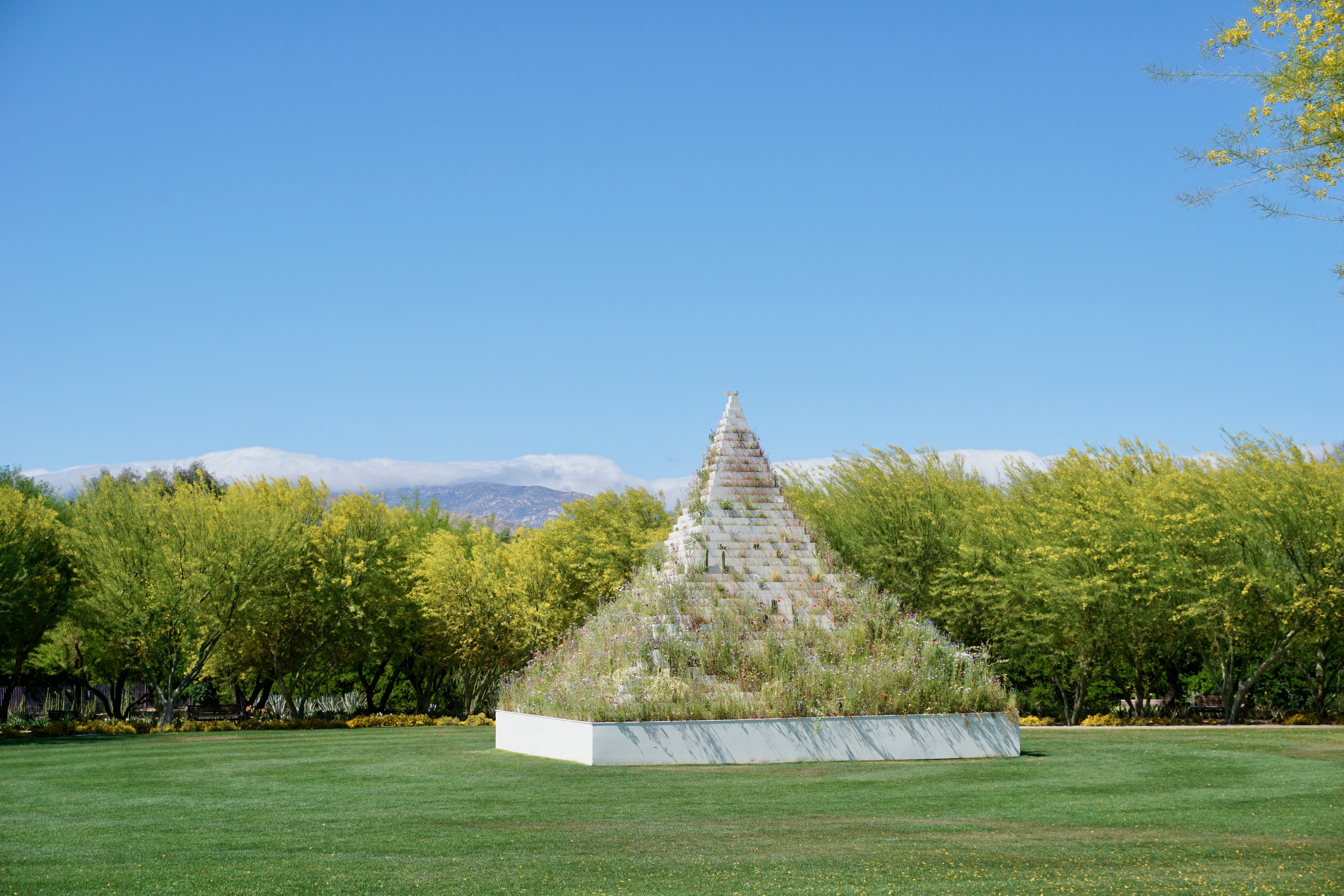
At the time of our visit, as part of Desert X, the gardens housed an outdoor art commission, Agnes Denes’ The Living Pyramid.
“A monumental step pyramid planted with rows of vegetation native to the region,” it cut a striking figure against the mountains to the east.
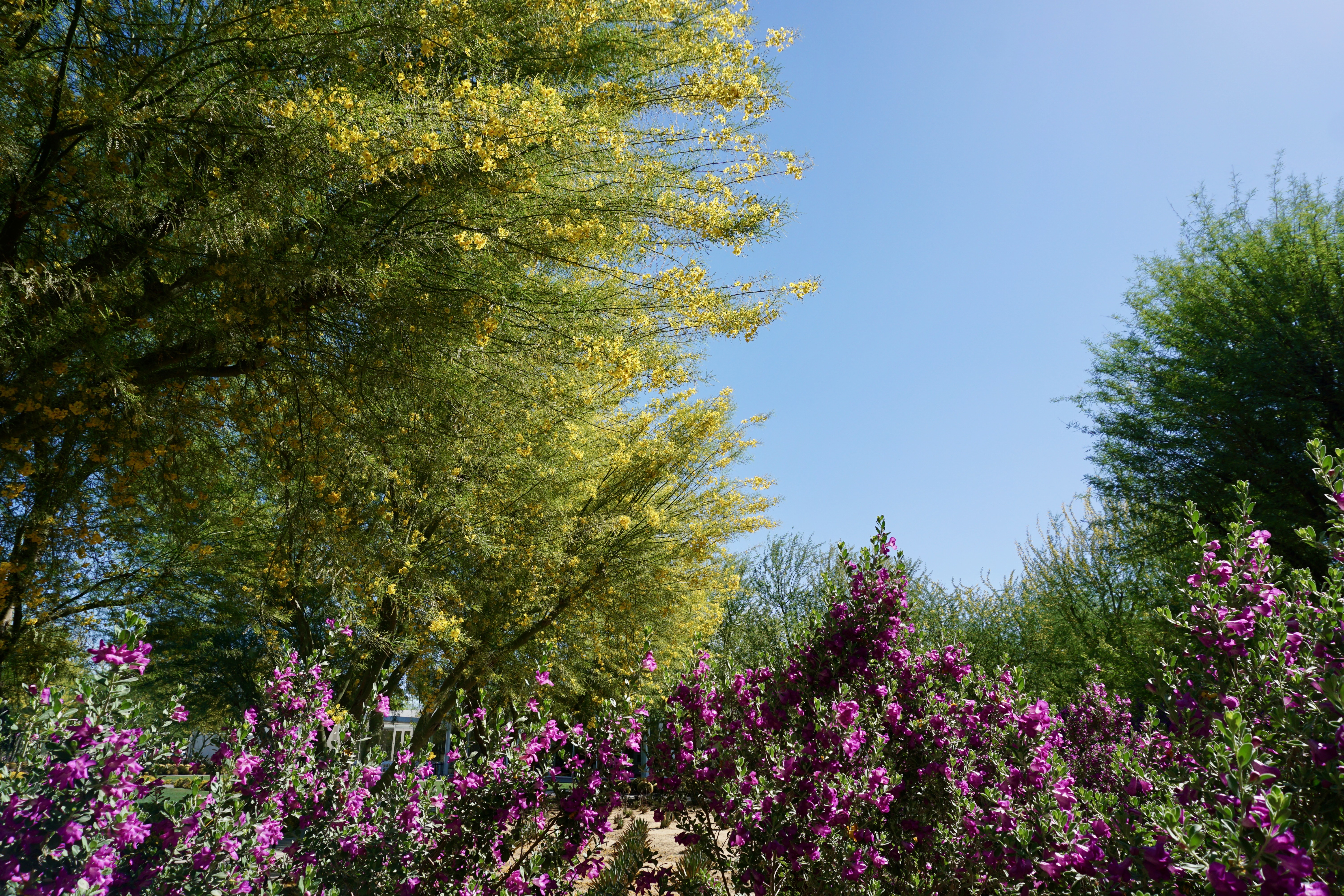
In this arid environment, purple flowers practically glow against all of the surrounding earth tones.
After a week of copious palms, it was almost a palette cleanser to see these trees, the yellows popping next to the greens and the clear blue skies. As much as I loved Palm Springs for its architecture, it was sublime to see some of the area’s natural beauty as well.
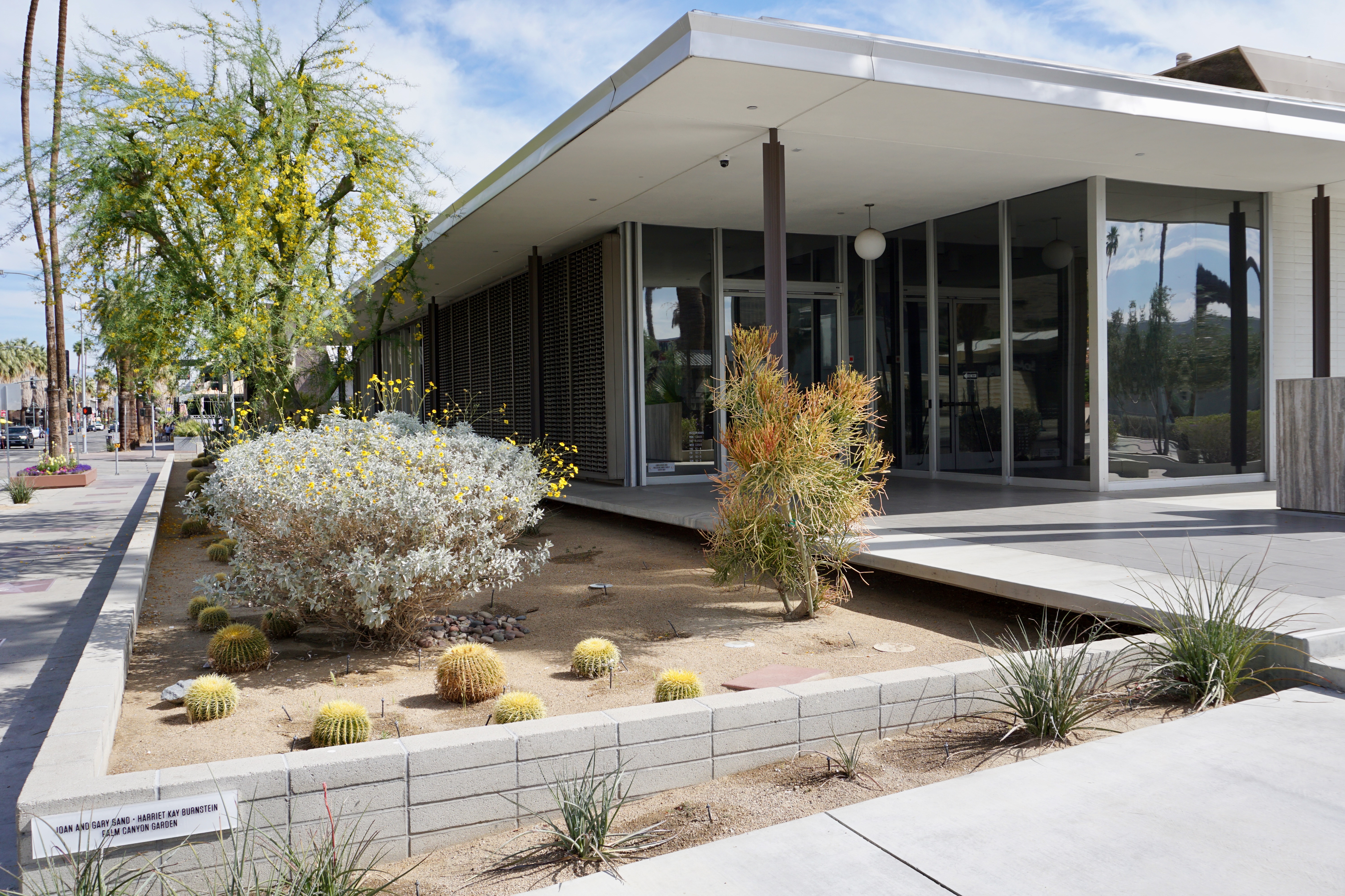
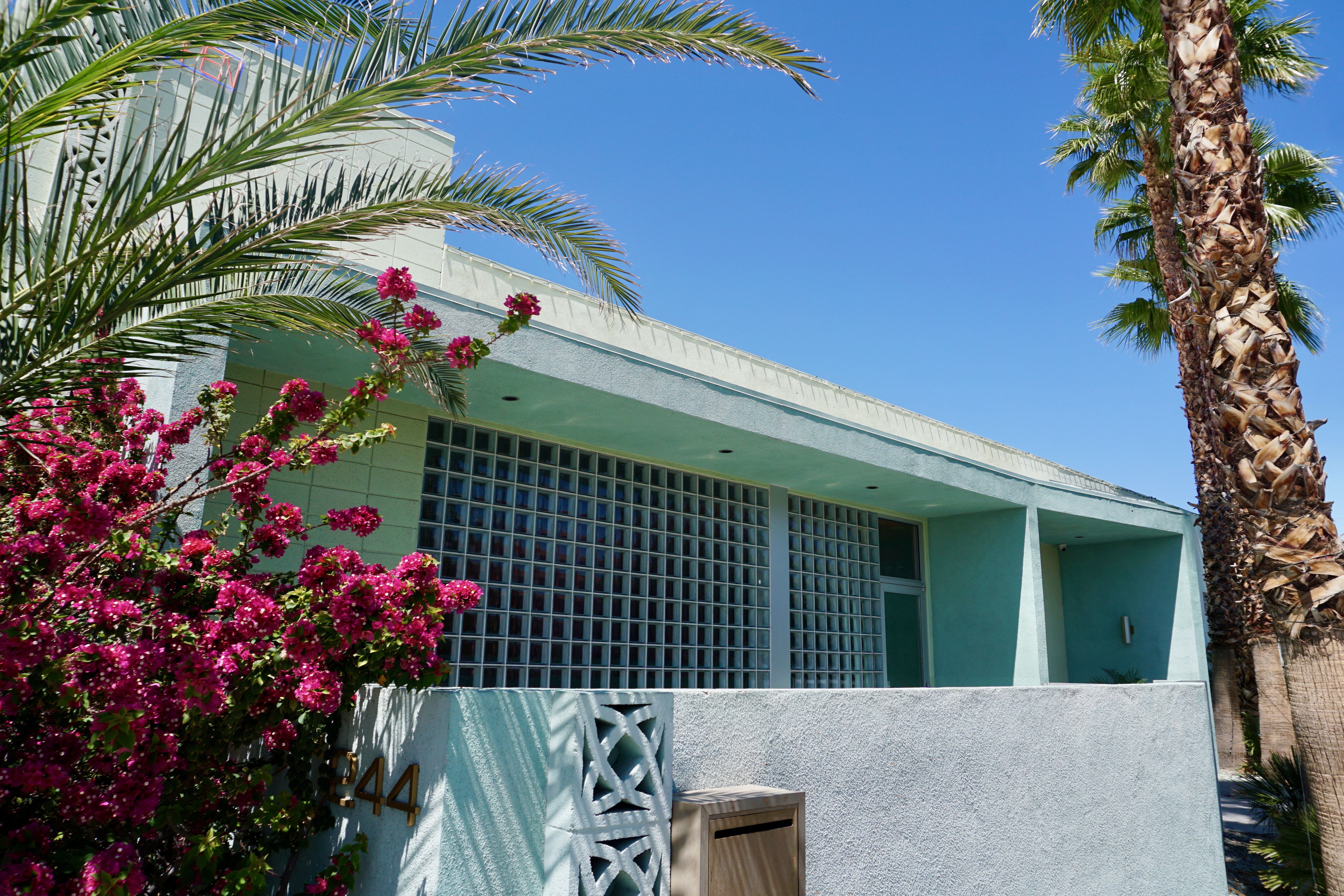
One motivation for visiting Palms Springs was its famous Mid-Century Modern architecture.
It’s as essential to the landscape as palm trees and mountain ranges.
The only other place I’ve seen buildings like this defunct ice cream parlor is Miami Beach.
The pastel colors and block glass also remind me of Southeastern Florida.
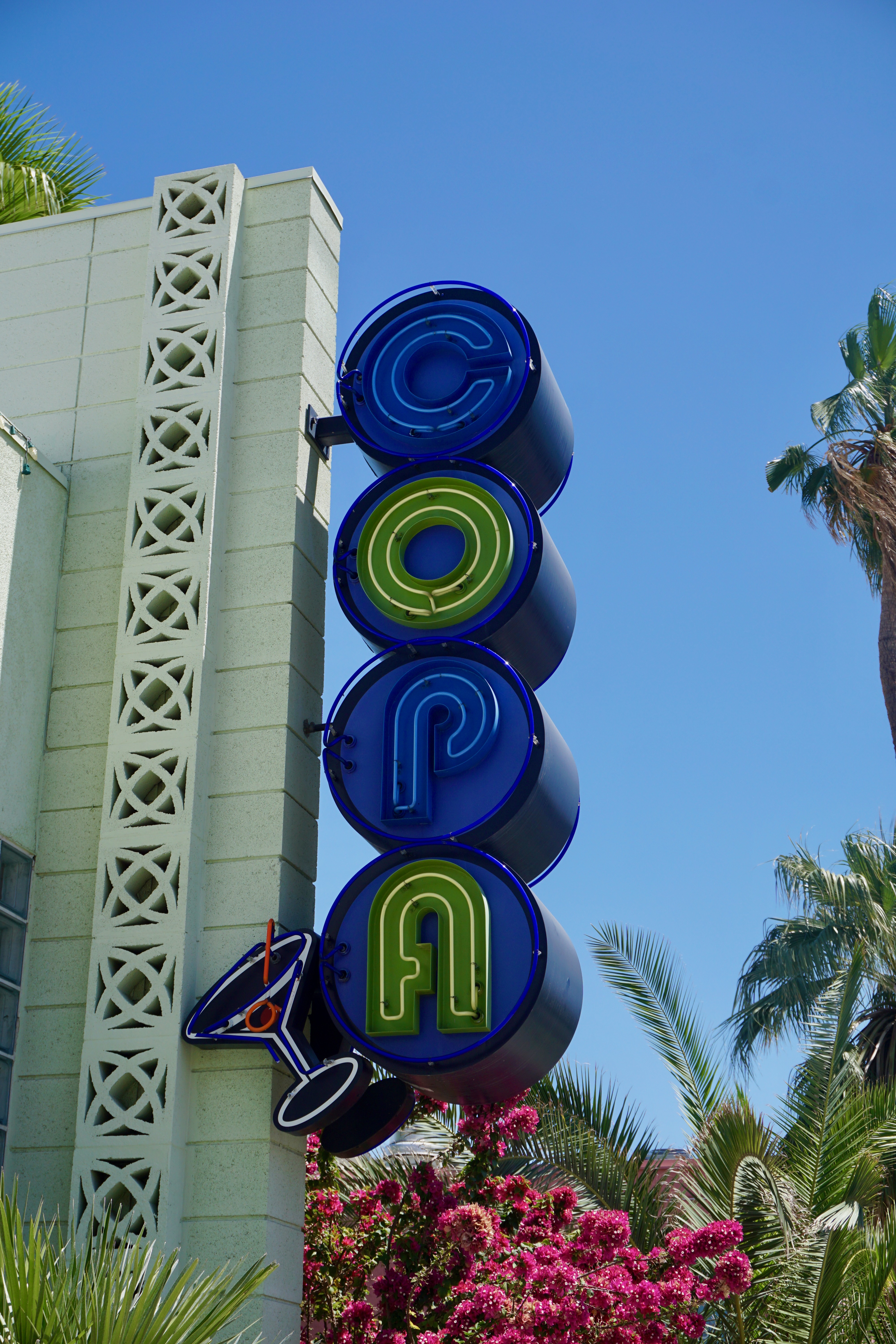
We stopped in a residential neighborhood to get some photos of the mountains; if we hadn’t, I never would have spotted this cool vintage-looking neon sign.
On the same block as the Copa above–another essential Mod-style pastel.
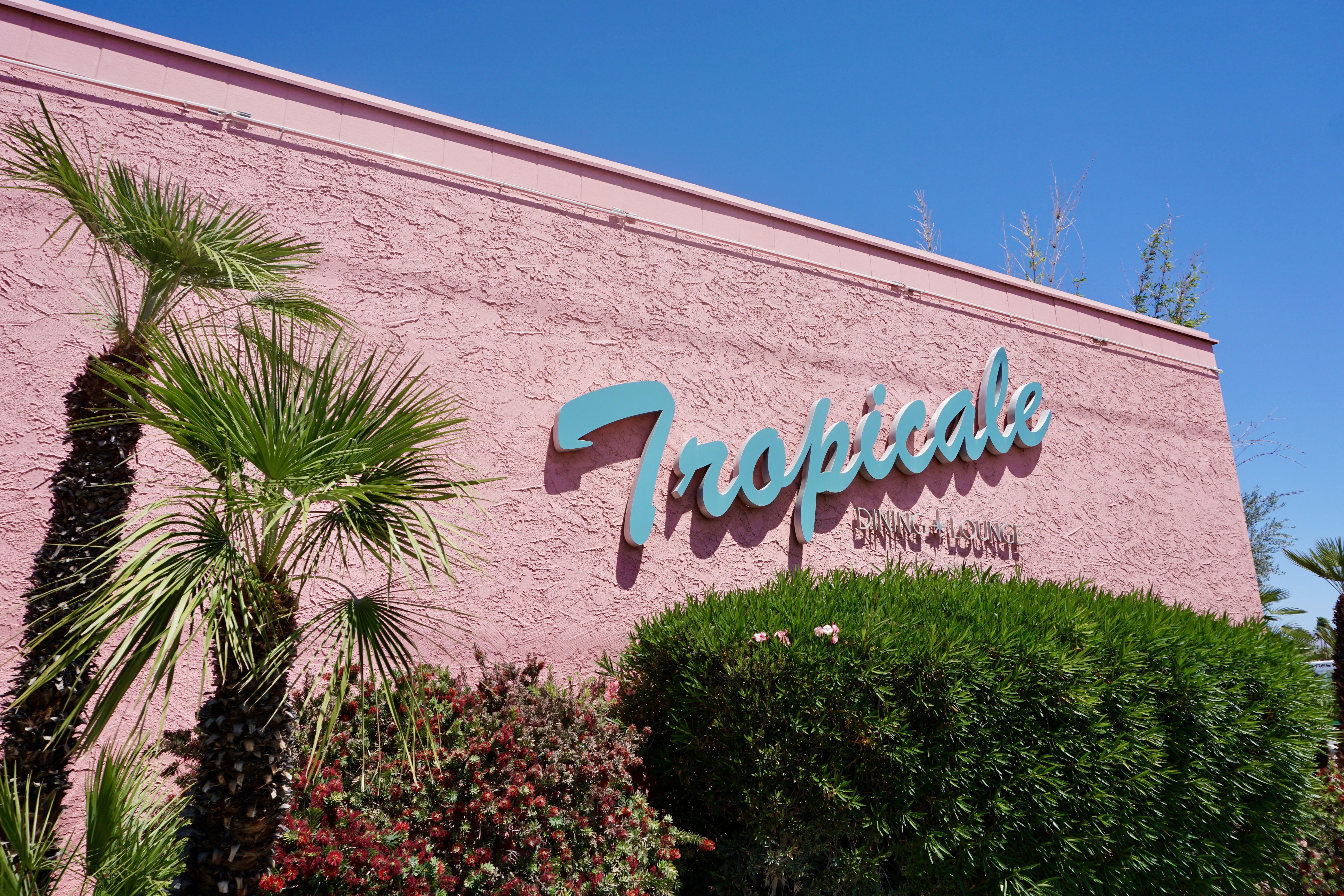
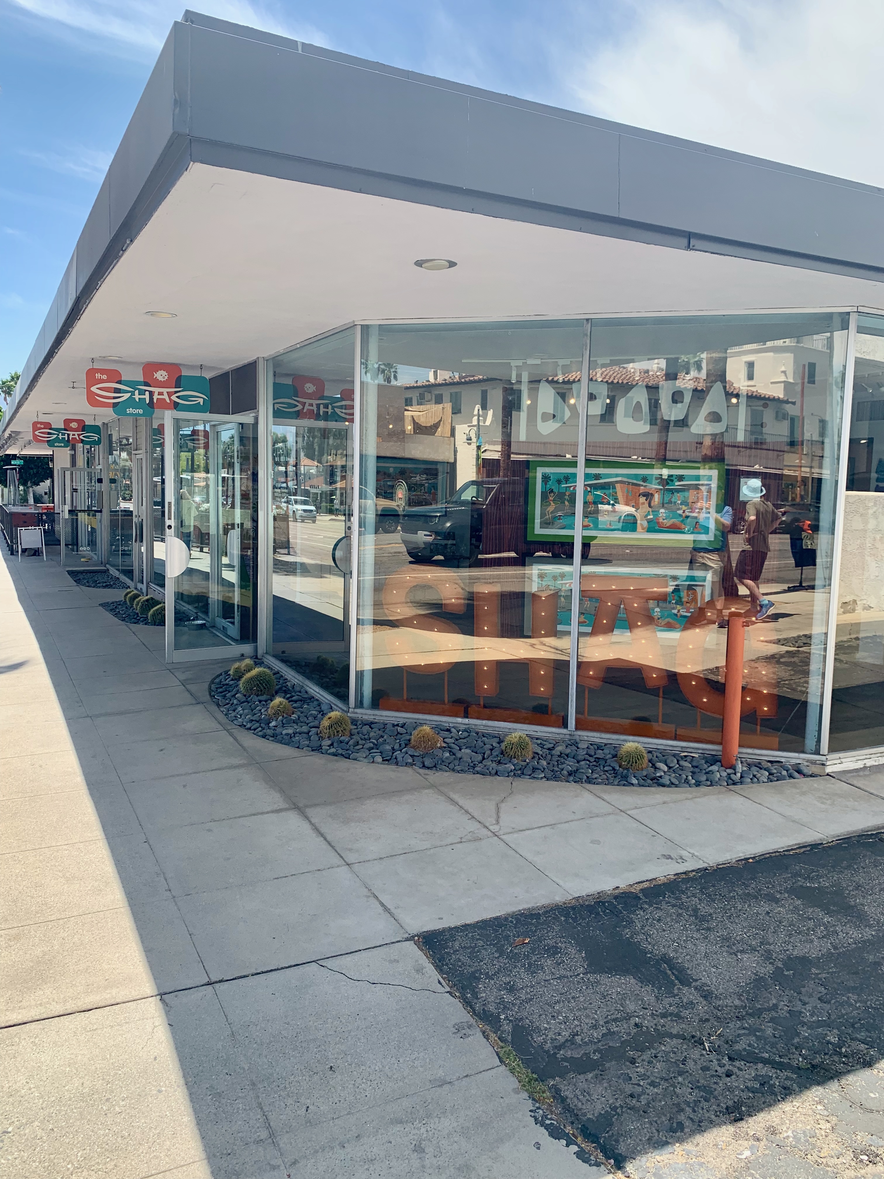
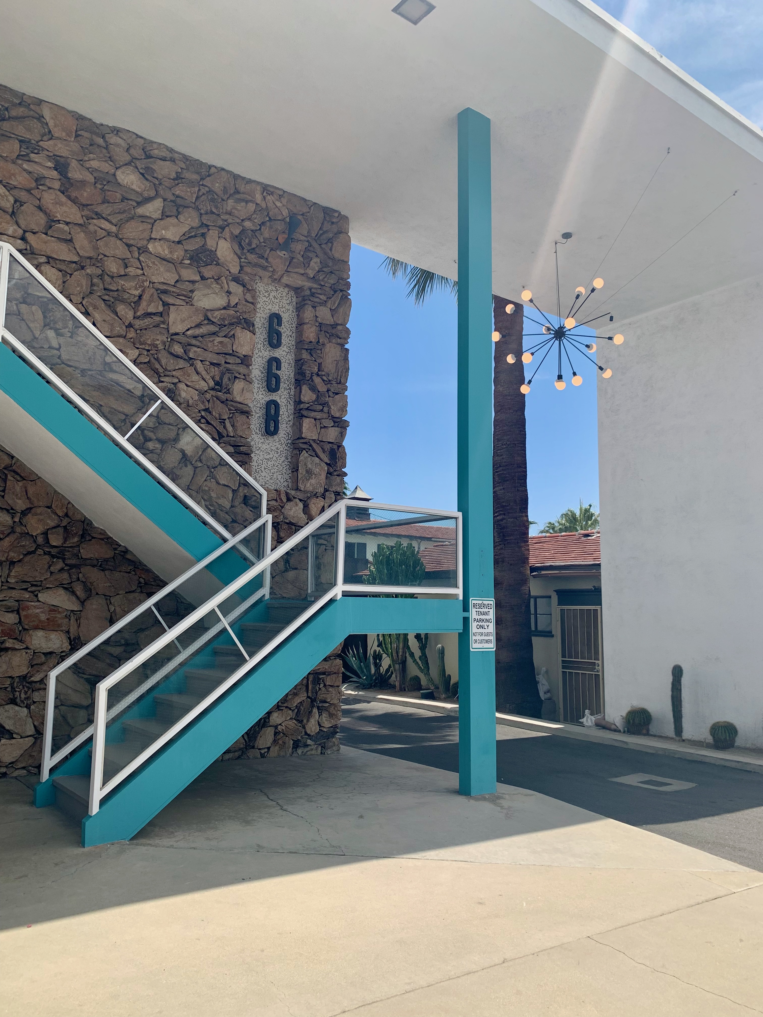
Although Downtown Palm Springs has its share of Mod buildings, the Uptown Design District feels more like totally stepping into a groovy past era.
When I think of “Shag” it’s the Carolina-style partner dance; on this coast, it refers to an artist.
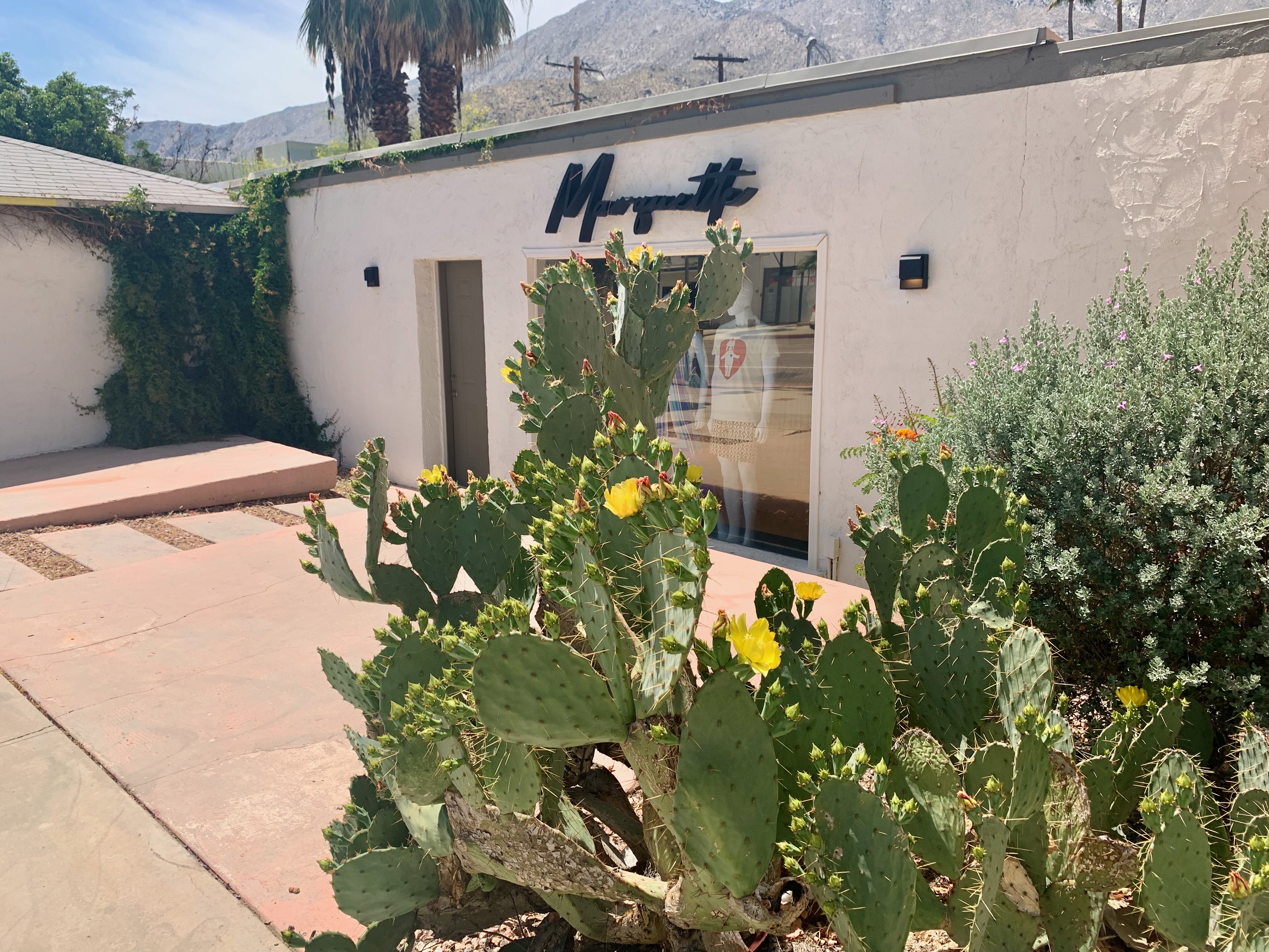
Facing North on Palm Canyon Drive in the Design District, which would not be complete without an art deco florist (or a row of cacti.)
Down the block from the florist–I should’ve just led the essay with this photo which is Palm Springs Mod in a nutshell.
Though not as aesthetically pleasing, this fulfills the same criteria as the above picture.
We bought a map to seek out Mod residences. Predictably, most where further away from the roads or camouflaged for privacy, but we did spot a few striking homes; check out the oversized front doors on this one.
The southern part of town tends to specialize in a more suburban kitsch take on the architectural style. While this shopping plaza isn’t strictly Mod, it did remind us of a kind of tableau one would see on the 1970s Wonder Woman TV series.
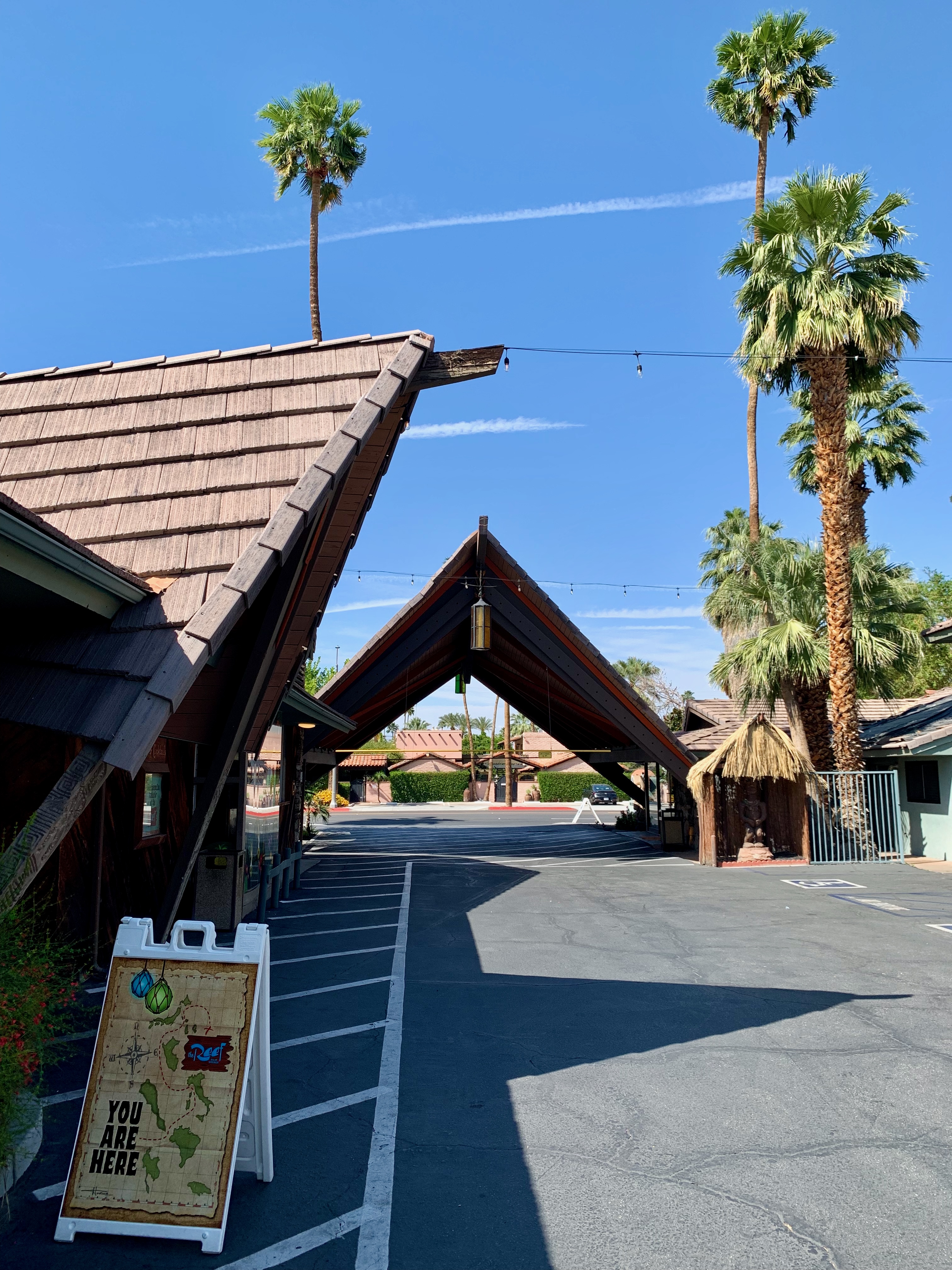
However, this resort complex is more the real Mod deal brimming with faux exotic splendor.
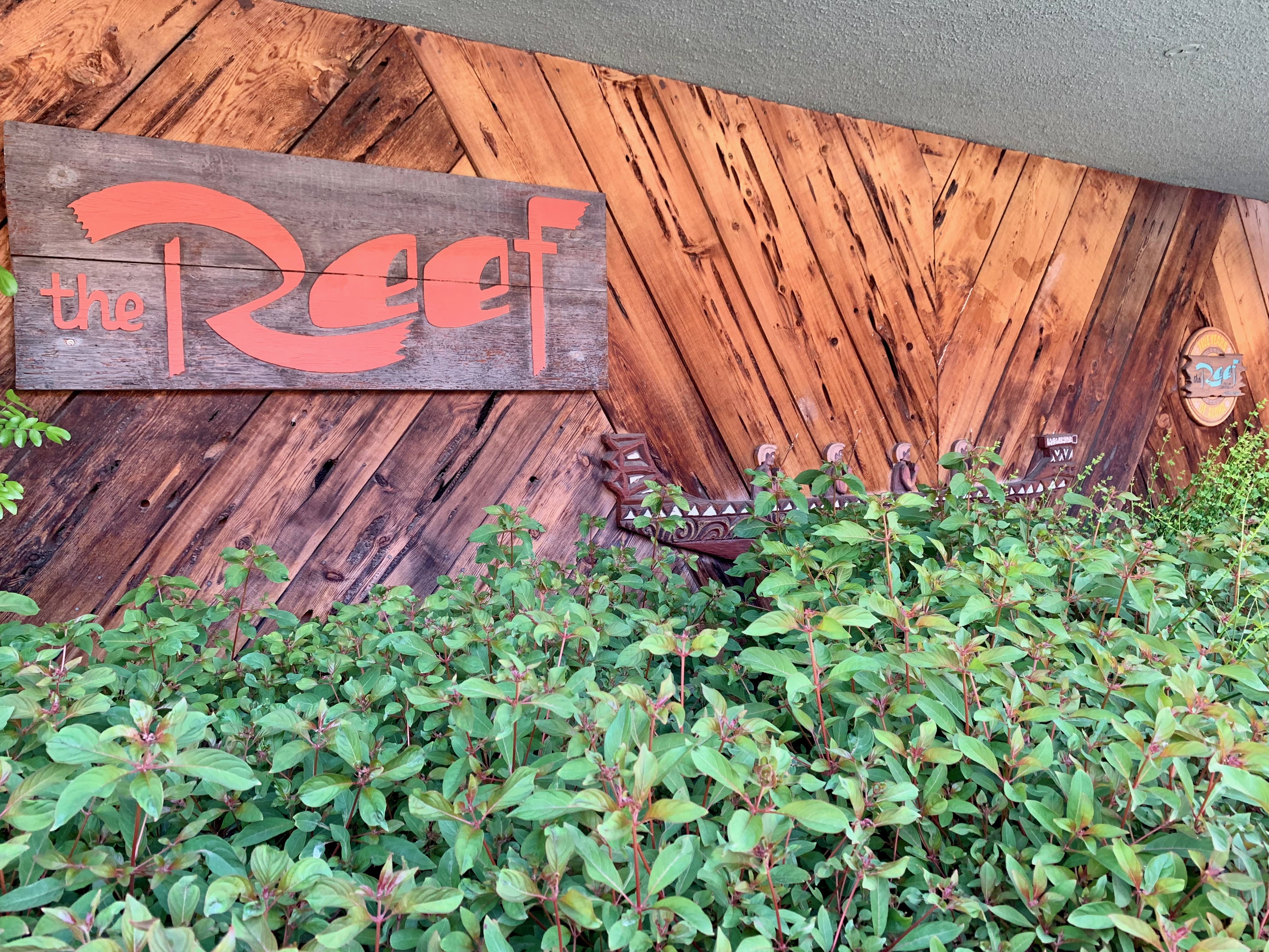
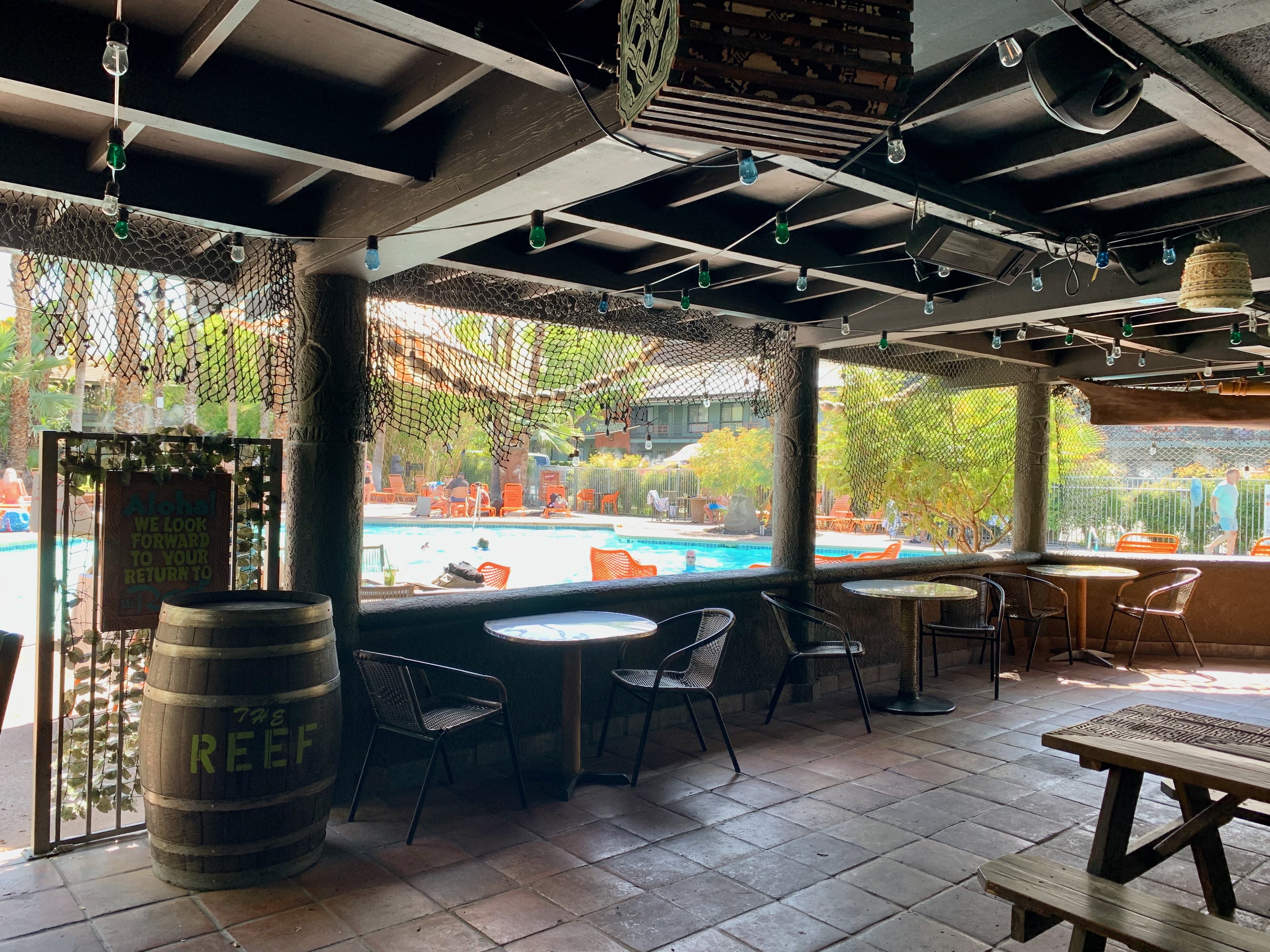
The Reef was one of two tiki bars we checked out. The other, Tonga Hut, is in Downtown and most notable for its neon sign.
The Reef’s patio which faces the adjacent resort’s pool. Lots of reggae on the soundsystem here.
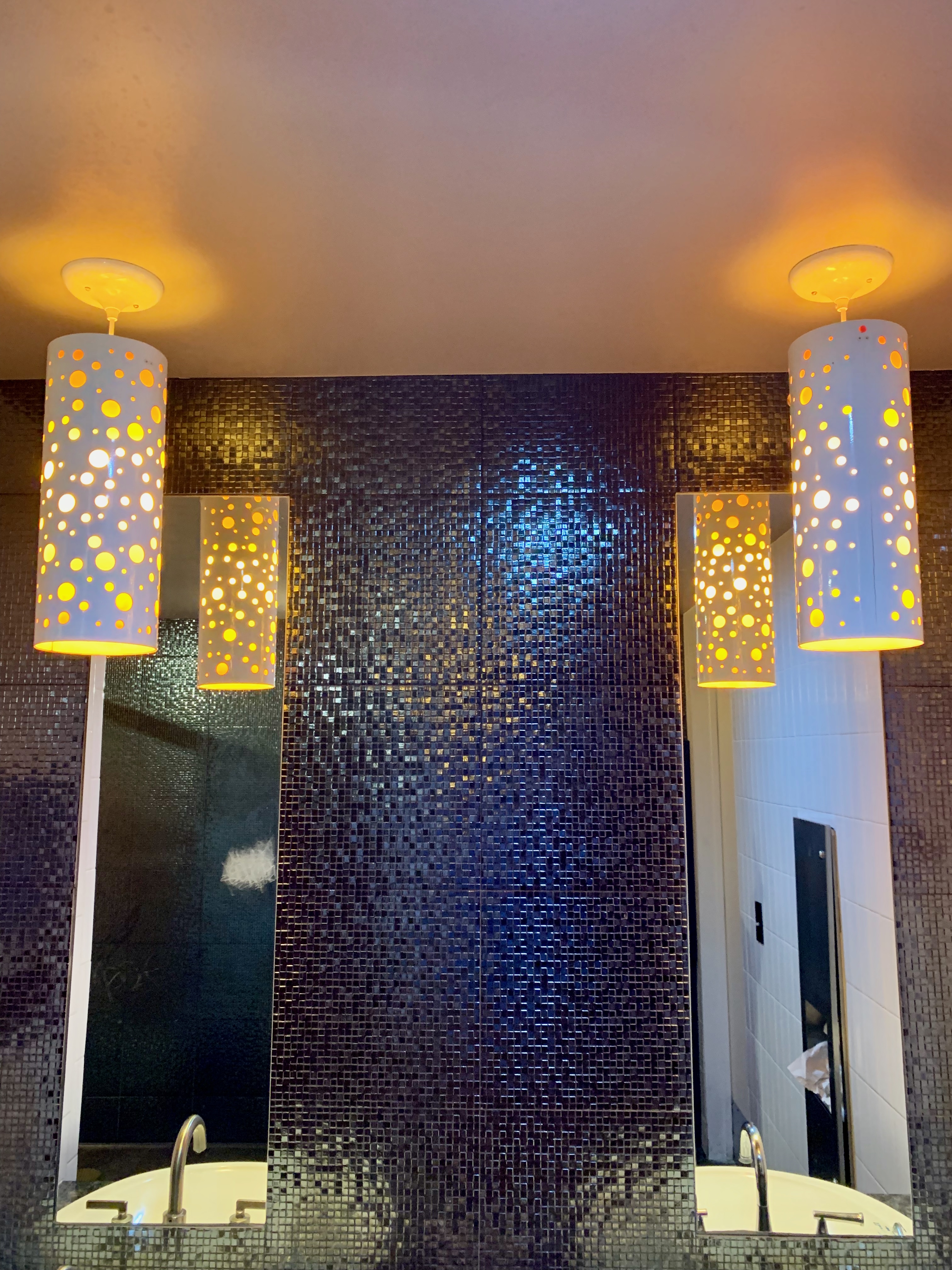
I couldn’t resist of shot of The Reef’s delectably retro (no matter how faux) bathroom lighting fixtures.
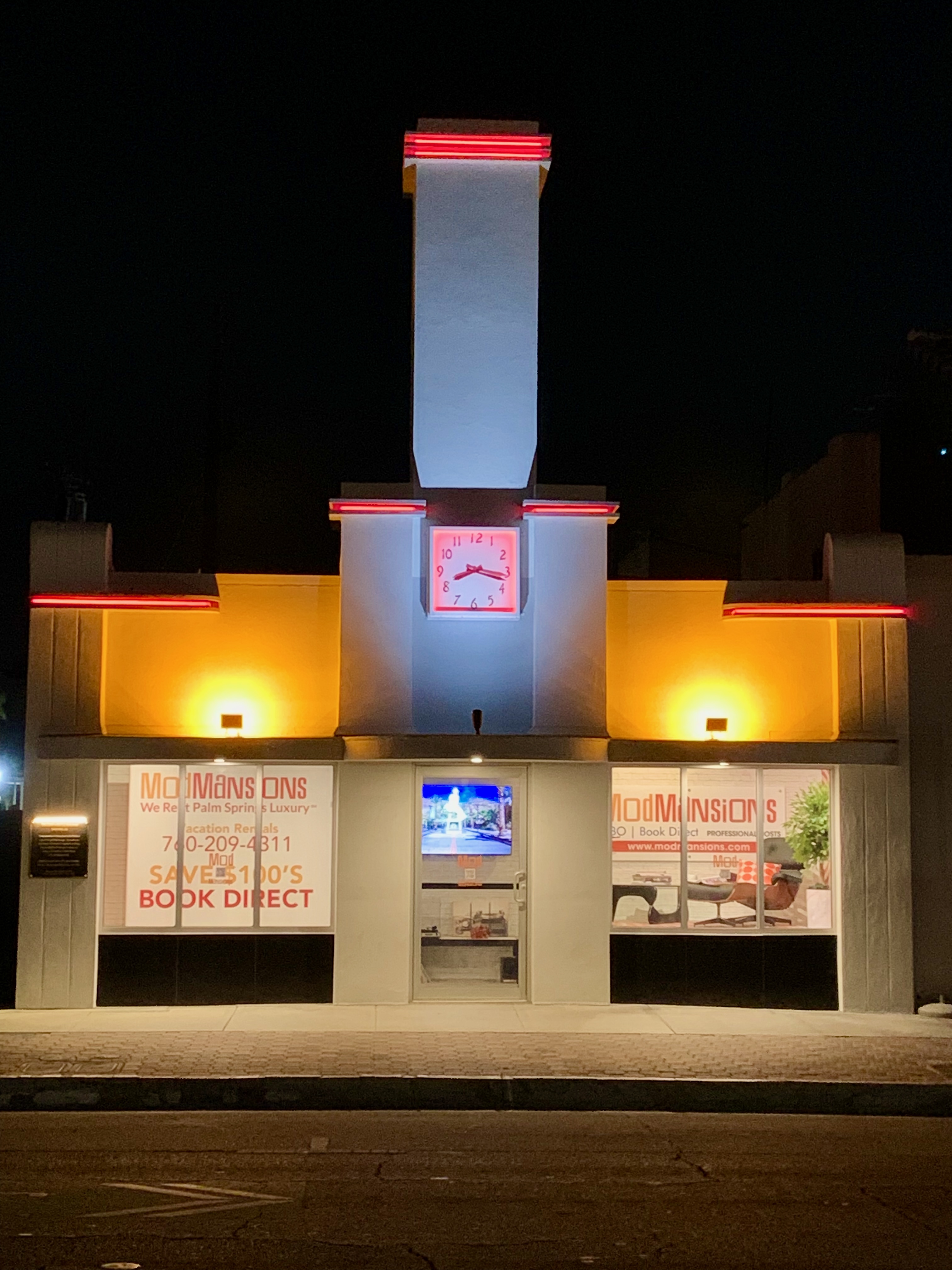
Back to Downtown after dark. If you’re looking for a “ModMansion”, what better place to find one than at this art deco wonder that almost could’ve been a vintage White Castle (or maybe a White Tower)?
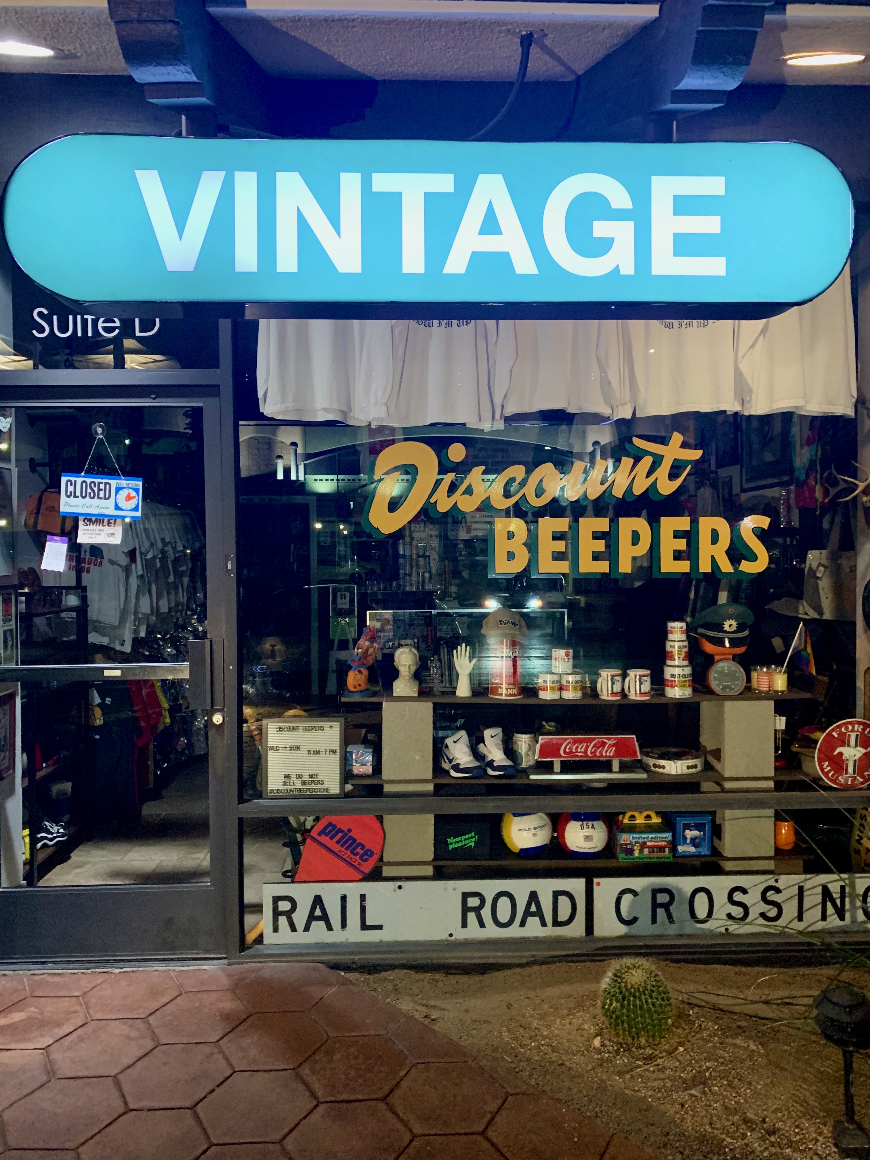
Not entirely Mod, but come on, I wasn’t not going to take a shot of this unusual establishment. Do people still want beepers (even at a discount price?)
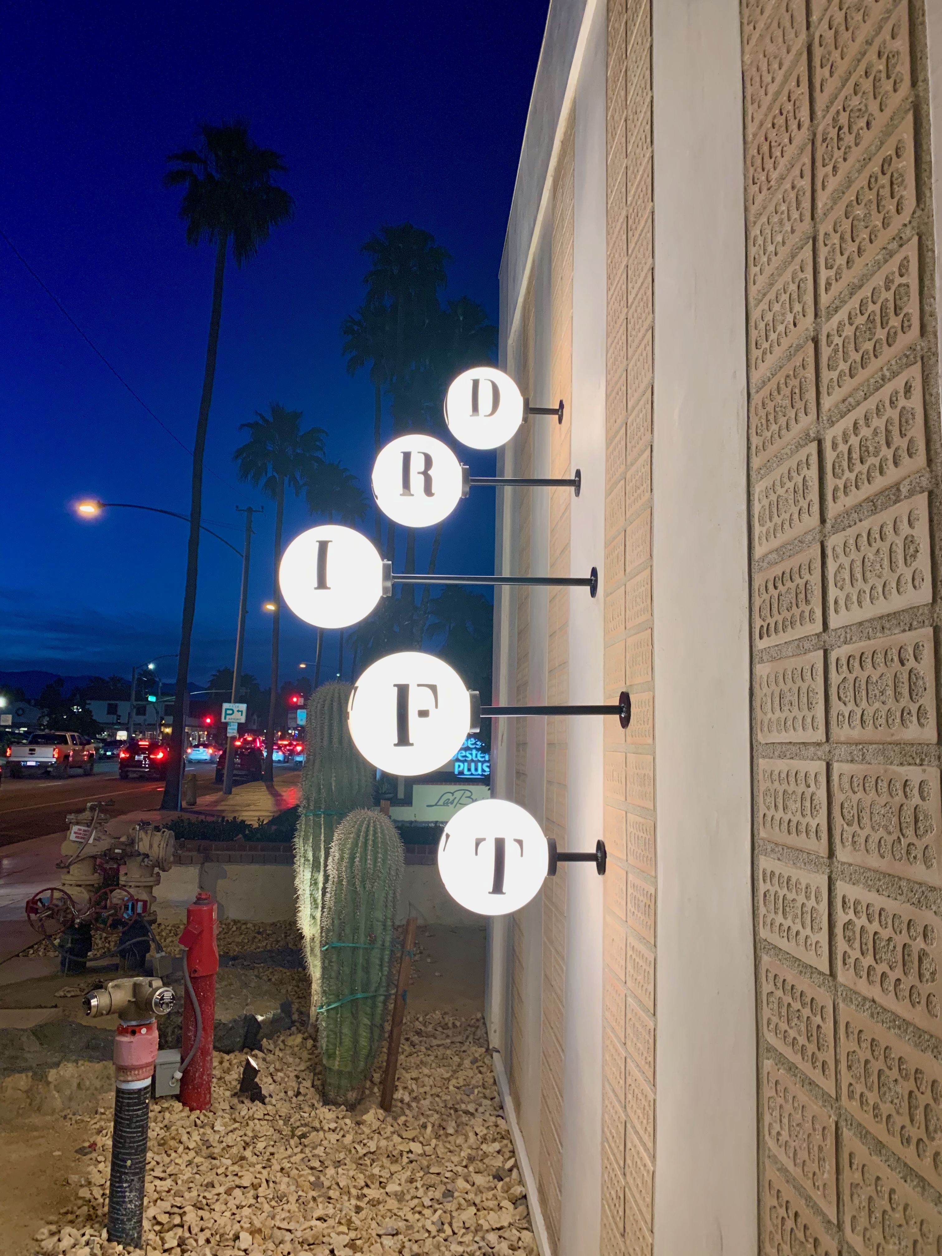
We end with this lovely hotel sign on Indian Canyon Road just after sunset. The globe lights, their whimsical placement, the font, the brick-like wall textures, the cacti–together, they practically sum up what I love about Palm Springs Mod (and the town in general.)
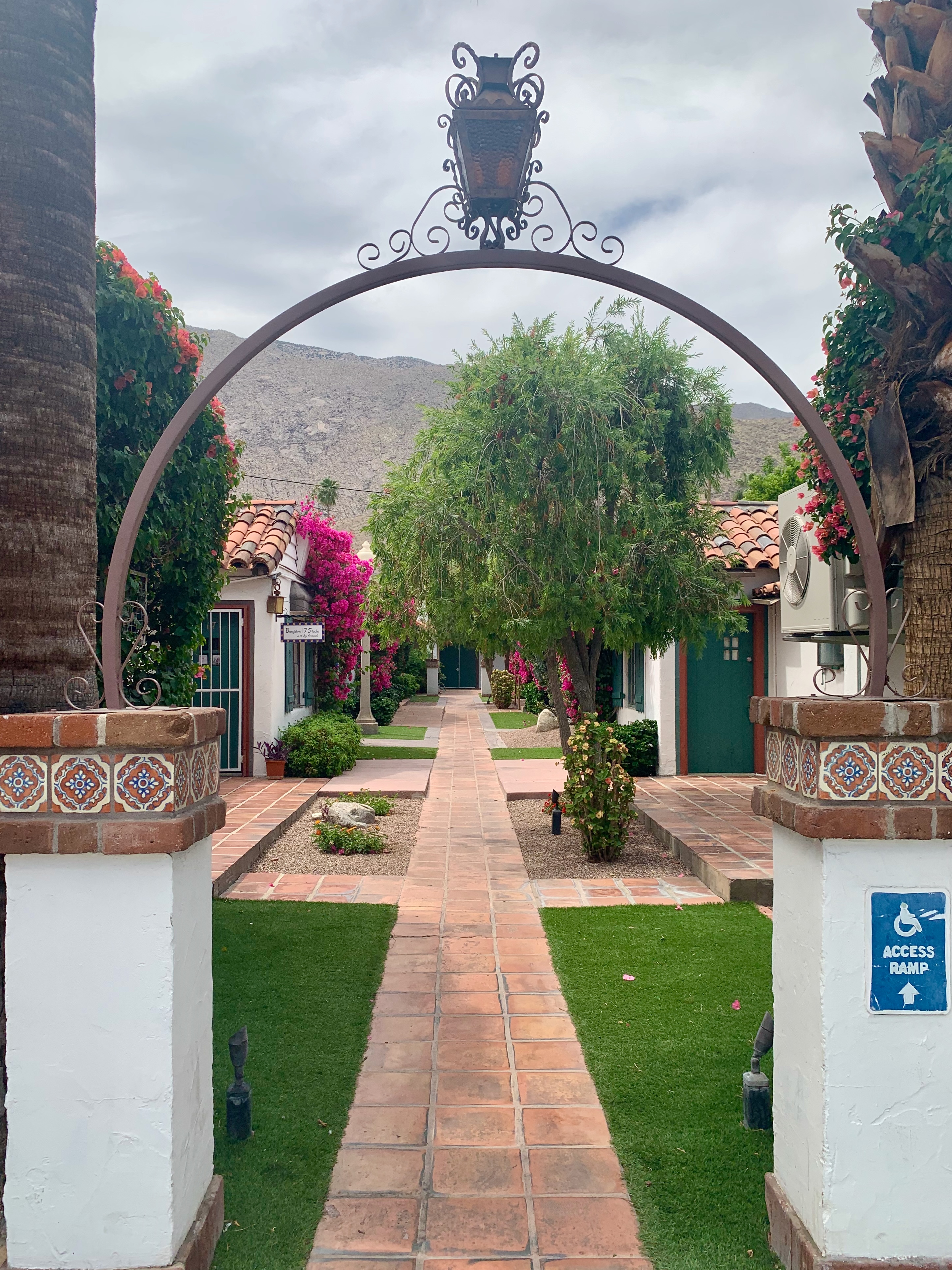
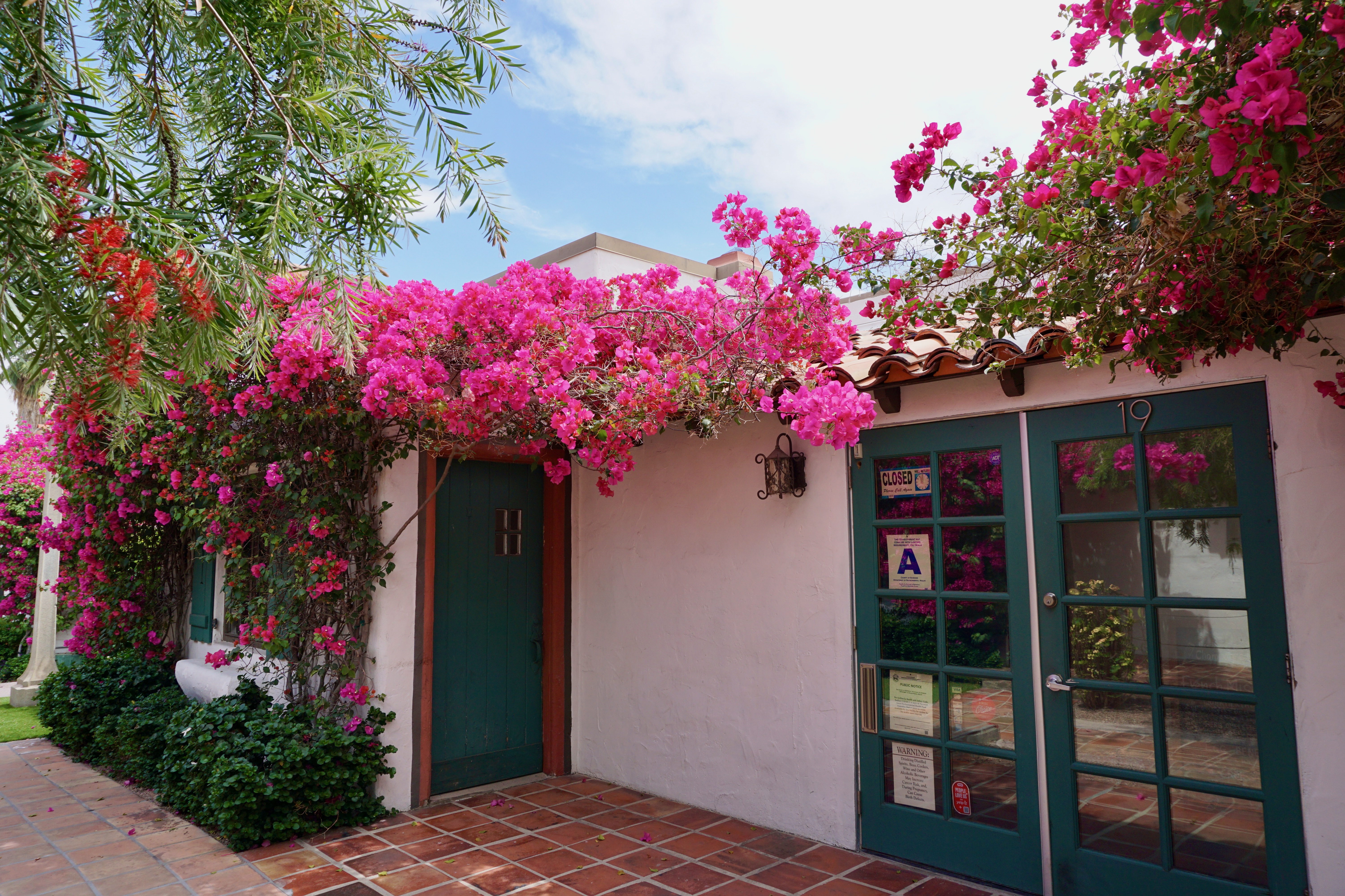
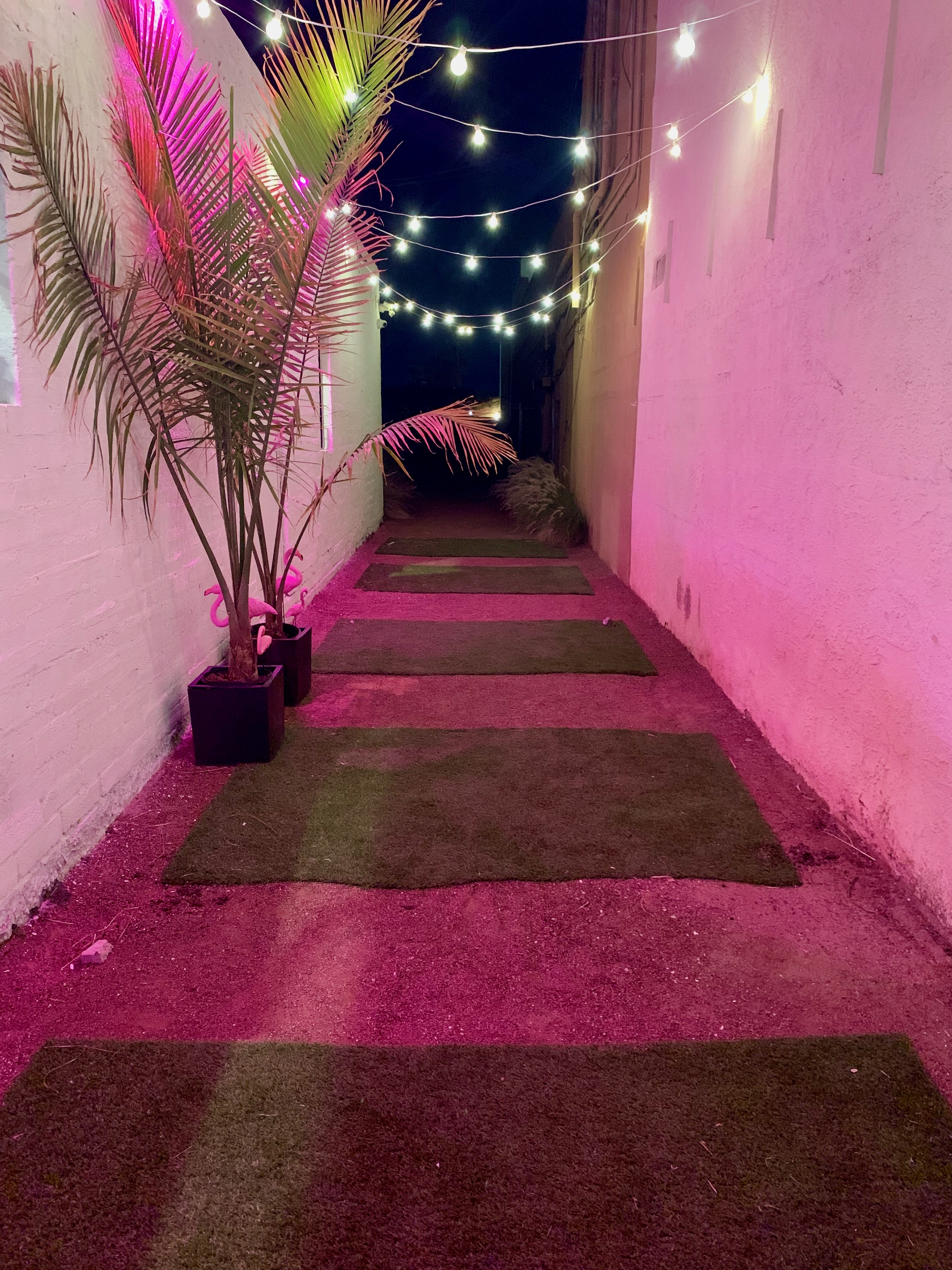
In my last photo essay, I alluded to the unexpected passageways one tends to find in Palm Springs.
While not fully “hidden”, this courtyard in La Plaza is the kind of place one is more likely to stumble upon than actively seek out (or at least this was the case for me.)
Built in 1936, La Plaza was one of the earliest outdoor shopping centers although it doesn’t really resemble what we think of when hearing that term today.
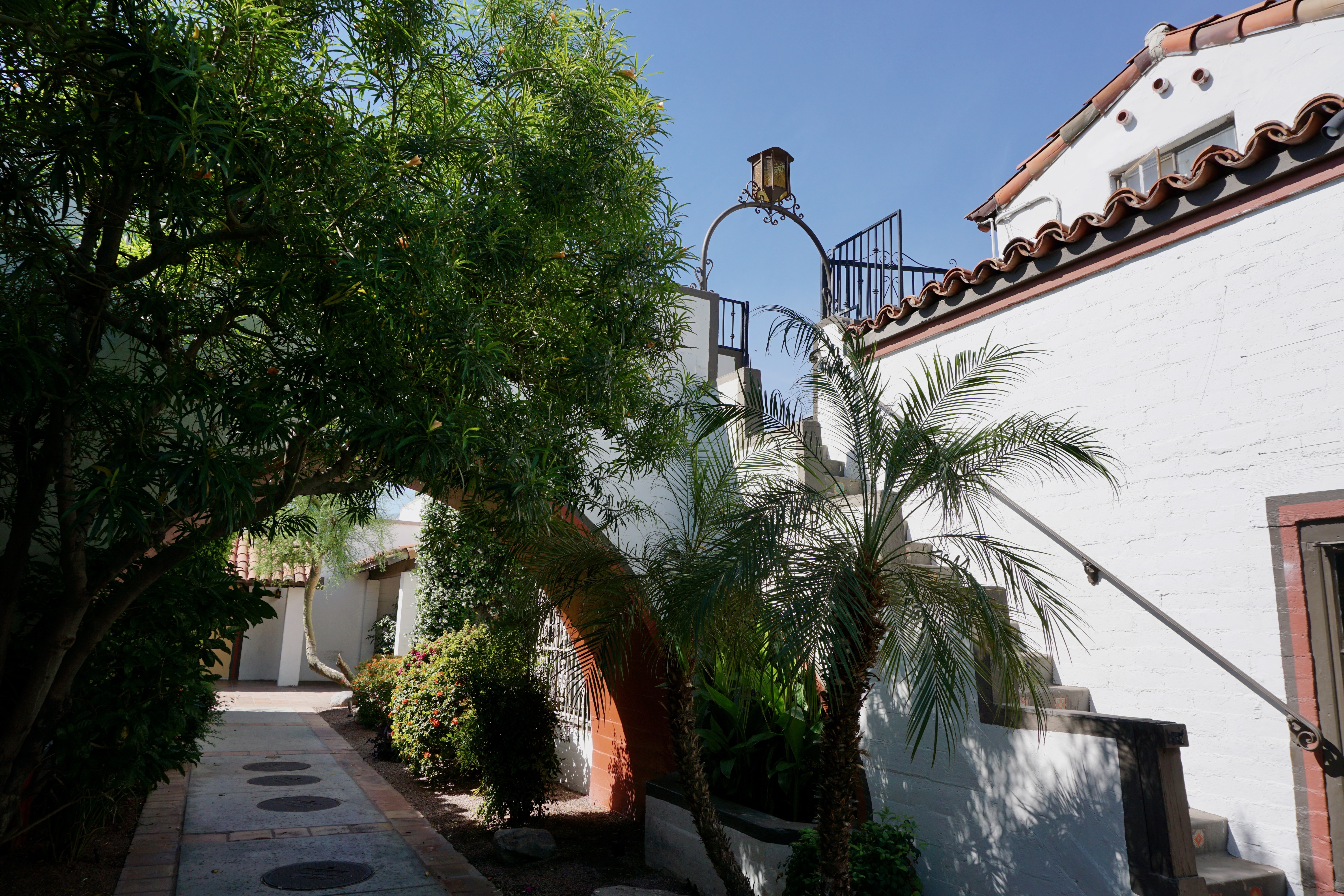
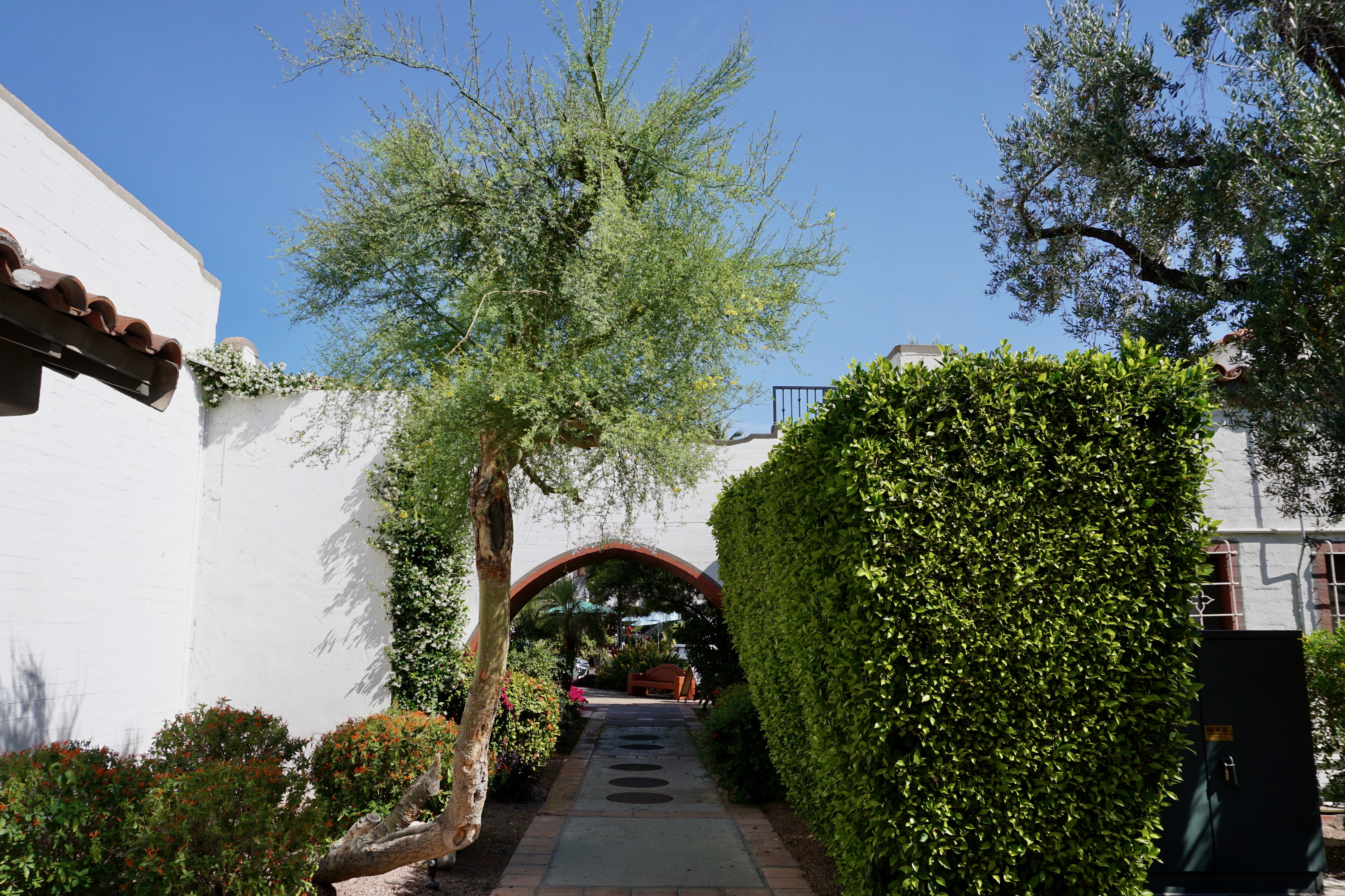
While some of La Plaza is street-facing (particularly the titular block linking Palm Canyon and Indian Canyon Drives), I was more fascinated by the interior section of its southern half.
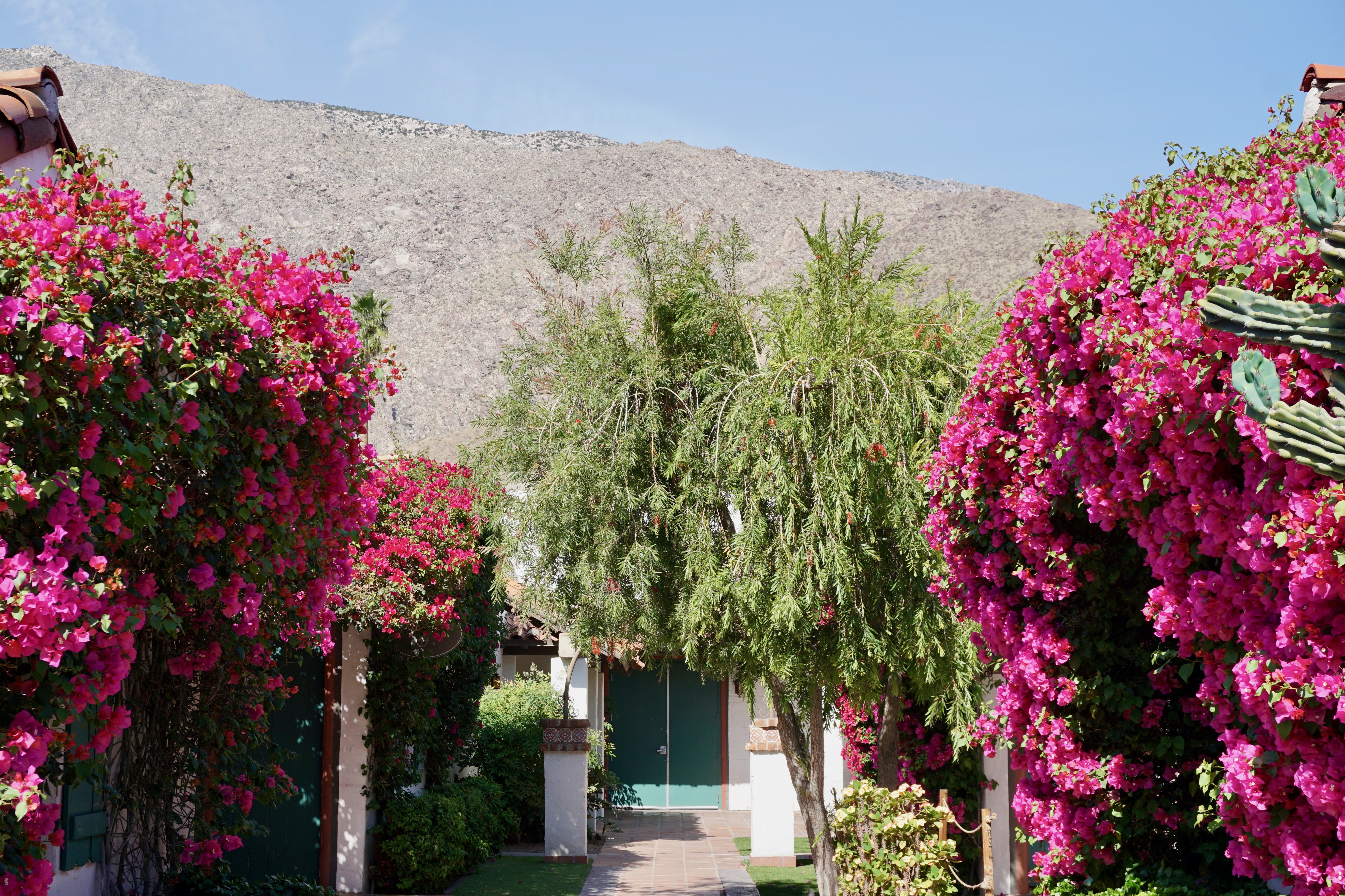
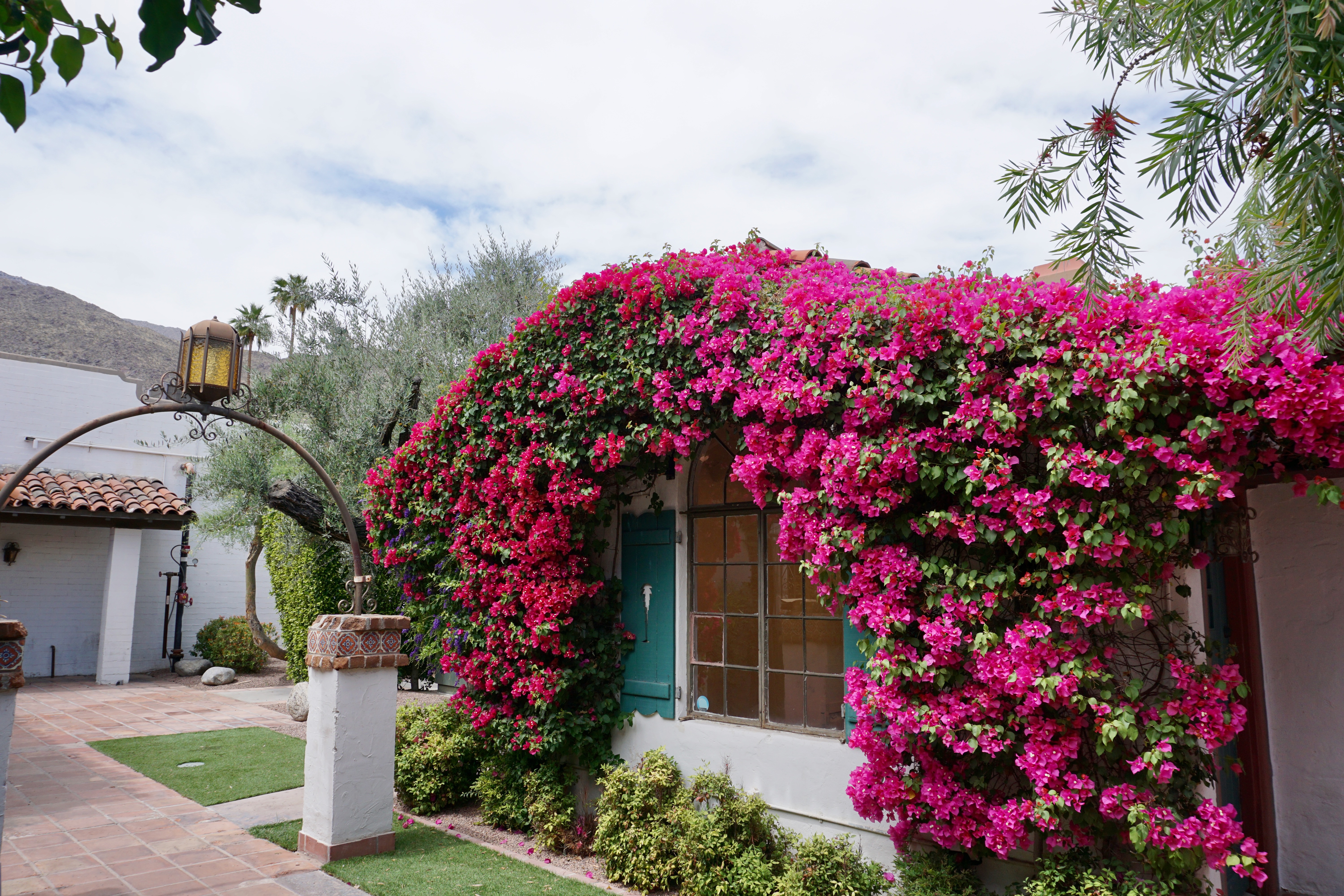
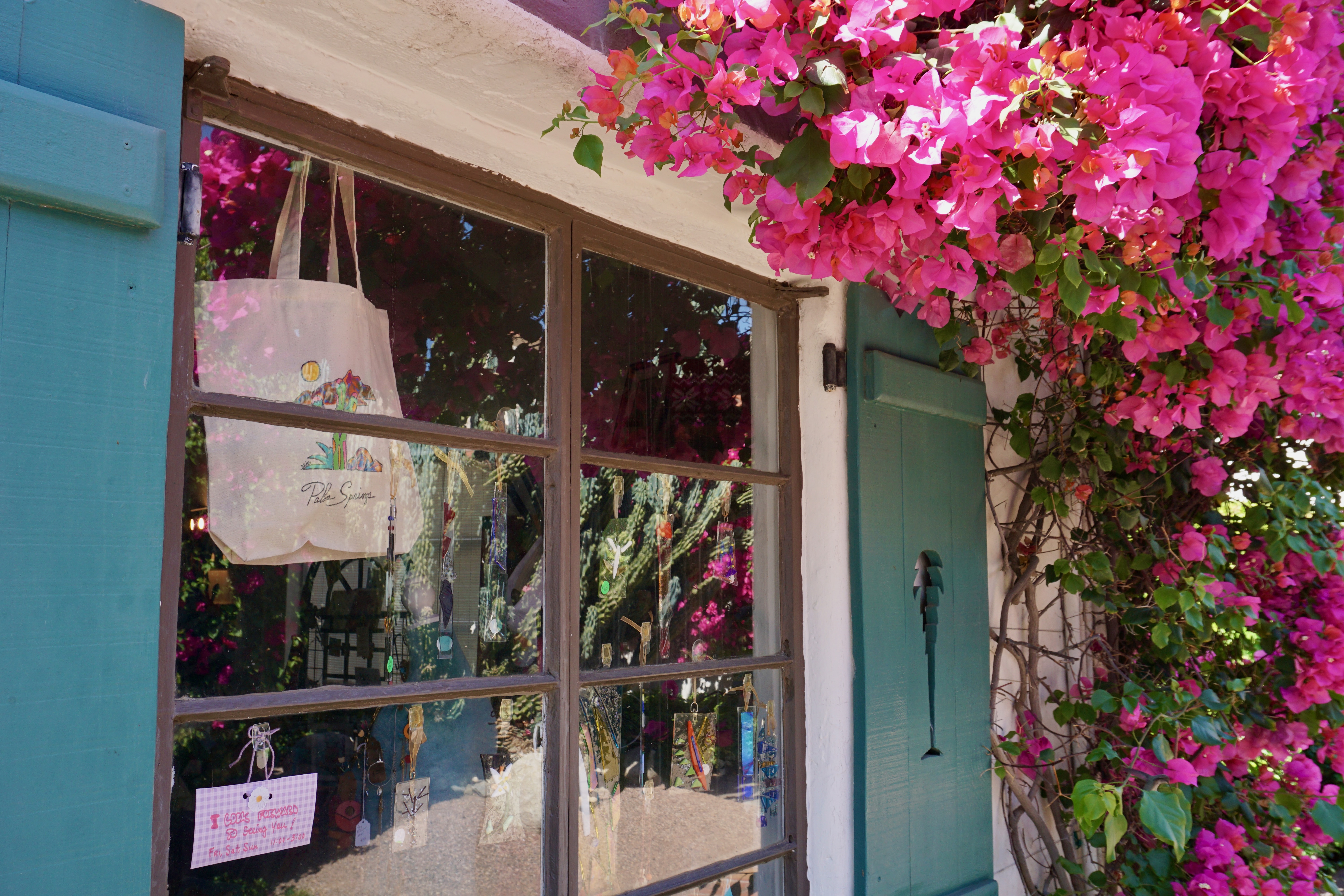
Along this corridor sits both commercial businesses and residences housed in white stucco buildings flanked by cascading pink flowers.
No chains at La Plaza; only homespun establishments.
Perhaps its most distinctive architectural features are these pine green, cut-out palm shutters.
Walking through here is like traveling back in time to a set from a classic Hollywood film or at least Ann Miller’s art-deco apartment complex in Mulholland Drive.
The L-shaped corridor as seen from its entrance opposite from the one in this essay’s first photo.
Walking along the street-facing section of La Plaza itself one can’t help but notice this giant rooster parked near L’Atelier Café.
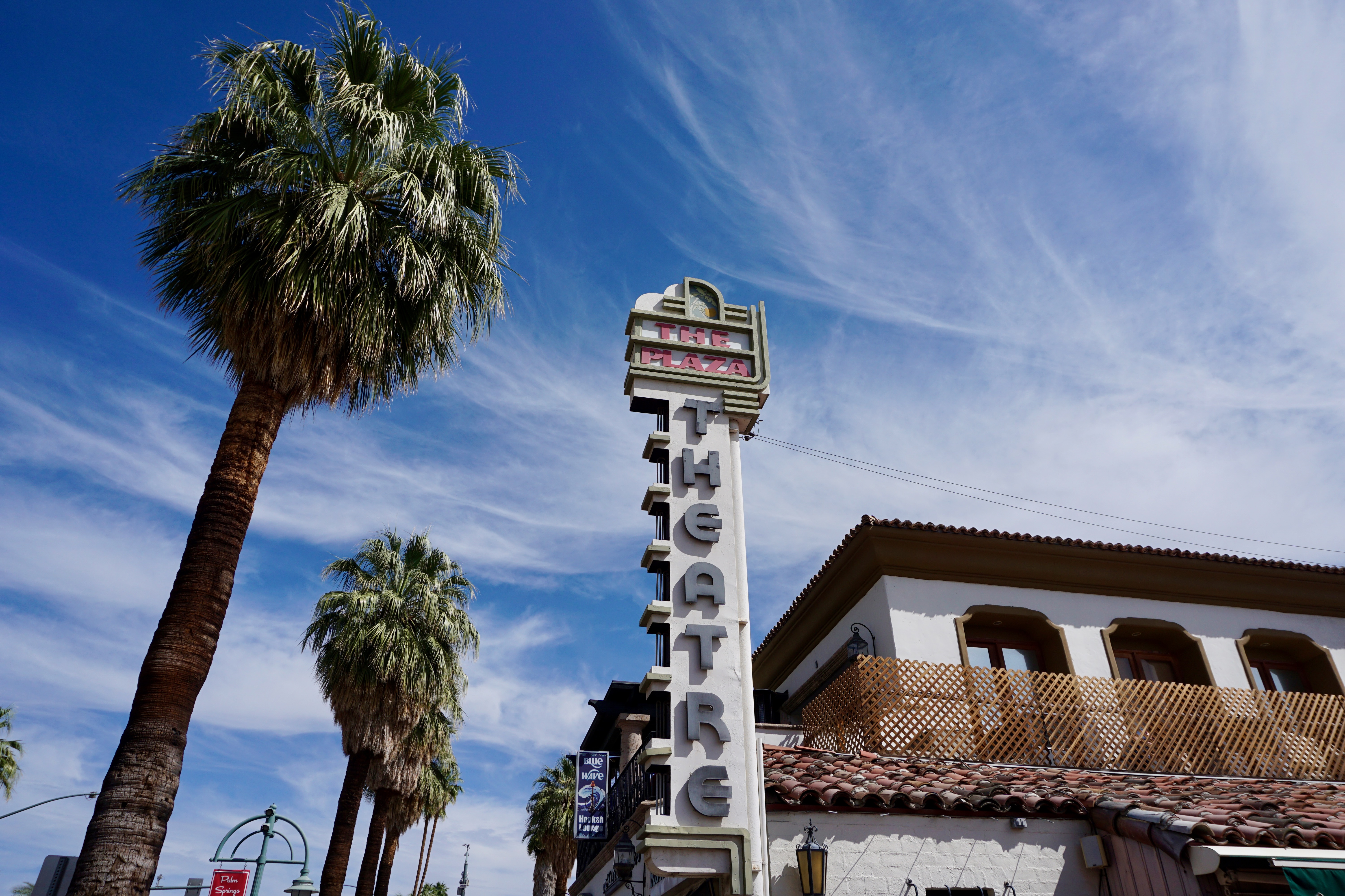
Near the northern half of La Plaza sits The Plaza Theatre, which is currently closed for renovations.
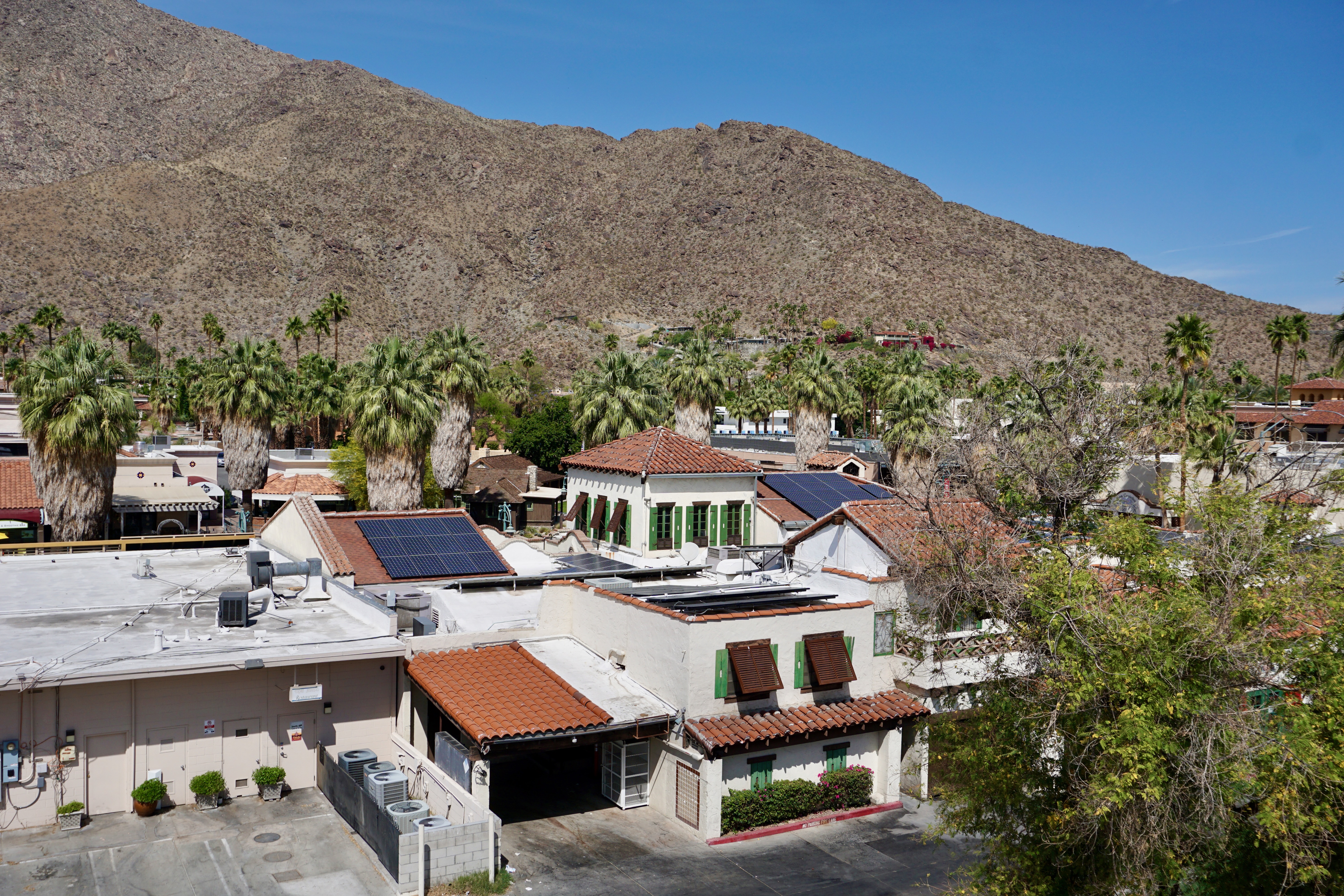
A partial birds-eye view of La Plaza from the top of an adjacent parking garage–those shutters are a dead giveaway.
Last month, I took my first ever trip to Palm Springs, California; it was also my first visit to the state in over 20 years.
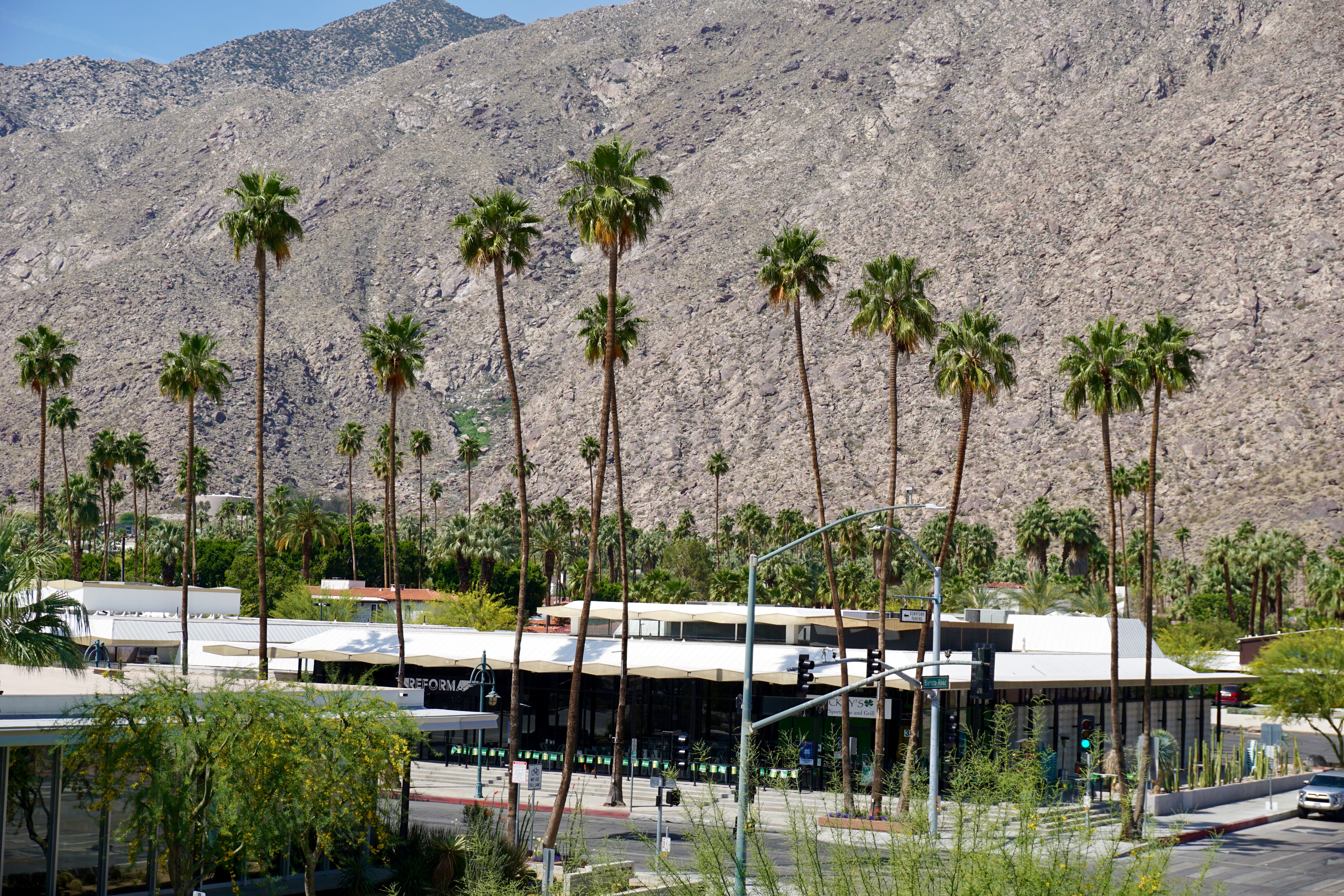
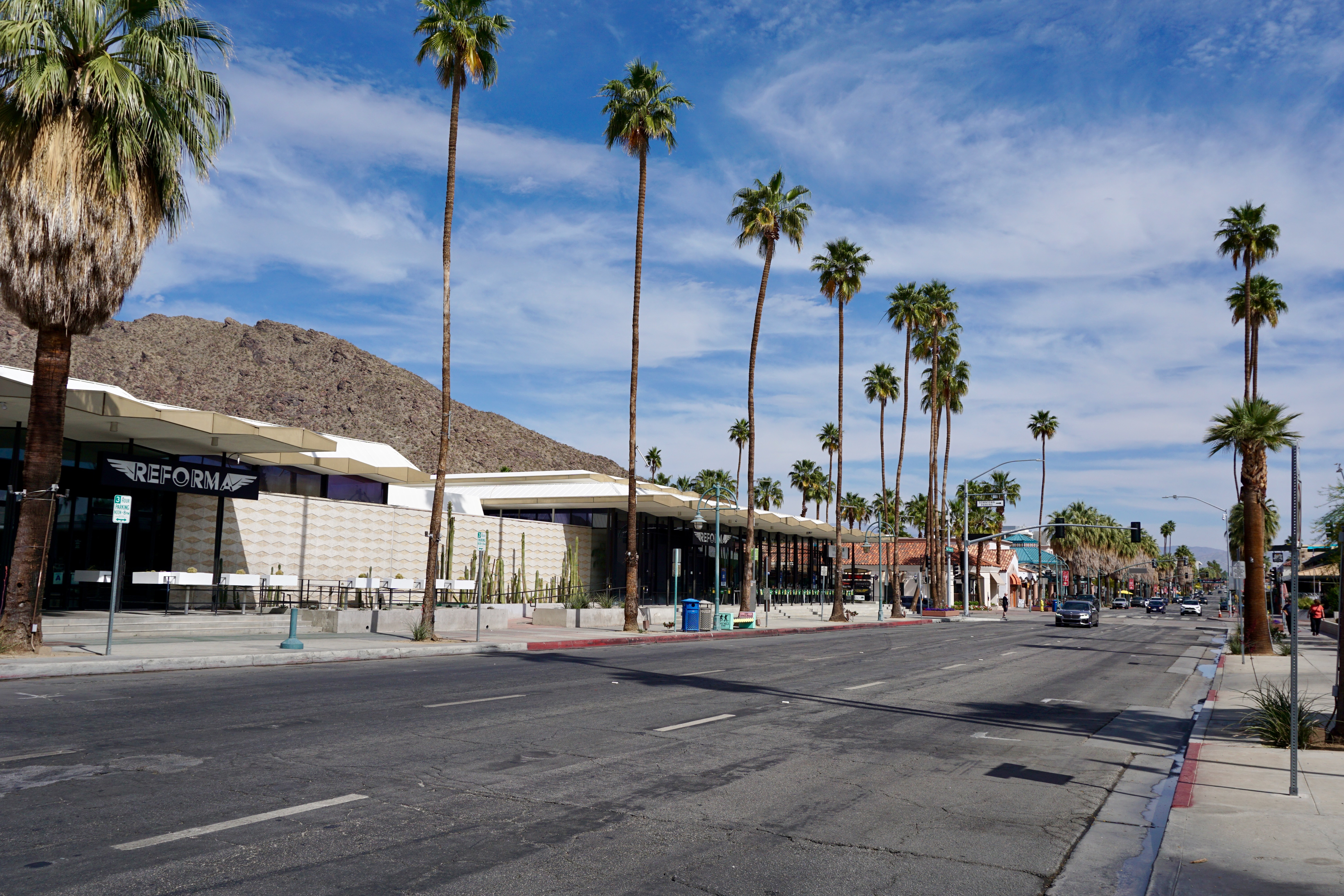
The city lives up to its name, although I wasn’t entirely expecting the mountain range right up against its Western border.
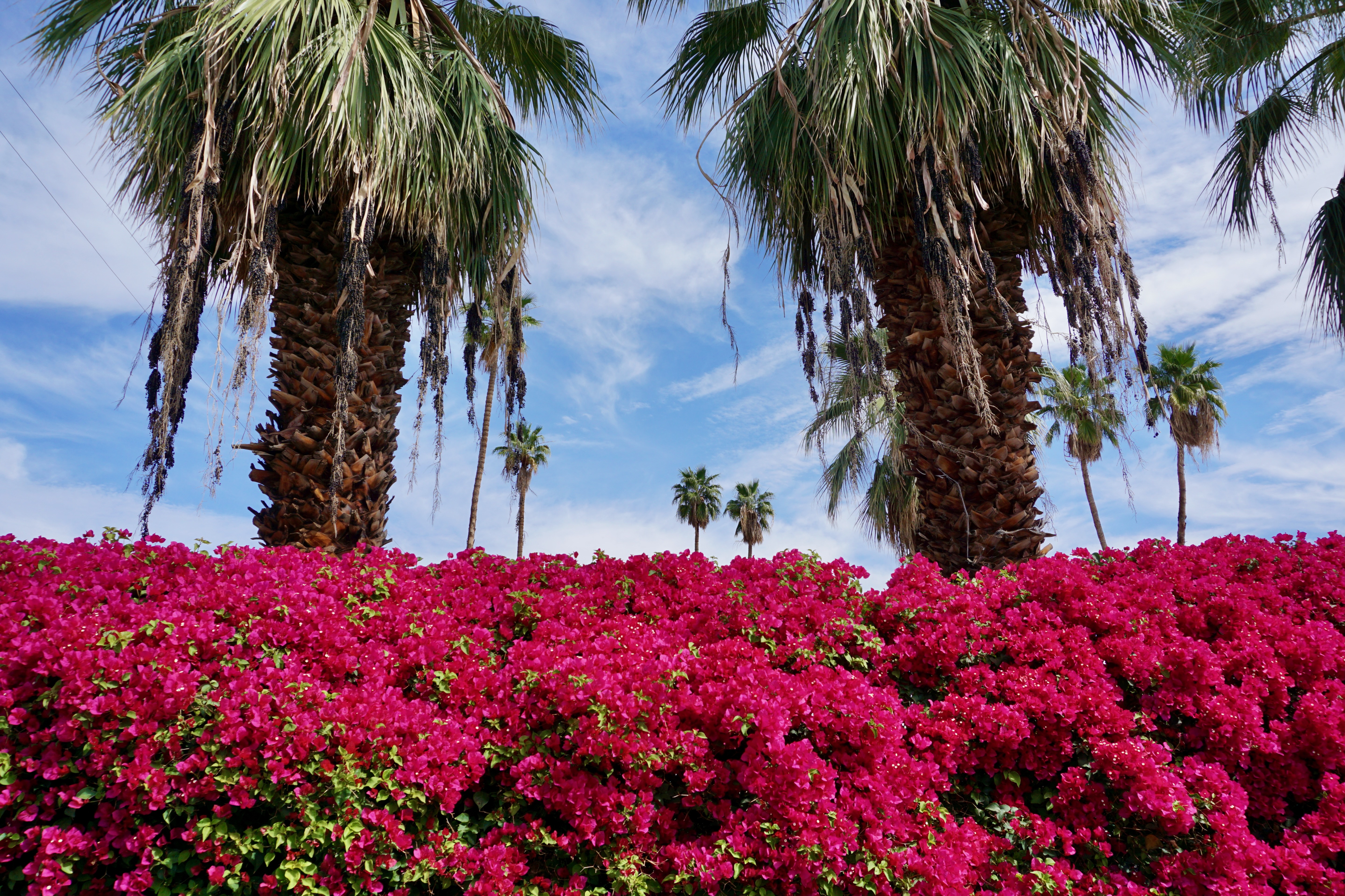
I was delighted to see bright pink bougainvillea of the type I’ve only previously encountered in Caribbean locales such as Turks and Caicos.
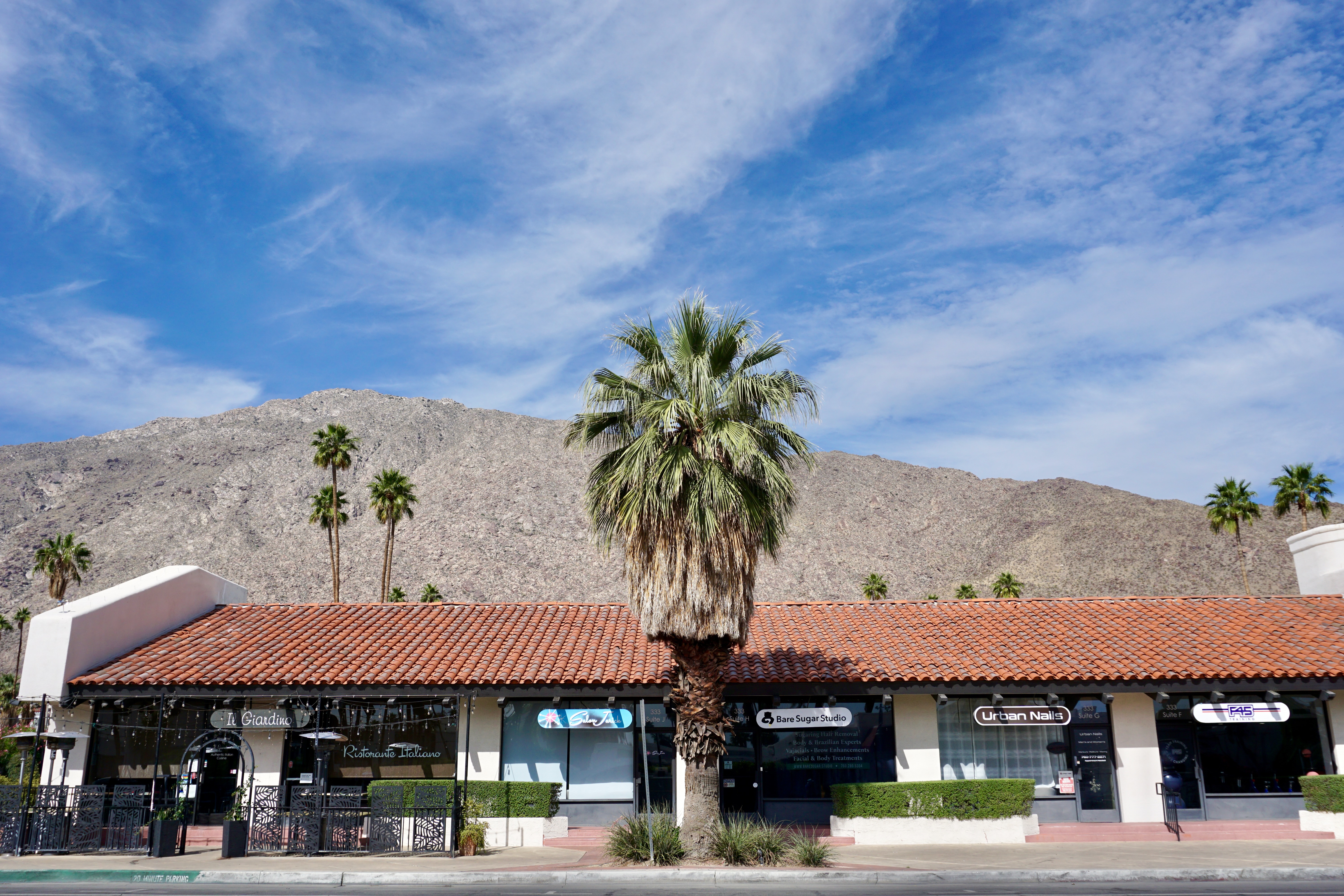
The city’s downtown has two main streets running parallel; this one is Palm Canyon Drive where a majority of the shops and restaurants are.
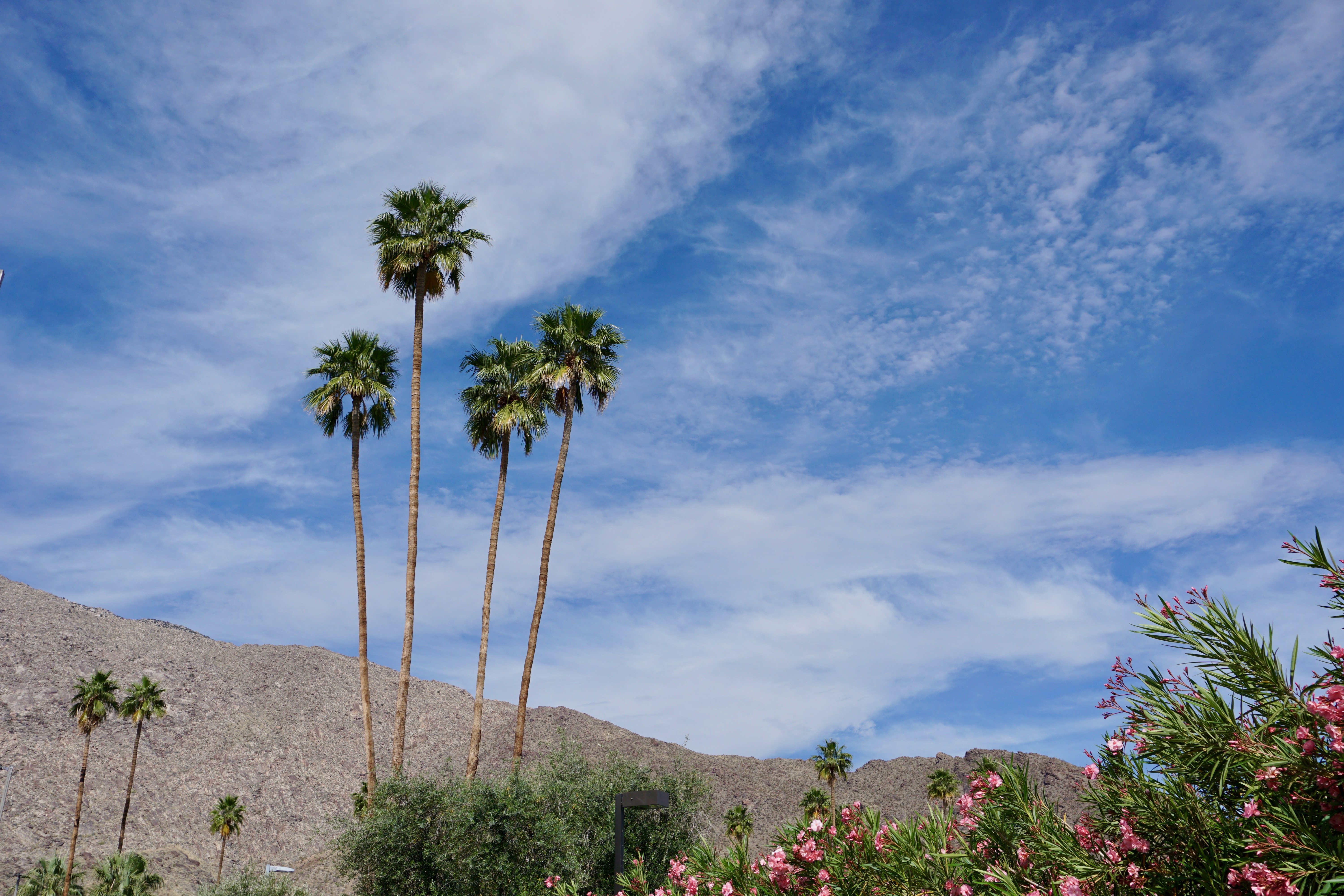
The central part of Palm Canyon Drive is dotted with giant, skirted palms.
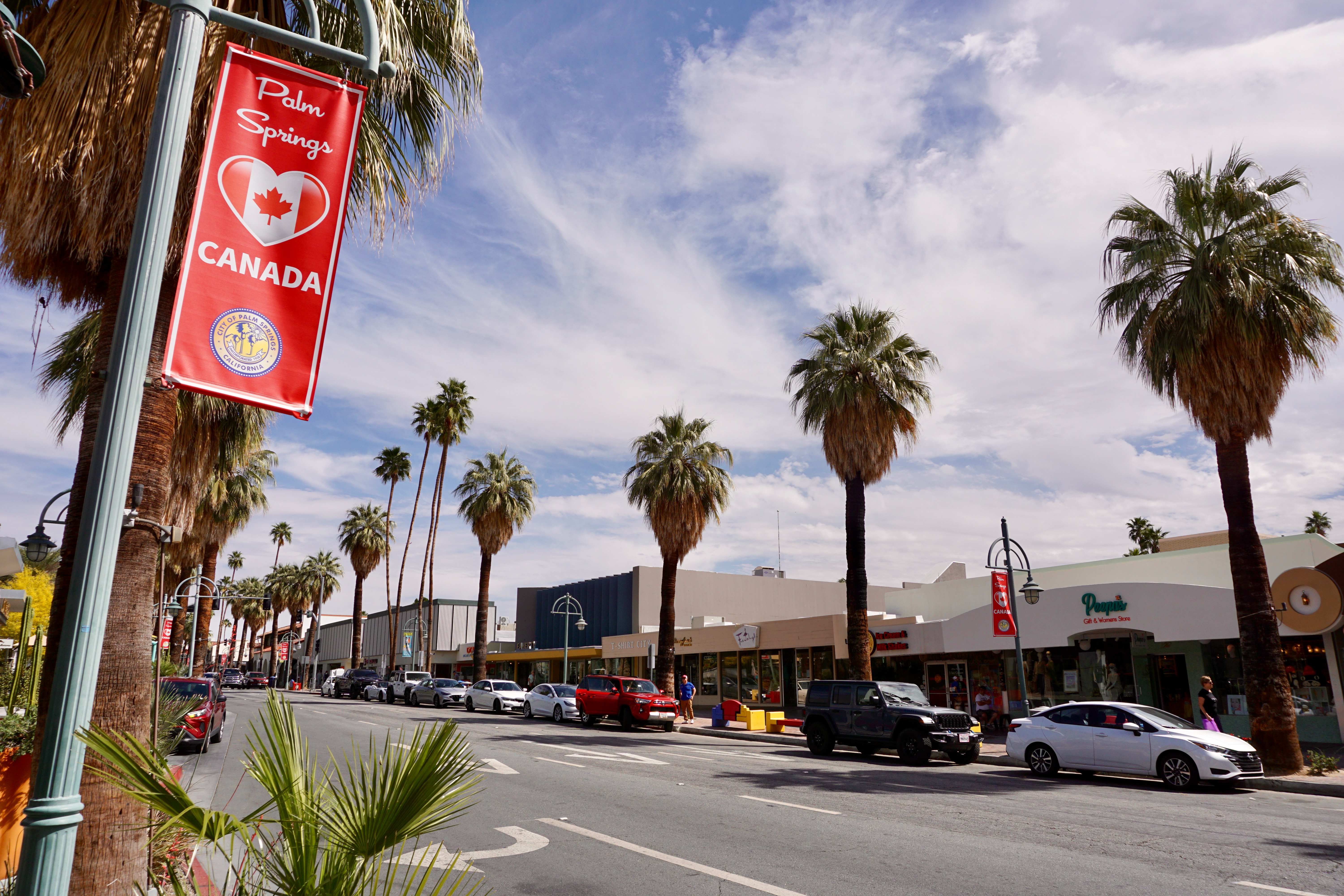
I was happy to see the city’s support for our Northern neighbors.
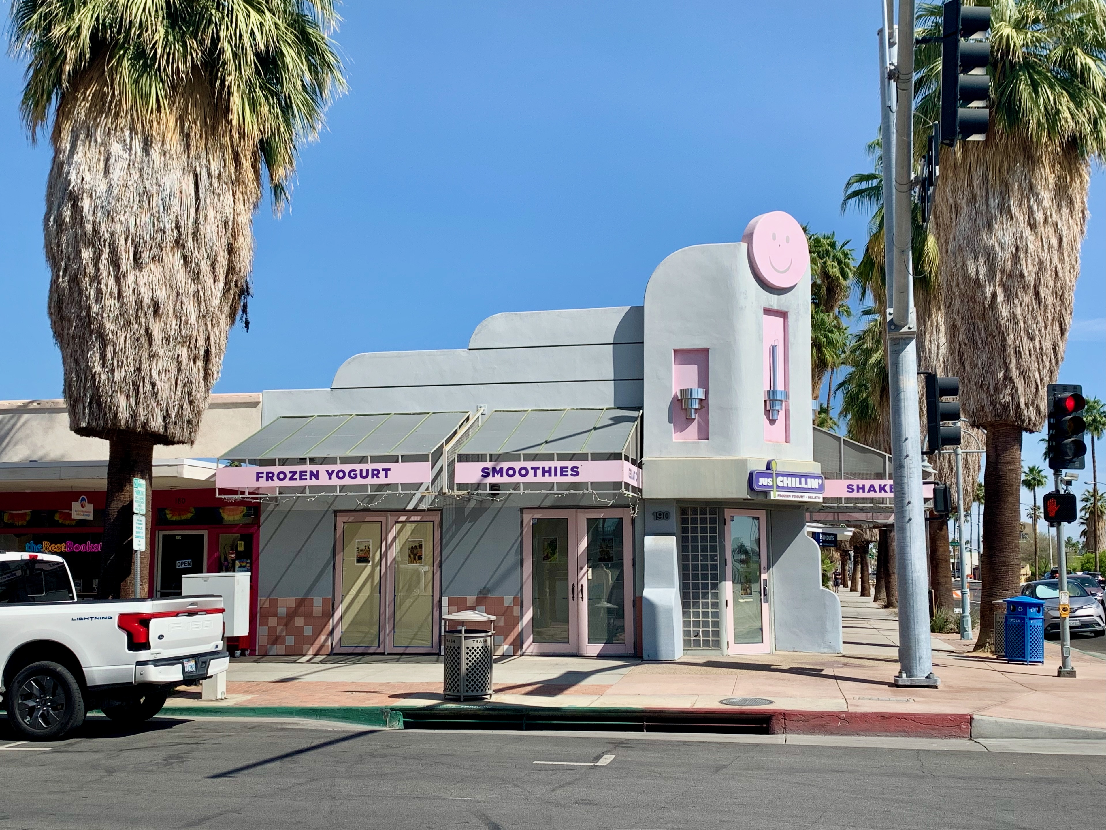
The main drag features plenty of mid-century modern architecture along with just as many pricey chain boutiques.
It also has its share of public art; I did not get a picture of the Sonny Bono statue (the city’s mayor from 1988 to 1992) but I did snap one of this pride-themed tribute to former resident Lucille Ball (there’s also a statue of her and at least it’s not an abomination like the one that used to be in her hometown.)
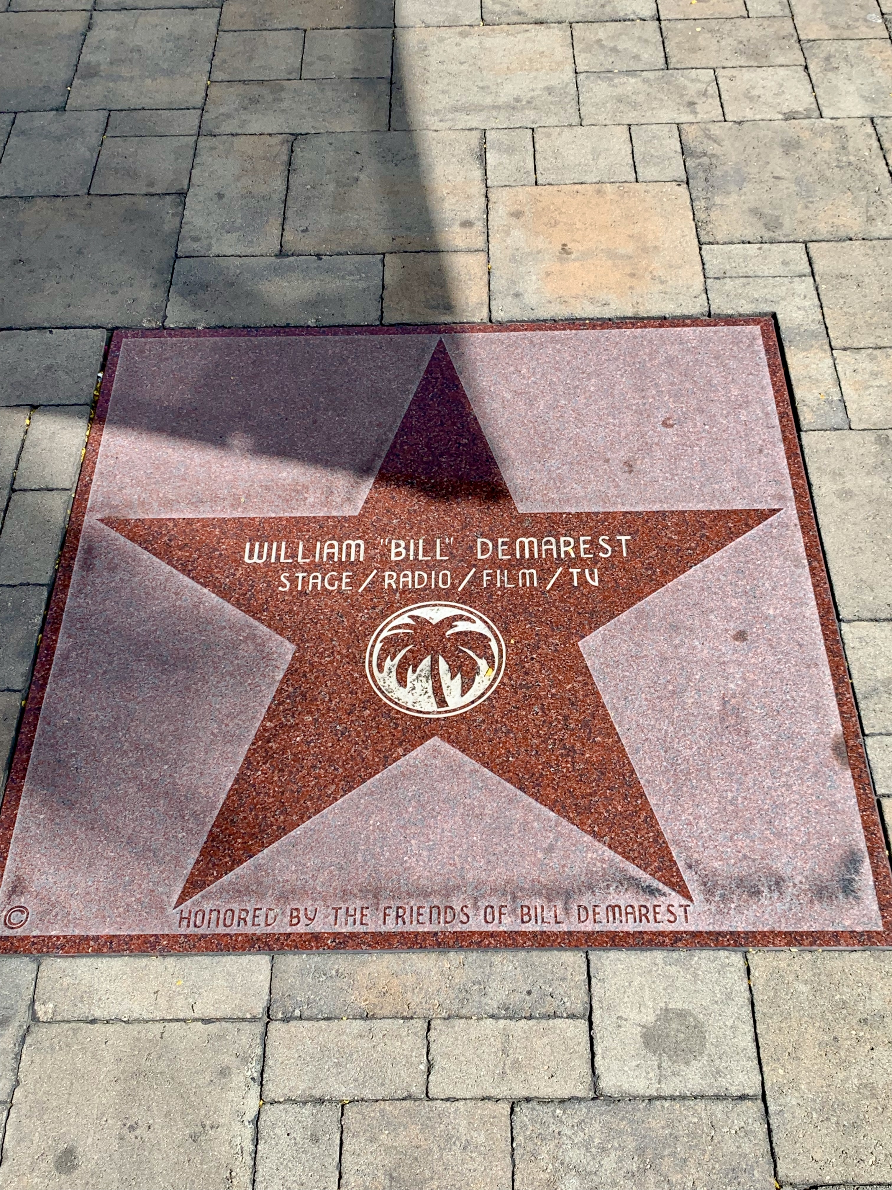
Downtown has its own walk of fame; one that reserves a space for this beloved character actor best known for work in 1940s Preston Sturges comedies (and also for playing “Uncle Charley” on My Three Sons) is my kind of walk of fame.
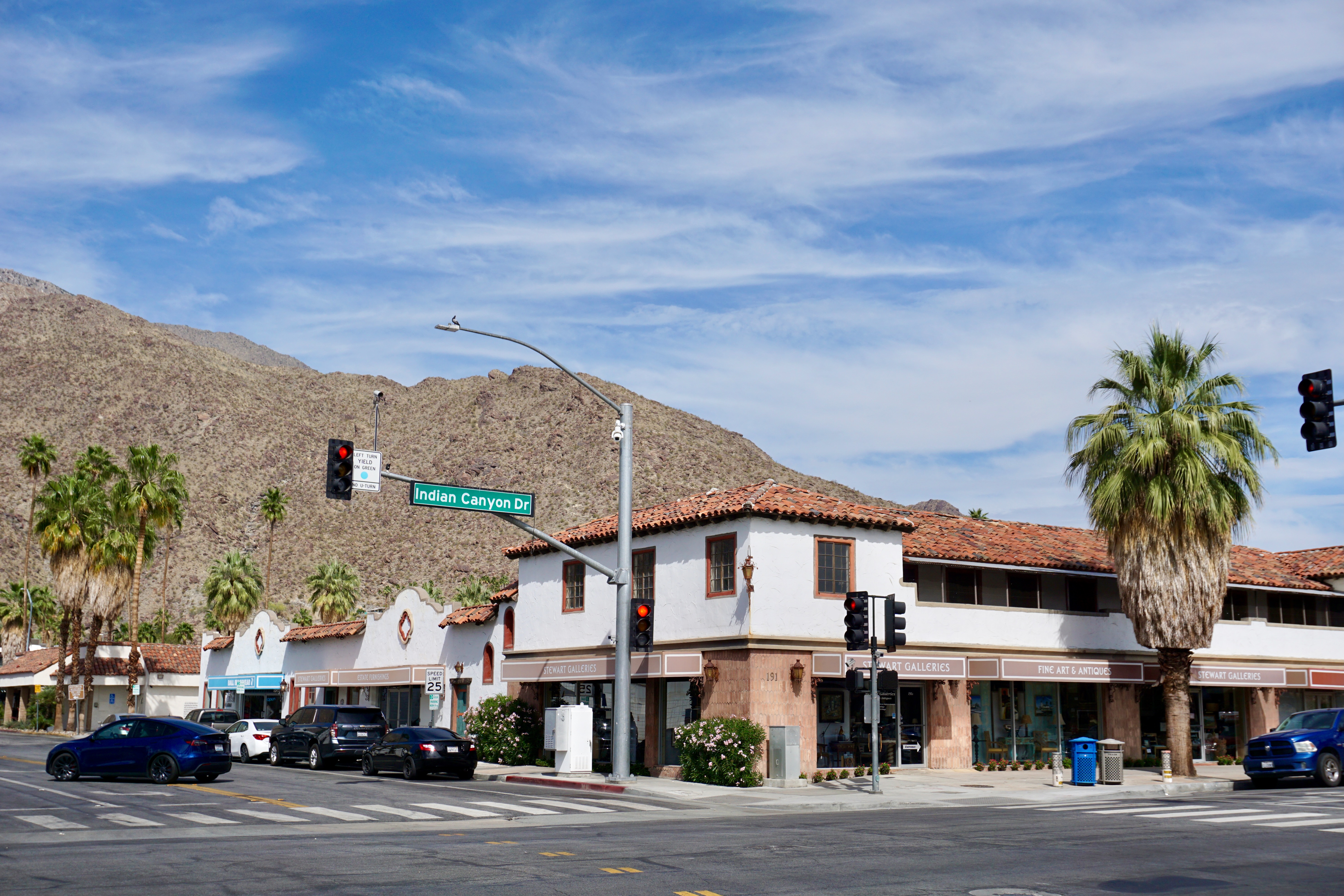
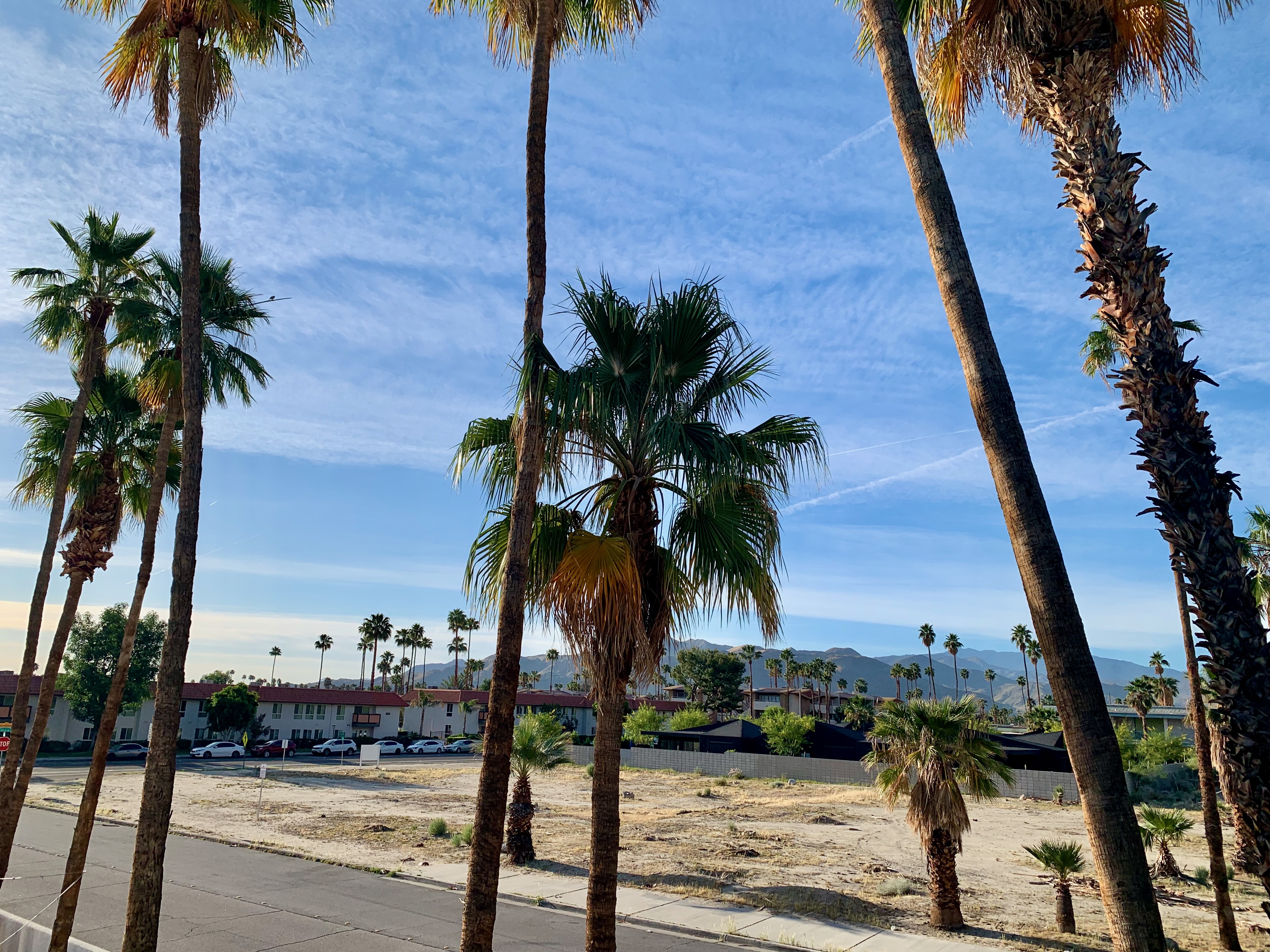
The other main thoroughfare running parallel to Palm Canyon Drive through the city is Indian Canyon Drive.
It’s less flashy than Palm Canyon Drive, consisting of scattered businesses and hotels but still offering expansive mountain views to the West.
We stayed at a hotel near Downtown off of Indian Canyon Drive and even had great views to the East from there.
Downtown after dark is often as gorgeous as it is by day. Built in 1941, the Welwood Murray Memorial Library is currently a research library for the Palm Springs Historical Society and I couldn’t imagine a more appropriate building physically.
One evening, we walked through this public corridor behind Palm Canyon Drive and stumbled across some more striking public art.
One can stroll down Palm Canyon Drive itself and spot the most unexpected passageways between buildings.
Palm Springs at twilight. Stay tuned for more photos focusing on architecture and other hidden delights around the city.